Feeds:
Posts
Comments

Posts Tagged ‘Joseph Ellicott’

blossom
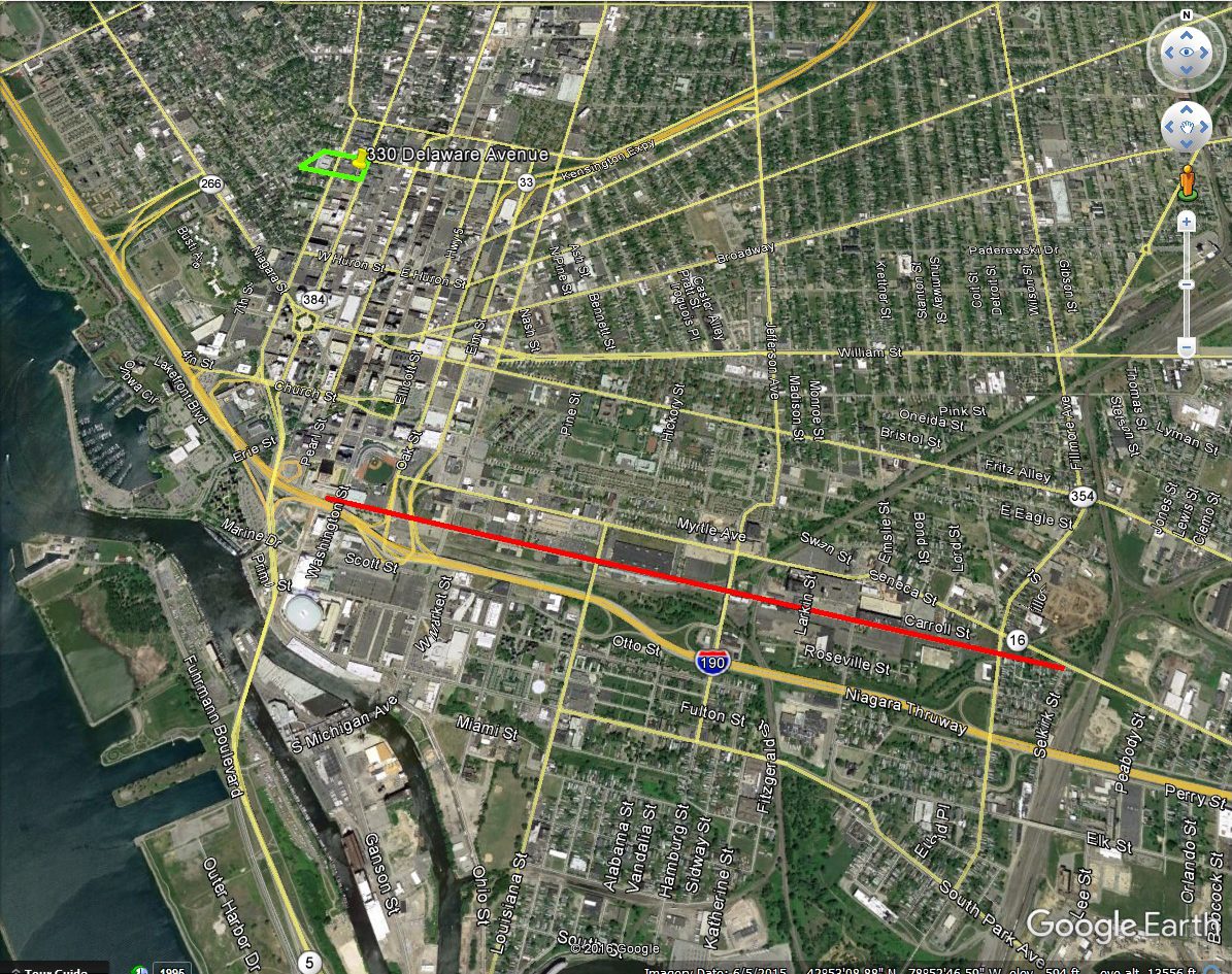
Blossom Street is a street in Downtown Buffalo that runs between East Huron Street and Broadway.  It is cut in half by Hersee Alley.  It functions mainly as an alley for buildings along Ellicott and Oak Streets these days, but it is still designated as a street by the City of Buffalo.  Buildings along the street have windows and doorway entrances that once looked out onto Blossom Street, but are now bricked over.

20200302_173054

20200302_173119

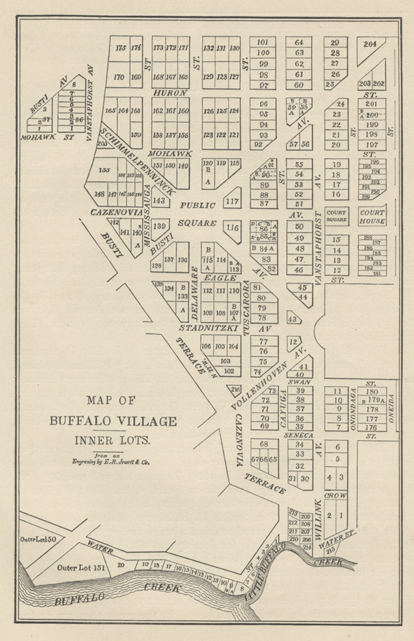
Street sign that has seen better days


20200301_154105It is not named for flowers, but for Ira Allen Blossom.  Mr. Blossom served as right hand man to Joseph Ellicott. Mr. Blossom’s family were pioneers in Monmouth, Maine, where Ira was born in 1789.  In his 20s, Ira moved to Meadville Pennsylvania for work.  When he was 26, he came to Buffalo as Joseph Ellicott’s assistant.

Mr. Blossom started as Joseph Ellicott’saide in 1821 and was later a Subagent for the Holland Land Company following Joseph’s resignation.  Mr. Blossom was connected to the Holland Land Company until the company was sold to the Farmer’s Loan & Trust Company in the 1840s.  He was then appointed receiver of the Buffalo branch of the United States Bank.  He was also made receiver of the Commercial Bank.  While working for the Holland Land Company and the banks, he was known for being lenient with giving credit to promising young men to start their businesses.  A number of businessmen in Buffalo attributed much of their success to Mr. Blossom’s confidence in them and expressing his confidence through credit.


Mr. Blossom partnered with Mr.Lewis Allen to lease what is now the site of the Ellicott Square Building.  In May, 1829, they secured a 63 year lease for the property bounded by Main, North Division, Washington and Swan Streets.  They were able to get the lease at a bargain.  This land had been set aside for Joseph Ellicott by the Holland Land Company in 1816 to build his home, but the Village Trustees interfered and straightened the path of Main Street.  Joseph was disgusted and gave the land to Joseph Ellicott the younger, his nephew.  For the first 21 years, they paid only $700 ($16,000 in today’s dollars) per year, for the second 21 years $850 ($19,000) a year, and for the third 21 years, they paid $1,000 ($23,000) a year.

It was written of Mr. Blossom and Mr. Allen at the time, “the magnitude of their enterprise frightened every conservative in town.” They saw the potential of the site and built a block of fourteen 2-story buildings on the site.  The first legitimate theater in Buffalo was built on the site in 1835.  This theater, William Duffy’s Theater, was on South Division Street between the alley at Washington Street.  It burned down in the 1840s.  The Young Men’s Association (which became the Buffalo Public Library) leased and occupied the upper part of the Theater building.  Reverend Cicero Stevens Hawkins worshiped in the theater in the late 1830s with a group of Episcopalians.  These worshipers later formed Trinity Church, on Delaware Avenue.  Other buildings on the site were filled with businesses as well.

20200301_151957

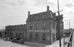
Buildings located at what is now the Ellicott Square Building

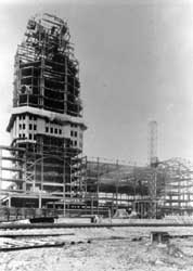
Mr. Blossom and Mr. Allen’s lease on the Ellicott Square ran out in 1892, after both men had died.  On March 1, 1893, the properties were all purchased by the Ellicott Square Company for a fee of $1,080,000 (about $33,583,730 today).   By 1895, when they were planning to construct the Ellicott Square Building, the buildings on this property were described as “the sorriest exhibit of business buildings in the city.”  The planned Ellicott Square Building was expected to cost 2 Million to construct.

Mr. Blossom married Eunice Hubbard.  They lived at the triangle at Franklin, Swan and Erie Streets, across from St. Joseph’s Cathedral.   The famous naturalist Audubon was a guest at their home.  Mr. Audubon was thought to have painted portraits of the Blossoms in 1825, which the family treasured.  The house stood in a garden and was framed by majestic trees of the primeval forest.  The Blossoms had one daughter, Anna.

In 1831, Mr. Blossom, along with John Beals, Samuel Callendar, Elizah Einer, James McKay and Noah Sprague met to organize a parish of the Unitarian church.  The congregation grew and constructed its first building in 1833, at the corner of Franklin and Eagle Street.  The building is still standing today, having been remodeled into a commercial building by the Austin Family. 

In 1832, Mr. Blossom was elected to Buffalo’s first Board of Alderman.  For two terms, he represented the old Third Ward on the board.  He was offered other public offices, but he declined them.  He helped to incorporate the University of Buffalo and was on the university’s first council.

He also was known for giving generously to public projects he believed would benefit Buffalo.  He was known for his hospitality.  He was also known for taking care of the poor, at a time when the indigent were not considered a general public responsibility; his gifts and kindness helped many families.

blossom grave 2
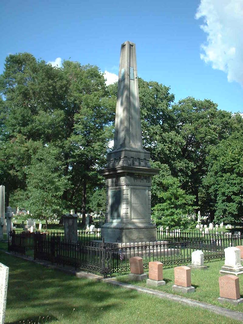
He died in 1856.  Mr. Blossom’s tombstone read “a man who never turned his back on his honor, a loyal citizen, a generous friend.”  He is buried in Forest Lawn Cemetery.

After Mr. Blossom died, living across from the Cathedral and hearing it’s carillon inspired Mrs. Blossom to become a Catholic.  She gave the house to the church.  On the site of the house, St. Stephen’s Hall was built.   Mrs. Blossom and Anna moved to New England.  When Mrs. Blossom died in 1875, she was buried along with her husband in Forest Lawn.

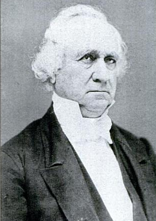
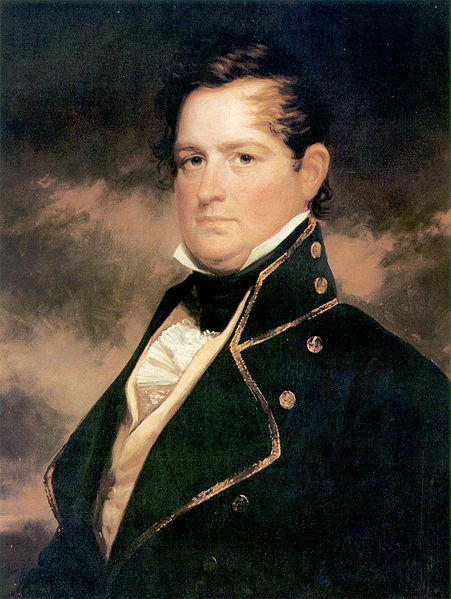
Portraits of Mr. Blossom can be found in the collection of the Albright Knox Art Gallery and the Buffalo History Museum, both portraits are the same painting.  The portrait in the Albright Knox Collection was attributed to John James Audubon and was believed to have been painted in 1825. The Albright’s  portrait was donated, along with a portrait of Mrs. Blossom, in 1943 by the grandson of the Blossoms, Ira A.B. Smith.  The second portrait, was donated to the Buffalo Historical Society at a later date by the estate of one of Mr. Blossom’s associates in the Holland Land Company office.  This second portrait was accompanied by Mr. Blossom’s journals.  The 1835 journal reveals that an associate (Mr. Johnson) commissioned the painting, along with a copy, for his colleague in 1835.  The paintings are both believed to have been done by Samuel Bell Waugh and not by Audubon as had been originally thought.  Both museums attribute the painting to Waugh now.  The picture of Mr. Blossom in this article is a newspaper copy clipping of the painting.

To learn about other streets, check out the Street Index.   Be sure to subscribe to the blog so that new posts are sent directly to you – you can do so on the right hand side of the home page.  You can also like my blog page on facebook at facebook.com/buffalostreets.

Sources:

  1. Winner, Julia Hull.  “The Puzzle of Buffalo’s Two Ira Blossom Portraits that Look Just Alike”.  Buffalo Evening News Magazine.  December 1, 1962, p 1.
  2. “Centennial Planned for Unitarian Church”.  Buffalo Evening News.  November 21, 1931.  p 4.
  3. Buffalo Changes:  The Old Buildings Now on Good Business Sites, and the New Structures which are to Replace Them.  Buffalo Express.  Feb 3, 1895.
  4. Audubon Works Are Acquired by Art Gallery.  Courier Express , Nov 19, 1939, sec 5 p3.
  5. Goldberg, Arthur.  The Buffalo Public Library:  Commemorating its first century of service to the citizens of Buffalo – 1836-1936.  Privately Printed, Buffalo New York, MCMXXXVII (1937).
  6. Smith, Katherine.  Named for Ira Blossom. Courier Express Nov 19, 1939, sec. 5, p3.


Advertisement

Read Full Post »

military road

Military Road’s modern alignment through the City of Buffalo and Town of Tonawanda

Military Road is a part of NYS Route 265, a 19.75 mile long state road that runs between Niagara Falls and Buffalo.  The portions called Military Road are located in the City of Buffalo/Town of Tonawanda and then again in Niagara Falls, NY.  The road dates back to 1801, when it was laid out as a road to connect Black Rock with Fort Niagara, near Lake Ontario.  The route begins at the intersection of Niagara Street and the Scajaquada Expressway.  It runs along Tonawanda Street through Black Rock, Amherst Street, then turns into Military Road where it runs for 4.3 miles until the City of Tonawanda border.  In the City of Tonawanda it is Main Street, in North Tonawanda it is River Road, in Niagara Falls it is Buffalo Ave before it turns back into Military Road through most of Niagara Falls where it ends at a junction with NY 104 (Lewiston Road) in Lewiston.  From Lewiston to Youngstown, the River Road that ran up to the Fort was already built, so that was used to connect the Military built road to Fort Niagara.

map of military road - from buffalo history gazette

Historic Map showing the route of Military Road Source: Buffalo History Gazette

Military Road was one of the first roads in the country planned for military purposes.  Roads for defense have been around for a long time and are still around in modern times – much of the United States Highway System was built as the “Dwight D. Eisenhower National System of Interstate and Defense Highways”, designed for defense and modeled partly after the German Autobahn network that Eisenhower saw in Germany during WWII.  After the Revolutionary War, the federal government realized they needed a highway extending from the town of the Lewiston Escarpment to the bluff at Black Rock.  At the time, they were planning a large fort on the Black Rock bluff to guard the entrance to the Niagara River.  Most of WNY’s roads at the time were based on Native American trails and the trails of the earliest settlers.  These trails typically took the path of least resistance, to avoid things like creeks, marshes, or heavily wooded areas.  The highway would replace the old Portage Road, which was too winding, as it followed closely to the course of the river, rather than in a more direct line.  The Historic Map shows both the routes of the Military Road, which has a smoother path than the Portage route, which curves further to the west towards the Falls.

After the Revolutionary War, there were boundary disputes between New York and Massachusetts.  An agreement signed in Hartford, Connecticut in 1786 deeded the land once occupied by the Haudenosaunee to New York State, but Massachusetts maintained that they had a right to the area west of Seneca Lake once the Native American title was extinguished, except for a one-mile strip, which New York State reserved for itself.  The strip ran one mile inland along the Niagara River, from Buffalo to Stedman’s Farm (also known as Fort Schlosser, near where the water intakes are currently located along the Niagara Scenic Parkway/Robert Moses Parkway in Niagara Falls). Despite the State’s reservation of the parcel, the Seneca maintained that they retained the title to the Mile Strip, which was affirmed in the 1794 Pickering Treaty.   Massachusetts sold the rights to the surveyed portion of the land to Robert Morris in 1791.  Keeping a portion of the land for his own purposes, Robert Morris sold the rest of the land (which the exception of Grand Island and the Mile Strip) to the Holland Land Company, the company which Joseph Ellicott was the land agent.  You can read more about Joseph Ellicott and the Holland Land Company by clicking these links for Part One, Part Two and Part Three.  In 1798, Seth Pease surveyed the Mile Line for the Holland Land Company.  In 1802, the Seneca claim to the Mile Strip was extinguished by a treaty signed in Albany.  There had been little settlement in the area by the Seneca, only two Seneca families lived there year-round.  The treaty was initiated because the government wanted to construct a fort at Black Rock (also known as Upper Black Rock).  In 1803, the Deputy State Surveyor, Joseph Annin began to survey the Mile Strip into lots.  Fort Niagara was given 716 acres which were set aside for the Federal government.  The Stedman’s Farm/Fort Schlosser farm lot was set aside at 680 acres.  The Jones and Parrish tracts, which were each 640 acres, were also set aside and were given to Mr. Jones and Mr. Parrish who had been Haudenosaunee captives during the war.  The Jones and Parrish lots were near the Scajaquada Creek.  A total of 111 lots were laid out within the remainder of the Mile Strip, the majority of which were 160 acres in size, but due to the curve of the river, many were slightly larger.  One square mile was set aside at the southern end for the Village of Black Rock.  For more on the laying out of Black Rock, you can read about Peter Porter, the streets named after states, and the numbered streets.

In 1801, General Moses Porter, commander at Fort Niagara, was ordered by the War Department to use his troops to build the road.  I was unable to find out if General Porter was related to Mr. Porter of Black Rock during my research.  They called the road Military Road because it was built by the soldiers.  Between 1802 and 1805, the right of way for the road was cleared.  At the time, road building typically consisted of cutting trees and brush wide enough  to bring an oxcart.  Military Road was built in a strip 100-feet wide.  Marshy areas were made passable by laying logs down, which was often referred to as a “corduroy road”.  It was a tough task, as the road was built through forests and over swamp lands to cut a straight path.  Bridges were built in Tonawanda, but work was stopped and the road surface was not finished for seven years, due to disagreements between the State and the Federal Governments. In 1808-1809, New York State gave $1,500 (about $30,000 in 2018 dollars) to the project and the road was complete.

fort tompkins sign
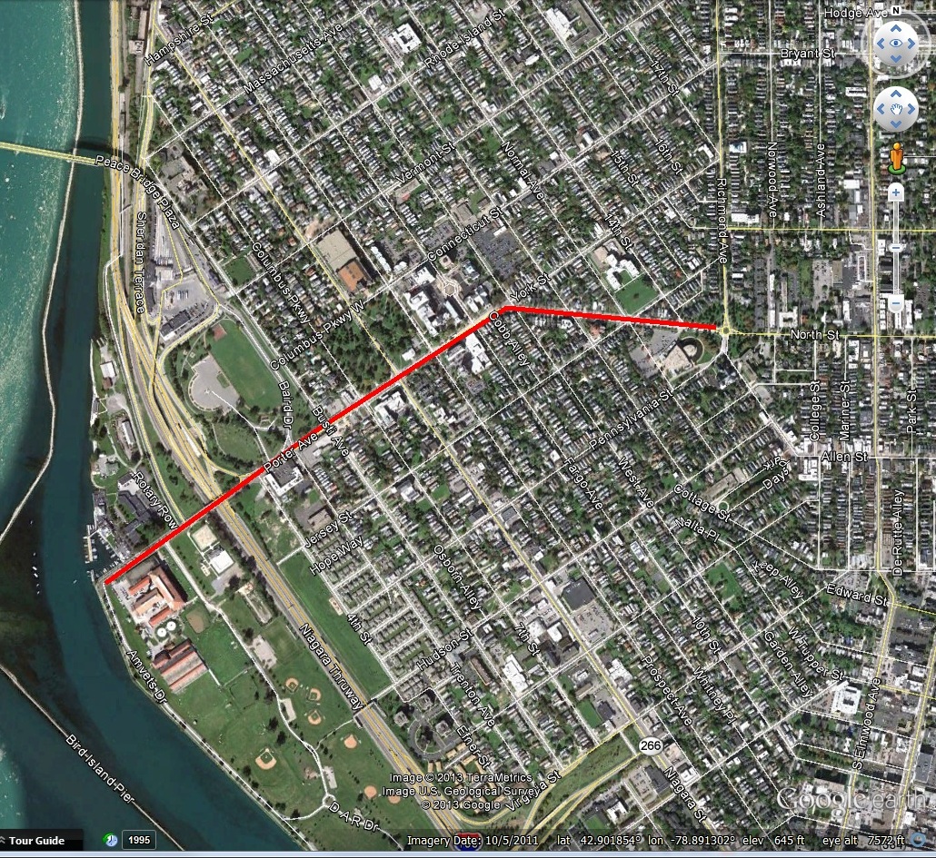
The large fort planned for Black Rock was never built, but a smaller one was built in 1807 and became Fort Tompkins in August 1812.  Fort Tompkins was also known as Fort Adams.  The fort was actually large mounds which were mounting points for seven guns.  It was technically a battery, which is a cluster of cannons in action as a group put into position during a battle of a fort or city.  Fort Tompkins was the largest of eight batteries that were built during the war.  It was located at the top of the bluff at the bend in Niagara Street.  The escarpment here allowed them to overlook the river, giving advantages over the attacks from the water.   The location was later the sight of railway barns.  A plaque was hung on the railway barn and still hangs on the building located at 1010 Niagara Street.  The more famous Fort Tompkins was located on Staten Island and was built in 1663.  They were both likely named for Governor Daniel Tompkins, Governor of New York from 1807 to 1817.  Fun fact for if you’re ever on Jeopardy:  Daniel Tompkins was later President Monroe’s Vice President and the only VP in the 19th century to serve two full terms.

Military Road Marker

Historic Marker near Amherst Street and Military Road

One of the only military uses of the road was during the War of 1812.  American General McClure lost Fort George after a significant battle.  General McClure then gave the notice to burn Fort George and the Village of Newark (now Niagara on the Lake) to deny shelter to the British.  The Americans then retreated to Fort Niagara.  The British reoccupied Fort George and planned an assault on Fort Niagara in retaliation for the burning of Newark.  General McClure claimed he had acted on Secretary of War’s order in the burning of Newark.  He had been told earlier in the year to destroy Newark if necessary but to give the residents several days notice to ensure they were not left destitute.  McClure had only given two hours notice, leaving residents without shelter or possessions during a heavy snowstorm.  This was against war conventions at the time.  McClure’s superiors disavowed his orders and McClure never again held command.

On December 19th, 1813, more than 500 soldiers crossed the Niagara River at a location known as Five Mile Meadows. They turned towards Youngstown and the Americans were taken by surprise and the story goes that they obtained the password to get into the fort by using a fake southern accent.  The British gained control of Fort Niagara and the British and their Native American allies marched upriver.  With the American Army gone, there were only civilian militias left to defend their land.  The British marched south, destroying farms and villages between Youngstown and Manchester (now Niagara Falls, NY).  The second British raid happened a few weeks later, December 31, 1813, which burned as far south as Black Rock and Buffalo.  General McClure retreated from Fort Niagara to Buffalo via Military Road after losing Fort Niagara.

The road fell into disuse and became overgrown, partly due to a debate between the state and federal governments as to who was supposed to maintain it.  Sections of it were used by local farmers.  Niagara County took over the road in 1820 and reconditioned it (at the time present day Erie County was part of Niagara County).  By 1832, it was cleared and repaired and became a state highway.

The idea behind the road was to facilitate travel of troops and munitions of war from Lake Ontario to Lake Erie.  Though the road was built for military function, it also helped to allow for commercial development of the area, with settlements occurring all along the Military Road.

In 1891, trolley service was extended along Military Road into the fledgling Village of Kenmore, allowing residents of Kenmore to arrive at the Military Road Station of the Belt Line, which would take them downtown for work.

miliatry marker sheridan drive

highlight-for-xml

Installation of the Boulder on Sheridan Drive, 1926. Source: Buffalo Courier Express

A boulder with a plaque honoring the Military Road was placed in Sheridan Drive by the Buffalo Chapter of the DAR in 1936.  It was part of a celebration of the centennial of the Town of Tonawanda.  The Centennial was held on exhibition grounds at the corner of Delaware Avenue and Sheridan Drive.  The dedication occurred on what was referred to as “Pioneer Day”.   New York State Historian, Dr. Alexander Flick, was on hand to give a speech and celebrate some of the oldest residents of Tonawanda.  Between 1906 and 1936, the Town had grown from 2,000 residents to 30,000.  Prizes were given to some of the residents including  the oldest married couple present, the oldest school teacher present, and the oldest male and female present.  Mrs. John Walters was unable to be present at the awards ceremony, but she had been a resident of Tonawanda for 93 years!

So the next time you drive along Military Road, think about the military history of WNY and remember the war fought right in our backyard, and the people who were determined enough to stay after their villages were burned to the ground.

Source:

  1. “Town Pioneers honor Guests and Centennial”.  Buffalo Courier Express, July 3 1936. p8.
  2. “Military Highway Will be Scene of Ceremonies” Buffalo Courier Express.  June 13, 1936, p13.
  3. Clinton Brown Architecture, pc.  Reconnaissance Level Historic Resources Survey:  Black Rock Planning Neighborhood.  November 2010.
  4. History of Old Fort Niagara.  https://www.oldfortniagara.org
  5. Lewis, Clarence.  “Evolution of Roadways in County Linked with Important Historical Happenings”.  Niagara Falls Gazette, July 29, 1954.
  6. Malloy, Jerry.  “Why is it Called Military Road?”  Buffalo History Gazette.  August 8, 2010.  http://www.buffalohistorygazette.net
  7. Percy, John & Graham Miller.  Images of America: Kenmore, New York.  Arcadia Publishing:  Charleston, South Carolina, 1998.


Read Full Post »

exchangeExchange Street has been an important street in Buffalo since the early days of settlement.  Exchange Street runs approximately 1.75 miles from Main Street in Downtown to Selkirk Street, near the Larkin District of the East Side of Buffalo.  Exchange Street was one of the first streets in Buffalo, originally a pathway that was traveled by Red Jacket and other members of the Seneca Nation as they came into Buffalo from the Buffalo Creek reservation. Joseph Ellicott incorporated the path when he laid out the original street plan for Buffalo.  The street was originally named Crow Street.  Exchange Street was particularly important during the railroad era of Buffalo’s history.

Map Showing the Inner Lots of Buffalo. Source

Map Showing the Inner Lots of Buffalo.  Source

John Crow arrived in Buffalo around 1801 or 1802, coming from Whitestone in Oneida County, New York.   Mr. Crow occupied a house on Inner Lot No. 1, the southwest corner of Washington and Crow Streets.  The log house had been built by Mr. Johnston, an Indian agent and interpreter who served for the British government and remained here until the Holland Land Company arrived.  Mr. Johnston had received land from the Native Americans in exchange for providing them with boards and planks from the timber on his land.  Legally, Mr. Johnston’s  land hold was not binding.  In negotiations with the Holland Land Company, Mr. Johnston gave up a portion of his land in exchange for keeping a portion along Buffalo Creek where he had his lumber mill separate from the Buffalo Creek Reservation.  Mr. Crow built an addition to the house with a tavern.

When Erastus Granger arrived in Buffalo to serve as postmaster, he set up shop in Mr. Crow’s tavern.  The tavern was also the first place of lodging for Samuel Pratt when he arrived in Buffalo.   You can visit a replica of the Crow Tavern and Mr. Granger’s post office in the Pioneer Gallery at the Buffalo History Museum.  At the time, Exchange Street only ran from Main to Washington, as no streets at the time had been laid out beyond those early streets.   In 1806, Buffalo had 16 houses (8 on Main Street, 3 on the Terrace, 3 on Seneca Street, and 2 on Cayuga-now Pearl Street), two stores – a contractor’s store and a drug store, two taverns, and two blacksmiths.  Mr. Crow stayed in Buffalo until 1806, when he moved to Hamburg and later Pennsylvania. Mr. Crow died in Waterford, PA in 1830.

In 1809, Crow’s Tavern became Landon’s, which burned down in 1813 during the Burning of Buffalo. It was rebuilt by Mr. Landon after the war, and was operated by him until 1824.  In 1825, Phineas Baron took over and renamed it the Mansion House.  Mansion House was in business until 1929!

Source: Picture Book of Earlier Buffalo

Source: Picture Book of Earlier Buffalo

The street was named Crow until many “gentleman” of the city felt that Crow was a vulgar name, since crows were considered to be vulgar, dirty birds, so the street was changed to Exchange Street in 1836.  By 1839, there were several unsuccessful petitions to try to change the name back to Crow.

ex-post

Exchange Street Terminal – NY Central

Many train stations were located along the Exchange Street corridor as early as the 1850s.  The New York Central Exchange Street Terminal was built in 1870, with expansions in 1885, 1900, 1901, 1906 and 1907.  The station was the starting point from where most people entering the City of Buffalo.  For 58 years, the station was the arrival point of most people coming to Buffalo.  Exchange Street was the first thing most people saw when they arrived.

In 1929, New York Central transferred its base of operations to the Curtiss Street Terminal (what we refer to today as Central Terminal) in the Broadway-Fillmore neighborhood of Buffalo.   They all closed their doors after the new terminal was built.  The Exchange Street station was still used by some commuters but they did not provide the neighborhood with enough spending to support businesses, as they rushed from their train to their office for work. The majority of the station was boarded up and only the western entrance was open.  The station restaurant and newsstand closed, and only one door was opened for coming and going.  Only two ticket windows remained open.  The offices over the station closed because most of the personnel went to Curtiss Street.

Central Terminal Under Construction

Curtiss Street Terminal (Central Terminal) Under Construction

Before the station closed, the Exchange Street corridor was one of the most important thoroughfares.  The street was busy with manufacturing, railroad terminals, hotels, and stores.  The Courier-Express said of the street’s heyday, “Exchange Street took off its hat to none of its rivals.”  There were shops for souvenirs and postcards, neighborhood restaurants and lunch counters, and cafes.  Trains arrived at all times of the day and night, so there was a constant flurry of mail trucks, express trucks, delivery vehicles, and people.  One hundred trains a day stopped at the old station.  A story goes that while Grover Cleveland was President, he was on a train heading to a funeral and a friend was staying at the European Hotel at the northwest corner of Washington and Exchange.  President Cleveland asked the train to stop so he could visit with his friend.  The hotel was then renamed the Washington Hotel in order to capitalize on its presidential connection.  The Exchange Street depot was the starting point of the Buffalo Belt Line railroad in 1883, which circled the city and allowed development of the City of Buffalo outside of the downtown core.

Once the NY Central train station closed, Exchange Street was left “looking something like Goldsmith’s deserted village.”  The popular Mansion House hotel, with its roots stretching back to Crow’s original tavern, closed after the train station left.  Between Michigan Avenue and Main Street, there had been a dozen barber shops which all closed.

eriedepot.jpg

Erie Railroad Depot

In addition to the NY Central station, there was also the Erie Station at Michigan and Exchange Street, and the Lehigh Valley Station was nearby on Washington Street.  In 1935, the NY Central Exchange Street Depot was torn down.  Also that year, the Erie Railroad Station was abandoned, when they moved their facilities into the DL&W Terminal on the Waterfront.   This was considered by some to be the end of Exchange Street as a bustling corridor.

The Lehigh Valley station and the right-of-way was purchased in 1954 by New York State to build the Niagara Section of the New York State Thruway.  In 1955, the Buffalo News purchased some of the surplus lands from the State to build their current building (1 News Plaza). The Thruway was built through this section of Downtown Buffalo and opened in 1960.  The six-mile-long Downtown Buffalo part of the Niagara Section was the last portion to be completed of the 559 miles of the New York State Thruway System.

The Exchange Street Terminal continues to serve trains today.  A new, significantly smaller Exchange Street station was built on Exchange Street in 1952.  This station served 21 trains a day and the station used two platforms that were connected via a walkway.  Passenger railroad traffic continued to decline and the station closed in 1962 when service to Niagara Falls was suspended.  Buffalo Central Terminal closed on October 28, 1979 and Amtrak service switched that morning back to Exchange Street where a new station was being built, which opened in 1980.  The Amtrak station currently serves eight trains a day at Exchange Street.

For more than 150 years, railroads were a huge part of the life of the Exchange Street corridor.  There is current talk (2016) about building a new train station in Buffalo.  The One Seneca Tower, with its one million square feet of vacant commercial space, sits ready for redevelopment at the end of Exchange Street at Main Street.  At the other end of Exchange Street, recent developments in the Larkin District are rejuvenating that area.  What’s next for Exchange Street?  It’s yet to be seen.  What would you like to see there?

To learn about other streets, check out the Street Index!

Sources:

  1. “Rebirth Awaited”. Buffalo Courier Express.  August 6, 1935
  2. Ketchum, William.  An Authentic and Comprehensive History of Buffalo, Vol. II.Rockwell, Baker & Hill, Printers, Buffalo NY, 1865.
  3. “Old Railroad Station Once City’s Busiest Spot”.  Buffalo Times, October 25, 1931.
  4. New York State Thruway Authority Records
  5. “As Silence Reigns in Old Exchange Street” Frank L. Blake.  Buffalo Times, Sept 1, 1929
  6. “Terrace Program Revives Memories of Exchange Street’s Famous Days” Buffalo News. Feb 25, 1950.  Streets Scrapbook Vol 1 pg 43

Read Full Post »

cary-streetCary Street is a two block street on the western side of Downtown Buffalo, running from Delaware Avenue to just past Elmwood Avenue.  The land upon which Cary Street sits was originally a wedding gift from Trumbull Cary to his son, Dr. Walter Cary.  The property included the Genesee Hotel (now the Hyatt), and the site of the Cary Home at 184 Delaware Avenue.  The Cary family played a role in Buffalo and Western New York’s development for generations.  Trumbull Cary established the first bank west of Albany, the Bank of Genesee, in Batavia in 1829.  His son, Dr. Walter Cary was a leader in Buffalo’s cultural and social life.  Three of Walter’s sons, Thomas, Charles and George made important contributions to Buffalo.

The first of the Cary family to arrive in the Americas was John Cary, who sailed arrived in Massachusetts from England in 1634.  When Joseph Ellicott came into the wilderness of Western New York during the early 1800s as the agent for the Holland Land Company, he brought with him as his right hand man, a surveyor named Ebeneezer Cary.  Ebeneezer Cary stayed in Batavia and in 1805, he hired his brother Trumbull, who had been living in Mansfield, Connecticut, to fill the position.

Trumbell Cary

Trumbell Cary

Trumbull Cary became postmaster, banker and a leading merchant in Batavia.  He founded the Bank of Genesee, served as adjutant in the War of 1812, and was elected to serve in both the State Assembly and Senate.  Trumbull Cary was married to Margaret Eleanor Brisbane.  Their large mansion, built in 1817, was a center of hospitality and culture in Batavia.  Trumbull Cary died in 1869.  The mansion was demolished in the 1960s.

Trumbull Cary and his family traveled often to New York, Philadelphia and Washington DC in days when stagecoach trips were tiring and often hazardous.  The Carys had one son, Walter.  Trumbull Cary died in 1869 and is buried in Batavia Cemetery.  The Bank of Genesee became the Genesee Trust Company and in 1956, the Genesee Trust Company merged with Manufacturers& Traders Trust Company to become the Batavia branch of M&T.

Dr. Walter Cary and Julia Love Cary

Dr. Walter Cary and Julia Love Cary

Walter Cary was born in Batavia in 1818.  He graduated from Union College in Schenectady in 1839, and then studied medicine at University of Pennsylvania.  He also studied at many leading European Universities and hospitals, at a time when the trip across the Atlantic meant six to seven weeks on a sailing ship.  Dr. Cary entered into the practice of Dr. Charles Winne in 1845.  Dr. Cary was well respected for the zeal and skill he executed during Buffalo’s second cholera epidemic.

Dr. Cary married Julia Love, daughter of Thomas Love, judge and congressman.  The Loves lived on the site of the YMCA prior to its construction (at Mohawk and Genesee Streets, now the Olympic Towers).   Judge Love named many of Buffalo’s streets – Edward for his friend Judge Edward Walden, Niagara for the River, Batavia Street (now Broadway) for the village, Genesee for Genesee County, North and South Division because they divided the business section of the city from the residential section, and Exchange Street, for the barter with the Indians conducted there.

Dr. Cary and his wife lived in the American Hotel, which was located where the Main Place Mall is currently located.  The apartment was considered one of the most beautiful apartments in town, modeled from the apartments Dr. Cary had visited in Paris.  Their first son was born there.  The apartment was  destroyed, along with much of the Carys belongings in the historic American Hotel fire.

Undated Photo of Cary House at 184 Delaware

Undated Photo of Cary House at 184 Delaware

After the fire, Dr. Cary built a home at Delaware Avenue and Huron Street.  A potato patch had been growing there, in honor of the potatoes, Mrs. Cary planted Japanese yam vines that grew over the house and bloomed with purple flowers each spring.  After ten years, Dr. Cary decided to stop practicing medicine to spend more time with his wife, daughter and six sons.  During the Franco-Prussian War, he took them all to Europe.  He had a coach built to order and they toured from Brussels to Naples.  The coach is in the collection of the Buffalo History Museum.  During President Grant’s presidency, Dr. Cary brought his family to Washington for the winter.  They were guests at many White House functions during this time.

Julia Cary’s sister, Maria Love, lived with the family and accompanied them on their trips.  Maria Love founded the Fitch Creche, Buffalo’s first day nursery.  She was the last member of the family to reside in the old Cary home, living there until her death in 1931.  The Maria Love Fund still exists today, continuing Ms. Love’s work in the community.

Walter and Julia had seven children – Trumbull – who followed in his namesake’s footsteps and became a bank president, Thomas – a lawyer, Charles- a physician, Walter – a journalist, Seward – a sculptor, George – an architect, and one daughter Jennie who became Mrs. Laurence Rumsey.  The Cary family were active polo players, the brothers began the first polo leagues in Buffalo, one of the first two leagues in the country.  Seward Cary is credited with bringing polo to Harvard during the 1880s.  A joke around town was that once when the boys were playing polo, one was injured and the game stopped.  When Mrs. Cary asked why the game had stopped, when she was told that her son was hurt, she replied they should just use one of the other sons to replace him.

Spirit of Niagara

Spirit of Niagara

The Cary family was also very involved in the Pan American Exposition.  The Cary family’s in-laws, the Rumseys, owned much of the land the Exposition was located on.  George Cary sat on the Board of the Exposition and designed the New York State Building for the Exposition (currently the Buffalo History Museum).   Charles Cary’s wife, Evelyn Rumsey Cary painted “the Spirit of Niagara” one of the popular paintings for the Pan American Exposition.

Thomas Cary was instrumental in founding the Charity Organization Society, one of the oldest organizations of its kind in the country.  Charles Cary, M.D., was Dean of the Medical School at University of Buffalo.

George Cary

George Cary

George Cary was a nationally renowned architect.  He apprenticed with McKim, Mead & White in New York City, and studied at Ecole des Beaux Arts in France.  Major buildings he designed included the medical school and dental college at UB, the Buffalo Historical Society, the Gratwick Laboratory (built for UB, part of the original Roswell Park Cancer Institute), the Pierce Arrow administration building, the first Buffalo General Hospital, Forest Lawn’s Delaware Avenue Gate and Administration Building, and many houses in the City of Buffalo.

Walter and Julia Grave

Walter and Julia Grave

The Cary siblings built the first crematory in Buffalo, the Buffalo Crematory, in memory of their father after his death in France in 1881.  The Cary family owned the house at 184 Delaware until the 1960s.  The house was used for a few years as a restaurant, which suffered a fire and the house was demolished in 1966 when the land was purchased by the federal government.  The Dulski Federal Building was built on the site, which was recently rehabbed into the Avant Building, at 200 Delaware Avenue.

184 Delaware in the 1960s

184 Delaware in the 1960s


Source:

  1. “Cary Street is Memorial to Leaders in Area Development”, Buffalo Courier-Express, May 13, 1940.
  2. “Obituary:  Death of HO. Trumbull Cary of Batavia”.  The New York Times, June 26, 1869.  
  3. “Cary House, 184 Delaware Avenue, Buffalo, Erie County, NY”.  Historic American Building Survey.  HABS NY, 15-BUF, 1-
  4. Editors.  Buffalo Medical and Surgical Journal.  Vol. XXI.  August 1881 to July 1882, Buffalo.
  5. “Last of the Cary Boys”.  Buffalo Courier Express.  Sept 9, 1948.

Read Full Post »

tupperTupper Street is an east-west road in downtown Buffalo that runs between Maryland Street and the Elm-Oak arterials.  Tupper Street was one of the first streets added to Buffalo after the original plan for the Village of Buffalo was laid out by Joseph Ellicott.

Samuel Tupper first came to Western New York in 1789 as a young surveyor.  He came from Connecticut and served for many years as a surveyor.  He worked on the Phelps and Gorman lands (between Lake Ontario and the PA State line, in the vicinity of Seneca Lake and the Genesee River), the Holland Purchase and as chief surveyor for the Connecticut Land Company on the “Western Reserve” in Ohio.  Mr. Tupper worked for Moses Cleaveland and laid out the City of Cleveland.  He also gave the city its name, deciding to name the city he was laying out after his boss.

Map of Buffalo Outer Lots - Samuel Tupper purchased lot 17, north of Chippewa Street in 1808

Map of Buffalo Outer Lots – Samuel Tupper purchased lot 17, north of Chippewa Street in 1808

In 1804, when New Amsterdam was laid out by Joseph Ellicott, there were only 14 landowners here in Buffalo.  In 1805, five more land owners were added, and Samuel Tupper was among them.  He came to Buffalo to run a contractor’s store, which were the stores that took care of purchasing and dispatching supplies to American military posts in the West.  He purchased inner lot 7 in 1805, which was at the northeast corner of Seneca Street and Willink Avenue (which became Main Street).  In 1808, he purchased outer lot 17.  He gave his name to the street north of his property on the outer lot and built his house at the corner of Main and Tupper.  Judge Tupper’s house was the 2nd house burned during the War of 1812.  Following the war, Judge Tupper built a large mansion on the site and served on a committee to investigate losses in Buffalo.

In 1808, Buffalo was made the county seat of what was then Niagara County (breaking off from Genesee County).  The first Judge was Augustus Porter, with Samuel Tupper and Erastus Granger working as his associates.  Mr. Tupper was not trained as a judge, but was known to have capabilities and qualities that were required of society at the time.  It was possible at the time to serve on the bench without legal training.  His title was Associate Judge of the Common Pleas.  He served as a judge until his death in December 1817.

Judge Tupper had no children.  An adopted daughter of his became the wife of Manly Colton, the Erie County Clerk.  The Colton family occupied the Tupper house for many years following Judge Tupper’s death.

To learn about other streets, check out the Street Index.

Sources:

  1. “Two Streets Perpetuate Names of Early Jurists”.  Courier Express Nov 2, 1941 sec 6 p 3
  2. Smith, Perry H.  History of the City of Buffalo and Erie County.  D. Mason & Co., publishers.  Syracuse, NY:  1884.


Read Full Post »

Often a group of streets will be named after a theme.  This is often seen when a developer may name a bunch of streets after his family members or friends.  Many people know that Washington, DC has streets named after all 50 states to form the City’s grid (crossed by alphabetic and numbered streets).   The City of Buffalo has streets named after 32 of the 50 states.  Many of these state street names originated in one of Buffalo’s original street grids.

Map of Village of Black Rock, 1816 Source:  New York State Archives

Map of Village of Black Rock, 1816
Source: New York State Archives

Many of the streets named after streets are located in what was the original development of the Village of Black Rock.  The Black Rock streets were originally laid out  two years before Joseph Ellicott came to Buffalo!  New York State purchased a one mile strip of land along the Niagara River known as the New York State Reservation in 1802.  The State laid out the streets of the Village of Black Rock.  For 20 years, Black Rock would serve as Buffalo’s rival.  In 1825, Buffalo won its fight to be the terminus of the Erie Canal, became a booming city, and annexed the Village of Black Rock in 1854.

State named streets in Black Rock include Georgia, Carolina, Virginia, Maryland, Pennsylvania, Jersey, York, Connecticut, Rhode Island, Massachusetts, Hampshire.  All of the original 13 colonies are represented by these streets, other than Delaware, which was originally located where Hudson Street is today.  When Buffalo and Black Rock merged, duplicate street names were changed to prevent confusion.  These streets all lay parallel to each other in what is now the West Side of the City of Buffalo, but was originally known as the South Village of Black Rock or Upper Black Rock.  When originally laid out, these streets formed a grid with numbered streets.  The streets were laid out by Lemuel Forester, a Surveyor for New York State.  You can read about the numbered streets in Buffalo by clicking here.  These streets form what was known as Upper Black Rock.  Peter Porter was an important person in the early days of Black Rock.

It is important to note that it is difficult to differentiate between states such as North and South Carolina or Virginia and West Virginia, as the cardinal directions (north, south, east, west) are used in street naming conventions.  Early maps of Black Rock show Jersey, York and Hampshire as New Jersey, New York and New Hampshire, but as time elapsed, the convention to name streets “New” to differentiate between different alignments of a street which changed over time, of which the alignment’s name may be “New _____ Street” or “Old ______ Street”.

Streets in Buffalo Named After States

Streets in Buffalo Named After States  (click to view larger image)

The City also has streets named after the following states:

  • Alabama
  • Arkansas
  • California
  • Colorado
  • North and South Dakota (as Dakota Street)
  • Delaware
  • Florida
  • Illinois
  • Kentucky
  • Louisiana
  • Michigan
  • Minnesota
  • Mississippi
  • Montana
  • Nevada
  • Ohio
  • Oregon
  • Tennessee
  • Texas
  • Vermont
  • Washington
  • Wisconsin
  • Wyoming

There are several streets named after states that used to be located in Buffalo.  These streets names have been removed for various reasons:

Portion of 1900 Sanborn Map depicting locations of Idaho and Arizona Streets.

Idaho Street and Arizona Streets– were located in North Buffalo off Military Road, north of Sayre Street.  The Buffalo Foundry was located here, and industrial facilities eventually absorbed the streets.

1951 Sanborn Map showing the former location of Indiana Street


Indiana Street was located near the foot of Main Street.  The street was eliminated when Crossroads Arena (aka Marine Midland, aka HSBC, aka First Niagara Center) was built.  The street is currently buried under First Niagara Center.

1925 Sanborn Map Showing Alaska Alley

1925 Sanborn Map Showing Alaska Alley

Alaska Alley  – was closed on February 24, 1960.  This was a small alley off of Chippewa near Genesee and Washington.   The block where Alaska and Seward Alleys were located is now parking for the Electric Tower building.

Iowa – used to be the part of LaSalle Avenue from Bailey to Eggert (near Minnesota Avenue).  However, they changed the name when they wanted to rename Perry Street to Iowa Street.  They then decided that Perry was too important to change the name of the street.  At this time, they also tried to change the name of Fulton Street to Oklahoma, but also decided that Fulton was too important of a person to change the name of the street.

In 1901, the City wanted to rename Indian Church, Hudson or South Division Street to Missouri.  Residents complained because it sounded like “Misery” to them, and they did not want to live on “Misery Street”.

There is no Maine Street, because it would be confusing because it sounds like Main Street.

I was unable to find evidence of streets in Buffalo named after the following five states:

  • Kansas
  • Nebraska
  • New Mexico
  • Utah
  • Hawaii

Buffalo Ex-Pats living in the Washington, DC area will be happy to know that Columbia Street, in the Cobblestone District near the arena, is named after the District of Columbia.

To answer the “which street named after a state is your favorite?” question – mine is York Street.  My dad moved to Buffalo (from Central New York….and after time spent in the Navy) in 1978 and his first apartment here was on York Street.  My parents lived there when the first got married.  This is where my branch of the Keppel family started in Buffalo.  🙂

To read about other streets, click the Street Index.

Sources:

  1. “Many Changes Made in Names of Streets Here” Courier Express, August 26, 1928
  2. “New Names for Streets” Buffalo Express Oct 7, 1901
  3. “Council Closes Alaska Alley” Buffalo Courier Express, February 24, 1960.

Read Full Post »

churchChurch Street is one of the main east-west streets in Downtown Buffalo, connecting to Main Street to what is now the Interstate-190.  The street was originally laid out by Joseph Ellicott and was named Stadnitski after Pieter Stadnitski, a Dutch banker and one of the agents of the Holland Land Company.  The street was renamed in honor of St. Paul’s Episcopal, St. Joseph’s Roman Catholic and First Presbyterian Churches.

The Downtown Buffalo core used to be home to other churches, but many moved uptown as their congregants moved out of downtown towards “suburbs”, such as the case with First Presbyterian Church or Lafayette Presbyterian Church.

The Three Church Street Churches circa 1880s

The Three Church Street churches circa 1880s

St. Paul’s Cathedral

St. Paul's Cathedral

St. Paul’s Cathedral

St. Paul’s Episcopal Cathedral is the cathedral of the Episcopal Diocese of Western New York.  The congregation started in 1820, and their first church was built on land donated by Joseph Ellicott, at the corner of Main and Erie Streets.  Reverend William Shelton came to the church in September 1829 and served as Rector until 1881.  The congregation started to grow significantly following the opening of the Erie Canal.  The current church opened (on the site of the old church) in 1851, on Shelton Square.  The church was designed by Richard Upjohn, who is considered one of the greatest American Gothic church designers.  The congregation wanted the church to be made out of limestone; however, they could not afford the limestone.  Upjohn instead used Medina sandstone.

On May 10, 1888, the church was almost destroyed following an explosion and fire.  All that remained was the walls.  The church was rebuilt according to Upjohn’s original plans and reopened in 1890.  St. Paul’s was listed on the National Register of Historic Places in 1973 and was named a National Historic Landmark in 1987.

Rev. Shelton

Rev. Shelton

Shelton Square was named after Reverend William Shelton in 1897.  Shelton Square was a public space within Joseph Ellicott’s original street layout for Buffalo, at the intersection of Erie, Church, Main and Niagara, North Division and South Division Streets.  The area was where Joseph Ellicott originally planned to build his house.  He later donated land at Shelton Square to the churches.  In the 1950s, Shelton Square was considered Buffalo’s “Piccadilly Circus”.  A trolley/bus shelter was located in the middle of the square, and this served as the main hub for the entire city – serving the International Railway Company and then the Niagara Frontier Transit system.   Shelton Square disappeared during the 1970s, when a portion of Shelton Square was covered by the Main Place Mall, and Erie street was replaced by Cathedral Park.

Shelton Square 1908

Shelton Square 1908

St. Joseph’s Cathedral

St. Joseph's Cathedral in 1914

St. Joseph’s Cathedral in 1914

St. Joseph’s Roman Catholic Cathedral is located at 50 Franklin Street.  The church serves as the cathedral church for the Buffalo Diocese.  Buffalo’s first Bishop, John Timon, established St. Joseph’s in 1847.  The cathedral was dedicated in 1855 and was consecrated in 1863.  The original plans for the cathedral called for two towers at the north and south ends of the facade, but only the south tower was built.  The tower contained a 43 bell carillon (a musical instrument consisting of bells, typically found in church towers or municipal buildings).  At the time of installation in 1869, the carillon was the largest in America and the third largest in the world.  The bells were too large for the tower and never worked properly, so all but two were removed from the church.

In 1902, the Buffalo Diocese determined that a new cathedral was necessary, so property was purchased at Delaware Avenue and West Utica Street.  The New St. Joseph Cathedral opened in 1915, and St. Joseph’s downtown was known as “St. Joseph’s Old Cathedral”. The new cathedral was not built for Buffalo’s climate and major repairs had to be made as soon as 1924.  The exterior marble started to fall off and in 1976, the Bishop decided repairs would be too costly.  In 1977, after demolition of the new cathedral, the “old cathedral” reverted to its former name of St. Joseph’s Cathedral.

First Presbyterian Church

Color Portrait of the First Building of the First Presbyterian Church  (First Presbyterian Church archives)

Color Portrait of the First Building of the First Presbyterian Church (First Presbyterian Church archives)

The third of the churches was First Presbyterian Church.  When First Presbyterian Church was organized on February 2, 1812, it was the first organized religious body formed in Western New York.  The first building for the church was built at the corner of Pearl Street and Niagara Street.  The church opened in 1824 and was used by the church until 1827. As the congregation grew, the building was sold to another congregation in 1828 and moved to the corner of Genesee and Hickory Streets, and was later moved to Walnut Street in 1878.  The building saw many uses over the years – a school-house, a tenement,  a cooper’s shop and an icehouse for a brewery.  It was destroyed by a fire in 1882.  No pictures of the building are known to exist.

"Old First" Presbyterian Church (1827-1890) from the First Presbyterian Church Archives

“Old First” Presbyterian Church (1827-1890) from the First Presbyterian Church Archives

First Presbyterian’s “Brick Church” was dedicated in March 1827.  With seating for 800, it was the largest church west of the Genesee River.  The church’s bell was referred to as the “town clock bell” and served all of Buffalo as a fire alarm.  When sounding alarm for a fire in 1833, the bell cracked, but was quickly recast and served the church until the church was razed.  The bell was then presented to a church in North Tonawanda.

As the congregation grew, members also moved away from the central part of the City of Buffalo.  At the time of founding, most of the congregation lived near the church, but as the central business district developed, many had moved uptown and found congregations closer to their homes.  The church was at risk of closing.  Many members of the congregation were against moving the church, so the matter had to be taken up with the Presbytery and was taken to court.  The matter was resolved in favor of moving.

First Presbyterian Church today on Symphony Circle

First Presbyterian Church today on Symphony Circle

In 1887, Mrs. Truman Avery, who lived where Kleinhans Music Hall is now located, donated a parcel of land across the circle, at the corner of Wadsworth and Pennsylvania Streets.  In April 1889, the congregation was ordered by the city to sell the property to Erie County Savings Bank to make way for the bank’s new office.  (the bank was located at Shelton Square until the 1970s, when it was demolished for construction of the Main Place Mall).

Sources:

  1. The Catholic Church in the United States of America:  Undertaken to Celebrate the Golden Jubilee of His Holiness, Pope Pius X.  Volume 3.  Catholic Editing Company, New York, 1914.
  2. DeMille, George.  St. Paul’s Cathedral, Buffalo, 1817-1967:  A Brief History.
  3. Rote, David.  30-A Shelton Square.  1994.  accessed through City of Buffalo Website:  https://www.ci.buffalo.ny.us/Home/OurCity/Buffalo_My_City/Buffalo_My_City_Watercolors/30A_Shelton_Square_1994

Read Full Post »

porterThe Porter family was very influential in Buffalo/Niagara during its formation and early years of settlement.  There is Porter Ave in Buffalo, Porter Road in Niagara Falls, a Town of Porter in Niagara County and the Porter Quadrangle complex at University of Buffalo.   Porter Avenue is located in the Front Park neighborhood on the West Side of Buffalo and is an Olmsted Parkway.   The street was originally known as Guide Board Road and predates Joseph Ellicott’s time in Buffalo.  It was an Indian Trail used during the Revolutionary War to a ferry which led to Canada.

Guide Board Road sign, on North Street near Franklin Street

Guide Board Road sign, on North Street near Franklin Street

The original street alignment went straight west towards the Niagara River.  When Frederick Law Olmsted designed the City’s parkway system, he decided to turn a portion of York Street into Porter Avenue, in order to connect to Front Park and Fort Porter.  This allowed the connections between parks that completes our parks system.

Castle at Fort Porter Postcard

Castle at Fort Porter Postcard

The former Fort Porter was located on the Lake Erie shoreline just north of Front Park.  Olmsted included the Fort’s grounds into his original plans for Front Park.  The Fort was torn down to build the Peace Bridge.  The Porter Family included Augustus and Peter Porter.  Augustus was prominent in Niagara Falls, living on and owning Goat Island  His brother Peter Porter was prominent in Black Rock/Buffalo.  

Peter Porter

Peter Porter

Peter Buell Porter was  born on August 14, 1773 and was raised in Connecticut.  He attended Yale and Litchfield Law School.  He moved west to Canandaigua for his law practice in 1793.  He served as Clerk of Ontario County from 1797 to 1804 and was elected to the New York State Assembly, representing Ontario and Steuben Counties in 1802.    

While in the Assembly, Peter Porter was influential in working with Joseph Ellicott to promote road construction in Buffalo.  However, shortly thereafter, Peter Porter began to develop a community two miles north of Buffalo called Black Rock.  At Black Rock, there was what was called a “safe and commodious” natural harbor, and the land was owned by New York State, unlike the majority of Western New York which was owned by the Holland Land Company.   Peter purchased land with his brother Augustus and Benjamin Baron to form Porter, Barton and Company.  New York State gave their trading firm a monopoly of the transportation business on the portage around Niagara Falls and it handled much of the trade on the Upper Great Lakes.

Around 1797, Joseph Ellicott tried to convince Porter and his friends to purchase property from the Holland Land Company.  Instead, they bought state lands along the Niagara River.  The laid out a town site, built warehouses and other trading facilities, establishing Black Rock.  This angered Paul Busti and other Holland Land Company agents, who then tried to purchased land from the State for the Holland Land Company in order to sabotage Porter’s plans.   As the town of Black Rock developed, the Holland Land Company tried hard to push Buffalo’s interests by using political influence in Albany.  However, Porter was equally determined to make Black Rock successful and had his own power in Albany.

Peter Porter moved to Black Rock in 1809 and was elected to the US House of Representatives, furthering his influence from Albany down to Washington, D.C.   He was so influential as a congressman that he convinced President Madison to move the customs house from Buffalo to the smaller Black Rock during summer (the more active) months. 

Map of Black Rock prior to the War of 1812

Map of Black Rock prior to the War of 1812

During the War of 1812, General Porter served in the New York State Militia.  In congress, Porter was labelled a War Hawk as he fought for security of the Niagara Frontier as the conflict leading up to the war became heated.  He found strong allies in Henry Clay and John Calhoun and was named  chair of the Foreign Affairs Committee.  Porter was presented a gold medal from Congress on November 3, 1814 for “gallantry and good conduct” during the Battle of Chippewa, Battle of Niagara and Battle of Erie.

Following the War of 1812, Porter was able to assist in getting the War Department to use federal troops to repair and improve roads between Fort Niagara and Black Rock which were damaged during the war.  Porter also brought federal funds to the area to build roads and canals.  Porter and his supporters also wanted the federal government to build roads from the “Buffalo Frontier” to Washington to foster trade between the federal capital, the Atlantic Coast and the Great Lakes.  This led to conflicts between Black Rock (which was Peter Porter, because of his vast real estate holdings and commercial enterprises) and Buffalo’s leaders – including Samuel Wilkeson, Albert Tracy, David Day and Oliver Forward.  Buffalo’s leaders were on the side of Dewitt Clinton, Mayor of New York City at the time.  Porter and his friends were on the anti-Clinton political faction.

General Peter served as Secretary of State of New York from 1815 to 1816.   During a special election after the resignation of Governor Tompkins, Tammany Hall printed ballots with Porter’s name on them.  Porter received 1300 votes, despite not running for office.  Governor Dewitt Clinton won that election, despite Tammany Hall’s efforts.

General Porter was appointed to the Canal Commission created to examine possible canal routes.  Governor Clinton opted for a Hudson River to Lake Erie straight across the state.  General Porter preferred two canals, one joining the Hudson River with Lake Ontario and one around Niagara Falls, joining Lake Erie and Ontario.  Buffalo Leaders and Joseph Ellicott preferred Clinton’s ideas, but in 1814, it seemed that the Canal Commission might adopt Porter’s suggestions.   By 1816, Porter had not been reappointed to the Canal Commission as he had accepted the office of boundary commissioner to clarify the disputed sections of the US-Canada Border.  Joseph Ellicott replaced Porter on the Commission, Dewitt Clinton had been elected Governor, and the Erie Canal took the alignment we are familiar with today.

The rivalry then shifted to whether Buffalo or Black Rock would be the western terminus for the Erie Canal.  Black Rock had a large, natural harbor which would be easy to expand and for years it had been the center of east-west trade and was used even by the merchants in Buffalo.  Black Rock also provided an escape from the turbulent winds and swells coming across Lake Erie.  It also would shorten the canal a few miles, lowering construction costs.  Buffalo had advantages too:  it was out of the range of British canons on the Canadian Shore (which was important given the recent War with Great Britain).  Higher water levels meant the canal would feed better in Buffalo.  Samuel Wilkeson led the charge, along with a group of enterprising men, determined to make Buffalo the canal terminus.  A report by engineers stated that the terminus should be located in Buffalo as the Black Rock harbor was too vulnerable to British attack, too exposed to ice damage and too expensive to develop.  While several later reports supported Black Rock, the Canal Commission designated Buffalo as the canal terminus in 1822, on the advice of four out of five of its engineers.  Efforts by Porter and his friends to alter the decision were fruitless, and bills were passed in the legislature for a canal link from Tonawanda to Buffalo, completely bypassing Black Rock.

Porter House facing Niagara Street circa 1880s when Lewis Allen owned the house

General Porter built a house at 1192 Niagara Street (between Breckenridge and Ferry) in 1816.  He Porter married Letitia Breckenridge of the prominent Breckenridge family.   Breckenridge Street, which was originally called Commerce Street, is named after her.     When Grover Cleveland moved here to Buffalo, he lived in the Porter house, with his Aunt and Uncle, the Allens.   Peter and Letitia’s son Peter A. Porter went on to become a Civil War Colonel, killed in the Battle of Cold Harbor in 1864.  

General Porter donated the land for the Union Meeting House Church across the street from his house.  The church is located at 44 Breckenridge and is also known as the Breckenridge Street Church.  

Peter Porter was also President of Jubilee Water Works, the first company to bring water into people’s homes.  The water came from the jubilee spring (located in present day Forest Lawn…Crystal Lake is formed from waters from the spring) and was pumped through wooden pipes.  Some of Buffalo’s wooden water pipes still exist.

porter grave

Peter Porter’s Grave

In 1837, Black Rock was dealt another blow when General Porter sold his interests there and moved to Niagara Falls where he built a new home.  Peter Porter died in 1844, and Fort Porter was named in honor of the businessman-politician-soldier.  Peter and Augustus Porter are both buried in Oakwood Cemetery in Niagara Falls.  Nine years after his death, Porter’s beloved Black Rock was annexed to a thriving, expanding Buffalo.   Black Rock became a neighborhood in the City of Buffalo.

The next time you’re driving down the 190 along the Niagara River or driving through Black Rock, think about Peter Porter and what our region might look like if we lived in the City of Black Rock and the Erie Canal went from Lake Erie to Lake Ontario!

Learn about other streets by checking out the street index.


Sources:

  1. Courier Express, July 24 1938, sec 6, p.4.
  2. Grande, Joseph.  Peter B. Porter and the Buffalo Black-Rock Rivalry.  Buffalo and Erie County Historical Society Publications.

Read Full Post »

otto

Otto Street Present Day

Otto Street is a small little street in the First Ward of Buffalo.  The street has had a front row to the changing transportation of Buffalo – in the 1880s, the north side of the street was a tannery and then the Hamburg Canal.  It then became the Lehigh Valley Rail Yard throughout the early 1900s.  And since the 1950s, the street has run along the southern side of the I-190.

Otto Street (top of map) in 1889

Otto Street (top of map) in 1889
(click to enlarge)

Otto Street in 1899

Otto Street in 1899
(Click to Enlarge)

Otto Street is named for Jacob S. Otto.  Mr. Otto took over for Joseph Ellicott following his retirement from the Holland Land Company.  For more on Joseph Ellicott, check out Part 1, Part 2 and Part 3.

Mr. Otto was born in Swedesboro, New Jersey in 1778.  He graduated from Princeton in 1797 and practiced law in Philadelphia.  In 1821, he joined the Holland Land Company.  When he took over the Holland Land Company, things were difficult.  Many of debtors purchased land during the boom of 1816-1817.  A panic occurred in 1817, prices had fallen, and the company was owed more than $1,000,000 (approximately 13 million in today’s dollars!).  When Joseph Ellicott resigned, the Holland Land Company did not side with the local suggestions for his replacement and selected Mr. Otto, who was working in Philadelphia as a capable businessman.   Mr. Otto revived the Holland Land Company’s acceptance of produce in payment of interest.  This helped to calm some of the troubles throughout the Holland Land Purchase.

While Mr. Otto never lived in Buffalo, he was well known here.  He was important in the development of Allegany and Cattaraugus Counties.   He also opened up the Ellicott tract for development by laying out North Division from Main to Washington in 1827.  North Division was extended to Jefferson in 1831.

Mr. Otto tightened the requirements for settlers to pay off their debt.  He brought suit against many of the debtors.  The settlers reacted to this by starting protest meetings in Lockport in January 1827 and in Buffalo in February 1827.  A petition was sent to Albany, where a bill to tax land of non-residents passed in the fall.  The collection reports of the company for 1826 showed that of the six million debt, less than one-fiftieth had been collected.  This changed the policies of the Holland Land Company.

Mr. Otto died in 1827 when he contracted pneumonia after officiating the opening of the Erie Canal.  He is buried in Batavia.  Mr. Otto’s son, John Otto, came to Buffalo from Philadelphia after his father’s death and worked at Pascal Pratt’s Hardware Store.  In 1858, John Otto formed his own real estate firm, John Otto and Sons.  The Towns of Otto and East Otto are named for Jacob Otto.

During the waning days of the Holland Land Company’s prominence in Western New York, David Ellicott Evans took over as land agent following Mr. Otto’s death.   The Town of Evans, New York is named after Mr. Evans, who was Joseph Ellicott’s nephew.   Lewis Ellicott Evans, David’s brother, lived in a house in Williamsville which was known as the “Evans House”.  The Evans House was built on Main Street, east of Ellicott Creek, and was believed to have been the oldest house in Erie County.  The House was demolished in 1955. Evans Street continues the Evans family legacy in Williamsville.

Sources:

  1. “Otto Street Honors Ellicott Successor” Courier Express, Dec 18, 1938, sec 5 p4
  2. Silsby, Robert.  “The Holland Land Company in Western New York”.  accessed online at http://bechsed.nylearns.org/pdf/low/The%20Holland%20Land%20Company%20in%20Western%20New%20York.pdf

Read Full Post »

joseph ellicottThis is the third and final part in a series about Joseph Ellicott.  Click here to read Part One about Joseph’s family and his early life.  Click here to read Part Two, about Joseph’s days with the  Holland Land Company.  Today, I am going to touch on Joseph’s legacy throughout Western New York.

Mindful of Buffalo’s strategic location as a port, Joseph Ellicott was a strong advocate for a canal to be built from the Hudson River to Lake Erie. He served as one of the first Erie Canal Commissioners and was appointed in 1816 to supervise the canal construction.  He was also responsible for convincing Governor Clinton not to send to England for engineers to design the canal, but to use local talent instead.  He donated more than 100,000 acres of company land for the canal project.  He resigned from the Canal in 1818, due to his declining health.

Joseph worked hard to further the settlement of Buffalo by encouraging development on certain transects.   As hard as Joseph worked, his later years were not as bright.  He suffered from physical and mental health issues in his later days.  As early as 1816 he began to suffer from periods of depression and melancholy.  At the time, his condition was thought to have been brought upon by his lonely, unmarried life as well as the disappointments of the unrealized hopes and dreams.  In 1821, the Holland Land Company suggested that he was no longer needed and  Joseph retired.   He became a hypochondriac and was admitted to Bloomingdale Asylum in New York City by his family around 1824.  He died in 1826 by hanging himself.  He was originally buried in New York City, but was exhumed and reburied in Batavia in the Batavia Cemetery.

Joseph Ellicott's Gravestone

Joseph Ellicott’s Gravestone

Joseph’s grave was erected in 1849 by his sister Rachel Evans. and is engraved with the following:

“He was the first resident agent of the Holland Land Company for whom in 1798 he began the survey of the western part of the state then owned by them.  Even at that day his predictions of its future wealth and importance fell but little short what has since been realized.  For more than twenty years, he used with great judgement combined with liberality, the powers entrusted to him as one of the earliest and by far the most efficient advocate of the Erie Canal.  His name is a part of the history of New York.  His reputation among his fellow citizens as a man of the highest intelligence as well as the influence of his station gave his opinions great weight with every successive administration during the first twenty years of the present century, and in every portion of the tract once subject to his control may be seen marks of his foresight and generosity.  He was the founder of Batavia and Buffalo, NY.”

The following places were named after Joseph Ellicott:

  • Ellicottville, New York – a village in Cattaraugus County
  • Ellicott, New York – town in Chautauqua County
  • Ellicott Square Building – A ten story office building in Downtown Buffalo.  When it was built in 1896, it was the largest office building in the world.  The building was designed by Charles Atwood of Daniel Burnham & Company Architects.  The building sits on the lot that Joseph Ellicott originally owned.
  • Ellicott Street – in addition to the one in Buffalo, there’s an Ellicott Street in Batavia, and an Ellicott Road in Orchard Park
  • Ellicott Complex – dorms at University of Buffalo
  • Ellicott Creek – a creek that runs through Tonawanda and Amherst
  • Ellicott Elementary School  -in orchard park
  • Ellicott Run – in Sinnemahoning State Park in Pennsylvania
Joseph Ellicott's Plan for the Village of New Amsterdam

Joseph Ellicott’s Plan for the Village of New Amsterdam

If you look closely at Joseph’s plan from 1804 (click on the picture for a better view), you will notice that some of the streets have different names.  Joseph named the streets after the dutch investors and  members of the Holland Land Company.

The street changes occurred on July 13, 1825.  There was a battle between the Highway Commissioners of the City of Buffalo and Joseph Ellicott.   As discussed in Part Two, Joseph owned a large lot in Downtown Buffalo.  After the Highway Commissioners decided that Main Street needed to be re-routed to cut through his property, Joseph changed his will to avoid leaving the land for a park.  In order to spite Joseph, the Commissioners changed the names of the streets:

  • Willink Avenue and Van Straphorst Avenue became Main Street
  • Schimmelpennick Avenue was renamed Niagara Street
  • Stadnitski Avenue was named Church Street since it was the location of St. Paul’s Church
  • Vallenhoven Street was named Erie Street
  • Cazenovia Street became Court Street, because the Courthouse was located near where the Central Library is currently located
  • North and South Onondaga Streets were merged to become Washington Street
  • North and South Cayuga Street became Pearl Street
  • Franklin was renamed from Tuscarora Street
  • Busti Avenue became Genesee Street
  • Mississauga Street became Morgan Street (which is currently South Elmwood)

In March 1836, Crow Street became Exchange Street.  In the end, Seneca, Swan, Chippewa, Huron, Eagle and Delaware were the only street names given by Joseph Ellicott that remained.

The Highway Commissioners must have felt a twinge of regret, because the changed the name of Oneida Street to Ellicott Street, honoring the man who laid out our streets and helped the fledgling Village of Buffalo Creek become the City of Buffalo.

To learn about how other streets got their name, check out the Street Index.  If you want to be the first to know about new blog posts, subscribe to the blog and updates will be emailed to you.  And as always, if you have any questions about specific streets, leave them in the comments and I can see what I can do to add them to my queue.

Sources:
  1. “Joseph Ellicott”  Memorial and Family History of Erie County New York. Volume 1, Biographical and Genealogical
  2. Beers, F.W.  ”Our County and It’s People:  A Descriptive Work on Genesee County, New York.”  J.W. Vose & Co Publishers, Syracuse NY 1890.
  3. “Our Street Names:  They Tell Much of Buffalo’s History”.  Buffalo Express, November 14, 1897.
  4. Burns, Rosamond.  ”Paving the Way For Settlers:  The Rise and Fall of the Holland Land Co.”  Buffalo News, January 25, 2004.
  5. Houghton, Frederick.  ”History of the Buffalo Creek Reservation”.   Buffalo Historical Society Publications, Volume 24:  Buffalo, 1920.

Read Full Post »

Older Posts »

Hidden Waters blog

Companion blog for the book "Hidden Waters of NYC"

DenCity

Urban History Blog

Hoping for a Tail Wind

Because I definitely brought way too much gear.

priorhouse blog

Photos, art, and a little bit of LIT.

Sheepie Niagara

The most popular sheep in Niagara Falls

Nonprofit AF

Exploring the fun and frustrations of nonprofit work

Gather by Image

An anagram. And a reason to write... to Grieve... to Heal