Feeds:
Posts
Comments

Archive for the ‘Allentown’ Category

collegestreet
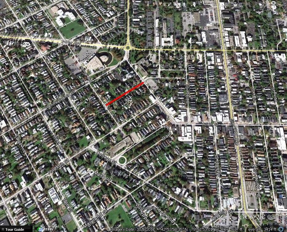
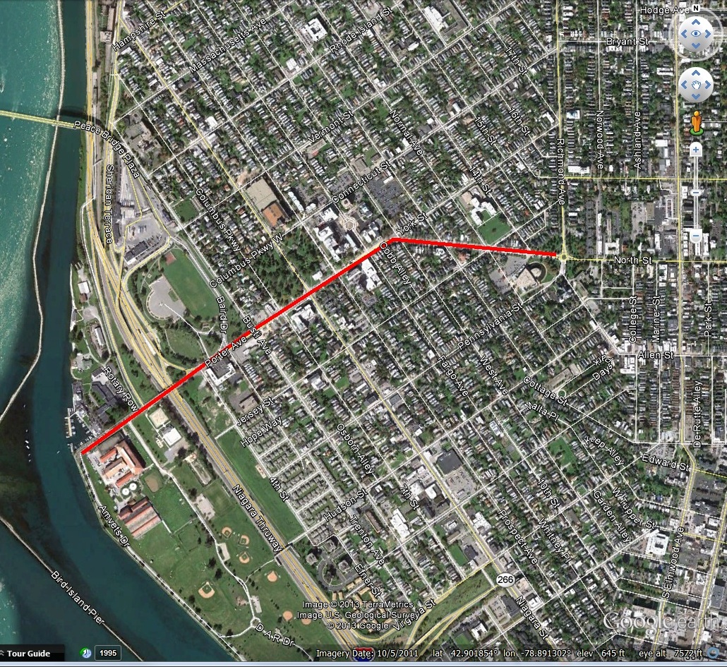
College Street runs one-third of a mile between North Street and Cottage Street in the Allentown neighborhood of Buffalo.  The street was laid out in September 1836.  But was there a college in Allentown?  Well, almost.

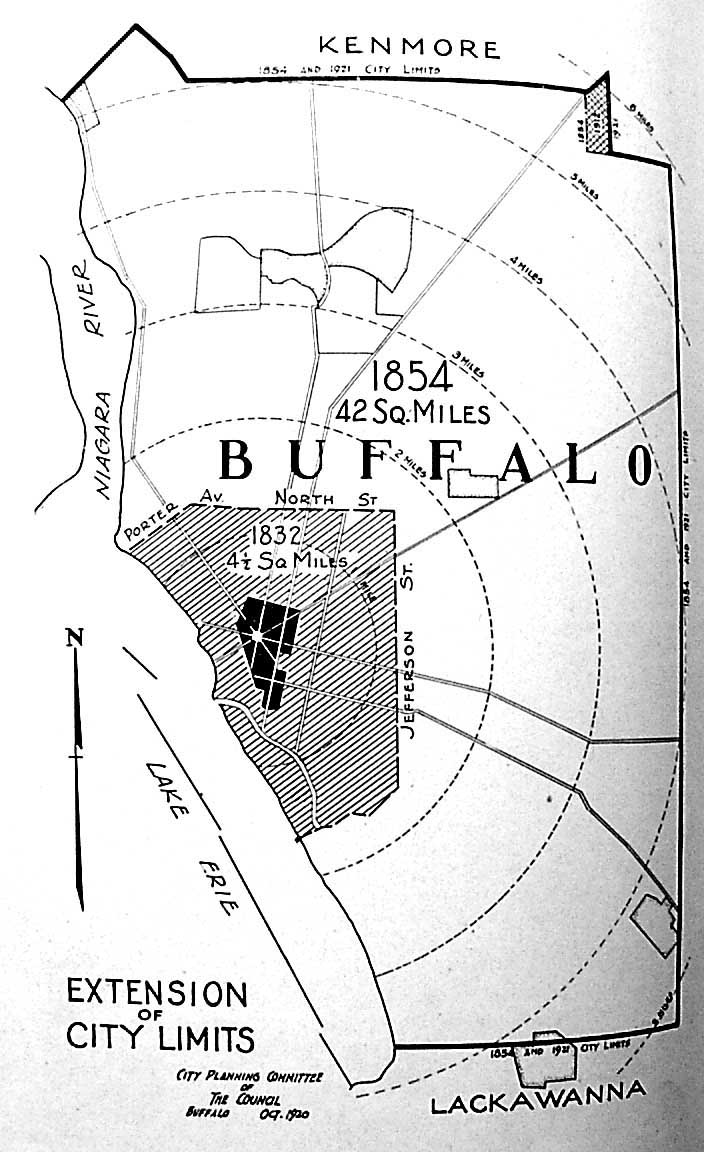
The University of Western New York was chartered on April 8, 1836.  It was also referred to as “Western University”.  The college was founded  to serve Western New York.  At the time, there was no chartered college in operation in the area. There was a significant amount of speculation in Buffalo in 1836.  The Erie Canal’s opening in 1825 had turned Buffalo into a stepping stone between East and West.   Wealthy industrialists began to settle in Buffalo as businesses in freight, transportation and banking began to thrive.  Many in Buffalo quickly made money and then just as quickly lost it. Between 1834 and 1836, construction projects completed in Buffalo totaled $3Million (about $88 Million today).  Buffalo was still an infant city.  Only 1/5 of a mile of street was paved, only one mile of sewer existed on three streets, and there were no street lamps.  Water service was only from wells and a single water salesman who filled his tank in the lake and went door to door selling water.

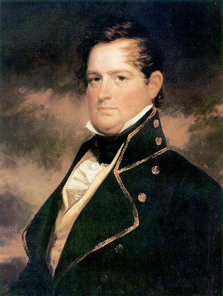
Many large-scale projects were proposed, such as a large 100-foot tall marble statue of Commodore Perry above Shelton Square.  For reference, McKinley Monument in front of City Hall is about 96 feet tall.  The memorial was estimated to cost $75,000 (about $2.2 Million today).  Another proposed project was a great Exchange Building with a 220-foot dome on Main Street to occupy the entire block of Clarendon Square (between North and South Division).

The University was another such large scale proposed project, associated with the Genesee Synod of the Presbyterian Church.  The Synod at the time had sought to establish a college within its boundaries, which included a nine county area.  Buffalo was selected for its location due to the city’s location for trade because of the Canal and the Great Lakes.  Buffalo was also accessible to students from the Midwest to the East Coast and Mid Atlantic States, so the founders felt it was a strategic place for a university.

The Executive Committee of the College consisted of H.B. Potter, Hiram Pratt, Reuben B. Heacock, John C. Lord, and Asa T. Hopkins.  Other Board Members included Norris Bull, John Barnard, Gilbert Crawford, Charles E. Furman, Abel Caldwell, Erastus J. Gillet, Ezra Scovel, Tyron Edwards, Asa Johnson, Herman Halsey, Conway P. Wing, Eli S. Hunter, Timothy Stillman, Samuel H. Gridley, Robert W. Hill, William Williams, Samuel Wilkeson, Alanson Palmer, Joseph Dart, Pierre A Barker, Guy H. Goodrich, Jabez Goodell, Ebenezer Johnson, Ebenezer Walden, Peter B. Porter, John B. Skinner, Allen Ayrault, and Elial T. Foot.  The board was a real who’s who of Buffalo at the time, and many of these folks have been covered here on the blog.  The leader of the group was Reverend Asa Hopkins, who graduated from Yale University and was a minister at First Presbyterian Church.  In 1826, First Presbyterian Church took out an $8,000 loan  to build their original church at the corner of Main Street and Church Street.  By 1836, the loan had been paid off and the church looked towards other endeavors.

The Board of the University acquired a Building at the corner of Virginia Street and St. Louis Place.  The building had originally been built in 1828 by the Buffalo High School Association as the site for the Buffalo High School.  The name was changed to the Buffalo Literary and Scientific Academy in 1830.  The Academy was actually a military academy, and students would march down Main Street for drills.  The Academy provided the only secondary education in the city at the time.  It ended up being too expensive for most students and had difficulty securing faculty to teach.  When the University of Western New York group was established, they acquired the property.  Fun fact, in 1848, the building at Virginia Street and St. Louis Place became the first home of Sister’s Hospital.  The building still stands.

Judge Walden donated land bounded by Delaware, Allen, College and North Street to the Board for a permanent college.  College Street was laid out on the western boundary of their land.  Some sources indicate that the entire area was meant for the school.  Some sources indicate that the eastern boundary of their land was Franklin Street. Some sources indicate only 9 acres of land were owned by the group.  I was unable to verify precisely how much property the group owned, or if they ever even officially owned the land.  If anyone lives in the area and has copies of their title searches that go back that far, I’d love to see if the University is listed to try to figure it out!  At the time, the main streets of Allentown were Main, Delaware, Cottage, Allen and North Street.  It is possible that they did own the entire area, since Mariner, Elmwood, Park and Irving were not yet constructed.  If they did own the entire area, the University would have taken up almost 1/3 of Allentown!  College Street was added in September 1836 in honor of the University.  Plans for the University included impressive buildings along North Street, they desired to have a campus that would rival that of Harvard or Yale!

The Board selected Rev. Justin Edwards to be Chancellor of the University and President of the College.  He was to be granted a salary of $2,000 ($58,800 in today’s dollars) a year.  He declined the post.  A number of other high ranking educators from along the East Coast were named to the faculty- however, none of them ever arrived in Buffalo.  Endowments of $15,000 each were granted by many of the who’s who of Buffalo to fund professors:

  • William Williams, the “Williams’ Professorship of Moral and Mental Philosophy”
  • Samuel Wilkeson, the “Wilkeson Professorship of Law”
  • Alanson Palmer, the “Alanson Professorship of Mathematics and Natural Philosophy”
  • Hiram Pratt and Orlando Allen, the “Pratt and Allen Professorship of Theology”
  • Joseph Dart and George Palmer, the “Dart and Palmer Professorship of English Literature and Belles Lettres”
  • Perrie A Barker, the “Barker Professorship of Languages”
  • Guy H. Goodrich, the “Goodrich Professorship of Chemistry and Mineralogy”
  • HB Porter and John C. Lord, “the Porter and Lord Professorship of Oriental Literature and Hebrew Language”

While many sources indicate that no classes were held for the University, newspaper accounts from the time indicate that there was at least one year of classes, and 20 students were enrolled.  Tuition was set for Freshmen and Sophomore years at $8.00 per term or $24.00 annually.  Boarding was not to exceed $70.00 annually, with rooming at $10.50, utilities at $10.00 and washing at $12.00.  Tuition and board all together cost of $126.50 ($3,721 in 2021 dollars) annually.  Students were expected to furnish their own bed and bedding, towels and furniture except for bedstead (a bed frame) and stove.

The second year was set to begin on Wednesday, Sept 13, 1837. I am unsure if classes were held that second year at all, I do not believe they were.  A Professor Hadderman was referenced in newspaper articles prior to the term starting, it may be that they taught all the classes.  Candidates for the Freshman Class were examined in: Virgil, Cicero’s Select Orations, the Greek Reader, Latin and Greek Grammar, Arithmetic, English Grammar and Geography prior to acceptance.

Wonder what a curriculum looked like in 1836?  Freshman were required to be 14 years old and they studied:

  • Folsom’s Livy
  • Adam’s Roman Antiquities
  • Horace
  • Graeca Majors (the historical parts)
  • Algebra
  • Legendre’s Geometry.

Sophomores studied:

  • Graeca Majors (vol 1 finished)
  • Horace (finished)
  • Cicero de Oratore
  • Geometry
  • Trigonometry
  • Mensuration (the measure of geometric magnitudes, lengths, areas and volumes)
  • Navigation
  • Surveying
  • Conic Sections, Spherical Geometry and Trigonometry
  • Rhetoric

Students attended prayer in the College Chapel every morning and evening, and attended three recitations daily except on Wednesday and Saturday, when there were only two.  Students were also required to attend public worship services on the Sabbath, at a church directed by their parent or guardian.  There were three terms in a year, separated by vacations – two weeks starting on the third Wednesday in December, four weeks starting at the second Wednesday in April, and six weeks starting on the first Wednesday in August.

The school was a victim of the financial panic of 1837.  The Panic of 1837 began in New York City in May of that year.  The Panic was detrimental to many places across the United States and resulted in a major depression for the following six years; many people lost their fortunes.  In 1851, it was reported that the “splendid effort to found the University of Western New York made in 1836 failed in  consequence of the pecuniary embarrassments.”

Buffalo was particularly hard hit by the Panic of 1837.  Benjamin Rathbun, Buffalo’s master builder had created a empire, operating quarries, brick factories and machine shops.  He built as many as 100 buildings in a single year.  He owned many major businesses in town as well, including the Eagle Tavern, several grocery and dry good stores, and his own bank.  To fund his empire, he overextended himself.  He was found to have used approximately $1.5 Million ($44 Million in 2021 dollars) in forged notes.  He was arrested and sentenced to five years hard labor in Auburn prison.  It was estimated that approximately 10% of Buffalo’s population was on his payroll – about 2,000 people, and around 5,000 people if you include their families who were dependent on that income.  The empire began to fall in August 1836.  The demise of Benjamin Rathbun’s empire coupled with the Panic of 1837 meant that much of the city became impoverished.  Real estate values dropped – lots were often worth less than 1/10th or even 1/20th of their value.

Additionally in 1837, Buffalo was weary of the Patriot War happening in Canada. Many Buffalonians feared that Buffalo could be attacked.  With the Burning of Buffalo during the War of 1812 just 24 years prior, many Buffalonians feared attack.  As a result, the Pointsett Barracks were built, between North Street, Delaware Avenue, Main Street and Allen Street.  If the University property did go to Franklin Street, a portion of it would have been included in the Pointsett Barracks.  The land for the Pointsett Barracks was also provided to the Federal Government by Judge Walden.  The only standing reminder of the Barracks is our beloved Wilcox Mansion, aka the Theodore Roosevelt Inaugural Site.

People were still eager to have a college in Buffalo.  Nine years after the University of Western New York closed, a group of physicians and a few laymen including Millard Fillmore, future President of the United States, met to establish a medical school.  While they were founding a medical school, they petitioned the Legislature for a general university charter rather than just a medical school charter.  This would allow for the future expansion of the institution beyond just a medical school, as we know occurred.  Julian Park, documenting the history of the University of Buffalo in 1917, notes that interestingly, the physicians were the ones who pushed for a full university charter instead of a medical school charter, not the laymen.

Pages from A_History_of_the_University_of_Buffalo

First Building of the University of Buffalo dedicated solely to education. Source: Julian Park, A History of the University of Buffalo.

The University of Buffalo came into being by a legislative act on May 11, 1846.  The Medical School opened in spring of 1847 with an enrollment of 63 students.  Like the University of Western New York, the University Council was made up of a whose who amongst Buffalo – the first council consisted of Millard Fillmore, George Clinton, Ira Blossom, Thomas Foote, Joseph Masten, Isaac Sherman, Gaius B Rich, William Bird, George Babock, Nathan Hall, James Wadsworth, Theodotus Burwell, John Shepard, Hiram Tucker, Orsamus Marshall, Orson Phelps , Elbridge Spaulding, James White, and James Putnam.  The first two terms were held in the Baptist church on Washington Street, before the University moved into a building built for them at the corner of Main and Virginia Street, just a block away from where the University of Western New York had held their classes!  For the first 40 years, UB operated solely as a medical school, but operated legally and officially as University at Buffalo.  Many of the subsequent departments and schools under the University umbrella were begun by the professionals of the city who wanted to help provide opportunities for training in their profession to the next generation of Buffalo.   Many of the first professors did so because of professional pride in passing down the trade, often while sacrificing their own finances.  In 1962, University of Buffalo joined the State University of New York (SUNY) system and became University at Buffalo.

So the next time you drive past or down College Street, take a moment to think about the University that never fulfilled its founder’s dreams.  Want to learn about other streets? Check out the Street Index. Don’t forget to subscribe to the page to be notified when new posts are made. You can do so by entering your email address in the box on the upper right-hand side of the home page. You can also follow the blog on facebook. If you enjoy the blog, please be sure to share it with your friends.

Sources:

  • “University of Western New York”.  Black Rock Advocate.  October, 13, 1836.
  • “University of Western New York”  Daily Commercial Advertiser.  July 28, 1837. p3.
  • “Education Convention.  The Advocate.  October 16, 1851, p2.
  • “An Act to Incorporate the University of Western New York.”  Passed April 8, 1836.  Chap 110, p 148.  Laws of the State of New York, of a General Nature Passed from 1828 to 1841.  T.H. Hyatt Publisher.  1841.
  • Fess, Margaret.  “Plans for University Here in 1836 Failed.  Buffalo Courier Express.  May 24, 1964. p30D.
  • Dreams and Realities.  Buffalo Courier Express. June 10, 1935. p6.
  • “University of Western New York”. Buffalo Daily Star.  August 27, 1836.  p1.
  • Park, Julian.  “A History of the University of Buffalo”.  Publications of the Buffalo Historical Society.  Buffalo: 1917.
  • Murphy, William F.  “Education in Buffalo, NY and the Panic of 1837”.  A Thesis Presented to the Faculty of the Department of Education, Canisius College.  June 1954.
  • Hosmer, George.  “Annual Address:  Physiognomy of Buffalo”.  Read before the Buffalo Historical Society, January 13, 1864.
  • Gordon, Thomas Francis.  “Gazetteer of the State of New York, Comprehending its Colonial History, General Geography, Geology and Internal Improvements; a Minute Description of its Several Counties, Towns and Villages.”  TK and PG Collins, Printers:  Philadelphia.  1836.
Advertisement

Read Full Post »

northNorth Street runs through the Allentown neighborhood of Buffalo, between Symphony Circle and Jefferson Avenue.  A small portion of East North Street exists east of Jefferson, divided by the Kensington Expressway.

North Street was originally known as Guide Board Road.  In front of the Episcopal Church of the Ascension at the corner of Linwood and North is a sign that states “Guide Board Road directing pioneers from the east to the Black Rock Ferry”.  The Guide Board Road was established shortly after Buffalo was settled. Pioneers cut through the woods so that early residents could get from Main Street to the Black Rock Ferry.  The road was used by many covered wagons of pioneers and ox carts of the early farmers.

Guide Board Road sign, on North Street near Franklin Street

Guide Board Road sign, on North Street near Franklin Street

During the War of 1812, when Buffalo was burned Dec 29, 1913, Guide Board Road was bathed in blood.  While retreating, American soldiers from Buffalo and Black Rock used Guide Board Road to get to Main Street to escape to Williamsville or Batavia.  Many of them were overtaken by the Native American allies of the British troops, scalped, tomahawked and robbed of their clothes.  Their bodies were left by the roadside.

northstreet cemeteryThe street was the northern boundary of the City of Buffalo when it was incorporated in 1832, hence the name North Street.  The City founders felt that the North Street boundary would give the City plenty of room to expand.  The road was also known as Lover’s Lane and Cemetery Road.  As cemeteries were being moved to outside the boundary of the City, North Street was bordered by six cemeteries at one time!

The Erie County Almshouse (and associated cemetery) was located near the location of D’Youville College today.   The area around North Street was first settled by residents of Buffalo looking to build houses in the Country.   Additionally, immigrants settling in the Buffalo area bought the land along the road west of Delaware for orchards and truck farms.  This section became known as Shingletown.  Buffalo continued growing and quickly grew to be larger than the Village of Black Rock.  Just 21 years after the City was incorporated, the New York State legislature gave permission to extend its boundaries and absorb Black Rock.

City Planning Committee Map of the Extension of City Limits

City Planning Committee Map of the Extension of City Limits Over Time

Plans had been discussed many times over the City’s history to extend North Street.  This was discussed as early as 1884 when a resolution was passed to extend North Street from Jefferson to Genesee Streets, but the idea was protested.  Plans were resubmitted in 1887.  Portions of East North Street east of Jefferson were built.

In the 1920s,  a plan was put forth to widen North Street and extended it to connect to the east with Humboldt Parkway.  The Buffalo City Planning Association proposed this link, which would connect the waterfront to the eastern part of the city to create a crosstown connecting parkway within a short distance of the downtown business district.  The new parkway would connect D’Youville College, Holy Angels Academy(which later moved to North Buffalo), the State Normal School (later Grover Cleveland High School), Masten Park High School(now City Honors), the 106th Regiment Armory, the proposed municipal stadium at the corner of Jefferson and Best Street (which became War Memorial Stadium aka the Rockpile, now John Wiley Sports Complex), and the proposed Natural Science Building to be located in Humboldt Park (today the Science Museum).  The proposed parkway would be a double roadway and was intended to provide relief from congestion currently occurring on streets such as High Street.  The planned width of the street would be 105 feet wide with two 27-foot roadways separated by a wooded park strip.  One unique thing about the proposal was that the road was planned to take North Street over Main and Ellicott Streets, as well as to tunnel Franklin, Linwood, Delaware and Elmwood Avenues under North Street.  The road was designed to separate the crosstown traffic from the north and south traffic. This road was never built.

If you could redesign any street in Buffalo, which would you change?

Learn about other streets by checking out the Street Index.


Sources:

“Urges Action on Widening of North Street”. Buffalo News, July 13, 1923.

“Cross-Town Street Plan is Explained”.  Buffalo Evening News, February 17, 1928.

“War Wealth Park of North Street History”. Courier Express, Feb 9, 1956.

Picture Book of Earlier Buffalo.  Buffalo Historical Society Publications:  1912.


Read Full Post »

streetSt. John’s place is a short, one block long street located in Allentown.  The street is named after the St. John family.  The St. John family had a significant role during the Burning of Buffalo 200 years ago, on December 30, 1813.

The St. John House  was the only house to survive the burning of Buffalo.  Only three buildings remained after the burning:  The St. John House, the jail on Washington Street near Eagle Street and David Reece’s blacksmith shop on Seneca Street.

Margaret St. John

Margaret St. John

Gamaliel St. John was born in Norwalk Connecticut on September 22, 1766.  Margaret Marsh was born in Kent, Connecticut.  Margaret’s father was among the first class of graduates at Yale College.   Gamaliel and Margaret were married in Kent on October 16, 1788.  They moved to Danbury, Connecticut where they lived for several years, before moving to Oneida County, New York.    While there, Gamaliel worked on constructing a portion of the turnpike from Albany to Cayuga Lake.   They had many children:  Elijah, Northrop, Maria, Aurelia, Cyrus, Sarah, Margaret, Parnell, Martha, John and LeGrand, and Orson.

In 1807, they moved to a farm in Williamsville.  Their farm was located near where the historic mill is now located in Williamsville.  They lived on the farm for three years before moving into Buffalo in the spring of 1810.  The family settled on Main Street.  Mr. St. John kept a tavern on the corner of Main and Court Streets.

Cyrus St. John died in December 1812 of camp distemper (also known as diphtheria).  Gamaleil and his eldest son, Elijah died on June 6, 1813, drowning in the Niagara River when their boat capsized after coming into contact with the war vessel John Adams, which was anchored in the River.  Gamaleil and Elijah were bearing dispatches from army headquarters in Buffalo to a division in Canada.

st. john houseJust before the burning of Buffalo, there were approximately 2,000-4,000 drafted and volunteer militia encamped in front of the old courthouse.   Recollections of the St. John children indicated that the citizens of Buffalo felt safe due to the presence of the militia, who could be seen marching through the Village.   When the alarm rang for people to evacuate Buffalo on December 30, 1813, the St. John family planned to leave in two trips.   Mr. Asaph Bemis, the husband of Aurelia St. John, accompanied the family.  Conditions along the roads prevented Mr. Bemis from returning. Margaret St. John was left in the house with her daughters Maria and Sarah.

20131230_075848

Plaque at site of St. John House

The St. John house was located at 437 Main Street, near Mohawk.  The house was demolished in 1871.  Today, the location is marked by a plaque.

As Buffalo settlers returned to town on New Year’s Day, Mrs. St. John and her daughters took in the refugees, while warding off constant threats to their home.  Many of the settlers returned to town and constructed makeshift roofs over their former basements, living in them for the rest of winter until a new house could be constructed.

Following the fire, a relief committee provided money, supplies and clothing.  The committee raised $13,000 quickly to help the citizens of Buffalo.  The State Legislature also contributed nearly $60,000.  Reconstruction of Buffalo happened quickly.  By April, Joseph Pomeroy had rebuilt his hotel.  After only five months, many stores and taverns were erected.

While the St. John family had its share of hardships, the family prevailed. The women sold their needlework and managed to survive on that income, keeping their place in society of the time.

grave of gamiel and margaretMargaret St. John died April 29, 1847.  She and her husband are buried in Forest Lawn.

Sarah St. John was only 16 at the time of the fire, spending her days putting out fires set by the Native Americans and foraging for food under the cover of night.   At one point, the Native Americans entered the St. John home.  Sarah fled in terror, chased by a man.  It is said that he raised his tomahawk to kill her, but she laughed at him.  He was so taken aback that he could not kill her.  He instead painted her face and let her return to her home.  Sarah went on to become the second wife of Samuel Wilkeson.  She was among the first to dig the earth for what became the Erie Canal on August 9, 1823.  She was beloved by the people of Buffalo; they reopened the Franklin Street Cemetery to bury her when she died in 1836, despite the cemetery being closed due to cholera fears.  (The Franklin Street Cemetery was located where the present County Hall is now).

Sarah’s grandson by marriage, Tellico Johnson, was one of the earliest developers of the Historic Plymouth neighbrohood.  He developed Orton and St. Johns Places and lived at 22 Orton Street.  The streets were created in 1884, from what was the Buffalo Circus Ground.  Several big name circuses performed there, including WW Cole Hippodrome, PT Barnum Circus, John B. Doris Inter-Ocena Show and the Adam Forepaugh Show.  In 1882, PT Barnum brought the elephant legend, Jumbo, to the grounds from London.

So remember the St. John family, all of the settlers of Buffalo, and all who fought in the War of 1812 today.  Remember that we’ve since had 200 years of peace between the United States and Canada.  The Peace Bridge plaza today stands where Fort Porter was located, a fitting tribute to the years of peace replacing a military establishment.  Remember the spirit of the earliest settlers of Buffalo, who were not afraid to brave a winter in makeshift home in order to build what became our city.  I believe that pioneer spirit still lives in Buffalo today….and that we can rebuild after 50 years of decline.

Be sure to check out the street index to learn about other streets. 

Sources:

  1. Mrs. Jonathan Sidway.  “Recollections of the Burning of Buffalo and Events in the History of the Family of Gamaliel and Margaret St. John”.  Publications of the Buffalo Historical Society, Volume 9.  Buffalo NY. 1906.
  2.  Brown, Christopher.  “Historic Plymouth Avenue in the Kleinhans Neighborhood”.  Kleinhans Community Association.  May 2008.
  3. Severance, Frank, editor.  The Picture Book of Earlier Buffalo.  Buffalo Historical Society Publications, Vol. 16, 1912.

Read Full Post »

porterThe Porter family was very influential in Buffalo/Niagara during its formation and early years of settlement.  There is Porter Ave in Buffalo, Porter Road in Niagara Falls, a Town of Porter in Niagara County and the Porter Quadrangle complex at University of Buffalo.   Porter Avenue is located in the Front Park neighborhood on the West Side of Buffalo and is an Olmsted Parkway.   The street was originally known as Guide Board Road and predates Joseph Ellicott’s time in Buffalo.  It was an Indian Trail used during the Revolutionary War to a ferry which led to Canada.

Guide Board Road sign, on North Street near Franklin Street

Guide Board Road sign, on North Street near Franklin Street

The original street alignment went straight west towards the Niagara River.  When Frederick Law Olmsted designed the City’s parkway system, he decided to turn a portion of York Street into Porter Avenue, in order to connect to Front Park and Fort Porter.  This allowed the connections between parks that completes our parks system.

Castle at Fort Porter Postcard

Castle at Fort Porter Postcard

The former Fort Porter was located on the Lake Erie shoreline just north of Front Park.  Olmsted included the Fort’s grounds into his original plans for Front Park.  The Fort was torn down to build the Peace Bridge.  The Porter Family included Augustus and Peter Porter.  Augustus was prominent in Niagara Falls, living on and owning Goat Island  His brother Peter Porter was prominent in Black Rock/Buffalo.  

Peter Porter

Peter Porter

Peter Buell Porter was  born on August 14, 1773 and was raised in Connecticut.  He attended Yale and Litchfield Law School.  He moved west to Canandaigua for his law practice in 1793.  He served as Clerk of Ontario County from 1797 to 1804 and was elected to the New York State Assembly, representing Ontario and Steuben Counties in 1802.    

While in the Assembly, Peter Porter was influential in working with Joseph Ellicott to promote road construction in Buffalo.  However, shortly thereafter, Peter Porter began to develop a community two miles north of Buffalo called Black Rock.  At Black Rock, there was what was called a “safe and commodious” natural harbor, and the land was owned by New York State, unlike the majority of Western New York which was owned by the Holland Land Company.   Peter purchased land with his brother Augustus and Benjamin Baron to form Porter, Barton and Company.  New York State gave their trading firm a monopoly of the transportation business on the portage around Niagara Falls and it handled much of the trade on the Upper Great Lakes.

Around 1797, Joseph Ellicott tried to convince Porter and his friends to purchase property from the Holland Land Company.  Instead, they bought state lands along the Niagara River.  The laid out a town site, built warehouses and other trading facilities, establishing Black Rock.  This angered Paul Busti and other Holland Land Company agents, who then tried to purchased land from the State for the Holland Land Company in order to sabotage Porter’s plans.   As the town of Black Rock developed, the Holland Land Company tried hard to push Buffalo’s interests by using political influence in Albany.  However, Porter was equally determined to make Black Rock successful and had his own power in Albany.

Peter Porter moved to Black Rock in 1809 and was elected to the US House of Representatives, furthering his influence from Albany down to Washington, D.C.   He was so influential as a congressman that he convinced President Madison to move the customs house from Buffalo to the smaller Black Rock during summer (the more active) months. 

Map of Black Rock prior to the War of 1812

Map of Black Rock prior to the War of 1812

During the War of 1812, General Porter served in the New York State Militia.  In congress, Porter was labelled a War Hawk as he fought for security of the Niagara Frontier as the conflict leading up to the war became heated.  He found strong allies in Henry Clay and John Calhoun and was named  chair of the Foreign Affairs Committee.  Porter was presented a gold medal from Congress on November 3, 1814 for “gallantry and good conduct” during the Battle of Chippewa, Battle of Niagara and Battle of Erie.

Following the War of 1812, Porter was able to assist in getting the War Department to use federal troops to repair and improve roads between Fort Niagara and Black Rock which were damaged during the war.  Porter also brought federal funds to the area to build roads and canals.  Porter and his supporters also wanted the federal government to build roads from the “Buffalo Frontier” to Washington to foster trade between the federal capital, the Atlantic Coast and the Great Lakes.  This led to conflicts between Black Rock (which was Peter Porter, because of his vast real estate holdings and commercial enterprises) and Buffalo’s leaders – including Samuel Wilkeson, Albert Tracy, David Day and Oliver Forward.  Buffalo’s leaders were on the side of Dewitt Clinton, Mayor of New York City at the time.  Porter and his friends were on the anti-Clinton political faction.

General Peter served as Secretary of State of New York from 1815 to 1816.   During a special election after the resignation of Governor Tompkins, Tammany Hall printed ballots with Porter’s name on them.  Porter received 1300 votes, despite not running for office.  Governor Dewitt Clinton won that election, despite Tammany Hall’s efforts.

General Porter was appointed to the Canal Commission created to examine possible canal routes.  Governor Clinton opted for a Hudson River to Lake Erie straight across the state.  General Porter preferred two canals, one joining the Hudson River with Lake Ontario and one around Niagara Falls, joining Lake Erie and Ontario.  Buffalo Leaders and Joseph Ellicott preferred Clinton’s ideas, but in 1814, it seemed that the Canal Commission might adopt Porter’s suggestions.   By 1816, Porter had not been reappointed to the Canal Commission as he had accepted the office of boundary commissioner to clarify the disputed sections of the US-Canada Border.  Joseph Ellicott replaced Porter on the Commission, Dewitt Clinton had been elected Governor, and the Erie Canal took the alignment we are familiar with today.

The rivalry then shifted to whether Buffalo or Black Rock would be the western terminus for the Erie Canal.  Black Rock had a large, natural harbor which would be easy to expand and for years it had been the center of east-west trade and was used even by the merchants in Buffalo.  Black Rock also provided an escape from the turbulent winds and swells coming across Lake Erie.  It also would shorten the canal a few miles, lowering construction costs.  Buffalo had advantages too:  it was out of the range of British canons on the Canadian Shore (which was important given the recent War with Great Britain).  Higher water levels meant the canal would feed better in Buffalo.  Samuel Wilkeson led the charge, along with a group of enterprising men, determined to make Buffalo the canal terminus.  A report by engineers stated that the terminus should be located in Buffalo as the Black Rock harbor was too vulnerable to British attack, too exposed to ice damage and too expensive to develop.  While several later reports supported Black Rock, the Canal Commission designated Buffalo as the canal terminus in 1822, on the advice of four out of five of its engineers.  Efforts by Porter and his friends to alter the decision were fruitless, and bills were passed in the legislature for a canal link from Tonawanda to Buffalo, completely bypassing Black Rock.

Porter House facing Niagara Street circa 1880s when Lewis Allen owned the house

General Porter built a house at 1192 Niagara Street (between Breckenridge and Ferry) in 1816.  He Porter married Letitia Breckenridge of the prominent Breckenridge family.   Breckenridge Street, which was originally called Commerce Street, is named after her.     When Grover Cleveland moved here to Buffalo, he lived in the Porter house, with his Aunt and Uncle, the Allens.   Peter and Letitia’s son Peter A. Porter went on to become a Civil War Colonel, killed in the Battle of Cold Harbor in 1864.  

General Porter donated the land for the Union Meeting House Church across the street from his house.  The church is located at 44 Breckenridge and is also known as the Breckenridge Street Church.  

Peter Porter was also President of Jubilee Water Works, the first company to bring water into people’s homes.  The water came from the jubilee spring (located in present day Forest Lawn…Crystal Lake is formed from waters from the spring) and was pumped through wooden pipes.  Some of Buffalo’s wooden water pipes still exist.

porter grave

Peter Porter’s Grave

In 1837, Black Rock was dealt another blow when General Porter sold his interests there and moved to Niagara Falls where he built a new home.  Peter Porter died in 1844, and Fort Porter was named in honor of the businessman-politician-soldier.  Peter and Augustus Porter are both buried in Oakwood Cemetery in Niagara Falls.  Nine years after his death, Porter’s beloved Black Rock was annexed to a thriving, expanding Buffalo.   Black Rock became a neighborhood in the City of Buffalo.

The next time you’re driving down the 190 along the Niagara River or driving through Black Rock, think about Peter Porter and what our region might look like if we lived in the City of Black Rock and the Erie Canal went from Lake Erie to Lake Ontario!

Learn about other streets by checking out the street index.


Sources:

  1. Courier Express, July 24 1938, sec 6, p.4.
  2. Grande, Joseph.  Peter B. Porter and the Buffalo Black-Rock Rivalry.  Buffalo and Erie County Historical Society Publications.

Read Full Post »

Allen Street is the backbone of the Allentown.  It runs approximately a half mile from Main Street to Wadsworth Street. Historically, Allentown formed around the area where the Village of Buffalo and the Village of Black Rock merged into each other.  Today, it’s a vibrant neighborhood. It wasn’t always that way… (more…)

Read Full Post »

Hidden Waters blog

Companion blog for the book "Hidden Waters of NYC"

DenCity

Urban History Blog

Hoping for a Tail Wind

Because I definitely brought way too much gear.

priorhouse blog

Photos, art, and a little bit of LIT.

Sheepie Niagara

The most popular sheep in Niagara Falls

Nonprofit AF

Exploring the fun and frustrations of nonprofit work

Gather by Image

An anagram. And a reason to write... to Grieve... to Heal