Today, we’re continuing our discussion about the Butlers of Buffalo. Last post, we discussed Butler Street and Butler Place (and the Fitch Institute/Fitch Creche of Buffalo). Today, we will discuss the third of the Butlers, Butler Avenue. Butler Avenue is a street in the Hamlin Park neighborhood of Buffalo, running between Lonsdale Road and Humboldt Parkway. The street is named for Edward H. Butler, the Founder and Publisher of The Buffalo News.

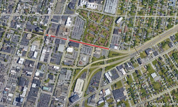
Butler Avenue is shown in red on the map.
Butler Avenue was laid out in 1915 between Lonsdale and Wohlers Avenue. The street was developed by the International Home Building Company. International Home Building Co’s offices were on East Ferry at the corner of Wohlers. Demand for houses on the street was so high that they decided to open it to Humboldt Parkway after just a few months. Hamlin Park’s development was centrally located and within easy riding distance of Buffalo’s downtown. A 1915 article states, “the development that has taken place (on Butler Ave) in the last year or two shows what it means when building operations start in a large city.”
Buffalo’s first newspaper was the Buffalo Gazette, first published in 1811. It was published “occasionally” and later became a weekly newspaper. The first daily newspaper in Buffalo was the Western Star, which began publishing published daily in 1834. Through a series of purchases and mergers over the years, the Western Star newspaper eventually evolved into the Buffalo Courier-Express in 1926.
Edward H. Butler, Senior
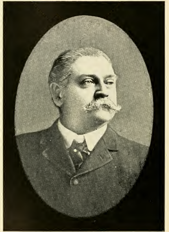
Edward H Butler, Sr. Source: 20th Century Buffalo
Edward Hubert Butler was born in 1850 in LeRoy in Genesee County, New York, to Irish immigrants Dennis and Lucy Butler. He attended public schools. The first newspaper he worked for was the LeRoy Gazette. He later became connected with the Scranton Times as City Editor and the Scranton Free Press as a Financial Interest Reporter.
In 1873, just 23 years old, Mr. Butler came to Buffalo to establish The Sunday News. This venture was regarded by many as reckless, but very quickly, Mr. Butler was able to prove that his judgment was sound. Other Sunday newspapers had failed to take hold, but The Sunday News was successful. In 1879, Mr. Butler established the Bradford Sunday News, published for four years before selling it to devote more time to his Buffalo newspapers. The Sunday News was published out of 200 Main Street in Downtown Buffalo.
Founding of the Buffalo Evening News
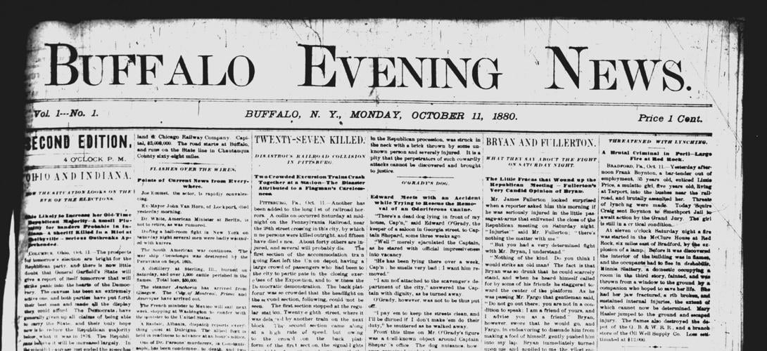
First Issue of the Buffalo Evening News from October 11, 1880. Source: The Buffalo News.
The first copy of the Buffalo Evening News was published by Mr. Butler on October 11, 1880. You may notice in the picture that the first issue was actually the Section Edition. The First Edition actually never made it to print. It was supposed to be off the presses at 2pm. Due to an elevator incident, the First Edition wound up on the floor, becoming “a tangled mess of handset type.” They reset the type, and the Second Edition rattled off the presses at 4pm, starting The Buffalo Evening News’ storied history.
With the expansion of The Evening News, The News moved to temporary quarters at 214 Main Street. The Evening News started as a four-page newspaper that cost 1 cent (about 30 cents today), less than the other daily newspapers of the time, which were 5 cents ($1.54 today). The first-day circulation was 7,000 newspapers. By 1882, just two years later, it had risen to 18,000 daily. The News was distributed by Buffalo’s system of horse-drawn streetcars. The papers were loaded aboard them. The News had a single horse-drawn, two-wheel cart for areas not reachable by streetcar. This was the only circulation department for the first several years. Eventually, a fleet of horse-drawn carriages replaced the streetcars for distribution. Some of those carriages were used again during the 1940s during WWII gas rationing.

Buffalo News Building on Main Street around 1908. Source: A History of the City of Buffalo, Its Men and Institutions.
In 1881, The News moved to 218 Main Street, a 20-foot-wide, four-story building. The business office (known as the counting room) was on the first floor, and the newsroom was on the second floor. By 1885, the Buffalo Evening News ran five editions daily, which would continue for a century. In 1896, the original 218 Main Street and the adjacent 216 Main Street were demolished for a new, larger building, which was used until 1973. The News building at 216-218 Main Street was described as “one of the finest publishing houses in the State” when it opened in 1898.
From the start, The Buffalo News differed from other newspapers in Buffalo and in cities other than New York City at the time. The News sent reporters out on the streets to bring their reports to life. It also offered something for everyone – news reports, market news, sports, prose and poetry, and advertisements. One of Mr. Butler’s adages was to “print nothing in The News a child may not read”, to keep The News clean and help it have appeal with everyone. It was designed to be “the People’s Newspaper” and to hold the public good above all else.
In 1885, The Buffalo News bought the Buffalo Telegraph. The Telegraph had been founded on October 30, 1880, just a few weeks after the Buffalo Evening News. The Telegraph had been run by James and George Scripps and John Sweeney. It had tried to compete with The News, but not been a financial success, so Mr. Butler took the opportunity and removed his competition.
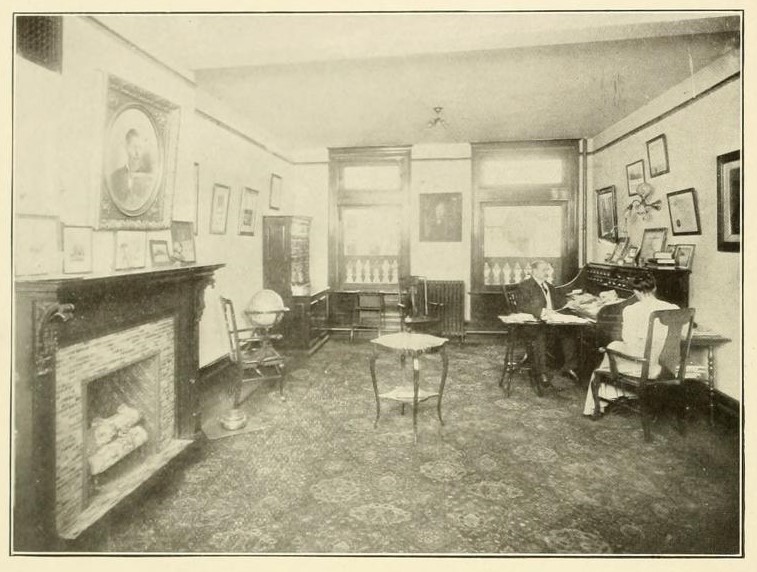
Mr Butler’s Private Office at The Buffalo News, circa 1908. Source: A History of the City of Buffalo, its Men and Institutions
Under Mr. Butler’s ownership, The Buffalo News was very successful. It grew from a four-page daily newspaper into one of the most important newspapers in the country in its first 40 years. By 1908, The Buffalo News had the largest circulation of any daily paper between New York and Chicago. It was recognized as one of the best newspapers in the country outside of the two or three largest cities. It was said that “his success as a journalist is due to his business capacity, his intellectual force and his habit of being in touch with people.” He kept in touch with every department and paid attention to the operations of his paper. When he was working on growing the newspapers’ circulation, there were times he was known to ride the train with the newspapers to ensure they made the connection to transfer for delivery of newspapers outside of Buffalo proper, personally ensuring that The News would get to people.
The Butler Family
Edward Butler married Mary E. Barber of West Pisston in 1871. They had four children, but only two survived – Ada Deen Butler, born May 31, 1879, and Edward H. Butler Jr, born June 19, 1883. The other two children were likely named Clara and Ambrose. [Note: It was difficult to find the names of the children who died young, as they do not show up in any records I could find. Special thanks to the staff at Forty Fort Cemetery in Pennsylvania, who took a peak into the Butler Mausoleum and found the crypts for Clara and Ambrose. There are no dates on their crypts, but many sources mentioned that Mary Butler was buried with her babies, so I will assume that Clara and Ambrose are the two children who died. Since there are no dates, there’s a possibility they were stillborn or died shortly after birth.] The Butler family attended Westminster Presbyterian Church.
In 1875, the Butlers lived at 109 Carolina Street (no longer extant). Along with Edward and his wife Mary, his brother Ambrose Butler was also living with them while he was working as a clerk in the Canal office. They also lived with a Domestic Servant – 19-year-old Mary Gorman, and a Housekeeper – 65-year-old Caroline Strong.
In 1880, the Butlers lived at 377 Prospect Street (still standing). The house had been the home of Seth Clark before the Butlers. Along with Edward, Mary and daughter ADA, Edward’s brother Ambrose also lived in the home. They lived with 20-year-old hosler (keeper of horses) John Collins, and 19-year-old servant Mary Schneck.

Image of 429 Linwood Ave as featured in Buffalo News, May 1984.
From 1890 to 1897, the Butlers lived at 429 Linwood Avenue (still standing). This house is often called the “Lock-Butler House, as it was constructed by William Lock and then was home to the Butlers. The house is an example of the Romanesque Style in Buffalo. Mrs. Mary Butler died in August 1893 at the age of just 38 after an illness of three months. She was buried in Forty Fort Cemetery in Forty Fort, Pennsylvania, in a plot near her two children who had passed away, her father, and her brother.
In 1905, Mr. Butler lived at 522 Delaware Avenue (no longer extant). He lived with his son Edward, daughter Ada and niece, 28-year-old Josephine Barber, a niece of the late Mrs. Mary Butler, who served as homemaker for the household. They had four servants – 38-year-old Catherine Clark, 32-year-old Anna Peterson, 32-year-old Anna Sticht, and 29-year-old Mary Gerhardt. Rounding out the household was 33-year-old Coachman August Gernoudt and his 32-year-old wife Nellie.
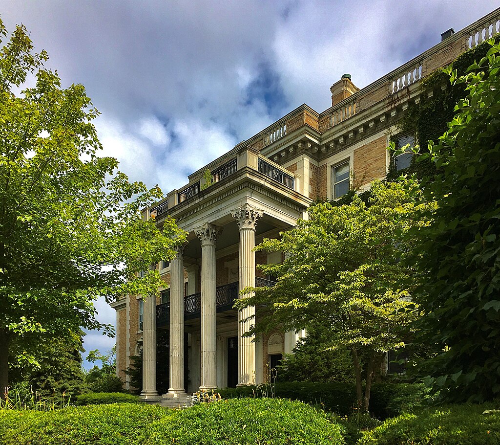
Butler Mansion at 672 Delaware Avenue
In 1909, Edward Butler, Jr. married Kate Maddox Robinson of Atlanta, Georgia. Also that year, the Butler family (Edward Sr., along with Edward Jr, his new bride Kate, and sister Ada) moved into the house at 672 Delaware Avenue, often called the Butler Mansion (still standing today). The mansion was originally built for banker and leather manufacturer George Williams. It is a three-story, Georgian Revival-style mansion with 40 rooms. It was designed by Mead McKim and White architects, and the two-acre property consists of a 16,000-square-foot mansion and an 8,000-square-foot carriage house.
In 1910, Mr. Butler lived with his son Edward Jr, daughter-in-law Kate, daughter Ada, and 8 servants: butler Herman Werne, and servants Pauline Benner, Caroline Killins, Antoinette Burnod, Emily Schnicklart, Gertrude Beck, Agnes Gambert, and Agnes Kelly.
Mr. Butler’s Other Involvements
Mr. Butler was very involved with enacting of grade crossing law that created the Grade Crossing Commission and served as a member of the Commission from its founding for its first 20 years. The Commission erected numerous grade crossing structures within the City of Buffalo city limits.
Mr. Butler was also involved in constructing the McKinley Monument in Niagara Square. The Buffalo News was able to help secure appropriations that made the monument possible. Mr. Butler was President of the Commission that erected the monument. Mr. Butler worked closely on the memorial to President McKinley with George E Matthews of the Buffalo Express.
Mr. Butler served as a member of the Board of Trustees for the State Normal School for many years and was President of the Board for the last three years of his life. He was President of the Buffalo Daily Newspaper Publishers Association, Vice-President of the United Press, Director of the Associated Press, and President of the State Editorial Association. He was a member of the Buffalo, Ellicott, Park and Country Clubs in Buffalo; the Lotus and Larchmont Clubs in New York’s Clover Club in Philadelphia and the Capital City Club in Atlanta.
According to the book 20th Century Buffalo, in 1902, Buffalo had the following newspapers:
- Morning Newspapers: Buffalo Morning Express (established 1846), Buffalo Courier (established 1842), and Buffalo Review (established 1883).
- Evening Papers: Buffalo Commercial (established 1835), Buffalo Evening News (established 1880), Buffalo Evening Times (established 1883), Buffalo Enquirer (established 1891), Demokkrat (German – established 1837), Freie Presse (German – established 1855), and Polak W’Amervca (Polish – established 1887).
- Sunday Papers: The Illustrated Buffalo Express (established 1883), Buffalo Sunday News (established 1873), Buffalo Courier (established 1885), and the Buffalo Sunday Times (established 1879).
The circulation of the Buffalo Evening News at the time was 75,000 daily. This was much more than the daily circulation of its closest competitors – the Buffalo Courier at 55,000 daily and the Buffalo Evening Times, The Buffalo Enquirer and the Buffalo Morning Express at 30,000 daily. By 1927, the Buffalo New daily circulation was reportedly at 150,000. By the mid-70s, the circulation was reportedly 280,000, with 300,000 on weekends.
The Death of Edward H. Butler
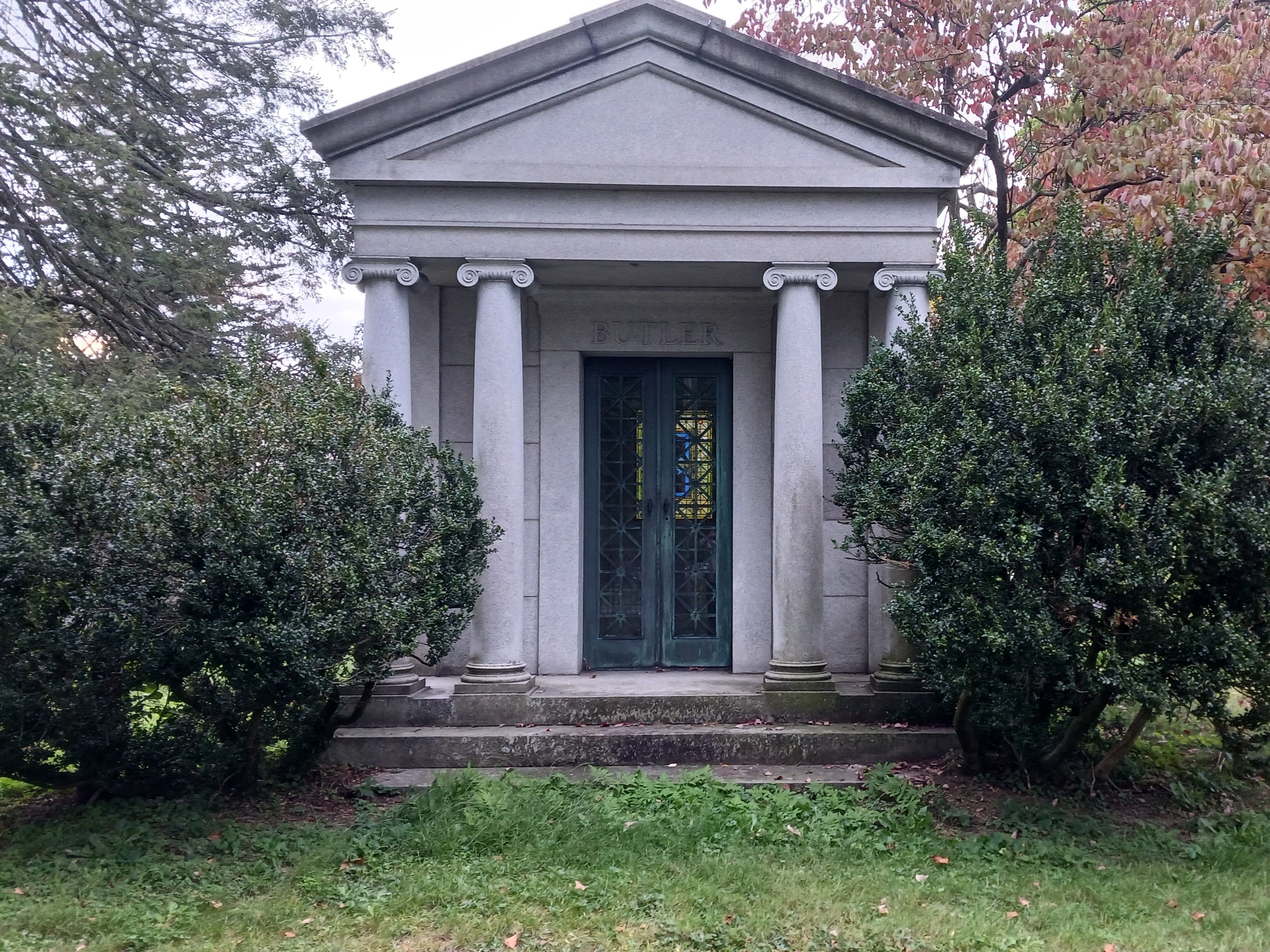
Butler Mausoleum in Forty Fort Cemetery in PA
In 1914, Edward H. Butler died at his residence near the corner of North and Delaware. He had been in poor health for about ten years, mainly due to diabetes. He had recently had an operation for mastoiditis, an infection of the ear. He did not recover well from the surgery. His funeral was held at Westminster Presbyterian Church on Delaware Ave in Buffalo. He was buried in a mausoleum in Forty Fort Cemetery in Forty Fort, Pennsylvania, next to his wife and the two babies who had passed away.

Interior of Butler Mausoleum showing Mr. Butler’s crypt.
Mr. Butler’s will gave to many charities. It was believed that Mr. Butler left personal property valuing $25,000(about $787,000 in today’s dollars) and real estate valued at $25,000(about $787,000) or more. He gave $60,000 (about $1.9 Million) dispersed amongst 40 charities/institutions. [Note: For a deep dive into Mr. Butler’s Bequests, we will discuss his will in my next post, going into each organization that received the money, the story of the charities and if they exist anymore. Stay tuned for that!]
Outside of Buffalo, he donated to the cemetery where he and his wife are buried and to the cemetery in LeRoy where his mother and other relatives were buried. He distributed approximately $60,000 (another $1.9 Million) to his personal friends, relatives and employees. Every employee of The Buffalo News who had worked there for at least three years was given $100(about $3,147 today).
Edward H. Butler, Jr.

Sketch of Edward Butler Jr. Source: The Fourth Estate.
Following Mr. Butler’s death, son Edward H. Butler, Jr. took over as Editor of The Buffalo News. Edward Jr also inherited the house at Delaware and North Streets, all of the oil paintings, plates, china, rugs and furnishings. Daughter Ada inherited her house at Delaware and Highland Avenue, which had recently been completed, along with $50,000 to equalize her brother’s more significant inheritance of the larger family home.
Edward Jr also inherited six-tenths of Mr. Butler’s ownership of the buildings used and occupied by the Buffalo Evening News and the Buffalo Sunday Morning News – 216 and 218 Main Street, the press and composition rooms on Pearl Street south of Seneca Street, the building at West Seneca Street and Lower Terrace that was used as a garage for the news vehicles, and all of the real estate used for the publication of the two newspapers. The remaining four-tenths of The Buffalo News and Sunday Morning News went to Ada.
Edward Jr had been well-trained to take his father’s place at The News. He joined The News after graduating from Yale in 1907. He took business courses at Bryant & Stratton Business Institute. He also worked various jobs in all of the newspaper’s departments. He knew all the people and how they made the newspaper work; the Butlers felt that learning and understanding every part of the business was important.
In 1914, Buffalo readers had a choice of six English-language daily newspapers. In the morning – The Courier and the Express. In the afternoon, The Buffalo News, the Buffalo Times, the Buffalo Enquirer, and the Buffalo Commercial.
One of Edward Jr.’s first tasks when he took over the newspapers was to close The Sunday News. The Evening News was doing well, but The Sunday News was operating at a deficit. Edward Sr had refused to kill The Sunday News as it was his first publishing venture in Buffalo. Edward Jr quietly killed The Sunday News at the start of 1915. The Buffalo News Sunday edition began again 63 years later when things shifted following the Butler family’s sale of the newspaper.
Edward Jr and Kate continued to live at 672 Delaware Avenue. They had two children – first a son, Edward H Butler III, was born in August 1915. Sadly, Edward III passed away in June 1919, just a few months before his fourth birthday, after several days of illness. According to his obituary, he had been in poor health for the previous year, suffering from “a peculiar glandular malady that had puzzled physicians.” Daughter Kate Robinson Butler was born in November 1921.
In the 1920s, Edward Jr became a pioneer in presenting news via radio. The Radio Commission authorized WBEN to go on the air on September 8, 1930. The WBEN stands for Buffalo Evening News. WBEN broadcast from a studio on the 18th floor of the Hotel Statler. WBEN started broadcasting with all live, local programs, no national programs and no prerecorded music. WBEN was a part of National Broadcasting Co.’s Red Network, which became the NBC Network. In 1936, Edward Jr bought WEBR, part of the Blue Network that would later become ABC. WEBR developed a slogan saying that their letters stood for We Extend Buffalo’s Regards. Edward Jr sold WEBR in 1942 to the Courier-Express.
In 1928, Mrs. Kate Butler gifted the University of Buffalo with the tower clock in Hayes Hall and the four bells accompanying it. Mrs. Butler was a member of the Council of the University of Buffalo. The bells and the clock were restored between 2011 and 2015 during the renovations of Hayes Hall and still operate today.
By the 1930s, the last competing daily newspapers, Buffalo Commercial Advertiser and Buffalo Times ceased publication. This left Buffalo with just two newspapers – The Buffalo News and the Buffalo Courier Express.
After WWII, Edward Jr brought The News to television in Buffalo. WBEN-TV went on the air on May 14, 1948 and for the first five years was Western New York’s only television station. In 1954, WBEN-TV became a CBS station. In 1977, WBEN-TV became WIVB-TV, Channel 4 in Buffalo still to this day.
Edward Jr was involved in many of the same causes as his father. He was the Chairman of the Board of Buffalo State Teachers College (Now Buffalo State University). He was involved with the efforts to move the school from his Normal Ave location to its current location on Elmwood Avenue. He also served as a Trustee of Nichols School. Edward Jr was a Director of Buffalo Trust Company and American Savings Bank. He was a member of the Buffalo, Saturn, University, Park, Buffalo Athletic, and Buffalo Country Clubs.

Butler Mausoleum in Forest Lawn Cemetery.
Edward Jr died in February 1956. He is buried in the Butler Mausoleum in Forest Lawn Cemetery. Also buried there are his son, Edward H Butler III, his wife, Mrs. Kate Butler, daughter Kate Butler Wickham and two of Kate’s husbands – Bruce Wallis and Robert Wickham.
Ada Butler and her Family
Edward Jr.’s sister, Ada Butler, married Roscoe Mitchell in April 1910. Mr. Butler, Senior built the house at 1114 Delaware Avenue as a wedding gift for Ada. The house is a three-story brick mansion designed by Buffalo architect Ulysses G Orr.
Roscoe Mitchell was a well-known Buffalo attorney. Ada and Roscoe had a daughter, Marjorie, born in 1911, and a son, Edward Butler Mitchell, born in 1912. Sadly, both Roscoe Mitchell and Edward Butler Mitchell died in June and July 1932 after a long period of illness. Roscoe was 49, and Edward was just 19.
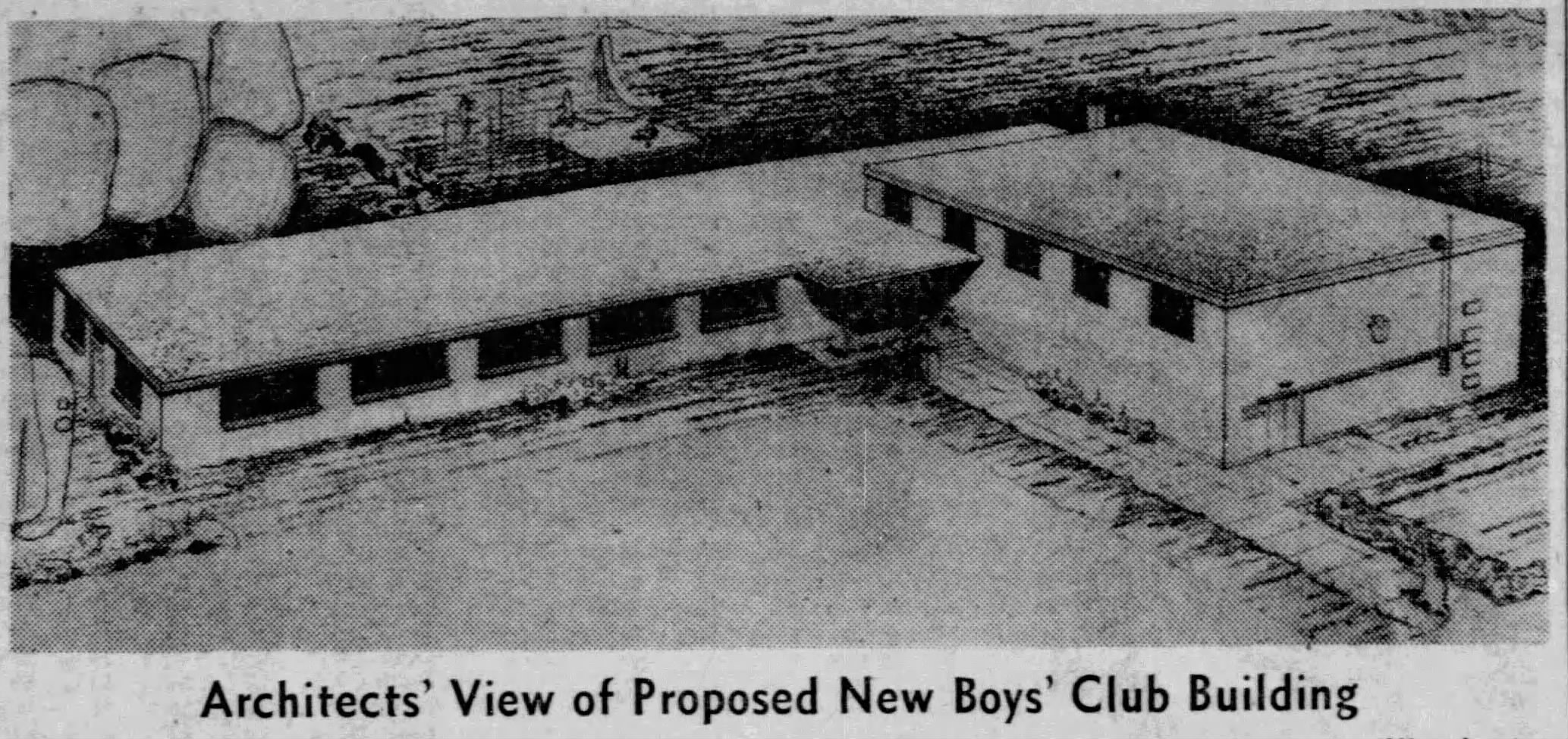
Rendering of Boys Club Building on Massachusetts Avenue. Source: Buffalo News, February 1955
The Butler Mitchell Boys Club was founded in the memory of Edward Butler Mitchell in 1933. The story goes that Ada was driving around the West Side shortly after her son died and saw some young men playing in a makeshift clubhouse and she pulled up to them and talked with them. She decided to buy an old barn on Efner Street to give to the boys of the neighborhood to use. The Butler Mitchell Club was founded to help the young men of the neighborhood, ages 16 to 24. The group quickly grew and rented a space in a church at 254 Virginia Street by December of 1933 (this former church is where Hispanics United of Buffalo is located today). In 1955, the Boys Club of Buffalo and the Boys Club of the Niagara Frontier joined together to erect a new building on the West Side at 370 Massachusetts Avenue, known as the Butler Mitchell Branch. The Butler Mitchell Boys and Girls Club is still located on this site.
After their father’s death, Edward Jr and Ada established and perpetually endowed the Edward H Butler Professorship in English Literature within the College of Arts and Science at the University of Buffalo. This professorship was established in honor of their father and still exists today.

Mitchell Family Plot in Forest Lawn Cemetery
Ada Butler died on April 1, 1934, in New York. She was buried in Forest Lawn Cemetery with her husband and son. The Mitchell family plot includes the graves of Roscoe, Edward, Ada, Marjorie and Marjorie’s husband Kent Schuyler McKinley, hence the “Mitchell McKinley” on the plot.
Ada’s daughter Marjorie was married several times. First to William Baird in July 1930. Baird Point at Lake LaSalle on North Campus at UB and Baird Hall are named for the Baird family – William, his brother Cameron, and their father Frank. A street by the Peace Bridge that bisected Front Park, Baird Drive, was also named for them. The road was removed in 2016 to restore park space to Front Park. Marjorie and William had one daughter, Barbara Butler Baird, born in August 1931.
Marjorie helped found the Butler-Mitchell Boys Club with her mother and served as president of the club from 1937 to 1952.
In 1943, Marjorie Mitchell married Kent Schuyler McKinley. As Marjorie McKinley, she financed the construction of the Edward H. Butler Auditorium in Samuel P Capen Hall [Note: this Capen Hall was located on South Campus; when North Campus opened, the Capen name moved to North Campus and Capen Hall on South Campus became Farber Hall…I am unsure if the auditorium still exists in Farber Hall – do any of my UB friends know?]
In 1950, Marjorie donated her family house on Delaware to the Episcopal Diocese of Buffalo. The Diocese used the house as its headquarters, calling it the “Marjorie Mitchell McKinley Diocesan House,” though many called it as “The D’ House.” The property has been the headquarters of Courier Capital since 2011.
Marjorie and her husband Kent moved to Sarasota and founded the Sarasota News in 1954. The Sarasota News was a daily afternoon newspaper. Talk about a family with deep newspaper ties! They sold the newspaper in 1962.
Also in 1962, Marjorie sold her 40% shares of The Buffalo News to her Aunt, Kate Butler.
In 1965, Marjorie was named honorary chancellor of Florida Southern College, the first woman elected to the office. That year, she also received an honorary doctor of fine arts degree from the college. She was the main donor for the music building built on campus, the Marjorie M McKinley Music Building, which was named for her.
Kent McKinley died in 1972. Marjorie married Ted C Van Antwerp in 1973. Marjorie passed away in November 1990. Marjorie and Kent are buried in the Mitchell McKinley plot in Forest Lawn Cemetery.
Mrs. Kate Butler
 Following Edward Jr’s death, his wife Kate Butler led The News. She became President of The News in 1956. She was known around town as “Mrs. Butler”, so I will call her that from here on out.
The News had purchased additional properties over the years, taking over much of the area at Main and Seneca Streets. In 1916, The News purchased a building on Pearl Street and remodeled it for use of the mailing department and for stock and file rooms. In 1924, The News bought a building at Seneca and Pearl Streets; the four-story structure became part of The News’ press room. In 1929, they purchased 214 Main Street and built an addition to their building. They continued to need more space. Mrs. Butler finished the construction of the printing plant, which her husband had begun. The printing plant on Scott Street opened in 1958 on land that was once part of the Lehigh Valley railroad depot. The new plant had 35 printing units arranged to operate as five giant presses. On June 30, 1958, President Dwight D. Eisenhower pressed a button at the White House to start the first production run with the new presses.
Mrs. Butler also became the Publisher of The News in 1971. James Righter was publisher from 1956, when Edward Jr died, until 1971. James Righter was married to Edward and Kate’s daughter Kate. While the public word was that he took early retirement, reportedly, Mrs. Butler became Publisher because she fired her son-in-law when she found out he was having an affair.

Buffalo News Birds Eye View, April 13, 1973. Source: Buffaloah.com
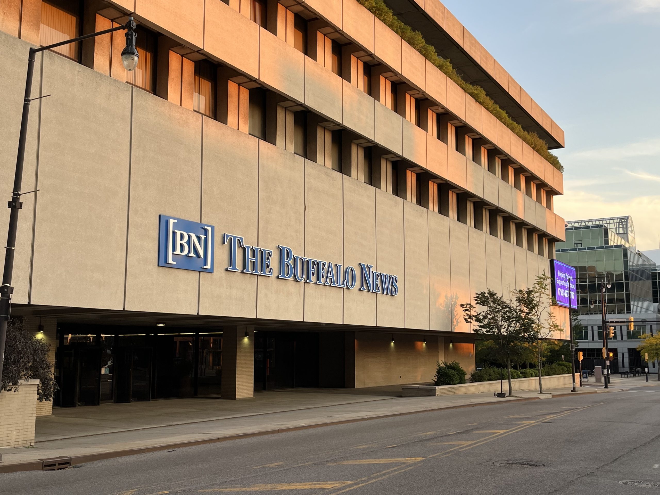
Mrs. Butler also made the tough decision to move The News from 218 Main Street after 75 years to the “new” Buffalo News building at the corner of Washington and Scott Streets. The Main Street property was going to be a part of the City’s redevelopment program to build Marine Midland Center (now Seneca One Tower). The new office building was built next door to the printing plant on Scott Street. One News Plaza, as the new building was known, was designed by NYC Architect Edward Durrell Stone. The modernist building is unusual because there are no support columns in the middle of the floor plates. The five-story building also has an atrium that houses a garden with trees and plants. The News moved into the new building at the corner of Washington and Scott Streets. Mrs. Butler, unfortunately, was never able to set foot into the new building, as ill health had confined her to her house.
Kate Butler died in 1974. She is buried in the Butler Mausoleum in Forest Lawn Cemetery.
The Buffalo News After Mrs. Butler’s Death
Mrs. Butler had reportedly been counseled by her attorneys to take steps to minimize the tax consequences that would occur upon her death by gifting off some of her assets, otherwise a “fire sale” would occur. After Mrs. Butler’s death, the Butler family decided to put The News up for sale. The newspaper, TV station and radio stations were each sold to different buyers following Mrs. Butler’s death. The News was officially out of broadcasting at that time.
The Butler Mansion was donated to Roswell Park Cancer Institute in 1976. In 1979, Jeremy Jacobs purchased the mansion for use as the headquarters of Delaware North Companies (the mansion is located at Delaware and North Streets, hence the Delaware North name). In 1991, the mansion was sold to the Variety Corporation. In 1999, Mr. Jacobs reacquired the mansion for the UB School of Management to use the property for executive training. In 2001, the mansion was renamed the Jacobs Executive Development Center. In December 2022, the UB Foundation announced the mansion’s sale to Douglas Development.
In 1977, after 97 years of being owned by the Butler family, the newspaper was purchased by Warren Buffett for $32.5 Million. Mr. Buffett became Chairman of The News. When Mr. Buffett purchased The News, it was an afternoon newspaper published every day except Sunday. Afternoon newspapers were dying across the country at the time due to the rise of office work over factory jobs and TV news, which made the afternoon edition feel out-of-date at the end of the work day. The Evening News was different than most; it still sold more than double as many copies as the Courier-Express morning edition. But it still lacked a Sunday paper. One of Mr. Buffett’s first decisions was to restart the Sunday edition, which began on November 13, 1977. There had been a gentleman’s agreement between The News and the Courier-Express that The News would be evening only and the Courier-Express would be morning only. The Courier-Express fought against the Sunday edition by persuading a local judge to issue rules designed to cripple the distribution of the Sunday News. In 1979, an appeals court overturned the crippling rules and scolded the judge who imposed them. Two months later, the Connors family sold the Courier-Express to a Minneapolis newspaper company. Three years later, on September 19, 1982, the Courier-Express published its last newspaper, leaving Buffalo with just one newspaper.
After the Courier-Express closed, The Buffalo News became a seven-day newspaper. In 1989, Buffalo News was the 27th largest newspaper in the United States, with 1100 full-time employees, 200 employees in editorial, and a circulation of 320,000 on weekdays and 390,000 on Sundays. In 1990, 75% of the newspapers were delivered to homes by 4900 newspaper carriers (4400 youth, 500 adult carriers). Like so many other Western New Yorkers, I delivered newspapers in middle school. The remaining newspapers were mailed out or found at newsstands/stores.
The evening edition was abandoned in October 2006, and what had begun as The Buffalo Evening News became a morning-only newspaper.
In January 2020, after 42 years of being a part of Warren Buffett’s Berkshire Hathaway group, The Buffalo News was sold to Lee Enterprises, just the third owner in the entire history of The News. Lee Enterprises had ties to Berkshire Hathaway and had managed the Berkshire Hathaway newspapers, except for The Buffalo News, since 2018.
Former Buffalo News building from Washington Street. The property is now vacant and fenced off.
In 2022, The Buffalo News announced they were selling their headquarters on Scott Street, moving out of Downtown Buffalo for the first time in almost 150 years. The 175 office employees relocated to 20,000 square feet in the Larkin Exchange Building on Exchange Street in October 2022. The print production facilities were originally going to remain on Scott Street.
In February 2023, The Buffalo News announced they were closing the printing production facility on Scott Street and moving print operations to Cleveland, Ohio, to the Plain Dealer printing facility. About 130 employees across 8 different unions were affected by the closure of the print operations. The final locally printed edition came off the presses on September 30, 2023.
In 2024, The Buffalo News announced they would no longer publish a print issue on major holidays, including New Year’s Day, Martin Luther King Jr Day, Presidents Day, Memorial Day, Independence Day, Labor Day, Veterans Day, Thanksgiving and Christmas.
The Buffalo News building was purchased by Douglas Jemal in July 2024. The sale included the office building, the adjacent production building and a parking lot across the street on Scott Street. Douglas Jemal also owns the former HSBC Atrium building, just south of The Buffalo News properties, giving the developer control of approximately 14 acres of land in Downtown Buffalo near Canalside and the Arena – I can’t wait to see what he does with the properties!
So the next time you drive down Butler Ave, or pass by the Former Buffalo News office or the Butler Mansion at Delaware and North, or read The Buffalo News, think of Mr. Edward H Butler and thank him for coming to Buffalo and giving us The Buffalo News and so much more. What’s your favorite Buffalo News memory?
Want to learn about other streets? Check out the Street Index. Don’t forget to subscribe to the page to be notified when new posts are made. You can do so by entering your email address in the box on the upper right-hand side of the home page. You can also follow the blog on Facebook. If you enjoy the blog, please share it with your friends; It really does help!
Sources:
- “Building is Active in Hamlin Park Now.” Buffalo News. November 20, 1915, p21.
- “Butler Ave Just Opened New Street in Hamlin Park.” Buffalo News. May 15, 1915, p23.
- “Edward H. Butler Died Soon After Serious Operation.” Buffalo Times. March 10, 1914, p4.
- “Will of Edward H. Butler is Filed This Afternoon” Buffalo News. March 18, 1914, p4.
- “Edward H. Butler Jr and Kate Butler.” Buffalo News. November 1, 2015, p84.
- “The News: A radio and TV Pioneer.” Buffalo News. November 15, 2015, p92.
- “How the News Grew In Downtown Buffalo.” Buffalo News. November 22, 2015, p90.
- “Buffalo’s Last Newspaper War.” Buffalo News. December 13, 2015, p94.
- “Death of Mrs. Edward H Butler.” Buffalo News. August 21, 1893, p13.
- “Striking Clock Being Installed at University.” Buffalo Times. June 21, 1928.
- “Bennet, A Gordon. Buffalo Newspapers Since 1870.” Adventures in Western New York History, Buffalo and Erie County Historical Society, 1974.
- Hill, Richmond C. Twentieth Century Buffalo: an illustrated compendium of her municipal, financial, industrial, commercial and general public interests. J.N.Matthews Co, Buffalo, 1902.
- Downs, Winfield Scott. Municipality of Buffalo: A History, 1720-1923, Volume 1. Lewis Historical Publishing Company, 1923.
- Kirchhofer, A.H. “Romance in American Journalism.” The Fourth Estate. November 19, 1927.
- “Jacobs Executive Development Center”. University at Buffalo Archives. library2.buffalo.edu/archives/campuses/detail.html?ID=118
- “Facts About The Buffalo News.” from The Buffalo News. Updated 9/1990. Found in the Newspapers Vertical File at the Central Library.
- History of the City of Buffalo, It’s Men and Institutions. Published by The Buffalo Evening News. 1908.
- “Obituary: Edward H. Butler, Jr.” Buffalo News. June 23, 1919, p1.
- “Station WEBR Transferred; WBEN’s Status Unchanged.” Buffalo News. July 12, 1942, p8.
- Hsu, Charlotte. “Journey to the Heart of the Hayes Hall Clock.” UBNow, October 22, 2014. buffalo.edu/ubnow/stories/2015/10/hayes_clock.html
- “Marjorie Van Antwerp Dies; Ex-News Executive”. Buffalo News. November 30, 1990, p5.
- Butler Mitchell Alumni Association. “Our History”. bmalumni.com/history
- Robinson, David. “The Buffalo News is Being Sold to Lee Enterprises.” Buffalo News. January 20, 2020.
- Petro, Michael. “Buffalo News Plans to Close Downtown Production Facility, Move Printing to Cleveland.” Buffalo News. February 20, 2023.
- Glynn, Matt. “Douglas Jemal agrees to buy Buffalo News complex to expand holdings near Canalside.” Buffalo News. March 19, 2024.
- Ashley, Grant. “Buffalo News no longer publishing print issue on ‘major holidays’. WBFO. July 6, 2024.
- Light, Murray B. From Butler to Buffett: The Story Behind The Buffalo News. Prometheus Books. 2011.
- Sullivan, Margaret. “Historic Change Coming for The News.” Buffalo News. October 1, 2006, p81.
 Discover Downtown – Then and Now – we will look at the area around Lafayette and Niagara Squares and the core of Downtown Buffalo. We’ll talk about the history of the central part of Downtown as the city grew and the buildings in the area. You’ll also get an up-close look at the progress of the Main Street Multi-Modal Access and Revitalization Project (Cars Sharing Main Street), which is currently working on replacing the 35-year-old metro rail track bed.
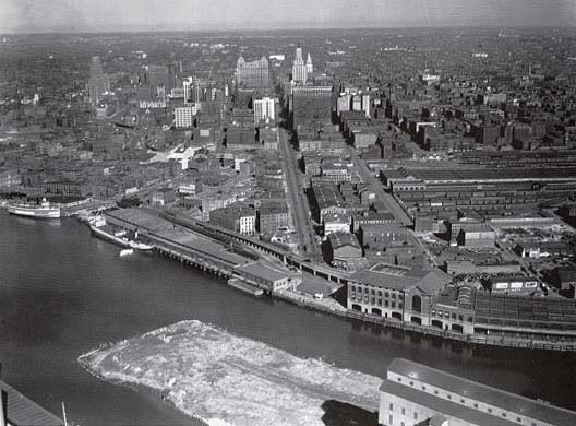 Discover Lower Main Street – this tour looks at the area of Lower Main Street, south of Church Street, portions of the former canal district, and the Erie Street corridor. We’ll talk about some of the earliest history of Buffalo, how the area has changed over the last 150 years, and you’ll get a glimpse of the construction happening right now at the former location of Memorial Auditorium.
 Emerson Place is a small one-block street that runs between Michigan Avenue and Masten Avenue in the Masten Park neighborhood on the East Side. The Street is named for Henry P. Emerson, superintendent of the Buffalo Public Schools. The Emerson neighborhood and Emerson School of Hospitality are also named after Henry Emerson. In Addition to the Emerson School on Chippewa, the Buffalo schools are about to start classes in a new location on West Huron, where the former CW Miller Livery was converted into classroom space and a new gymnasium was built on a parking lot. The new school will be The Buffalo School of Culinary Arts and Hospitality Management, formerly known as Emerson Annex. The school expansion project was one of Mark Croce’s projects. Mark passed away earlier this month. He was a friend of this blog and I always enjoyed talking with him about the history of his buildings. Since there’s no Croce Street, I write this post in memory of Mark, as well as in celebration of the new space for the students!


 Goodell Street is an east-west street that runs Michigan Avenue to Main Street. Goodell Street forms the northern boundary of the Central Business District and typically “south of Goodell” is used as a definition for what constitutes “Downtown Buffalo”. North of Goodell Street is the Medical Campus and the Fruit Belt neighborhood. Until the 1950s, Goodell Street ran thru to an intersection with Cherry and Locust Streets. The Kensington Expressway, which ends at Goodell Street, cut through the Fruit Belt. I am currently working on a multipart series about the streets of the Fruit Belt and the historic development of the neighborhood. Stay tuned! Goodell Street is named for Jabez Goodell, one of the early residents of Buffalo.

 Mr. Goodell died in September 1851 at 75 years old. In death, he donated 10 acres and $10,000 (about $333,000 in 2019 dollars) to the newly formed Buffalo Female Academy to build a 30,0000 square foot school. Ten months after he died, Goodell Hall opened at the school, just behind the Evergreen Cottage at the corner of Johnson Park and Delaware. Classes had been held in Evergreen Cottage (
 Wasmuth Avenue runs between Genesee Street and Walden Avenue near Martin Luther King Jr Park on the East Side of Buffalo. The street is named after one of the first female developers in Buffalo, Caroline Wasmuth. Ms. Wasmuth was one of Buffalo’s pioneer business women.
 Ms. Wasmuth was married twice and had four sons and five daughters: Frank, George, Maggie, Lillian, Anna, Caroline, John, Fredrick, and Charles. The family lived on Michigan Street (now Ave) near Carlton Street, on what is now the Buffalo Niagara Medical Campus. She was also one of the investors in the Pan American Exposition, having bought a subscription in 1899. She died in 1904 at the age of 75. She is buried in Forest Lawn Cemetery.
 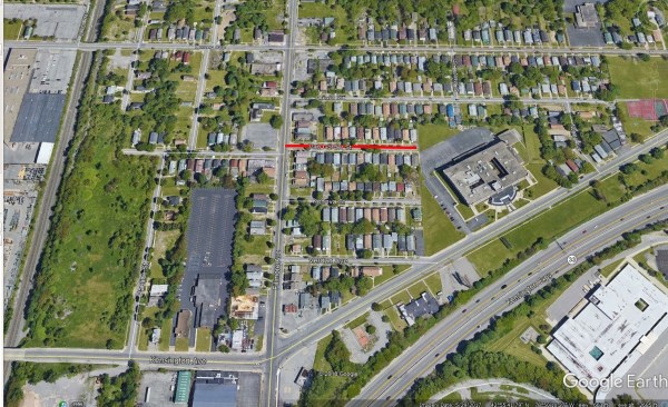 Van Gorder Street is a short street located off of Fillmore Avenue in the Fillmore-Leroy neighborhood of Buffalo. The street runs one block east of Fillmore Ave where it dead-ends at Burgard High School (PS #301).
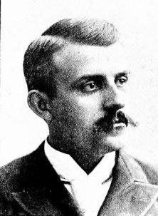 The street is named after Greenleaf S. Van Gorder, a politician and banker.

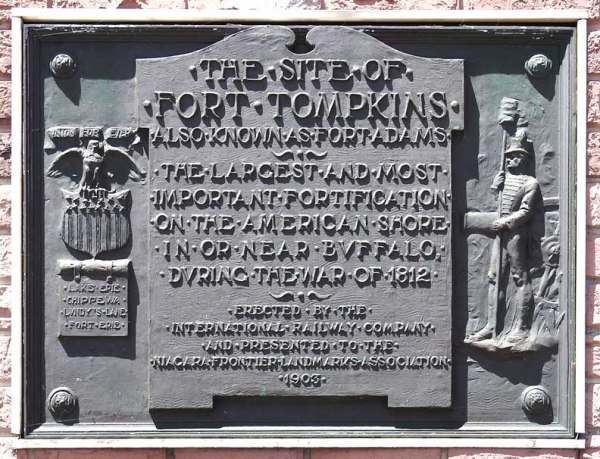 The large fort planned for Black Rock was never built, but a smaller one was built in 1807 and became Fort Tompkins in August 1812. Fort Tompkins was also known as Fort Adams. The fort was actually large mounds which were mounting points for seven guns. It was technically a battery, which is a cluster of cannons in action as a group put into position during a battle of a fort or city. Fort Tompkins was the largest of eight batteries that were built during the war. It was located at the top of the bluff at the bend in Niagara Street. The escarpment here allowed them to overlook the river, giving advantages over the attacks from the water. The location was later the sight of railway barns. A plaque was hung on the railway barn and still hangs on the building located at 1010 Niagara Street. The more famous Fort Tompkins was located on Staten Island and was built in 1663. They were both likely named for Governor Daniel Tompkins, Governor of New York from 1807 to 1817. Fun fact for if you’re ever on Jeopardy: Daniel Tompkins was later President Monroe’s Vice President and the only VP in the 19th century to serve two full terms.


 Gill Alley runs between Breckenridge Street and Auburn Avenue in the Elmwood Village. Gill Alley is one of a common type of alley that exists in Buffalo, particularly around the West Side. These alleys give access to carriage houses and garages via the rear of the properties along the adjacent streets. Housing ads in the early parts of the 1900s used frontage along the alleys as a selling point for homes. Many of these carriage houses have now been converted into apartments.
 Mrs. Gill developed a large garden in the rear of her home. She was a member of Lafayette Avenue Presbyterian Church and a Vice President of the Crippled Children’s Guild. She lived for nearly thirty years in the home she had built for herself. She died in 1919 and is buried in Forest Lawn.
 Abbott Road is a road that starts in the City of Buffalo at an intersection of Bailey Avenue and South Park Avenue and runs to an intersection at Bayview Road/Armor Duells. Abbott Road is about 9 miles in length and runs through not only the City of Buffalo, but also the City of Lackawanna and the Town of Orchard Park. Abbott Road used to continue north across the Buffalo River towards the First Ward neighborhood, but that portion of the road was changed to
 Seth Abbott died on June 8, 1831 and is buried in Hillcrest Cemetery in Hamburg.
 Samuel Abbott died on October 2, 1846 and is buried in Deuel Cemetery in Orchard Park.
 Kimmel Avenue is a short street, running two blocks between Abbott Road and Cazenovia Creek in South Buffalo. The street is named after Christian Kimmel, an inventor.
 Mr. Kimmel owned much of the real estate on the street that now bears his name. In addition to real estate and politics, he enjoyed working in his yard and garden and was proud of his horses, which he’d drive around town on their carriage.