Feeds:
Posts
Comments

Posts Tagged ‘War of 1812’

military road

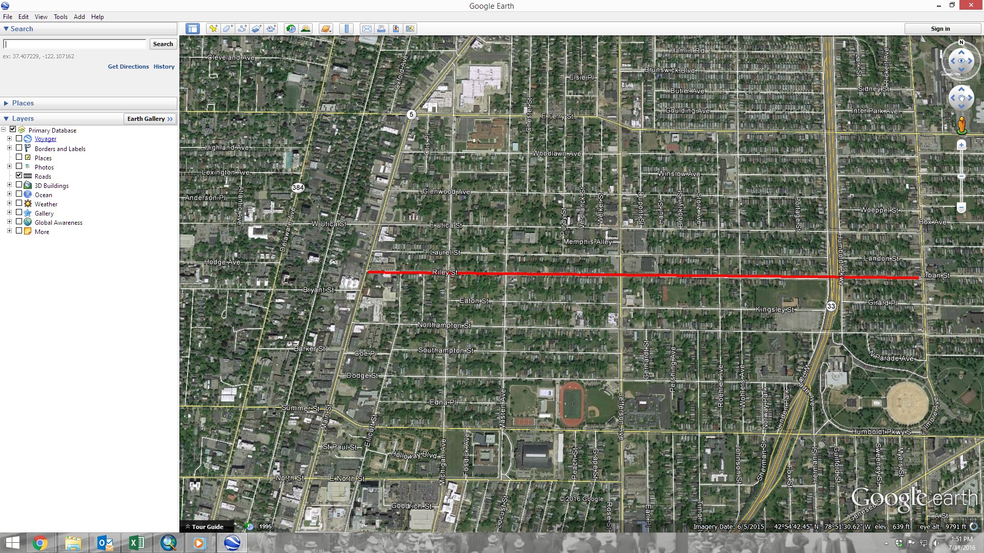
Military Road’s modern alignment through the City of Buffalo and Town of Tonawanda

Military Road is a part of NYS Route 265, a 19.75 mile long state road that runs between Niagara Falls and Buffalo.  The portions called Military Road are located in the City of Buffalo/Town of Tonawanda and then again in Niagara Falls, NY.  The road dates back to 1801, when it was laid out as a road to connect Black Rock with Fort Niagara, near Lake Ontario.  The route begins at the intersection of Niagara Street and the Scajaquada Expressway.  It runs along Tonawanda Street through Black Rock, Amherst Street, then turns into Military Road where it runs for 4.3 miles until the City of Tonawanda border.  In the City of Tonawanda it is Main Street, in North Tonawanda it is River Road, in Niagara Falls it is Buffalo Ave before it turns back into Military Road through most of Niagara Falls where it ends at a junction with NY 104 (Lewiston Road) in Lewiston.  From Lewiston to Youngstown, the River Road that ran up to the Fort was already built, so that was used to connect the Military built road to Fort Niagara.

map of military road - from buffalo history gazette

Historic Map showing the route of Military Road Source: Buffalo History Gazette

Military Road was one of the first roads in the country planned for military purposes.  Roads for defense have been around for a long time and are still around in modern times – much of the United States Highway System was built as the “Dwight D. Eisenhower National System of Interstate and Defense Highways”, designed for defense and modeled partly after the German Autobahn network that Eisenhower saw in Germany during WWII.  After the Revolutionary War, the federal government realized they needed a highway extending from the town of the Lewiston Escarpment to the bluff at Black Rock.  At the time, they were planning a large fort on the Black Rock bluff to guard the entrance to the Niagara River.  Most of WNY’s roads at the time were based on Native American trails and the trails of the earliest settlers.  These trails typically took the path of least resistance, to avoid things like creeks, marshes, or heavily wooded areas.  The highway would replace the old Portage Road, which was too winding, as it followed closely to the course of the river, rather than in a more direct line.  The Historic Map shows both the routes of the Military Road, which has a smoother path than the Portage route, which curves further to the west towards the Falls.

After the Revolutionary War, there were boundary disputes between New York and Massachusetts.  An agreement signed in Hartford, Connecticut in 1786 deeded the land once occupied by the Haudenosaunee to New York State, but Massachusetts maintained that they had a right to the area west of Seneca Lake once the Native American title was extinguished, except for a one-mile strip, which New York State reserved for itself.  The strip ran one mile inland along the Niagara River, from Buffalo to Stedman’s Farm (also known as Fort Schlosser, near where the water intakes are currently located along the Niagara Scenic Parkway/Robert Moses Parkway in Niagara Falls). Despite the State’s reservation of the parcel, the Seneca maintained that they retained the title to the Mile Strip, which was affirmed in the 1794 Pickering Treaty.   Massachusetts sold the rights to the surveyed portion of the land to Robert Morris in 1791.  Keeping a portion of the land for his own purposes, Robert Morris sold the rest of the land (which the exception of Grand Island and the Mile Strip) to the Holland Land Company, the company which Joseph Ellicott was the land agent.  You can read more about Joseph Ellicott and the Holland Land Company by clicking these links for Part One, Part Two and Part Three.  In 1798, Seth Pease surveyed the Mile Line for the Holland Land Company.  In 1802, the Seneca claim to the Mile Strip was extinguished by a treaty signed in Albany.  There had been little settlement in the area by the Seneca, only two Seneca families lived there year-round.  The treaty was initiated because the government wanted to construct a fort at Black Rock (also known as Upper Black Rock).  In 1803, the Deputy State Surveyor, Joseph Annin began to survey the Mile Strip into lots.  Fort Niagara was given 716 acres which were set aside for the Federal government.  The Stedman’s Farm/Fort Schlosser farm lot was set aside at 680 acres.  The Jones and Parrish tracts, which were each 640 acres, were also set aside and were given to Mr. Jones and Mr. Parrish who had been Haudenosaunee captives during the war.  The Jones and Parrish lots were near the Scajaquada Creek.  A total of 111 lots were laid out within the remainder of the Mile Strip, the majority of which were 160 acres in size, but due to the curve of the river, many were slightly larger.  One square mile was set aside at the southern end for the Village of Black Rock.  For more on the laying out of Black Rock, you can read about Peter Porter, the streets named after states, and the numbered streets.

In 1801, General Moses Porter, commander at Fort Niagara, was ordered by the War Department to use his troops to build the road.  I was unable to find out if General Porter was related to Mr. Porter of Black Rock during my research.  They called the road Military Road because it was built by the soldiers.  Between 1802 and 1805, the right of way for the road was cleared.  At the time, road building typically consisted of cutting trees and brush wide enough  to bring an oxcart.  Military Road was built in a strip 100-feet wide.  Marshy areas were made passable by laying logs down, which was often referred to as a “corduroy road”.  It was a tough task, as the road was built through forests and over swamp lands to cut a straight path.  Bridges were built in Tonawanda, but work was stopped and the road surface was not finished for seven years, due to disagreements between the State and the Federal Governments. In 1808-1809, New York State gave $1,500 (about $30,000 in 2018 dollars) to the project and the road was complete.

fort tompkins sign
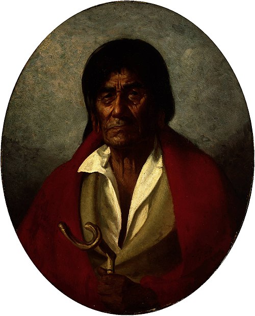
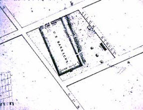
The large fort planned for Black Rock was never built, but a smaller one was built in 1807 and became Fort Tompkins in August 1812.  Fort Tompkins was also known as Fort Adams.  The fort was actually large mounds which were mounting points for seven guns.  It was technically a battery, which is a cluster of cannons in action as a group put into position during a battle of a fort or city.  Fort Tompkins was the largest of eight batteries that were built during the war.  It was located at the top of the bluff at the bend in Niagara Street.  The escarpment here allowed them to overlook the river, giving advantages over the attacks from the water.   The location was later the sight of railway barns.  A plaque was hung on the railway barn and still hangs on the building located at 1010 Niagara Street.  The more famous Fort Tompkins was located on Staten Island and was built in 1663.  They were both likely named for Governor Daniel Tompkins, Governor of New York from 1807 to 1817.  Fun fact for if you’re ever on Jeopardy:  Daniel Tompkins was later President Monroe’s Vice President and the only VP in the 19th century to serve two full terms.

Military Road Marker

Historic Marker near Amherst Street and Military Road

One of the only military uses of the road was during the War of 1812.  American General McClure lost Fort George after a significant battle.  General McClure then gave the notice to burn Fort George and the Village of Newark (now Niagara on the Lake) to deny shelter to the British.  The Americans then retreated to Fort Niagara.  The British reoccupied Fort George and planned an assault on Fort Niagara in retaliation for the burning of Newark.  General McClure claimed he had acted on Secretary of War’s order in the burning of Newark.  He had been told earlier in the year to destroy Newark if necessary but to give the residents several days notice to ensure they were not left destitute.  McClure had only given two hours notice, leaving residents without shelter or possessions during a heavy snowstorm.  This was against war conventions at the time.  McClure’s superiors disavowed his orders and McClure never again held command.

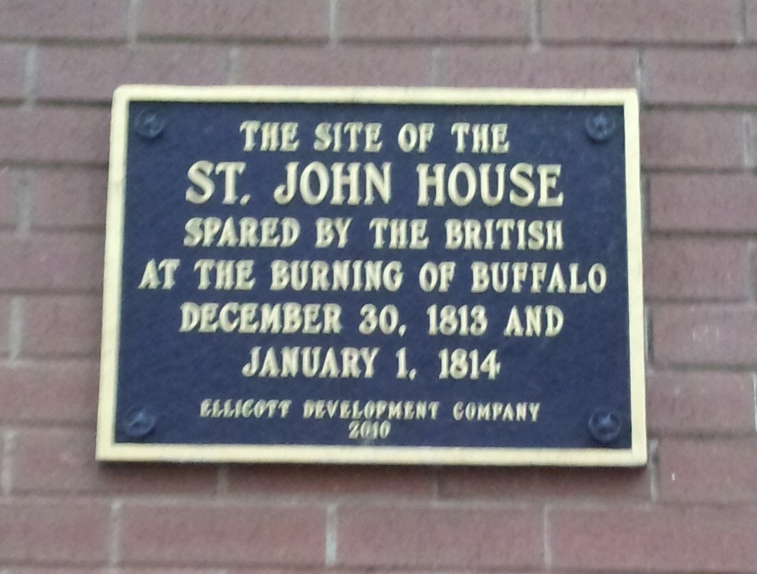
On December 19th, 1813, more than 500 soldiers crossed the Niagara River at a location known as Five Mile Meadows. They turned towards Youngstown and the Americans were taken by surprise and the story goes that they obtained the password to get into the fort by using a fake southern accent.  The British gained control of Fort Niagara and the British and their Native American allies marched upriver.  With the American Army gone, there were only civilian militias left to defend their land.  The British marched south, destroying farms and villages between Youngstown and Manchester (now Niagara Falls, NY).  The second British raid happened a few weeks later, December 31, 1813, which burned as far south as Black Rock and Buffalo.  General McClure retreated from Fort Niagara to Buffalo via Military Road after losing Fort Niagara.

The road fell into disuse and became overgrown, partly due to a debate between the state and federal governments as to who was supposed to maintain it.  Sections of it were used by local farmers.  Niagara County took over the road in 1820 and reconditioned it (at the time present day Erie County was part of Niagara County).  By 1832, it was cleared and repaired and became a state highway.

The idea behind the road was to facilitate travel of troops and munitions of war from Lake Ontario to Lake Erie.  Though the road was built for military function, it also helped to allow for commercial development of the area, with settlements occurring all along the Military Road.

In 1891, trolley service was extended along Military Road into the fledgling Village of Kenmore, allowing residents of Kenmore to arrive at the Military Road Station of the Belt Line, which would take them downtown for work.

miliatry marker sheridan drive

highlight-for-xml

Installation of the Boulder on Sheridan Drive, 1926. Source: Buffalo Courier Express

A boulder with a plaque honoring the Military Road was placed in Sheridan Drive by the Buffalo Chapter of the DAR in 1936.  It was part of a celebration of the centennial of the Town of Tonawanda.  The Centennial was held on exhibition grounds at the corner of Delaware Avenue and Sheridan Drive.  The dedication occurred on what was referred to as “Pioneer Day”.   New York State Historian, Dr. Alexander Flick, was on hand to give a speech and celebrate some of the oldest residents of Tonawanda.  Between 1906 and 1936, the Town had grown from 2,000 residents to 30,000.  Prizes were given to some of the residents including  the oldest married couple present, the oldest school teacher present, and the oldest male and female present.  Mrs. John Walters was unable to be present at the awards ceremony, but she had been a resident of Tonawanda for 93 years!

So the next time you drive along Military Road, think about the military history of WNY and remember the war fought right in our backyard, and the people who were determined enough to stay after their villages were burned to the ground.

Source:

  1. “Town Pioneers honor Guests and Centennial”.  Buffalo Courier Express, July 3 1936. p8.
  2. “Military Highway Will be Scene of Ceremonies” Buffalo Courier Express.  June 13, 1936, p13.
  3. Clinton Brown Architecture, pc.  Reconnaissance Level Historic Resources Survey:  Black Rock Planning Neighborhood.  November 2010.
  4. History of Old Fort Niagara.  https://www.oldfortniagara.org
  5. Lewis, Clarence.  “Evolution of Roadways in County Linked with Important Historical Happenings”.  Niagara Falls Gazette, July 29, 1954.
  6. Malloy, Jerry.  “Why is it Called Military Road?”  Buffalo History Gazette.  August 8, 2010.  http://www.buffalohistorygazette.net
  7. Percy, John & Graham Miller.  Images of America: Kenmore, New York.  Arcadia Publishing:  Charleston, South Carolina, 1998.


Advertisement

Read Full Post »

expressway

Scajaquada Expressway (NYS 198)

The Scajaquada Express (aka NYS 198) has been in the news a lot in the last few years.  Everyone has a lot of opinions on the road and what it should look like – whether to remain an expressway, be downgraded to a parkway, etc.  Of course, the expressway takes its name from the creek along who’s route it follows.  Did you know that in addition to the creek, there is also a second Scajaquada Street in Buffalo?

scajaquada street

Scajaquada Street

Scajaquada Street runs between Bailey Avenue and Grider Street on the east side of Buffalo, cut into two pieces by railroad tracks.  Scajaquada is the type of word that Buffalonians know, but the kind of word that immediately stumps out-of-towners, a relic of our Native American roots here in Western New York.  Both the street and the expressway get their names from Scajaquada Creek.  Did you know that Scajaquada Creek was named after a person?

The creek is named after Philip Conjockety.  His name was also spelled Kenjockety.  He was also known as Ska-dyoh-gwa-deh (meaning “Beyond the Multitude”), which was also spelled Skandauchguaty or Conjaquady.  There are estimated to be as many as 90 different spellings of the word.  No wonder we still have trouble spelling the word today!  (One of my favorite Buffalo jokes:  How do you spell Scajaquada?  “198”)  The Seneca name was commonly Ga-noh-gwaht-geh, meaning “after a peculiar kind of wild grass that grew near its borders”.  The grass was important to early settlers, because it was used to create woven baskets, fishing nets, and supplies.

1850 Portrait of Philip Conjockety by Lars Gustaf Sellstedt

Philip had come to Buffalo with the Senecas shortly after the Revolutionary War, when they were driven away from the Genesee Valley.  Philip’s great grandfather was a member of the Kah-kwahs, who once lived in the Western New York area.  The Kah-kwahs were overtaken by the more powerful Senecas around 1651, and the survivors were adopted into the Seneca nation.  Philip’s father, John, became Chief of the Seneca, and was part of the influence which brought the Seneca Nation to the banks of the Niagara River near what became Scajaquada Creek when they left the Genesee Valley.

Philip was born near the Tonawanda Reservation and lived in Fort George during the Revolutionary War, when he fought with the Senecas against the Americans.

Philip died April 1, 1866, at Newtown, on the Cattaraugus Reservation.  When he died, the Courier reported at the time that he was the oldest resident of the region.  Some accounts listed him as 120 to 130 years old, but it was generally believed that he was nearly 100 when he died.  His mind was clear in his old age, so much of the early history of Buffalo was gathered from Philip’s stories.

During the War of 1812, the navy yard at the mouth of Scajaquada Creek was where five of Commodore Perry’s ships were reconditioned during 1813.  A plaque commemorating this location of this navy yard is on the Niagara Street Bridge, north of Forest Ave.   On South Side of the creek near its mouth was Sailor’s Battery – the last in a line of 8 batteries stretching from the Terrace to the Creek that helped defend during the War of 1812.   The Sailor’s Battery was the first to be overtaken during the night of December 29, 1813 during the Battle of Black Rock which led to the Burning of Buffalo.

Doreen-DeBoth-Buffalo-NY

“Battle of Scajaquada Creek Bridge” Artist: Doreen Boyer DeBoth

The Battle of Scajaquada Bridge was fought August 3, 1814.  British forces were attacked by American forces at the bridge, west of where Niagara Street crosses the creek.  The American forces were entrenched on the south side of the creek and began to dismantle the bridge to prevent the British from crossing.  The British attempted to rebuild the bridge, but failed and ended up retreating to Canada.  The outnumbered American men were able to stand up to the British men in what was the last act of British aggression towards Buffalo during the war.  The victory is described as a decisive engagement and a triumph for the United States.

By 1902, the area around the mouth of Scajaquada Creek had become a city dump.  The area was a popular place for “mouchers” to rifle through the discarded waste of the city to resell things.  Of the Scajaquada Creek dump, it was written:  ” Once it was a picturesque stream, but here its glory is departed.  It has banks of ashes six or eight feet high and between them flows the noble stream in a sluggish, dirty current.  Its channel obstructed by peach baskets, bottomless coffee pots, kerosene cans, bed springs, tin cans and other materials which the moucher rejects.”

Historic View of Scajaquada Creek Source: Buffalo News

In 1899, the National Motor Transit Company entered into a 1 year contract with the Park Board of Buffalo to operate an automobile transit service to travel along what would become, 60 years later, the route of the City’s first intra-urban highway, the Scajaquada Creek Expressway.  Four cars traveled from Lincoln Parkway past the zoo to Humboldt Parkway and Main Street every half hour.

Around 1946, New York State began planning for a system of highways throughout the City of Buffalo in a report titled Report on the New York State Thruway and Arterial Routes in the Buffalo Urban Area.  In 1951, the Buffalo Planning Commission adopted a Major Traffic Ways Plan that included the Scajaquada Expressway as a component of the system.  Traffic was quickly growing within the City and the highways were designed to find a place for the cars by channeling them onto expressways.  The Scajaquada Expressway was constructed during the 1950s and 1960s.   The route was designated by the Surface Transportation Act of 1982 as NYS Route 198.

Buffalo NY Courier Express 1958 a - 2435

Proposed plan for Delaware Park Shortway. Source: Courier Express, September 5, 1958

Other plans to create a second limited access highway was proposed for Delaware Park in 1958.  The “Delaware Park Shortway” would have run parallel to 198 across the north side of the Delaware Park meadow.  The City Planning board tabled the proposal in order to finish construction of the Scajaquada and Kensington Expressways to be completed before the Shortway was built, so plans never came to fruition.

Studies have been going on since the late 1990s regarding downgrading and/or removal of the Scajaquada Expressway, particularly the section through Delaware Park.

Historically, Scajaquada Creek was a shallow, wide, meandering creek.  Over time, the creek was channelized and portions were routed underground in three ares.  Residents would use the creek to dump their waste, creating a public health issue in the stagnant water.  Putting the creek underground would help resolve this issue, and created numerous pocket parks along the former length of the creek.  The largest tunnel was created as the Scajaquada Drain project in 1928.  This project buried 3.5 miles of the creek, from Pine Ridge Road to Forest Lawn Cemetery.  A portion of the buried creek runs under Scajaquada Street.

FotoJet

Top photo 1924.  Bottom photo modern image same site.  Corner Scajaquada Street and Kilhoffer during construction of Scajaquada Drain.  Source:  WNY Heritage.

During the 1930s, the sewer systems crossing the creek were disconnected, connected the creek into the city’s combined sewer overflow system.  The Delevan Drain was built to try to divert the combined sewage near Main Street, but it is designed to function during low flows, and during storm events or high flows, the water exits the Delevan tunnel and flows into the stream channel.  At Forest Lawn Cemetery, the creek is recharged by underground springs, and the Onondaga Escarpment creates Serenity Falls within the Cemetery.  When Delaware Park was originally designed, the 42 aces lake was formed by damming Scajaquada Creek.  As part of the Expressway construction, park, portions of the lake were filled.  The lake retains little of its original shoreline.  During the 1950s, the lake was declared by the Department of Health a health hazard and was closed to the public due to the sewage overflow issues.  The creek was rerouted to separate it from the lake in the early 1980s.  Buffalo Niagara Riverkeeper and other organizations are working to restore and provide environmental restoration to the creek.

So the next time you drive over the Scajaquada, think of Philip Konjockety, a highway that were never built, and a creek that’s been buried.  To learn about other streets, check out the street index.

Sources:
  1. Carstens, Patrick Richard and Timothy L. Sanford.  Searching for the Forgotten War – 1812.  Xlibris Corporation:  2012.
  2. “Death of Philip Kenjockety”.  Courier & Republic.  Wednesday Evening, April 4, 1866.
  3. OH Marshall. “The Niagara Frontier” Vol. II Buffalo Historical Society Publications
  4. Parke, Bill.  “Battle of Scajaquada Bridge”.  Black Rock Historical Society.  Online at http://www.blackrockhistoricalsociety.info/battle-of-scajaquada-creek-bridge.html
  5. Delaware Park Shortway. Courier Express. September 5, 1958.  Pg 6.
  6. Cichon, Steve.  The Buffalo You Should Know:  The Slow Death of Humboldt Parkway in Building the 33 & 198.  Buffalo News. May 8, 2016.
  7. NYSDOT.  NY Route 198 Scajaquada Corridor Study P.I.N. 5470.14.  June 2005
  8. WNY Heritage.  Scajaquada Drain Project.  Online at https://www.wnyheritage.org/content/scajaquada_drian_project_-_1920s/index.html
  9. Treasure at the Dump.   The Illustrated Buffalo Express.  1902.


Read Full Post »

rileystRiley Street is a street in the Masten Neighborhood of the East Side of Buffalo, running from Main Street to Fillmore Avenue.  The street is named after Major General Bennet Riley.  Note 1:  sometimes his first name is spelled Bennett, but his gravestone says Bennet, so I’m using that spelling.  Note 2:  There was another famous General Riley in Western New York, General Aaron Riley, whose house still stands in East Aurora.  As far as I can tell, the two men are not related.  Riley street in East Aurora is named after Aaron Riley and Riley Street in Buffalo is named after Bennet Riley.

19547819_122948017206Bennet Riley was born in St. Mary’s, Maryland in 1787.  He served as an apprentice in a cobbler shop as a young man, later serving as a foreman in a shoe factory.

Riley volunteered for service in the War of 1812.  In January 1813, he was appointed Ensign of Rifles.  He saw action at Sackets Harbor, New York, in the second of two battles to control the shipyards on Lake Ontario.  He was promoted to first lieutenant in March 1817.  He later advanced to captain in the 5th US Infantry and in 1821, he was transferred to the 6th US infantry.  He was promoted to brevet major in 1828 and lead the first military escort along the Santa Fe Trail in 1829.

Mr. Riley married Arabella Israel of Philadelphia in 1834.  They had eight children, including  twins William and Samuel who died in Fort King, Florida in 1841 and Bennet, Jr. who served in the Navy and died aboard the war-sloop USS Albany which disappeared with all hands in 1854. In Buffalo, the Riley Family lived in a frame house at Main and Barker Streets (1238 Main Street – where Delta Sonic is now located).  The house was later known as the Cobb Mansion, was home to St. Joseph’s Collegiate Institute in 1897 before they moved to Kenmore Avenue, and the site was then the location of Bishop Fallon High School.  It is said that Riley enjoyed purchasing second-hand furniture to furnish his house, and he purchased so much that while he was away, Mrs. Riley would send it downtown to be sold at auction.  One story survives that says that General Riley returned home and attended a sale, and ended up buying back many of his items, without an inkling that he was actually purchasing items that he had previously owned!

In 1837, Riley served as major of the Fourth Infantry and was stationed at Fort Gibson on the Arkansas River.  From Fort Gibson, he was ordered to Florida, where he was an active part of the Seminole War.  In 1842, at the close of the war in Florida, he was ordered to Buffalo, where he served at the Buffalo Barracks.

1840 Map showing the Buffalo Barracks. Source: National Parks Service, Theodore Roosevelt Inaugural Site

1840 Map showing the Buffalo Barracks.
Source: National Parks Service, Theodore Roosevelt Inaugural Site

The Buffalo Barracks was built near what was then the northern edge of the city in the fall of 1839.  The federal government leased the land from Ebenezer Walden to use eighteen acres of land, bounded by Main, Allen, Delaware and North Streets.  Buildings were erected and were occupied during winter 1839.  The Barracks was built in response to the Patriot’s War with Canada in 1837.  At the time, Buffalonians still remembered the Burning of Buffalo during the War of 1812, which had occurred just 25 years earlier during the winter of 1813-1814.

The facility was also known as the Pointsett Barracks, named after the Secretary of War, Joel Pointsett.  The buildings formed a rectangle around the parade grounds on the northern end of the barracks.  Buildings included company quarters (enlisted men’s housing), officer’s quarters, storehouses, a guardhouse and stables.  The first regiment to occupy the barracks was Col. James Bankhead’s 2nd Artillery.  And was later occupied by Lt. Col. Crane’s 4th Artillery, and then by Bennet Riley’s 2nd Infantry.  The military post became a center of social life in Buffalo, who enjoyed watching military parades and listening to the military band.  Many of the officers became an important part of Buffalo social society and ended up marrying Buffalo women.

In December 1839, Riley is promoted to Lieutenant Colonel of the 2nd Regiment of Infantry.  His officers quarters are located near where Allen Street and North Pearl Street now meet.  In mid-1840, the officer’s quarters were likely moved to the Barracks property.  In 1841, Lt. Colonel Riley is promoted to full Colonel, becoming the 4th and final Commandant of the Buffalo Barracks.   In Mid 1845, Col. Riley and his 2nd infantry are ordered to the Mexican Border.  The government abandoned the post at the Buffalo Barracks shortly after, breaking its lease with the land.  Relations with Canada improved by the mid-1840s and Fort Porter opened in 1845, rendering the barracks redundant.  The property was sold for $2,250 and the buildings were demolished, except for the quarters that house the Commandant and the Post Surgeon.  This building is now the front portion of the Theodore Roosevelt Inaugural Site.  The quarters made up the portion of the house that includes the present-day library and exhibit room and the second floor above.  The house was originally one of a row of three identical houses, each designed as duplexes to house two officers and their families, one on each side.  The house was renovated into a single family house by Judge Masten and his family.

californiaIn summer of 1846, Riley was ordered away to Mexico to join the army of General Taylor.  After the war with Mexico, Riley served at Fort Hamilton, New York in 1848.  He then commanded the Military Department in Upper California in 1849 and 1850.  He served as the provisional Governor of California.  At the time, congress was debating on the issue of California statehood, which made his role complicated.  The California Territory was transitioning from Mexican to American lawn and the Gold Rush at the time was violent.  Riley commanded eight companies of infantry, two artillery and two dragoons between San Diego and San Francisco.  The military had a hard time preventing the slaughter of California’s native population and was unable to suppress the violence in the often lawless gold camps.

riley grave forest lawnAfter the administrative service concluded in California, Riley was next sent to a regiment on the Rio Grande.  His declining health prevent his further military service, so he retired. He returned to his home in Buffalo, where he was greeted with a grand ovation.  The Mayor and a committee of citizens received him, along with a military escort and a procession of civil societies and citizens.  Of his return, it was recalled in 1892, “flags and banners flying, everything conspired to give a festal appearance to the city”.   There was some talk that he should be nominated to be President (a member of the Whig party).  He claimed that he “never got the presidential bee in his bonnet” and that he ” was far too sensible for that”.  He died of cancer on June 9, 1853.  He had a full military funeral, escorted by the 65th Regiment and the Independent Guard, commanded by Major Bidwell.  He is buried at Forest Lawn.  Riley Street was laid out in 1859 and dedicated in commemoration of his death.

Major General Riley is one of only three generals for whom military posts were named.  In June 1852, Camp Center (Kansas Territory) was renamed Fort Riley in Bennet Riley’s honor.  Riley County, Kansas is also named in his honor.


Sources:

  1. “Souvenirs of Major General Bennet Riley.”Publications of the Buffalo Historical Society, Volume 25.
  2. https://www.nps.gov/thri/buffalobarracks.htm
  3. “Streets Have Historical Link”.  Buffalo Courier Express, Sunday December 7, 1952.  p 7.
  4. “An Old Buffalonians Recollections of Gen. Bennett Riley”.  Buffalo Evening News.  April 16, 1892.  p4.


Read Full Post »

Grosvenor Street

Grosvenor Street

Grosvenor Street is a street on the near East Side of Buffalo.  The street currently runs two blocks, between South Division Street and Eagle Street.  Historically, the street continued south to Seymour Street, and changed name to Heacock after crossing the railroad tracks.  When at-grade rail crossings were removed, the street was shortened, and Heacock Street was later changed to Larkin Street.  The street is named after Seth Grosvenor, who only was in Buffalo for a short while, but left an important impact on the City.  Heacock Street was named after family friend, business partner, and brother-in-law of Mr. Grosvenor, Reuben Heacock (we’ll learn more about him later).    The name is pronounced Grove-nor, with a silent s.  There is also a Grosvenor Road in the Town of Tonawanda.  The name also lives on in the Grosvenor Room at the Buffalo Library, which happens to be where I do most of my research for this blog!

Seth Grosvenor Source: New York Historical Society

Seth Grosvenor
Source: New York Historical Society

Seth Grosvenor was born on Christmas Day, December 25, 1786, in Pomfret, Connecticut.  Seth’s family consisted of sixteen children – Abigail, Lucia, Roswell, Marcia, Godfrey, Martha, Mary, Polly, Betsey, Eliza, Thomas, Abel, Peggy, George, Seth, Stephen.   The family moved to Columbia County, New York around 1800. Little is known about when Seth Grosvenor arrived in Buffalo, as reports from the times tell conflicting stories.  It is believed that Seth Grosvenor arrived in Buffalo in late 1812/early 1813 to settle his brother Abel’s estate and run his store following Abel’s death.  Abel had been attacked by a mob of volunteer troops from Baltimore who mistook Abel for Mr. Ralph Pomeroy, the keeper of the hotel at Main and Seneca Streets.  The story goes that Mr. Pomeroy offended the folks from Baltimore by stating he was a friend of the British, and a mob set out to kill Mr. Pomeroy.  They saw Abel and mistook him for Mr. Pomeroy and attacked him instead.  Abel Grosvenor left Buffalo with his family but died from his injuries a short time later.  It is believed that Seth came to town shortly thereafter, but some reports indicate that Seth had arrived earlier to help his brother at the store.

On December 31, 1813, during the Battle of Buffalo, Seth Grosvenor organized a group of 20 to 30 men to defend the village against the British and Native American Troops, by taking a stand at the corner of Main and Niagara Streets.  During the Battle of Buffalo, the Grosvenor store and all its merchandise were burned to the ground on December 31, 1813.  Four days later, on January 4th, Seth advertised that he was back in the dry goods business, selling out of the Harris Tavern in Clarence.  One of the amazing things about Buffalo’s resilience following the burning of Buffalo is the quickness with which people and businesses returned to the fledgling village.  On April 5th, the Gazette read:  “Buffalo village which once adorned the shores of Erie and was prostrated by the enemy, is now rising again; several buildings are already raised and made habitable; contracts for twenty or thirty more are made and many of them are in considerable forwardness.  A brick company has been organized by an association of most enterprising and public-spirited citizens, with sufficient capital for the purpose of rendering the price of brick so reasonable that the principal streets may be built up of that article”.  Mr. Grosvenor was a member of the brick company.  By May 24th, the Gazette reported the following completed structures:  “23 houses occupied by families, 3 taverns, 4 dry goods and grocery stores, 12 grocery and other shops, 3 offices, 39 or 40 huts (or shanties).”  Mr. Grosvenor had also returned to Buffalo from Clarence by April 24th advertising that he can be called upon “at the new house situate where the Printing Office of Salisburys’ stood, will find him opening an assortment of dry goods, groceries, hardware, cigars and tobacco.”  His shop was located at the northwest corner of Pearl and Seneca Streets, which is where the Pearl Street Brewery is now located.  Later that year, Mr. Grosvenor went into business with his youngest brother, Stephen.

It is said that Mr. Grosvenor remained a bachelor all his life due to a bad romance between himself and Mary Merrill of Buffalo.  Before the Battle of Buffalo, Mary was said to be engaged to Mr. Grosvenor.  Following the Battle, many Buffalonians sought shelter and safety at Harris Tavern in Clarence.  Miss Merrill was said to have been affected by the charm and heroics of Captain Harris.  Two months later, in February 1814, Mary Merrill became Mrs. Harris.  Their breakup is also said to be one of the reasons Mr. Grosvenor left Buffalo for New York City in 1815, after teaching his brother Stephen the ins and outs of business and leaving Stephen in charge of the business.  Stephen Keyes Grosvenor was an active member of the Whig Party, and later served as Justice of the Peace in Buffalo.   Despite Seth only spending two years here, he had established many close ties during those years, and he kept close to Buffalo even after he left.  Mr. Grosvenor lived at 39 White Street in Manhattan.  Following his death, his estate expanded the home and later built a new building, which still stands on White Street.

Seth Grosvenor Grave

Seth Grosvenor Grave

Mr. Grosvenor died in October 1857 and was originally interred in Manhattan at New York Marble Cemetery.  His remains were later removed and re-interred at Green-Wood Cemetery in Brooklyn in 1862.  He is buried next to his sister Eliza.

Mr. Grosvenor is often referred to as the “City’s greatest benefactor”.  He donated money to build the Grosvenor Library in Buffalo (as well as money for the New York Historical Society and Library in NYC).  In 1857, while living in New York City,  he announced that he was leaving $40,000 to the City of Buffalo, to be paid two years after his death.  The first $10,000 was to be used to purchase a lot and build a building for a public library.  The remaining $30,000 was given, to be invested forever, and its income to be used for the purchase of books, to be kept open for the use of the public, and the books not to be lent out nor rented, only used for reading within the building.

Grosvenor Library Source: A History of the City of Buffalo: It's Men and Institutions

Grosvenor Library
Source: A History of the City of Buffalo: It’s Men and Institutions

The City accepted the bequest in 1865.  The library first used in space within the Buffalo Savings Bank Building at Broadway and Washington Street, and the library was opened to the public in 1870.   The City set aside $4,000 a year to operate the library.  Over time, a building fund was put together, and in 1891, the trustees erected the Grosvenor Library at the corner of Franklin and Edward Streets.  In 1897, the library was passed into the control of the City of Buffalo and by 1908, the library contained more than 75,000 books and 7,000 pamphlets for reference use.  The library operated for free use for citizens of Buffalo, temporary residents and strangers alike.  By 1920, the collection had grown to 162,000 volumes and the library was open from 9 am to 10 pm Monday through Saturday and 2pm to 6pm on Sundays.

The Grosvenor Library was open until 1956.  Of note are the Grosvenor Library’s collection of music as well as one of the largest genealogy collections in the country~  At the time, there were three different libraries in the Buffalo area – the Grosvenor Library, the Erie County Public Library – which was founded in the 1940s and provided bookmobile services to rural towns and villages, and the Buffalo Public Library – which developed out of the Young Men’s Association as early as 1836.  In 1953, the three institutions were combined by an act of the New York State legislature, creating the Buffalo and Erie County Public Library.  In 1963, the collections of the Buffalo Public and the Grosvenor Library were integrated on the shelves in the new Central library, which opened at Lafayette Square in October of 1964.  The Buffalo and Erie County Public Library inherited the collections, which form the core of the Grosvenor Room at the Downtown Buffalo Library.    The Grosvenor Library Building was demolished in 1974.

Want to learn about other streets?  Check out the Street Index.

Sources:

  1. Rooney, Paul M. 150 years, 1836-1986 : Buffalo and Erie County Public Library.  [Buffalo, N.Y. : Grosvenor Society, 1986].
  2.  “Grosvenor Street Reminds City of Donor of Library”  Courier Express Jan 11, 1942, sec. 5 p 5
  3. “Seth Grosvenor and Buffalo” Grosvenor Library Bulletin, Volume 3, Number 4.  June 1921
  4. A History of the City of Buffalo:  It’s Men and Institutions.  Buffalo Evening News, Buffalo. 1908.
  5. Grosvenor Library Bulletin, Vol III.  September, 1920.
  6. “History of the Buffalo & Erie County Public Library”.  Buffalo and Erie County Library.  175th Anniversary of the Buffalo and Erie County Public Library.
  7. “The Grosvenor Family in Connecticut”.  Grosvenor Library Bulletin, Volume 1.


Read Full Post »

Lovejoy Street

Lovejoy Street

Lovejoy is a street, a neighborhood and a council district on the East Side of Buffalo.  The street used to run to Fillmore Avenue but when the railroads near the Central Terminal cut Lovejoy Street in half, the portion in the Polish neighborhood was renamed Paderewski.

Sarah Johnson was born October 21, 1771.  Sarah married Joshua Lovejoy.  The Lovejoys came to Buffalo in 1807 or 1808 from Avon on the Genesee River.

Etching of the Burning of Buffalo

Etching of the Burning of Buffalo

Sarah Lovejoy was the only woman killed in the defense of Buffalo when it was burned by the British in 1813.   When the British came, most of the men went to Black Rock to defend against the attack.  Sarah remained with her 12-year-old son, Henry.  On December 30th, 1813, she sent Henry into the woods as the British Native Americans arrived in Buffalo.  She was afraid they would take him prisoner but felt that they would not harm her since she was a woman.  Henry is said to have grabbed his musket and went towards Black Rock, rather than hiding as his mother asked him.

As the Native Americans went ransacked her house, she fought hard to save her treasured belongings.  The house was located at 465 Main Street, across from the St. John House.  The St. John family tried to convince Sarah to come to their house, but she chose to stand her ground and defend her home.  It is said that she stated “When my property goes, my life shall go with it.”  As she tried to pull a shawl out of the intruders hands, she was stabbed with a tomahawk. Her body was dragged into the yard.

When the troops left, her body was carried into the house and placed on her bed by the St. Johns and Ebenezer Walden.  The British returned the next day to finish their pillaging of Buffalo, and her house was burned with her body in it.  There is a cenotaph in Forest Lawn Cemetery to honor Sarah and also a memorial in Mumford Rural Cemetery near her parents.

Sarah Lovejoy memorial in Mumford Cemetery

Sarah Lovejoy memorial in Mumford Cemetery

Henry Lovejoy

Henry Lovejoy

Joshua Lovejoy married Sarah Grey Ferriss, a war widow who’s husband had died while bringing supplies to Erie during Commodore Perry’s victory on Lake Erie.  Joshua Lovejoy died in 1824 at age 53.  Sarah and Joshua’s son, Henry Lovejoy became a well-known surveyor in Buffalo.  Henry laid out the streets and ran lot lines in most of the older parts of Buffalo.  Henry died in 1872 and is buried in Forest Lawn Cemetery in the Lovejoy family plot.

Lovejoy family plot in Forest Lawn Cemetery

Lovejoy family plot in Forest Lawn Cemetery

Check out the Street Index to learn about other streets.

Sources:

  1. Ketchum, William.  An Authentic and Comprehensive History of Buffalo.  Rockwell, Baker & Hill, Printers:  Buffalo, NY.  1865.
  2. Smith, Henry Perry.  History of the City of Buffalo and Erie County.  D. Mason & Co, Publishers.  Syracuse, NY:  1884.

Read Full Post »

tupperTupper Street is an east-west road in downtown Buffalo that runs between Maryland Street and the Elm-Oak arterials.  Tupper Street was one of the first streets added to Buffalo after the original plan for the Village of Buffalo was laid out by Joseph Ellicott.

Samuel Tupper first came to Western New York in 1789 as a young surveyor.  He came from Connecticut and served for many years as a surveyor.  He worked on the Phelps and Gorman lands (between Lake Ontario and the PA State line, in the vicinity of Seneca Lake and the Genesee River), the Holland Purchase and as chief surveyor for the Connecticut Land Company on the “Western Reserve” in Ohio.  Mr. Tupper worked for Moses Cleaveland and laid out the City of Cleveland.  He also gave the city its name, deciding to name the city he was laying out after his boss.

Map of Buffalo Outer Lots - Samuel Tupper purchased lot 17, north of Chippewa Street in 1808

Map of Buffalo Outer Lots – Samuel Tupper purchased lot 17, north of Chippewa Street in 1808

In 1804, when New Amsterdam was laid out by Joseph Ellicott, there were only 14 landowners here in Buffalo.  In 1805, five more land owners were added, and Samuel Tupper was among them.  He came to Buffalo to run a contractor’s store, which were the stores that took care of purchasing and dispatching supplies to American military posts in the West.  He purchased inner lot 7 in 1805, which was at the northeast corner of Seneca Street and Willink Avenue (which became Main Street).  In 1808, he purchased outer lot 17.  He gave his name to the street north of his property on the outer lot and built his house at the corner of Main and Tupper.  Judge Tupper’s house was the 2nd house burned during the War of 1812.  Following the war, Judge Tupper built a large mansion on the site and served on a committee to investigate losses in Buffalo.

In 1808, Buffalo was made the county seat of what was then Niagara County (breaking off from Genesee County).  The first Judge was Augustus Porter, with Samuel Tupper and Erastus Granger working as his associates.  Mr. Tupper was not trained as a judge, but was known to have capabilities and qualities that were required of society at the time.  It was possible at the time to serve on the bench without legal training.  His title was Associate Judge of the Common Pleas.  He served as a judge until his death in December 1817.

Judge Tupper had no children.  An adopted daughter of his became the wife of Manly Colton, the Erie County Clerk.  The Colton family occupied the Tupper house for many years following Judge Tupper’s death.

To learn about other streets, check out the Street Index.

Sources:

  1. “Two Streets Perpetuate Names of Early Jurists”.  Courier Express Nov 2, 1941 sec 6 p 3
  2. Smith, Perry H.  History of the City of Buffalo and Erie County.  D. Mason & Co., publishers.  Syracuse, NY:  1884.


Read Full Post »

streetPerry Street was originally named Beaver Street by Joseph Ellicott in the original 1804 Plan of New Amsterdam/Buffalo.  In 1907, Alderman Hendrick Callahan suggested new names for a bunch of streets.  The streets that he renamed were Liberty, Erie, Columbia, and Perry.  He also suggested renaming Main Street to Iroquois Avenue; however, this was not approved.  Liberty Street was later renamed Baltimore Street.  Perry also lends his name to the Commodore Perry projects, located near Perry Street.

Additionally, Perry Boulevard used to be located along the former route of the Erie Canal where the I-190 Thruway is currently located.  The road led from Main Street up to Porter Avenue, and was constructed when the canal was filled in during the construction of the Lakeview Housing Project.  At the time, the unused canal bed was considered a health hazard, so it was filled in to protect the residents of the public housing.  A short portion of the roadway under the Thruway is still called Perry Boulevard.

OliverHazardPerryEngraving

Oliver Hazard Perry

Oliver Hazard Perry was born in 1785 in Rhode Island.  His younger brother Matthew Calbraith Perry was involved in the opening of Japan. Matthew Perry also served under his brother during the Battle of Lake Erie.

Perry served in the West Indies, the Mediterranean, and the Caribbean, but he is best known as the “Hero of Lake Erie” for his role during the War of 1812.   At the start of the War of 1812, the British Navy controlled the Great Lakes, except for Lake Huron.  The American Navy controlled Lake Champlain.  The American Navy had only a small force, which allowed the British to make advances on the Great Lakes and northern New York waterways.

Perry was named Chief Naval Officer in Erie, P.A., and built a fleet on Presque Isle Bay.   On September 10, 1813, Perry fought a successful action during the Battle of Lake Erie.  During the battle, Perry’s ship, the USS Lawrence, was severely disabled.  the British Commander, Robert Barclay, thought Perry would surrender.  Commander Barclay sent over a small boat to request that the Americans pull down the flag.

1911 Painting of the Battle of Lake Erie by Edward Percy Moran.  Perry is standing in front of the boat

1911 Painting of the Battle of Lake Erie by Edward Percy Moran. Perry is standing in front of the boat

Perry remained faithful to the phrase “DON’T GIVE UP THE SHIP”, which were paraphrased from the dying words of Captain Lawrence, Perry’s friend and the ship’s namesake.  The men rowed through heavy gunfire to transfer to the USS Niagara.  Perry’s forces continued until Barclay’s ships surrendered.  Although Perry was aboard the Niagara during the fighting of the battle, he had the British surrender on the deck of the Lawrence to allow the British to see the price his men had paid.  Perry’s report following the battle was brief but became famous:  “We have met the enemy and they are ours; two ships, two brigs, one schooner and one sloop”.  This was the first time in history that an entire British naval squadron had surrendered.

Perry's Congressional Gold Medal

Perry’s Congressional Gold Medal

He was awarded a Congressional Gold Medal and for his role during the Battle of Buffalo.  He also helped completed successful outcomes at all nine Lake Erie military campaigns, which was a turning point during the War of 1812.

The Perry statue in Front Park was erected by the State of New York Perry Victory Centennial Committee.  The statue was dedicated at the 100th annual reunion of the New York Veterans Association.  The statue has recently been restored and returned to the park, along with cannons that were originally located in the park due to the park’s connection to Fort Porter, which was located near where the Peace Bridge plaza is currently located.

statue

Perry Statue, Front Park

Commodore Perry did not live to old age.  He died in 1819, on his 34th birthday, of yellow fever while at sea.  He was buried at Port of Spain, Trinidad with full military honors.  In 1826, his remains were moved to Newport, Rhode Island.

Learn about the origins of other street names by checking out the Street Index.

Sources:

  1. “What Think You Of These Names” Buffalo Express May 31, 1907
  2. News May 6 1937 (clipping in local street scrapbook vol 2)

Read Full Post »

jewettJewett Parkway, Jewett Avenue, Elam Place and Willowlawn Street are streets in the Parkside Neighborhood of Buffalo (Jewett Avenue is located on the East Side of Main Street, just outside the Parkside Neighborhood).  The streets are all named after Elam Jewett.   Mr. Jewett started his career with a $35 loan from his father, turning that $35 into a great amount of wealth and prominence.

Elam Richardson Jewett was born in New Haven, Vermont in 1810.  His father was a farmer and was in the wool and cloth-dressing business.  At age seven, Elam began to work on the farm, attending school only during the coldest months of the year when no farm work was necessary.  At age 13, Elam quit school and decided to learn a trade.  He began as an apprentice to a publisher in Middlebury, Vermont, to learn printing.

At age 20, Mr. Jewett was a “first class printer”.  He decided to enter Montpelier Academy after completing his apprenticeship, because he knew the value of education in his field.  He only stayed at the Academy two months.  He then got a job with the publisher of the Vermont State Journal and the Middlebury Free Press.  In 1838, Mr. Jewett decided to take his chances out west.  With $35 borrowed from his father, he toured New York State and Ohio.  He decided to open a stationery and book store in Ohio City, across the river from Cleveland.  He quickly learned that Ohio City was suffering from the panic of 1837, and was not a good place for a business.  While planning to leave Ohio, he stopped in the office of a Cleveland newspaper, where he noticed an advertisement for the sale of the Buffalo Daily Journal, owned by the late Samuel Wilkeson.  Mr. Jewett came to Buffalo and arranged to buy and publish the newspaper.  At the time, its circulation was 600, which was large for its time.

00014.tif100The Daily Journal later merged with the Buffalo Commercial Advertiser.  Mr. Jewett remained in charge of the paper.  Mr. Jewett was known for publishing articles that did not side-step around sensitive opinions.  In 1847, Mr. Jewett wrote an article that upset a Polish midshipman of the U.S. Navy.  The man met Mr. Jewett in his office, drew a pistol and fired two shots at him.  The shots were low, and the bullets lodged in Mr. Jewett’s leather wallet, saving him from death.

In 1850, Mr. Jewett became manager of the New York State Register of Albany.  He managed his time between Buffalo and Albany while also establishing the printing and engraving firm that later became Matthews-Northrup Company. The company’s printing and engraving was deemed best in the country and the U.S. Patent Office in Washington DC contracted with the firm for all engraved reproductions of inventions.

During the 1850s, Mr. Jewett traveled through Europe with Millard Fillmore.  While in Europe, they were entertained by English nobility and Pope Pius IX.

In 1857, Mr. Jewett established a large envelope factory in Buffalo.  In 1862, he sold his newspaper, and two years later he retired from all business activities.  His nephew William Phelps Northrup took over at Matthews Northrup Company.  Mr. Jewett retired in 1864 and bought 400 acres of the Chapin farm.  He called his estate Willow Lawn.  The property was located on the west side of Main Street from around Amherst Street to Leroy Avenue, stretching back to Delaware Avenue. Approximately 200 acres of the farm are now part of the meadow in Delaware Park.  The land had been first settled by Daniel Chapin, who built a log cabin and developed a farm there in 1807.  During the War of 1812, a company of American Soldiers were stationed there.  When the British burned Buffalo, many of those men lost their lives defending that position.  Willow Lawn took its name from the large willow trees growing on the property.  Two of these willows marked the location of the buried soldiers in the meadow.

00013.tif100Mr. Jewett married Caroline Wheeler of his hometown in 1838.  None of their children lived long enough to enjoy Willow Lawn.   The mansion was located at 2364 Main Street and was considered to be one of the most beautiful of its day.  The property was described as a “model farm demonstrating to what perfection a country residence and farm can be”.  The first tomatoes raised in Buffalo were grown in Mr. Jewett’s gardens.  They were called “love apples” and were only used for decoration at the time, because tomatoes were believed to be poisonous.

Jewett Grave in Forest Lawn

Jewett Grave in Forest Lawn

In 1870, Mr. Jewett received two deer which he kept in a paddock in the meadow.  Some consider this the start of what eventually became the Buffalo Zoo in Delaware Park.  In 1885, Mr. Jewett started the Parkside Land Improvement Company along with Washington Russell III and Dr. J. White.  These three men owned most of the land in the Parkside neighborhood, which had been laid out by Frederick Law Olmsted.  The three men parceled off the land and sold the lots for development purposes.  Mr. Jewett donated a parcel from his estate, along with $10,000, to build the Church of the Good Shepherd, on Jewett Parkway.

Another Jewett, Sherman Skinner Jewett, was influential in the development of the Olmsted Parks, helping to bring Olmsted to Buffalo to tour possible sites. However, Sherman Jewett is not related to Elam Jewett.  Elam R. Jewett died in 1887 and is buried in Forest Lawn along with his wife.  Willow Lawn runs through what used to be the gardens of the Jewett farm.  The Commercial Advertiser ceased operations in 1890.  The willow tree that Mr. Jewett loved dearly only survived him by 14 years before falling during a gale storm in 1901.

willowlawn

Read about other streets in the Street Index.


Sources:

  1. “Four Streets Remind Buffalo of Elam Jewett, Publisher”.  Courier Express June 22 1941, sec 6 p 3.
  2. Smith, Henry Perry.  History of the City of Buffalo and Erie County.  D. Mason & Co Publishers:  Syracuse, NY:  1884.
  3. Pictorial Year-Book and Calendar for 1888.  Buffalo Express.
  4. Larned, Josephus Nelson.  A History of Buffalo:  Delineating the Evolution of the City.  The Progress of the Empire State Company.  New York:  1911.

Read Full Post »

northNorth Street runs through the Allentown neighborhood of Buffalo, between Symphony Circle and Jefferson Avenue.  A small portion of East North Street exists east of Jefferson, divided by the Kensington Expressway.

North Street was originally known as Guide Board Road.  In front of the Episcopal Church of the Ascension at the corner of Linwood and North is a sign that states “Guide Board Road directing pioneers from the east to the Black Rock Ferry”.  The Guide Board Road was established shortly after Buffalo was settled. Pioneers cut through the woods so that early residents could get from Main Street to the Black Rock Ferry.  The road was used by many covered wagons of pioneers and ox carts of the early farmers.

Guide Board Road sign, on North Street near Franklin Street

Guide Board Road sign, on North Street near Franklin Street

During the War of 1812, when Buffalo was burned Dec 29, 1913, Guide Board Road was bathed in blood.  While retreating, American soldiers from Buffalo and Black Rock used Guide Board Road to get to Main Street to escape to Williamsville or Batavia.  Many of them were overtaken by the Native American allies of the British troops, scalped, tomahawked and robbed of their clothes.  Their bodies were left by the roadside.

northstreet cemeteryThe street was the northern boundary of the City of Buffalo when it was incorporated in 1832, hence the name North Street.  The City founders felt that the North Street boundary would give the City plenty of room to expand.  The road was also known as Lover’s Lane and Cemetery Road.  As cemeteries were being moved to outside the boundary of the City, North Street was bordered by six cemeteries at one time!

The Erie County Almshouse (and associated cemetery) was located near the location of D’Youville College today.   The area around North Street was first settled by residents of Buffalo looking to build houses in the Country.   Additionally, immigrants settling in the Buffalo area bought the land along the road west of Delaware for orchards and truck farms.  This section became known as Shingletown.  Buffalo continued growing and quickly grew to be larger than the Village of Black Rock.  Just 21 years after the City was incorporated, the New York State legislature gave permission to extend its boundaries and absorb Black Rock.

City Planning Committee Map of the Extension of City Limits

City Planning Committee Map of the Extension of City Limits Over Time

Plans had been discussed many times over the City’s history to extend North Street.  This was discussed as early as 1884 when a resolution was passed to extend North Street from Jefferson to Genesee Streets, but the idea was protested.  Plans were resubmitted in 1887.  Portions of East North Street east of Jefferson were built.

In the 1920s,  a plan was put forth to widen North Street and extended it to connect to the east with Humboldt Parkway.  The Buffalo City Planning Association proposed this link, which would connect the waterfront to the eastern part of the city to create a crosstown connecting parkway within a short distance of the downtown business district.  The new parkway would connect D’Youville College, Holy Angels Academy(which later moved to North Buffalo), the State Normal School (later Grover Cleveland High School), Masten Park High School(now City Honors), the 106th Regiment Armory, the proposed municipal stadium at the corner of Jefferson and Best Street (which became War Memorial Stadium aka the Rockpile, now John Wiley Sports Complex), and the proposed Natural Science Building to be located in Humboldt Park (today the Science Museum).  The proposed parkway would be a double roadway and was intended to provide relief from congestion currently occurring on streets such as High Street.  The planned width of the street would be 105 feet wide with two 27-foot roadways separated by a wooded park strip.  One unique thing about the proposal was that the road was planned to take North Street over Main and Ellicott Streets, as well as to tunnel Franklin, Linwood, Delaware and Elmwood Avenues under North Street.  The road was designed to separate the crosstown traffic from the north and south traffic. This road was never built.

If you could redesign any street in Buffalo, which would you change?

Learn about other streets by checking out the Street Index.


Sources:

“Urges Action on Widening of North Street”. Buffalo News, July 13, 1923.

“Cross-Town Street Plan is Explained”.  Buffalo Evening News, February 17, 1928.

“War Wealth Park of North Street History”. Courier Express, Feb 9, 1956.

Picture Book of Earlier Buffalo.  Buffalo Historical Society Publications:  1912.


Read Full Post »

streetSt. John’s place is a short, one block long street located in Allentown.  The street is named after the St. John family.  The St. John family had a significant role during the Burning of Buffalo 200 years ago, on December 30, 1813.

The St. John House  was the only house to survive the burning of Buffalo.  Only three buildings remained after the burning:  The St. John House, the jail on Washington Street near Eagle Street and David Reece’s blacksmith shop on Seneca Street.

Margaret St. John

Margaret St. John

Gamaliel St. John was born in Norwalk Connecticut on September 22, 1766.  Margaret Marsh was born in Kent, Connecticut.  Margaret’s father was among the first class of graduates at Yale College.   Gamaliel and Margaret were married in Kent on October 16, 1788.  They moved to Danbury, Connecticut where they lived for several years, before moving to Oneida County, New York.    While there, Gamaliel worked on constructing a portion of the turnpike from Albany to Cayuga Lake.   They had many children:  Elijah, Northrop, Maria, Aurelia, Cyrus, Sarah, Margaret, Parnell, Martha, John and LeGrand, and Orson.

In 1807, they moved to a farm in Williamsville.  Their farm was located near where the historic mill is now located in Williamsville.  They lived on the farm for three years before moving into Buffalo in the spring of 1810.  The family settled on Main Street.  Mr. St. John kept a tavern on the corner of Main and Court Streets.

Cyrus St. John died in December 1812 of camp distemper (also known as diphtheria).  Gamaleil and his eldest son, Elijah died on June 6, 1813, drowning in the Niagara River when their boat capsized after coming into contact with the war vessel John Adams, which was anchored in the River.  Gamaleil and Elijah were bearing dispatches from army headquarters in Buffalo to a division in Canada.

st. john houseJust before the burning of Buffalo, there were approximately 2,000-4,000 drafted and volunteer militia encamped in front of the old courthouse.   Recollections of the St. John children indicated that the citizens of Buffalo felt safe due to the presence of the militia, who could be seen marching through the Village.   When the alarm rang for people to evacuate Buffalo on December 30, 1813, the St. John family planned to leave in two trips.   Mr. Asaph Bemis, the husband of Aurelia St. John, accompanied the family.  Conditions along the roads prevented Mr. Bemis from returning. Margaret St. John was left in the house with her daughters Maria and Sarah.

20131230_075848

Plaque at site of St. John House

The St. John house was located at 437 Main Street, near Mohawk.  The house was demolished in 1871.  Today, the location is marked by a plaque.

As Buffalo settlers returned to town on New Year’s Day, Mrs. St. John and her daughters took in the refugees, while warding off constant threats to their home.  Many of the settlers returned to town and constructed makeshift roofs over their former basements, living in them for the rest of winter until a new house could be constructed.

Following the fire, a relief committee provided money, supplies and clothing.  The committee raised $13,000 quickly to help the citizens of Buffalo.  The State Legislature also contributed nearly $60,000.  Reconstruction of Buffalo happened quickly.  By April, Joseph Pomeroy had rebuilt his hotel.  After only five months, many stores and taverns were erected.

While the St. John family had its share of hardships, the family prevailed. The women sold their needlework and managed to survive on that income, keeping their place in society of the time.

grave of gamiel and margaretMargaret St. John died April 29, 1847.  She and her husband are buried in Forest Lawn.

Sarah St. John was only 16 at the time of the fire, spending her days putting out fires set by the Native Americans and foraging for food under the cover of night.   At one point, the Native Americans entered the St. John home.  Sarah fled in terror, chased by a man.  It is said that he raised his tomahawk to kill her, but she laughed at him.  He was so taken aback that he could not kill her.  He instead painted her face and let her return to her home.  Sarah went on to become the second wife of Samuel Wilkeson.  She was among the first to dig the earth for what became the Erie Canal on August 9, 1823.  She was beloved by the people of Buffalo; they reopened the Franklin Street Cemetery to bury her when she died in 1836, despite the cemetery being closed due to cholera fears.  (The Franklin Street Cemetery was located where the present County Hall is now).

Sarah’s grandson by marriage, Tellico Johnson, was one of the earliest developers of the Historic Plymouth neighbrohood.  He developed Orton and St. Johns Places and lived at 22 Orton Street.  The streets were created in 1884, from what was the Buffalo Circus Ground.  Several big name circuses performed there, including WW Cole Hippodrome, PT Barnum Circus, John B. Doris Inter-Ocena Show and the Adam Forepaugh Show.  In 1882, PT Barnum brought the elephant legend, Jumbo, to the grounds from London.

So remember the St. John family, all of the settlers of Buffalo, and all who fought in the War of 1812 today.  Remember that we’ve since had 200 years of peace between the United States and Canada.  The Peace Bridge plaza today stands where Fort Porter was located, a fitting tribute to the years of peace replacing a military establishment.  Remember the spirit of the earliest settlers of Buffalo, who were not afraid to brave a winter in makeshift home in order to build what became our city.  I believe that pioneer spirit still lives in Buffalo today….and that we can rebuild after 50 years of decline.

Be sure to check out the street index to learn about other streets. 

Sources:

  1. Mrs. Jonathan Sidway.  “Recollections of the Burning of Buffalo and Events in the History of the Family of Gamaliel and Margaret St. John”.  Publications of the Buffalo Historical Society, Volume 9.  Buffalo NY. 1906.
  2.  Brown, Christopher.  “Historic Plymouth Avenue in the Kleinhans Neighborhood”.  Kleinhans Community Association.  May 2008.
  3. Severance, Frank, editor.  The Picture Book of Earlier Buffalo.  Buffalo Historical Society Publications, Vol. 16, 1912.

Read Full Post »

Older Posts »

Hidden Waters blog

Companion blog for the book "Hidden Waters of NYC"

DenCity

Urban History Blog

Hoping for a Tail Wind

Because I definitely brought way too much gear.

priorhouse blog

Photos, art, and a little bit of LIT.

Sheepie Niagara

The most popular sheep in Niagara Falls

Nonprofit AF

Exploring the fun and frustrations of nonprofit work

Gather by Image

An anagram. And a reason to write... to Grieve... to Heal