Feeds:
Posts
Comments

Posts Tagged ‘Niagara Falls’

Note from Angela:  This week marks eight years since I started researching and writing this blog.  In honor of the anniversary, I decided to have someone else write a post for me.  Today’s post is written by Natasha Davrados.  Natasha is a recent Masters in Urban Planning graduate from the University at Buffalo who has an interest in history and historic preservation.

Niagara Falls Boulevard was conceived, in the late 1880s, as a scenic connector between Buffalo and Niagara Falls. There was a need, largely due to increasing tourism, for a continuous, paved route to the Falls. Prior to the Boulevard there were travelling guides and digests that included confusing, quickly outdated written directions with zigzagging paths. Want for the route to include panoramic views posed some issues in the fast developing region causing the alignment of Niagara Falls Boulevard to change several times before settling where we know it today.

1917 nfb

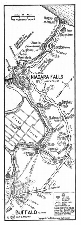
1917 Map of Niagara Falls Blvd (Source: Automobile Journal Vol. 63 )

One of the first attempts was on the Niagara River waterfront along River Road. Conceivably, it would provide idyllic views of the river and the green shores of Canada and Grand Island but steam engines and streetcars had gotten there first. Not only did the fast-moving vehicles spoil the view and experience but they were dangerous too. One man, upset at the 20 mph speed of the streetcars, said “What good is the scenery going to do you if one of those cars hits you? You won’t even have time to sneak a glance at the river while they keep whizzing by.” Next, an inland option was proposed using Colvin Street, now Colvin Avenue, but with residential development quickly closing in, the Boulevard changed paths again. Moving further inland to the more bucolic Town Line Road, today Niagara Falls Boulevard, the third route would follow Ellicott, Sawyer’s, and Cayuga Creeks. This would continue to Pine Street in Niagara Falls as the permanent route. Almost. The Boulevard would make two more minor adjustments on Sawyer’s Creek and near Bergholtz.


goatisland

Visiting the spring on Goat Island (circa 1901)
(Source: Niagara Falls Public Library)

Thanks to the romanticism movement, which produced art and literature glorifying the American landscape, the northeast saw the rise of tourism in the 1820s. Travelling to escape the city, most well-to-do travelers sought out natural settings like mountain villages, hot springs, lakes, and beaches. They followed itineraries from fashionable guides and periodicals that outlined grand tours of the northeast that took weeks or even months. They included scenic views of the Hudson River and the Catskills with layovers in places like Saratoga Springs. Niagara Falls quickly became one of the most famous destinations of the nineteenth century. Shortly thereafter, the Falls became a popular destination for honeymooners earning it the moniker “honeymoon capital of the world.”

campauto

Example of family auto camping (circa 1915-1923)
(Source: Library of Congress)

By the 1920s, leisure travel and the Sunday drive were taking the place of grand tours. Private automobile ownership was on the rise making travel accessible to more people. As car ownership increased, the route to Niagara Falls developed roadside attractions. Among them were tourist camps and the establishment of public campgrounds that could accommodate auto-camping. The “tourist-” or “motor-court” was the transition from camping to something more hotel-like featuring cabins with winterizing and running water. By the 1940s, the Boulevard was home to around 88 tourist camps and courts. After World War II, the family vacation became accessible to the middle class. The motel, a term coined around 1924, came to play their part with the colorful neon signage and pools or playgrounds prominently placed to entice motorists and their children. The Boulevard once boasted at least 27 motels of varying sizes and styles catering to all types of travelers.

castle court

Castle Courts Motel postcard
(Source: The Cardboard America Archives)

rodeway

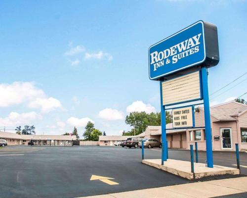
Former Castle Courts Motel is now the Rodeway Inn & Suites.
(Source:  https://www.booking.com/hotel/us/castle-motor-inn.html

taxpayerstrip

Example of a taxpayer strip (circa 1924)
(Source: University of New Mexico Library)

Commercial development on the Boulevard likely started as what was called the “taxpayer strip.” Much like the stripmalls that would come after them, taxpayer strips were made up of buildings constructed with cheap and efficient materials, going up quickly in order to begin making a profit as soon as possible. They were largely meant to be temporary but their presence influenced residential development and many became permanent fixtures with the first stripmalls, as we know them, appearing around the 1920s. The indoor shopping mall wouldn’t come to be until around 1956. The Boulevard gained its own shopping mall with the opening of the Boulevard Mall in 1963. The Buffalo Evening News explained that the mall would “not only provide Western New Yorkers with a new concept in shopping, but will launch a year-long program of community activities in the concourse of the spacious mall.”

12003889716_74100c747e_z

McDonalds on the Blvd, Amherst

Along with the rise of car culture came fast food restaurants which began to flourish on the Boulevard in the 1950s following the increasing suburban population. The afternoon or weekend drive to a fast food joint increased in popularity becoming a staple in many suburban households. The Boulevard was such a staple of car culture that the first McDonald’s in New York State opened on the Boulevard in 1958. This McDonald’s, though renovated, has maintained its signature double golden arch building design. There is also an Arby’s, opened a few years later, that still uses its original hat-shaped sign.

Niagara Falls Boulevard doesn’t seem like much of a tourist destination at the moment but it does present unique opportunities for both preservation and future development. It is very car oriented, somewhat to its detriment, but there are currently talks of part of the Boulevard being included in the light rail expansion. It will be exciting to see what the future has in store for the next chapter of development on the Boulevard.

Bibliography:

  1. Chiang and Shaffer, “See America First: Tourism And National Identity, 1880-1940.”
  2. “For A Boulevard To Niagara Falls”. Automobile Topics, 1908. 107-108.
  3. Jakle, John A. The Tourist: Travel In Twentieth-Century North America. Lincoln, NE: University of Nebraska Press, 1985.
  4. “Niagara And The Great Lakes Country”. The Automobile Journal, 1917. 42-43.
  5. Ott, Bill, “Band to Play, Trans-Oceanic Phone Will Ring at Opening of the Boulevard Mall Wednesday,” Buffalo Evening News, March 12, 1963.
  6. Sullivan, T. John. “The Proposed Buffalo Niagara Falls Boulevard”. Good Roads Magazine, 1908. 219-221.
Advertisement

Read Full Post »

military road

Military Road’s modern alignment through the City of Buffalo and Town of Tonawanda

Military Road is a part of NYS Route 265, a 19.75 mile long state road that runs between Niagara Falls and Buffalo.  The portions called Military Road are located in the City of Buffalo/Town of Tonawanda and then again in Niagara Falls, NY.  The road dates back to 1801, when it was laid out as a road to connect Black Rock with Fort Niagara, near Lake Ontario.  The route begins at the intersection of Niagara Street and the Scajaquada Expressway.  It runs along Tonawanda Street through Black Rock, Amherst Street, then turns into Military Road where it runs for 4.3 miles until the City of Tonawanda border.  In the City of Tonawanda it is Main Street, in North Tonawanda it is River Road, in Niagara Falls it is Buffalo Ave before it turns back into Military Road through most of Niagara Falls where it ends at a junction with NY 104 (Lewiston Road) in Lewiston.  From Lewiston to Youngstown, the River Road that ran up to the Fort was already built, so that was used to connect the Military built road to Fort Niagara.

map of military road - from buffalo history gazette

Historic Map showing the route of Military Road Source: Buffalo History Gazette

Military Road was one of the first roads in the country planned for military purposes.  Roads for defense have been around for a long time and are still around in modern times – much of the United States Highway System was built as the “Dwight D. Eisenhower National System of Interstate and Defense Highways”, designed for defense and modeled partly after the German Autobahn network that Eisenhower saw in Germany during WWII.  After the Revolutionary War, the federal government realized they needed a highway extending from the town of the Lewiston Escarpment to the bluff at Black Rock.  At the time, they were planning a large fort on the Black Rock bluff to guard the entrance to the Niagara River.  Most of WNY’s roads at the time were based on Native American trails and the trails of the earliest settlers.  These trails typically took the path of least resistance, to avoid things like creeks, marshes, or heavily wooded areas.  The highway would replace the old Portage Road, which was too winding, as it followed closely to the course of the river, rather than in a more direct line.  The Historic Map shows both the routes of the Military Road, which has a smoother path than the Portage route, which curves further to the west towards the Falls.

After the Revolutionary War, there were boundary disputes between New York and Massachusetts.  An agreement signed in Hartford, Connecticut in 1786 deeded the land once occupied by the Haudenosaunee to New York State, but Massachusetts maintained that they had a right to the area west of Seneca Lake once the Native American title was extinguished, except for a one-mile strip, which New York State reserved for itself.  The strip ran one mile inland along the Niagara River, from Buffalo to Stedman’s Farm (also known as Fort Schlosser, near where the water intakes are currently located along the Niagara Scenic Parkway/Robert Moses Parkway in Niagara Falls). Despite the State’s reservation of the parcel, the Seneca maintained that they retained the title to the Mile Strip, which was affirmed in the 1794 Pickering Treaty.   Massachusetts sold the rights to the surveyed portion of the land to Robert Morris in 1791.  Keeping a portion of the land for his own purposes, Robert Morris sold the rest of the land (which the exception of Grand Island and the Mile Strip) to the Holland Land Company, the company which Joseph Ellicott was the land agent.  You can read more about Joseph Ellicott and the Holland Land Company by clicking these links for Part One, Part Two and Part Three.  In 1798, Seth Pease surveyed the Mile Line for the Holland Land Company.  In 1802, the Seneca claim to the Mile Strip was extinguished by a treaty signed in Albany.  There had been little settlement in the area by the Seneca, only two Seneca families lived there year-round.  The treaty was initiated because the government wanted to construct a fort at Black Rock (also known as Upper Black Rock).  In 1803, the Deputy State Surveyor, Joseph Annin began to survey the Mile Strip into lots.  Fort Niagara was given 716 acres which were set aside for the Federal government.  The Stedman’s Farm/Fort Schlosser farm lot was set aside at 680 acres.  The Jones and Parrish tracts, which were each 640 acres, were also set aside and were given to Mr. Jones and Mr. Parrish who had been Haudenosaunee captives during the war.  The Jones and Parrish lots were near the Scajaquada Creek.  A total of 111 lots were laid out within the remainder of the Mile Strip, the majority of which were 160 acres in size, but due to the curve of the river, many were slightly larger.  One square mile was set aside at the southern end for the Village of Black Rock.  For more on the laying out of Black Rock, you can read about Peter Porter, the streets named after states, and the numbered streets.

In 1801, General Moses Porter, commander at Fort Niagara, was ordered by the War Department to use his troops to build the road.  I was unable to find out if General Porter was related to Mr. Porter of Black Rock during my research.  They called the road Military Road because it was built by the soldiers.  Between 1802 and 1805, the right of way for the road was cleared.  At the time, road building typically consisted of cutting trees and brush wide enough  to bring an oxcart.  Military Road was built in a strip 100-feet wide.  Marshy areas were made passable by laying logs down, which was often referred to as a “corduroy road”.  It was a tough task, as the road was built through forests and over swamp lands to cut a straight path.  Bridges were built in Tonawanda, but work was stopped and the road surface was not finished for seven years, due to disagreements between the State and the Federal Governments. In 1808-1809, New York State gave $1,500 (about $30,000 in 2018 dollars) to the project and the road was complete.

fort tompkins sign
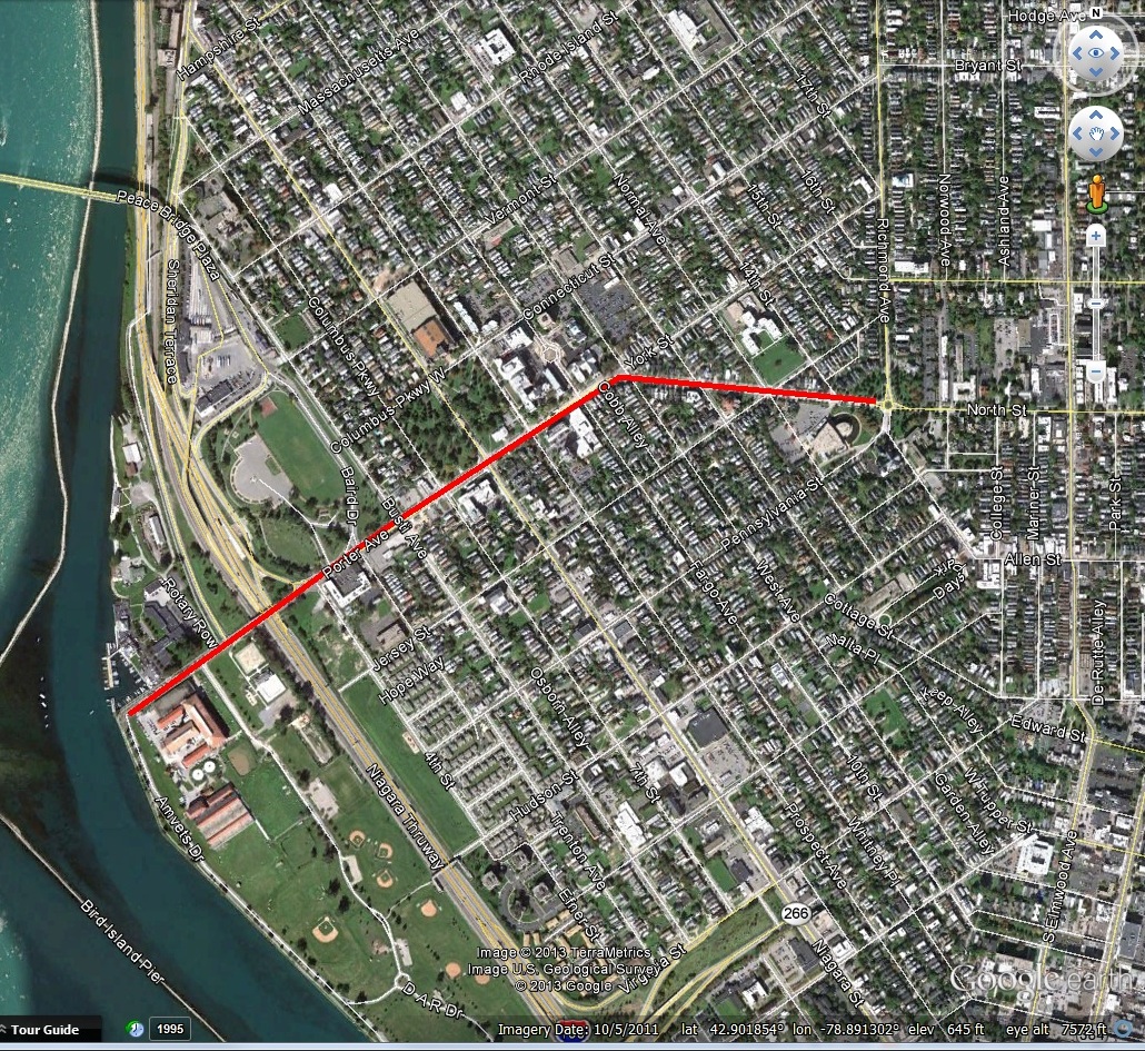
The large fort planned for Black Rock was never built, but a smaller one was built in 1807 and became Fort Tompkins in August 1812.  Fort Tompkins was also known as Fort Adams.  The fort was actually large mounds which were mounting points for seven guns.  It was technically a battery, which is a cluster of cannons in action as a group put into position during a battle of a fort or city.  Fort Tompkins was the largest of eight batteries that were built during the war.  It was located at the top of the bluff at the bend in Niagara Street.  The escarpment here allowed them to overlook the river, giving advantages over the attacks from the water.   The location was later the sight of railway barns.  A plaque was hung on the railway barn and still hangs on the building located at 1010 Niagara Street.  The more famous Fort Tompkins was located on Staten Island and was built in 1663.  They were both likely named for Governor Daniel Tompkins, Governor of New York from 1807 to 1817.  Fun fact for if you’re ever on Jeopardy:  Daniel Tompkins was later President Monroe’s Vice President and the only VP in the 19th century to serve two full terms.

Military Road Marker

Historic Marker near Amherst Street and Military Road

One of the only military uses of the road was during the War of 1812.  American General McClure lost Fort George after a significant battle.  General McClure then gave the notice to burn Fort George and the Village of Newark (now Niagara on the Lake) to deny shelter to the British.  The Americans then retreated to Fort Niagara.  The British reoccupied Fort George and planned an assault on Fort Niagara in retaliation for the burning of Newark.  General McClure claimed he had acted on Secretary of War’s order in the burning of Newark.  He had been told earlier in the year to destroy Newark if necessary but to give the residents several days notice to ensure they were not left destitute.  McClure had only given two hours notice, leaving residents without shelter or possessions during a heavy snowstorm.  This was against war conventions at the time.  McClure’s superiors disavowed his orders and McClure never again held command.

On December 19th, 1813, more than 500 soldiers crossed the Niagara River at a location known as Five Mile Meadows. They turned towards Youngstown and the Americans were taken by surprise and the story goes that they obtained the password to get into the fort by using a fake southern accent.  The British gained control of Fort Niagara and the British and their Native American allies marched upriver.  With the American Army gone, there were only civilian militias left to defend their land.  The British marched south, destroying farms and villages between Youngstown and Manchester (now Niagara Falls, NY).  The second British raid happened a few weeks later, December 31, 1813, which burned as far south as Black Rock and Buffalo.  General McClure retreated from Fort Niagara to Buffalo via Military Road after losing Fort Niagara.

The road fell into disuse and became overgrown, partly due to a debate between the state and federal governments as to who was supposed to maintain it.  Sections of it were used by local farmers.  Niagara County took over the road in 1820 and reconditioned it (at the time present day Erie County was part of Niagara County).  By 1832, it was cleared and repaired and became a state highway.

The idea behind the road was to facilitate travel of troops and munitions of war from Lake Ontario to Lake Erie.  Though the road was built for military function, it also helped to allow for commercial development of the area, with settlements occurring all along the Military Road.

In 1891, trolley service was extended along Military Road into the fledgling Village of Kenmore, allowing residents of Kenmore to arrive at the Military Road Station of the Belt Line, which would take them downtown for work.

miliatry marker sheridan drive

highlight-for-xml

Installation of the Boulder on Sheridan Drive, 1926. Source: Buffalo Courier Express

A boulder with a plaque honoring the Military Road was placed in Sheridan Drive by the Buffalo Chapter of the DAR in 1936.  It was part of a celebration of the centennial of the Town of Tonawanda.  The Centennial was held on exhibition grounds at the corner of Delaware Avenue and Sheridan Drive.  The dedication occurred on what was referred to as “Pioneer Day”.   New York State Historian, Dr. Alexander Flick, was on hand to give a speech and celebrate some of the oldest residents of Tonawanda.  Between 1906 and 1936, the Town had grown from 2,000 residents to 30,000.  Prizes were given to some of the residents including  the oldest married couple present, the oldest school teacher present, and the oldest male and female present.  Mrs. John Walters was unable to be present at the awards ceremony, but she had been a resident of Tonawanda for 93 years!

So the next time you drive along Military Road, think about the military history of WNY and remember the war fought right in our backyard, and the people who were determined enough to stay after their villages were burned to the ground.

Source:

  1. “Town Pioneers honor Guests and Centennial”.  Buffalo Courier Express, July 3 1936. p8.
  2. “Military Highway Will be Scene of Ceremonies” Buffalo Courier Express.  June 13, 1936, p13.
  3. Clinton Brown Architecture, pc.  Reconnaissance Level Historic Resources Survey:  Black Rock Planning Neighborhood.  November 2010.
  4. History of Old Fort Niagara.  https://www.oldfortniagara.org
  5. Lewis, Clarence.  “Evolution of Roadways in County Linked with Important Historical Happenings”.  Niagara Falls Gazette, July 29, 1954.
  6. Malloy, Jerry.  “Why is it Called Military Road?”  Buffalo History Gazette.  August 8, 2010.  http://www.buffalohistorygazette.net
  7. Percy, John & Graham Miller.  Images of America: Kenmore, New York.  Arcadia Publishing:  Charleston, South Carolina, 1998.


Read Full Post »

porterThe Porter family was very influential in Buffalo/Niagara during its formation and early years of settlement.  There is Porter Ave in Buffalo, Porter Road in Niagara Falls, a Town of Porter in Niagara County and the Porter Quadrangle complex at University of Buffalo.   Porter Avenue is located in the Front Park neighborhood on the West Side of Buffalo and is an Olmsted Parkway.   The street was originally known as Guide Board Road and predates Joseph Ellicott’s time in Buffalo.  It was an Indian Trail used during the Revolutionary War to a ferry which led to Canada.

Guide Board Road sign, on North Street near Franklin Street

Guide Board Road sign, on North Street near Franklin Street

The original street alignment went straight west towards the Niagara River.  When Frederick Law Olmsted designed the City’s parkway system, he decided to turn a portion of York Street into Porter Avenue, in order to connect to Front Park and Fort Porter.  This allowed the connections between parks that completes our parks system.

Castle at Fort Porter Postcard

Castle at Fort Porter Postcard

The former Fort Porter was located on the Lake Erie shoreline just north of Front Park.  Olmsted included the Fort’s grounds into his original plans for Front Park.  The Fort was torn down to build the Peace Bridge.  The Porter Family included Augustus and Peter Porter.  Augustus was prominent in Niagara Falls, living on and owning Goat Island  His brother Peter Porter was prominent in Black Rock/Buffalo.  

Peter Porter

Peter Porter

Peter Buell Porter was  born on August 14, 1773 and was raised in Connecticut.  He attended Yale and Litchfield Law School.  He moved west to Canandaigua for his law practice in 1793.  He served as Clerk of Ontario County from 1797 to 1804 and was elected to the New York State Assembly, representing Ontario and Steuben Counties in 1802.    

While in the Assembly, Peter Porter was influential in working with Joseph Ellicott to promote road construction in Buffalo.  However, shortly thereafter, Peter Porter began to develop a community two miles north of Buffalo called Black Rock.  At Black Rock, there was what was called a “safe and commodious” natural harbor, and the land was owned by New York State, unlike the majority of Western New York which was owned by the Holland Land Company.   Peter purchased land with his brother Augustus and Benjamin Baron to form Porter, Barton and Company.  New York State gave their trading firm a monopoly of the transportation business on the portage around Niagara Falls and it handled much of the trade on the Upper Great Lakes.

Around 1797, Joseph Ellicott tried to convince Porter and his friends to purchase property from the Holland Land Company.  Instead, they bought state lands along the Niagara River.  The laid out a town site, built warehouses and other trading facilities, establishing Black Rock.  This angered Paul Busti and other Holland Land Company agents, who then tried to purchased land from the State for the Holland Land Company in order to sabotage Porter’s plans.   As the town of Black Rock developed, the Holland Land Company tried hard to push Buffalo’s interests by using political influence in Albany.  However, Porter was equally determined to make Black Rock successful and had his own power in Albany.

Peter Porter moved to Black Rock in 1809 and was elected to the US House of Representatives, furthering his influence from Albany down to Washington, D.C.   He was so influential as a congressman that he convinced President Madison to move the customs house from Buffalo to the smaller Black Rock during summer (the more active) months. 

Map of Black Rock prior to the War of 1812

Map of Black Rock prior to the War of 1812

During the War of 1812, General Porter served in the New York State Militia.  In congress, Porter was labelled a War Hawk as he fought for security of the Niagara Frontier as the conflict leading up to the war became heated.  He found strong allies in Henry Clay and John Calhoun and was named  chair of the Foreign Affairs Committee.  Porter was presented a gold medal from Congress on November 3, 1814 for “gallantry and good conduct” during the Battle of Chippewa, Battle of Niagara and Battle of Erie.

Following the War of 1812, Porter was able to assist in getting the War Department to use federal troops to repair and improve roads between Fort Niagara and Black Rock which were damaged during the war.  Porter also brought federal funds to the area to build roads and canals.  Porter and his supporters also wanted the federal government to build roads from the “Buffalo Frontier” to Washington to foster trade between the federal capital, the Atlantic Coast and the Great Lakes.  This led to conflicts between Black Rock (which was Peter Porter, because of his vast real estate holdings and commercial enterprises) and Buffalo’s leaders – including Samuel Wilkeson, Albert Tracy, David Day and Oliver Forward.  Buffalo’s leaders were on the side of Dewitt Clinton, Mayor of New York City at the time.  Porter and his friends were on the anti-Clinton political faction.

General Peter served as Secretary of State of New York from 1815 to 1816.   During a special election after the resignation of Governor Tompkins, Tammany Hall printed ballots with Porter’s name on them.  Porter received 1300 votes, despite not running for office.  Governor Dewitt Clinton won that election, despite Tammany Hall’s efforts.

General Porter was appointed to the Canal Commission created to examine possible canal routes.  Governor Clinton opted for a Hudson River to Lake Erie straight across the state.  General Porter preferred two canals, one joining the Hudson River with Lake Ontario and one around Niagara Falls, joining Lake Erie and Ontario.  Buffalo Leaders and Joseph Ellicott preferred Clinton’s ideas, but in 1814, it seemed that the Canal Commission might adopt Porter’s suggestions.   By 1816, Porter had not been reappointed to the Canal Commission as he had accepted the office of boundary commissioner to clarify the disputed sections of the US-Canada Border.  Joseph Ellicott replaced Porter on the Commission, Dewitt Clinton had been elected Governor, and the Erie Canal took the alignment we are familiar with today.

The rivalry then shifted to whether Buffalo or Black Rock would be the western terminus for the Erie Canal.  Black Rock had a large, natural harbor which would be easy to expand and for years it had been the center of east-west trade and was used even by the merchants in Buffalo.  Black Rock also provided an escape from the turbulent winds and swells coming across Lake Erie.  It also would shorten the canal a few miles, lowering construction costs.  Buffalo had advantages too:  it was out of the range of British canons on the Canadian Shore (which was important given the recent War with Great Britain).  Higher water levels meant the canal would feed better in Buffalo.  Samuel Wilkeson led the charge, along with a group of enterprising men, determined to make Buffalo the canal terminus.  A report by engineers stated that the terminus should be located in Buffalo as the Black Rock harbor was too vulnerable to British attack, too exposed to ice damage and too expensive to develop.  While several later reports supported Black Rock, the Canal Commission designated Buffalo as the canal terminus in 1822, on the advice of four out of five of its engineers.  Efforts by Porter and his friends to alter the decision were fruitless, and bills were passed in the legislature for a canal link from Tonawanda to Buffalo, completely bypassing Black Rock.

Porter House facing Niagara Street circa 1880s when Lewis Allen owned the house

General Porter built a house at 1192 Niagara Street (between Breckenridge and Ferry) in 1816.  He Porter married Letitia Breckenridge of the prominent Breckenridge family.   Breckenridge Street, which was originally called Commerce Street, is named after her.     When Grover Cleveland moved here to Buffalo, he lived in the Porter house, with his Aunt and Uncle, the Allens.   Peter and Letitia’s son Peter A. Porter went on to become a Civil War Colonel, killed in the Battle of Cold Harbor in 1864.  

General Porter donated the land for the Union Meeting House Church across the street from his house.  The church is located at 44 Breckenridge and is also known as the Breckenridge Street Church.  

Peter Porter was also President of Jubilee Water Works, the first company to bring water into people’s homes.  The water came from the jubilee spring (located in present day Forest Lawn…Crystal Lake is formed from waters from the spring) and was pumped through wooden pipes.  Some of Buffalo’s wooden water pipes still exist.

porter grave

Peter Porter’s Grave

In 1837, Black Rock was dealt another blow when General Porter sold his interests there and moved to Niagara Falls where he built a new home.  Peter Porter died in 1844, and Fort Porter was named in honor of the businessman-politician-soldier.  Peter and Augustus Porter are both buried in Oakwood Cemetery in Niagara Falls.  Nine years after his death, Porter’s beloved Black Rock was annexed to a thriving, expanding Buffalo.   Black Rock became a neighborhood in the City of Buffalo.

The next time you’re driving down the 190 along the Niagara River or driving through Black Rock, think about Peter Porter and what our region might look like if we lived in the City of Black Rock and the Erie Canal went from Lake Erie to Lake Ontario!

Learn about other streets by checking out the street index.


Sources:

  1. Courier Express, July 24 1938, sec 6, p.4.
  2. Grande, Joseph.  Peter B. Porter and the Buffalo Black-Rock Rivalry.  Buffalo and Erie County Historical Society Publications.

Read Full Post »

Hidden Waters blog

Companion blog for the book "Hidden Waters of NYC"

DenCity

Urban History Blog

Hoping for a Tail Wind

Because I definitely brought way too much gear.

priorhouse blog

Photos, art, and a little bit of LIT.

Sheepie Niagara

The most popular sheep in Niagara Falls

Nonprofit AF

Exploring the fun and frustrations of nonprofit work

Gather by Image

An anagram. And a reason to write... to Grieve... to Heal