Feeds:
Posts
Comments

Posts Tagged ‘Buffalo’

titusgoodyearkoonsTitus Avenue is a street running between Broadway and Walden in the Emerson Neighborhood of the East Side of Buffalo. The street was named for Judge Robert Titus.  Judge Titus went into a partnership with Charles Goodyear, Frank Goodyear, Edward Koons and Henry Koons to subdivide and develop the land on these streets.  You can read about the Goodyear brothers by clicking here.

Robert Cyrus Titus was born in Eden, New York  in October 1839.  His parents came from Otsego County, New York to the “far west”, as the Holland Purchasewas called in 1817.  At the time, there were no roads through the countryside surrounding the small Village of Buffalo.  Guideposts along the way were blazed trees along the lines most frequently traveled by the occasional settler.  By 1831, they had plowed fields and built a house with a large fireplace and dutch oven.  In this house, Robert Titus grew up, the youngest of six siblings.

judgetitusRobert Titus was educated in a one-room school-house and then attended Oberlin College.  He taught school during the winter term to help finance his own education.  He studied law and set up a practice with Horace Boies in Hamburg, New York.  He opened a practice in Hamburg, New York.  In 1863, Mr. Titus organized a company, which became part of the 98th Regiment of the National Guard of New York State.  The regiment was in service from August 10, 1864 to December 22, 1864.  After he returned home, he was admitted to the bar.  Shortly thereafter  he was appointed Special Deputy Clerk of Erie County and held the office until 1864.  In 1867, he was a candidate for the New York State Assembly, but was defeated.  His first public office was Supervisor of Hamburg from 1868-1871.

In 1873, Mr. Titus moved to Buffalo with his wife Arvilla  to enter into a partnership with Joel Walker.  In 1878, he was elected district attorney.  In 1879, Mr. Titus was made a partner in the firm of Osgoodby, Titus & Moot and practiced with them until 1883, when he formed a partnership with B.S. Farrington.   In 1881   he went to Albany as a State Senator.  During his term in Albany, there was a great opposition to the Erie Canal, however Robert was a strong supporter to keeping the canal open.

In 1885, Mr. Titus was elected Judge of the Superior Court of Buffalo.   He was made Chief Judge in 1891.  When the Court was abolished in 1895, the judges were transferred to the New York Supreme Court.

An Artist's Depiction of President McKinley's Assassination.

An Artist’s Depiction of President McKinley’s Assassination.

Robert Titus was considered to be one of the state’s leading trial lawyers before he ascended to the bench. He was chosen by the state Bar Association to defend  President William McKinley’s assassin in 1901.  The trial of Czolgosz was notorious for how quickly it was completed.  President McKinley died on Saturday, September 14th, Czolgosz was indicted on Monday September 16th.    The jury for the trial was selected in two hours and twelve minutes.  The trial began on September 23rd, as soon as the final juror was named.  By the following afternoon, it was over.  Judge Titus had been in Milwaukee attending a masonic convention when he heard he was assigned to the case.

While the judges were highly respected, neither he nor his partner on the case, Judge Loran Lewis, had worked as a trial lawyer in years.  Judge Titus and Judge Lewis had not wanted to represent the assassin; however, they took the side of justice to ensure that he was given a fair trial.  The public outrage over the murder of the President was demanding a speedy trial and at the time, there was fear that it might not be a fair one.  It was a credit to the both of theirs honor that they ensured that Czolgosz was dignified with a fair trial and not disposed of by “lynch or mob law”.  Czolgosz assisted with the trial’s speed by refusing to cooperating with his legal counsel.  Czolgosz tried to enter a plea of guilty; however, due to the magnitude of the trail, he was not allowed. The jury took only 30 minutes to determine that Czolgosz was guilty and he was sentenced to death on September 26th.   One month later, Czolgosz was electrocuted in Auburn Prison.

Judge Titus' House on Columbus Parkway

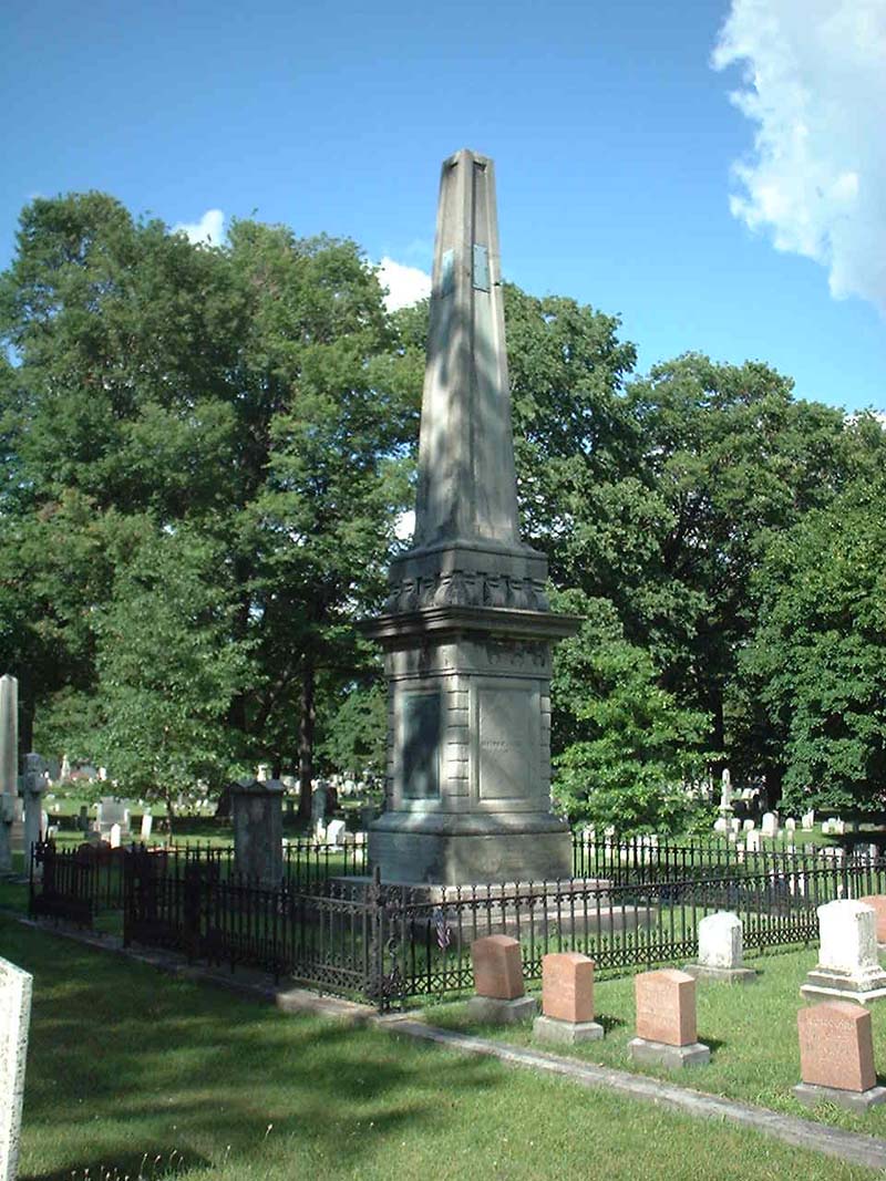
Judge Titus lived on Seventh Street.  The portion of 7th Seventh Street on which he lived later became Columbus Parkway.  Mr. Titus died on April 28, 1918 at the age of 79.  He was survived by his son, Lieutenant Allan S. Titus, and daughter, Amy Titus Worthington.  Judge Titus is buried in Hillcrest Cemetery in Hamburg, New York.

Don’t forget to check out the Street Index to find out about other streets!

Sources:

  1. Contemporary American Biography:  Biographical Sketches of Representative Men of the Day.  Volume 1, Part 2.  Atlantic Publishing and Engraving Co:  New York, 1895.
  2. Lord, Walter.  The Good Years:  From 1900 to the First World War.  Kessinger Publishing, LLC, 2007.
  3. Our County and its people:  A descriptive work on Erie County, New York.  Edited by: Truman C. White.  The Boston History Company, 1898
  4. Miller, Scott.  The President and the Assassin.  Random House Publishing Group:  New York, 2011.
  5. “Assassin Czolgosz Refuses to Plead:  His Lawyer Enters a Provisional Plea of Not Guilty”.  New York Times, September 18, 1901.
  6. Obituary of the Honorable Robert C. Titus.  Buffalo Morning Express, Sunday April 28, 1918.

Read Full Post »

I normally wouldn’t go into something this personal on the blog, but it ties into the City of Buffalo and the street I am going to discuss today.  I was recently attacked and robbed while waiting on the Subway platform at Allen Street.   I am alright, a little bruised and a little shook up, but otherwise alright.   This is my public service announcement to you all – Please be safe!!

Anyways, this event is your luck, because as I was soaking my sore muscles in some Epsom salts, I realized that I needed to write about Mineral Springs Road!

mineralsprings

Mineral Springs Road

Mineral Springs Road is located in the southeastern edge of the City of Buffalo, extending into West Seneca.  The street runs between Seneca Street in Buffalo to Union Road in West Seneca.  The Mineral Springs (also known as the Sulphur Springs) were located in a grove of trees near the corner of Mineral Springs and Harlem Road.  From my estimations of the old maps, it appears that they were located approximately where the I-90 crosses the Buffalo River, which is technically in the Town of West Seneca.

The springs were known to the Seneca as Dyos-hih, “the sulphur spring”.   On August 10, 1830, a notice was posted in local newspapers advertising that “a medicinal spring possessing the properties of the Spring at Avon has been discovered on the Indian Reservation about three miles from Buffalo Village near the junction of the Hydraulic Canal and Buffalo Creek”.  The waters in this area were reputed to have healing powers for the sick.

In 1848, a brochure was published by A.F. Lee to advertise the Springs.   Mineral springs were known as an ancient cure, going back to at least the time of the Greeks.  The waters didn’t have the medicinal properties when they were bottled, so people would drink them directly at the spring.  The sulphur springs contain sulphuretted hydrogen.

Construction of Aix La Chapelle

Construction of Aix La Chapelle

Other famous sulphur springs include Aix-La-Chapelle which was built during the time of Charlemagne, the Sulphur Springs of Virginia, the waters of Harrowgate in Yorkshire, England, and the Avon Springs in Avon, New York.  The springs at Buffalo was believed to be superior to all of the other springs.   A chemical analysis of the springs was done by Dr. Chilton of New York City in 1844.  The water was found to contain sodium chloride, calcium chloride, magnesium chloride, lime carbonate, soda carbonate, magnesia sulphate, and lime sulphate.  The springs contained 12 times more sulphuretted hydrogen than most springs and double that of the spring at Avon.

Different springs were cured different diseases.  The spring at Buffalo was good for the following diseases: obstinate cutaneous diseases, rheumatic and gouty affections, cases of neuralgia, indolent ulcers, dyspepsia, early stages of tuberculosis and consumption, and was also “useful in some complaints peculiar to females”.

The spring was endorsed by several doctors in Buffalo.  The following doctors wrote letters of support of the medicinal properties of the spring:  J. Trowbridge, Bryant Buruell, A.S. Sprague, M. Bristol, Austin Flint, Frank Hamilton, Erastus Wallis, J. Barnes, Jno. S. Trowbridge, and Chas. W. Harvey.

The springs were owned by Messieurs Burr and Waters of Buffalo.  A three-story frame structure with a large porch was built as a bathing house.  The springs were a resort for Buffalonians for a short while, but the roads were well not well maintained and the springs were eventually abandoned.

Postcard Showing St. John's Hom

Postcard Showing St. John’s Home

The bathing house from the resort became the  home for boys as part of St. John’s Evangelical Lutheran Orphan Home in 1874.  The church and the original orphanage was located on Hickory Street.  The home for girls stayed on Hickory Street while the boys moved out to the Springs.  The boys home was destroyed by fire in 1876 and a new building was erected.   In 1898, a new building was added to the Sulphur Springs property to transfer the girls from their original home in the city and consolidate the home to one site.

The orphanage was run by the church.  The children usually remained at the Home until the age of sixteen, when they were placed out into the families of the congregation.  The grounds were 105 acres, included a hospital and schoolhouse with a gymnasium.  The students had tennis courts, a baseball diamond, a two-run toboggan slide, an orchard, and a picnic grove with shelters and grills.  In 1956, a swimming pool was added to the grounds.  To help raise money for the pool, donations were collected at neighborhood taverns.

Operating costs rose steadily for the Home following WWII as state regulations became more stringent.  The Home suffered a fire on November 14, 1959.  The increased budget due to regulations and the fire damage forced the Home to close its doors in 1960.

st johns dining hall

St. John’s Dining Hall at LCLC

Although the Home was closed, the Board was still allowed to donate money to those in need.  In 1965, $50,000 was given to Lake Chautauqua Lutheran Camp for the construction of St. John’s Hall.  The Gustavus Adolphus Home for Children in Jamestown was also given a $275,000 grant in 1967.

A portion of the property actually still provides for youth, as it is now the location of the Renaissance House, a drug and alcohol rehabilitation facility for adolescents.

In 1891, the Buffalo Parks Commissioners had considered using a grove of trees near Mineral Springs as a location for a park.   A report was made describing several places as potential for parks in South Buffalo.  The grove at Mineral Springs was described as “wet, except in the driest months of the year”, and the grove had been known informally as “Old Red Jacket Park” and was used as a picnic resort.    The park was rejected for this location and the Cazenovia Park site was chosen as the site to build the new park.  This grove of trees was referred to as “Old Red Jacket Park” until at least the 1920s.  This grove of trees still exists along the north side of Mineral Springs Road.

So the next time you use some bath salts, be sure to think of the mineral springs in Buffalo!  Be sure to read up on other streets in the street index.

Sources:

  1. “Street Names Link South Buffalo to Its Indian Past” Buffalo Evening News 9-14-1960
  2. “The Indian Reservation Sulphur Springs, Near Buffalo NY with an Account of its Analysis, Medicinal Properties, and the Diseases for Which it is Applicable”.  A.F. Lee, Printer:  1848.
  3. http://buffalo-orphanage-studies.com/StJohns.html
  4. Thirteenth Annual Report of the Buffalo Park Commissioners, Buffalo:  Press of the Courier Company,  January 19, 1883.
  5.  Verlag and Druck Van Reinecke & Zesch, History of Germans In Buffalo and Erie County: Buffalo, 1898.  Part I, pgs 282-286.
  6. Alexander, W.P. “What Spring Means to the Lover of Flowers”, Hobbies Magazine,  Buffalo Society of Natural Sciences, May 1920.

Read Full Post »

otto

Otto Street Present Day

Otto Street is a small little street in the First Ward of Buffalo.  The street has had a front row to the changing transportation of Buffalo – in the 1880s, the north side of the street was a tannery and then the Hamburg Canal.  It then became the Lehigh Valley Rail Yard throughout the early 1900s.  And since the 1950s, the street has run along the southern side of the I-190.

Otto Street (top of map) in 1889

Otto Street (top of map) in 1889
(click to enlarge)

Otto Street in 1899

Otto Street in 1899
(Click to Enlarge)

Otto Street is named for Jacob S. Otto.  Mr. Otto took over for Joseph Ellicott following his retirement from the Holland Land Company.  For more on Joseph Ellicott, check out Part 1, Part 2 and Part 3.

Mr. Otto was born in Swedesboro, New Jersey in 1778.  He graduated from Princeton in 1797 and practiced law in Philadelphia.  In 1821, he joined the Holland Land Company.  When he took over the Holland Land Company, things were difficult.  Many of debtors purchased land during the boom of 1816-1817.  A panic occurred in 1817, prices had fallen, and the company was owed more than $1,000,000 (approximately 13 million in today’s dollars!).  When Joseph Ellicott resigned, the Holland Land Company did not side with the local suggestions for his replacement and selected Mr. Otto, who was working in Philadelphia as a capable businessman.   Mr. Otto revived the Holland Land Company’s acceptance of produce in payment of interest.  This helped to calm some of the troubles throughout the Holland Land Purchase.

While Mr. Otto never lived in Buffalo, he was well known here.  He was important in the development of Allegany and Cattaraugus Counties.   He also opened up the Ellicott tract for development by laying out North Division from Main to Washington in 1827.  North Division was extended to Jefferson in 1831.

Mr. Otto tightened the requirements for settlers to pay off their debt.  He brought suit against many of the debtors.  The settlers reacted to this by starting protest meetings in Lockport in January 1827 and in Buffalo in February 1827.  A petition was sent to Albany, where a bill to tax land of non-residents passed in the fall.  The collection reports of the company for 1826 showed that of the six million debt, less than one-fiftieth had been collected.  This changed the policies of the Holland Land Company.

Mr. Otto died in 1827 when he contracted pneumonia after officiating the opening of the Erie Canal.  He is buried in Batavia.  Mr. Otto’s son, John Otto, came to Buffalo from Philadelphia after his father’s death and worked at Pascal Pratt’s Hardware Store.  In 1858, John Otto formed his own real estate firm, John Otto and Sons.  The Towns of Otto and East Otto are named for Jacob Otto.

During the waning days of the Holland Land Company’s prominence in Western New York, David Ellicott Evans took over as land agent following Mr. Otto’s death.   The Town of Evans, New York is named after Mr. Evans, who was Joseph Ellicott’s nephew.   Lewis Ellicott Evans, David’s brother, lived in a house in Williamsville which was known as the “Evans House”.  The Evans House was built on Main Street, east of Ellicott Creek, and was believed to have been the oldest house in Erie County.  The House was demolished in 1955. Evans Street continues the Evans family legacy in Williamsville.

Sources:

  1. “Otto Street Honors Ellicott Successor” Courier Express, Dec 18, 1938, sec 5 p4
  2. Silsby, Robert.  “The Holland Land Company in Western New York”.  accessed online at http://bechsed.nylearns.org/pdf/low/The%20Holland%20Land%20Company%20in%20Western%20New%20York.pdf

Read Full Post »

joseph ellicottThis is the third and final part in a series about Joseph Ellicott.  Click here to read Part One about Joseph’s family and his early life.  Click here to read Part Two, about Joseph’s days with the  Holland Land Company.  Today, I am going to touch on Joseph’s legacy throughout Western New York.

Mindful of Buffalo’s strategic location as a port, Joseph Ellicott was a strong advocate for a canal to be built from the Hudson River to Lake Erie. He served as one of the first Erie Canal Commissioners and was appointed in 1816 to supervise the canal construction.  He was also responsible for convincing Governor Clinton not to send to England for engineers to design the canal, but to use local talent instead.  He donated more than 100,000 acres of company land for the canal project.  He resigned from the Canal in 1818, due to his declining health.

Joseph worked hard to further the settlement of Buffalo by encouraging development on certain transects.   As hard as Joseph worked, his later years were not as bright.  He suffered from physical and mental health issues in his later days.  As early as 1816 he began to suffer from periods of depression and melancholy.  At the time, his condition was thought to have been brought upon by his lonely, unmarried life as well as the disappointments of the unrealized hopes and dreams.  In 1821, the Holland Land Company suggested that he was no longer needed and  Joseph retired.   He became a hypochondriac and was admitted to Bloomingdale Asylum in New York City by his family around 1824.  He died in 1826 by hanging himself.  He was originally buried in New York City, but was exhumed and reburied in Batavia in the Batavia Cemetery.

Joseph Ellicott's Gravestone

Joseph Ellicott’s Gravestone

Joseph’s grave was erected in 1849 by his sister Rachel Evans. and is engraved with the following:

“He was the first resident agent of the Holland Land Company for whom in 1798 he began the survey of the western part of the state then owned by them.  Even at that day his predictions of its future wealth and importance fell but little short what has since been realized.  For more than twenty years, he used with great judgement combined with liberality, the powers entrusted to him as one of the earliest and by far the most efficient advocate of the Erie Canal.  His name is a part of the history of New York.  His reputation among his fellow citizens as a man of the highest intelligence as well as the influence of his station gave his opinions great weight with every successive administration during the first twenty years of the present century, and in every portion of the tract once subject to his control may be seen marks of his foresight and generosity.  He was the founder of Batavia and Buffalo, NY.”

The following places were named after Joseph Ellicott:

  • Ellicottville, New York – a village in Cattaraugus County
  • Ellicott, New York – town in Chautauqua County
  • Ellicott Square Building – A ten story office building in Downtown Buffalo.  When it was built in 1896, it was the largest office building in the world.  The building was designed by Charles Atwood of Daniel Burnham & Company Architects.  The building sits on the lot that Joseph Ellicott originally owned.
  • Ellicott Street – in addition to the one in Buffalo, there’s an Ellicott Street in Batavia, and an Ellicott Road in Orchard Park
  • Ellicott Complex – dorms at University of Buffalo
  • Ellicott Creek – a creek that runs through Tonawanda and Amherst
  • Ellicott Elementary School  -in orchard park
  • Ellicott Run – in Sinnemahoning State Park in Pennsylvania
Joseph Ellicott's Plan for the Village of New Amsterdam

Joseph Ellicott’s Plan for the Village of New Amsterdam

If you look closely at Joseph’s plan from 1804 (click on the picture for a better view), you will notice that some of the streets have different names.  Joseph named the streets after the dutch investors and  members of the Holland Land Company.

The street changes occurred on July 13, 1825.  There was a battle between the Highway Commissioners of the City of Buffalo and Joseph Ellicott.   As discussed in Part Two, Joseph owned a large lot in Downtown Buffalo.  After the Highway Commissioners decided that Main Street needed to be re-routed to cut through his property, Joseph changed his will to avoid leaving the land for a park.  In order to spite Joseph, the Commissioners changed the names of the streets:

  • Willink Avenue and Van Straphorst Avenue became Main Street
  • Schimmelpennick Avenue was renamed Niagara Street
  • Stadnitski Avenue was named Church Street since it was the location of St. Paul’s Church
  • Vallenhoven Street was named Erie Street
  • Cazenovia Street became Court Street, because the Courthouse was located near where the Central Library is currently located
  • North and South Onondaga Streets were merged to become Washington Street
  • North and South Cayuga Street became Pearl Street
  • Franklin was renamed from Tuscarora Street
  • Busti Avenue became Genesee Street
  • Mississauga Street became Morgan Street (which is currently South Elmwood)

In March 1836, Crow Street became Exchange Street.  In the end, Seneca, Swan, Chippewa, Huron, Eagle and Delaware were the only street names given by Joseph Ellicott that remained.

The Highway Commissioners must have felt a twinge of regret, because the changed the name of Oneida Street to Ellicott Street, honoring the man who laid out our streets and helped the fledgling Village of Buffalo Creek become the City of Buffalo.

To learn about how other streets got their name, check out the Street Index.  If you want to be the first to know about new blog posts, subscribe to the blog and updates will be emailed to you.  And as always, if you have any questions about specific streets, leave them in the comments and I can see what I can do to add them to my queue.

Sources:
  1. “Joseph Ellicott”  Memorial and Family History of Erie County New York. Volume 1, Biographical and Genealogical
  2. Beers, F.W.  ”Our County and It’s People:  A Descriptive Work on Genesee County, New York.”  J.W. Vose & Co Publishers, Syracuse NY 1890.
  3. “Our Street Names:  They Tell Much of Buffalo’s History”.  Buffalo Express, November 14, 1897.
  4. Burns, Rosamond.  ”Paving the Way For Settlers:  The Rise and Fall of the Holland Land Co.”  Buffalo News, January 25, 2004.
  5. Houghton, Frederick.  ”History of the Buffalo Creek Reservation”.   Buffalo Historical Society Publications, Volume 24:  Buffalo, 1920.

Read Full Post »

Holland Land Purchase

Holland Land Purchase

This is Part Two of a series on Joseph Ellicott, for whom Ellicott Street is named.  If you haven’t read Part 1 yet, you can read it by clicking here.

Following his time surveying in Washington, DC and along the Georgia-Carolina boundary, Joseph Ellicott began to survey some property in Western PA that a group of Dutch investors purchased.  The Dutch Investors had formed the Holland Land Company to invest in land in New York and Pennsylvania.  The Company also purchased a large tract of land in Western New York known as the Holland Purchase.  The Holland Land Purchase consisted of approximately 3,250,000 acres of land, stretching from 12 miles west of the Genesee River to the present western boundary of New York State.  Much of the land had been owned by Robert Morris, who had purchased it from the Senecas.  Between 1798 and 1800, the area was surveyed under the direction of Joseph Ellicott.  Joseph brought a crew of 11 surveyors, each with his own assistants to survey the property.  Joseph himself surveyed the east line of the purchase.   While Joseph laid out the site of Buffalo, there were many who doubted a city would establish there. Interference from the State and Buffalo Creek Reservations was calmed due to Joseph’s skills as a surveyor and diplomat.  He persuaded the Senecas to leave the Village’s location out of the reservation.  At the time, the Buffalo River as we know it was only a simple stream that ended in a marshland.  Joseph foresaw that Buffalo would be important as a port due to the convergence of Buffalo Creek on Lake Erie.  In Spring 1798, Joseph opened the first wagon track in Erie County, improving the trails from East Transit to Buffalo, and from Buffalo to Batavia.

The Holland Land Company had purchased the land, intending to sell large tracts of lands to investors for a profit. The bankers were unable to sell large tracts of land and began to sell directly to settlers looking to build homes.   Holland Land Company bought the land for 35 cents per acre and sold it for $2-2.50 per acre.

Holland Land Office in Batavia (now a museum)

Holland Land Office in Batavia (now a museum)

Joseph Ellicott was appointed Resident Agent of the Holland Land Company and opened an office in Batavia in 1801.    He oversaw the surveying crews to complete the subdividing the land into townships , each six square miles.  The townships were then subdivided into lots.  The officers of the Holland Land Company had an extensive program to build roads, lay out towns and attract settlers to the area by selling small tracts of land on liberal terms and providing loans to help businessmen set up shops.  The typical agreement was a down payment of  5-25 percent to be paid in 4-8 years at 7 percent interest.  During that period, the settlers were required to clear several acres of land, erect a dwelling and fence in a portion of his property.   Pioneers purchasing land here faced the hard task of relocating.  It took weeks or months to navigate over muddy, rugged roads.   The area was primarily a primeval forest.   A typical settler would have to clear about 50 trees to build a modest log cabin.

The first map of Buffalo was made by Joseph in 1804, calling it the Village of New Amsterdam, to honor the Holland Land Company.   The fledgling Village had a population of about 25 at the time, including a blacksmith, a silversmith, and half a dozen houses.  While Ellicott wanted to call it “New Amsterdam”, the residents preferred the name of Buffalo Creek, so their name stuck, which was then later shortened to Buffalo.  He is responsible for the radial street plan of the City of Buffalo.  He named most of the streets after members of the Holland Land Company.

Buffalo Lots in 1805

Buffalo Lots in 1805
(Lot 104 can be seen in the center of the map)

Joseph Ellicott also purchased his own share of Downtown Buffalo, a 100-acre tract of land known as Outer Lot 104, bounded by the current Main Street, Swan Street, Eagle Street and Jefferson Avenue.  There was a half-moon shaped piece of land along the Main Street frontage of Joseph’s property, from which Niagara, Church and Erie Streets radiated.  Joseph planned to build a mansion on this half-moon; however, in 1809, the Village authorities decided to straighten Main Street.  Ellicott abandoned the idea of building on the lot and during his lifetime, no development occurred on Outer Lot 104.   Also, Ellicott changed his will, which had been drawn to leave the tract of land to the City for a public park.   Today, the Ellicott Square Building sits on the Main Street part of the lot, a fitting reminder of Ellicott’s influence in Buffalo.

Many of the settlers were unable to pay back for their land; however, Joseph was lenient with them and allowed them to extend their payments.   After 10 years, the Holland Land Company opened an office in Mayville in Chautauqua County. This allowed them to better serve the pioneers by ridding them of the burden of travelling all the way to Batavia to make payments.

During the War of 1812, the Holland Land Company allowed settlers to make payments in goods instead of cash.  They mostly accepted black salt, which they would then make into pearl ash to sell to Montreal.

In 1833, New York State laws changed, forcing foreign owners to be taxed the same as residents.  The Holland Land Company began to enforce their payment schedules and were no longer as lenient with settlers.

Holland Land Company Vault postcard, Mayville NY

Holland Land Company Vault postcard, Mayville

In 1835, the Holland Land Company sold its remaining holdings in Chautauqua County to Trumbell Cary, George Lay, Jacob LeRoy and Herman Redfield.  They instituted a new policy called the “Genesee Tariff”, forcing those who still owed to pay a penalty of a specific amount per acre in additional to the original price paid for the land.  They also threatened to sell the land to another purchaser if payments were not made.  The settlers fought back against the Genesee Tariff.  In 1836, 500 men gathered in Hartfield, rioted and marched to Mayville to destroy the Land Office.  The building and furniture were destroyed and the company’s books were burned in a bonfire.  The company salvaged what they could and reopened an office in Westfield.   William Seward was made the Land Agent of the new office, and was able to renew peace.  Seward later went on to become Abraham Lincoln’s Secretary of State, and is best known for “Seward’s Folly”, aka the purchase of Alaska.  A stone vault near the present day County Courthouse is the only visible landmark of the Holland Land Company’s presence in Chautauqua County.

In 1839, the Holland Land Office in Batavia closed.  The last holdings of the company were sold in 1846 at little profit.  The building, which was built in 1815 to replace the original log cabins is still standing in Batavia.   The building is listed on the National Register of Historic Places.  The building was saved by a Batavia High School teacher, John Kennedy, and the Class of 1894.  The site currently operates as the Holland Land Office Museum.

For more on Ellicott’s legacy in Western New York, check out Part Three by clicking here.

Sources:

  1. “Joseph Ellicott”  Memorial and Family History of Erie County New York. Volume 1, Biographical and Genealogical
  2. Beers, F.W.  “Our County and It’s People:  A Descriptive Work on Genesee County, New York.”  J.W. Vose & Co Publishers, Syracuse NY 1890.
  3. “Our Street Names:  They Tell Much of Buffalo’s History”.  Buffalo Express, November 14, 1897.
  4. Burns, Rosamond.  “Paving the Way For Settlers:  The Rise and Fall of the Holland Land Co.”  Buffalo News, January 25, 2004.
  5. Houghton, Frederick.  “History of the Buffalo Creek Reservation”.   Buffalo Historical Society Publications, Volume 24:  Buffalo, 1920.

Read Full Post »

Central Park Neighborhood shown in Red
Former Buffalo Cement Company land shown in Blue

Central Park is the name of a street, a plaza and a neighborhood in Buffalo.  The red outline on the map to the right depicts the Central Park Neighborhood, on the west side of Main Street.  On the east side of Main Street, the blue outline depicts the boundaries of the former Buffalo Cement Company.  A portion of the quarry still exists along East Amherst Street, adjacent to McCarthy Park.

Central Park Avenue is located along the south side of Central  Park Plaza, which is along the southern border of the blue line on the map.  Central Park Plaza was developed in the 1950s to provide an urban shopping destination.  At its peak, Central Park Plaza contained 45 stores including several major grocery stores, a day care facility, a charter school, Radio Shack, and various other stores.  During the 1980s, the plaza decline due to shifting populations and the rise of suburban shopping malls.   This past May, Central Park Plaza got a new owner and there is hope for the redevelopment of the surrounding neighborhood.

Central Park neighborhood was named by Lewis Jackson Bennett the Founder of the Buffalo Cement Company.  Mr. Bennett was born in Schenectady County NY in July 1833.  He began his life as a clerk in a grocery store in Fultonville, NY.   He was a collector of tolls on the Erie Canal at Fultonville for a  short while.  Bennett moved to Buffalo in 1866 after he obtained a contract to do repair work along the canal here.  He used the money he earned doing this work to buy land in North Buffalo to extract the limestone for use in a cement factory. He was responsible for all slips and basins in Buffalo and the area 17 miles east of the City.  Along with his father-in-law, Andrew Spaulding, he formed an independent contracting business for dredging.  They were given city, state and federal contracts throughout Western New York.  They supervised the building of the first iron bridges in the area.  Mr. Bennett than became interested in the manufacture of hydraulic cement.

In 1875, Mr. Bennet began to acquire land on the east and west sides of Main Street where the cement deposits were located.   (more…)

Read Full Post »

Perkins Drive is a little street coming off of Niagara Square, along the south side of City Hall.  It’s one of the streets in Buffalo that we drive on and most of us don’t realize it actually has a name.  It’s most well-known for showing up in google maps when you have directions starting from Buffalo.  When you list “Buffalo” as the starting point for directions, the first few steps normally get you onto the I-190 via Church Street using these steps:

  1.  Head South toward Perkins Drive
  2. Exit Traffic Circle onto Perkins Drive
  3. Turn Left onto S Elmwood Ave

Perkins Drive is named for Former Councilman Frank. C. Perkins.  He served as President of the Common Council.  He was considered a socialist at the time, but not a radical.  He was elected to the Council several times, but never spent more than $50 on a campaign.

Mr. Perkins was born in 1868 in Dunkirk, New York.  He won a scholarship to Cornell University and paid for the remainder of his education by publishing marketing booklets about the university   After graduating from Cornell, he studied electrical engineering in Germany and other European Countries.  He then opened an office in the Erie County Bank Building.  He conducted night school there to teach streetcar motormen and boys to learn the fundamentals of electricity.  Electrical equipment was still in its infancy at the time.  Mr. Perkins was published in electrical journals in the US, England and Germany.

He was the inventor of the first electric incubator to be patented.  He was well-known in the engineering community.  When he was elected to Council, he closed his consulting business.

Perkins Family House

Mr. Perkins and his wife lived at on Prospect Avenue near The Connecticut Street Armory.  Their house was the first house in Buffalo to be wired for electricity.  Mr. Perkins did all the wiring himself.  The Perkins Family was especially proud of an apple tree in their back yard which was 100 years old when they were living there.  The house is still standing today, I wonder if the apple tree is still there!

Mr. Perkins was a socialist, the type that was of the sort that advocated municipal ownership of electrical power plants to light the streets and asphalt plants to pave the streets.  He left the socialist party in 1920 after one of his appointments was rejected by the rest of the City Council.

For those of you who enjoyed yourselves at Larkin Square this summer might have heard about how the original proposal for Larkin Square was established in the earlier part of the century, but never built.  Here’s a post at the Hydraulics Press that explains a little more about that.

Mr. Perkins was known as “the watchdog of City Government”.  Shortly after his death, his fellow council members named the street after him.


Be sure to check out the Street Index to learn about other streets!

Sources:

  1. “Perkins Drive Memorial to Councilman”  Courier Express Apr 2, 1939, sec 5 p 2
  2. “Perkins Quits, Buffalo Local Socialists Are Not Surprised”  The New York Call, February 13, 1920, p3.

Read Full Post »

Doyle Avenue is a street in the Riverside Neighborhood in Buffalo.  The street runs 0.25 miles between Kenmore Avenue and Skillen Street.

Doyle Avenue is named for Major General Peter Cozzens Doyle.  Maj. Doyle was born in Washington County in 1842.  He came to Buffalo with his family via the Erie Canal when he was 4.  He lived in Buffalo until his death.  He attended Public School No. 2 and Old Central High School, but his formal education ended in his teens as was custom in the time, due to the need to earn a living.  He became a telegrapher and became an operator for the Lake Shore Railroad before he was 16.  At 16, he became a bookkeeper for the Buffalo Courier, and worked for the paper from 1858 until the outbreak of the Civil War.  He enlisted and became a lieutenant.  His knowledge of telegraphy was valuable to the army signal corps.  Following the war, he returned to the Courier.  He was associated with the railroads and local wholesale grocers.

Maj. Doyle was elected to his first public office in 1869, when he was elected superintendent of the Buffalo Fire Department.  At the time, firemen were all volunteers, and Superintendent Doyle was a pioneer in advocating the use of horses to draw hose carts and hook and ladder apparatus.  At the time, volunteer firemen and any other men or boys who were nearby would hitch up to the apparatus and run to the scene of action.

In 1870, Doyle became Chief of Police.  During this time, he purchased the right of way for the Buffalo and Jamestown Railroad.  He would drive his buggy along the right of way and buy the land, parcel by parcel.  He became first superintendent of that railroad.

In 1881, Doyle was chairman of the Democratic Committee of Erie County.  That year, they were having a hard time finding a candidate for Mayor, as many democratic candidates had been defeated in previous elections and they found running to be a hopeless cause.   Five people had been asked to run for office, all turning down the offer.  Doyle was instrumental in convincing prominent Buffalo attorney and former Erie County Sheriff Grover Cleveland to run for Mayor.  The rest is political history, as Cleveland rose from Mayor to Governor to President by 1885.

Maj. Doyle was also the Buffalo representative for the Lehigh Valley Railroad and Coal Company, president of the Local Merchants Exchange and a vestryman of Trinity Episcopal Church.

Maj. Doyle married Annie Kelderhouse (her uncle William Mowry operated the first cotton mill in New YorK State).  Annie and Peter built a brick home at Niagara and Georgia Streets.  Later, they built another house on Mariner Street.  Although he owned a great deal of real estate throughout the City, he owned no land near what would eventually became Doyle Avenue.  However, his brother-in-law, John Kelderhouse owned land in that area, which was instrumental in the choice of the name Doyle Avenue.  Maj. Doyle and his wife had three daughters and two sons.  Sadly, the sons died of diphtheria in their teens, only a year before the discovery of the antitoxin.

During the Spanish-American War Maj. Doyle commanded the troops at Peeksill.  At the war’s close in 1901, he was made Major General.  He died later that same year and is buried in Forest Lawn.

To learn about other streets in Buffalo, check out the Street Index.

Source: “Doyle Avenue Honors Soldier- Civic Leader” Courier Express, Jan 1 1939, sec. 5, p.2

Read Full Post »

Buffalo Skyway around 1956
(from WNY Heritage Website)

The Buffalo Skyway was originally known as “High Level Bridge”, a description of the function of getting the road over the Buffalo River.  The bridge opened in 1955 and was a marvel of modern engineering.  The bridge is fraught with controversy today, as many people see the skyway as a barrier to development of the waterfront.

The bridge eliminated the waits for railroad and lift bridges that plagued commutes between downtown Buffalo and South Buffalo/Lackawanna.    Plans for a bridge had been discussed amongst the Planning Commission as early as 1922.  Some early traffic planners had fought for a tunnel instead.  The tunnel idea was scrapped because the City would have been responsible for operation and maintenance costs for lighting, ventilating and other maintenance, which the City could not afford.  New York State is responsible for maintenance of the Bridge.

Some planners insisted that construction of either the bridge or a tunnel would be too expensive and not worthwhile.  The Skyway was built despite the fierce opposition and bitter criticism.  It was heralded as a triumph of development and engineering.

The highest piece of the bridge sits 120 feet above the River.  And the viaduct is 5,803 feet in length.  The Steel used to create the skyway was from the Bethlehem Steel plant, just down the road.  The girders were brought to the River via barge.   The Father Baker Bridge, further down the river, was built in similar fashion to cross the Union Slip Canal and opened in November the following year  The two plate girder spans measure 348 feet and at the time were the second longest on any structure in the United States (not sure if they still are).  The bridge was built by the Bates and Rogers Construction Corporation.  Approximately 10,000 cubic yards of concrete was used.  It is supported by 15 massive steel “bents”.  More than 10,000 gallons of paint were used to protect it from the weather.  The bridge incorporated 11,516 tons of structural steel that was fabricated by Bethlehem Steel.

The Street was named The Buffalo Skyway after a contest was held to name the bridge.  Mrs. Wallace E. Easter, of Lackawanna, submitted the name “Skyway”.  Mrs. Easter received a golden key to the City and $100 for her prize.  If you had to name the road, what would you have named it?

Officials on the Skyway
October 4, 1955
From The Buffalo News

The Bridge cost $12,000,000 (1955 dollars) and Opened on Oct 19, 1955.  The Ribbon Cutting Ceremony was held on October 19th and consisted of Mayor Pankow accompanying an inspection party of city and state officials on a tour by car and a ribbon cutting at the north abutment near Delaware and Church Street.  A reception was held following the ceremony at the Hotel Lafayette, which included an address by State Public Works Superintendent John W. Johnson.

The Skyway brought the start to some major transportation investment projects in Buffalo.  The following projects were announced as being funded during the reception (costs in 1955 dollars):

  • Union Slip Canal Bridge (aka the Father Baker Bridge…it has since been demolished) – $13,000,000
  • Kensington Expressway – $6,3,00,000 (for Section 1)
  • Broadway Viaduct Elimination (aka the Z-viaduct of the New York Central) – $2,4,00,000
  • Scajaquada Creek Expressway – $10,000,000.

These investments brought the City of Buffalo into a new time period.  A time where the car was king.   The state officials at the reception called the opening of the Skyway “so magnificent as to be unforgettable”.

Today, many people consider the Skyway to be a barrier to development of our waterfront.   Many public meetings regarding the waterfront, canalside, and other projects result in cries to remove the Skyway.  However, from a traffic perspective, it’s one of the best ways to move traffic.  It’s a key transportation artery in the City of Buffalo, carrying an average of 38,800 vehicles each day (according to 2011 data from GBNRTC).  The New York State Department of Transportation see the Skyway as “a safe, efficient sturdy roadway with another 40,50 years of life in it”.

Yesterday, a new article was published in Next American City which quotes the Congress for the New Urbanism stance that the Skyway as one of the top 12 roads that need to be removed.

Many argue that the accidents on the Skyway is a reason for its removal.  However, the rate of accidents on the Skyway is 0.61 accidents per mile, far below the statewide average for urban, divided four-lane highways, which is 1.52.

Some see the Skyway, with its smooth curves as graceful, while at the same time monumental and graceful.   The ride along the Skyway is unlike any other drive in Buffalo – these people see the climb, the descent, and the view as phenomenal.

So which side of the Skyway Debate do you fall on?

[To learn about other streets, check out the street index. ]

Sources:

  1. “Buffalo Skyway to Open” Oct 19 with a ribbon-cutting, Buffalo News 10-4-1955
  2. “Final River Span Lifted Into Place” , Courier Express 5-5-1955
  3. “Skyway Name Approved by Mayor” Buffalo News 10-6-1955
  4. “Traffic Streaming Over Skyway Heralds New Era For City”,  Buffalo News 10-19-1955
  5. “Skyway Called First Of Big Projects”,  Courier Express 10-20-1955
  6. “Skyway Celebrates 50th Year” Buffalo News, 10-21- 2005

Read Full Post »

Nash Street is a short street a close walk from the Central Business District, between Broadway and William Street near Michigan Avenue.  The street is less than a quarter-mile long, but is a part of the rich history of Buffalo.  Nash Street was known as Potter Street until the 1950s.

The Street is named after Jesse Edward Nash, Sr.  Dr. Nash was one of the City of Buffalo’s most prominent African-American citizens for the first half of the 20th Century.

J. Edward  Nash was born in Occoquan Virginia in 1868.  He worked as a farm hand, a blacksmith, a mason and a boatman.    He was a student at Virginia Union College in Richmond with Reverend Adam Clayton Powell, Senior, the pastor of Harlem’s Abyssinian Baptist Church.   Rev. Powell’s son was the first African-American elected to congress.  Reverend Nash became a minister at age 18.  At age 24, he came to Buffalo in 1892 to serve as pastor of Michigan Avenue Baptist Church.  He was pastor from 1892 until he retired in 1953.   Dr. Nash married Frances Jackson in 1925 and moved to 36 Potter Street in 1925.  Dr. and Mrs. Nash had one son, Jesse Junior, who became a professor at Canisius College.

Dr. Jesse Edward Nash, Senior

The City of Buffalo has had a strong history of African-Americans living in freedom.  When the City was incorporated in 1832, the city directory listed the names of 68 colored heads of families.  The majority of the African-Americans in Buffalo lived in the 4th Ward of Buffalo at the time – east of Main Street between North Street and South Division Street.  Michigan Avenue was the heart of the African-American neighborhood.  The Michigan Avenue Baptist Church was founded in 1836.  The current church was built in 1845, prior to this, they worshiped in a meeting room on Niagara Street near Pearl Street.

During the early 1900s, Buffalo’s African-American community was growing quickly, due to the City’s industrial economy.  When Dr. Nash came to Buffalo, there were only three established African-American churches.  By 1952, there were more than 30 churches.  Because of his education, Dr. Nash was well respected and he became one of the main representatives and spokesperson for the City’s African-American Community.

Reverend Nash helped to found the Buffalo Urban League.  This functioned as an agency to welcome African-Americans to Buffalo when they arrived from the south, by helping them find housing and jobs.  The Buffalo Urban League is still in operations today.

Reverend Nash was unique in his role in Buffalo.  He was widely respected by the city’s white leadership, so he had access to the Mayor and elected officials.  This was uncommon in many other cities during this time.   He worked to put together community meetings of black Buffalonians to intercede on behalf of other black citizens who were being wronged because of their race.

Dr. Nash was well-known, not just in Buffalo, but throughout New York State and the entire country.  He hosted Booker T. Washington in 1910 in Buffalo.  In addition to Mr. Washington, many nationally known African-American leaders were guests of Dr. Nash’s, including WEB DuBois.  Dr. Nash’s neighbor was Mary Talbert, another significant African-American in Buffalo during this time period, but we’ll get to her later (there’s a street named after her as well).

In 1912, Virginia Union University awarded Nash an honorary doctorate.  Dr. Nash served as treasurer of the Western New York Baptist Association, secretary of the Baptist-Disciples Ministers Fellowship.  He was chaplain at Meyer Memorial Hospital (the predecessor to ECMC).

During the 1950s. Buffalo was undergoing a series of urban renewal projects.  Many of these projects impacted African-American neighborhoods disproportionately.   Dr. Nash advocated for fair housing and worked to stop the loss of affordable housing which was occurring under the name of “slum clearance”.

Dr. Nash retired as pastor in 1953.  To commemorate his retirement, the City renamed the street from Potter Street to Nash Street.  In 1954, Dr. Nash was awarded one of the first Brotherhood Awards from the National Conference of Christians and Jews.  He passed away in 1957 and was survived by his wife and his son Jesse Edward Nash, Junior.  He is buried at Forest Lawn.

Nash House, 36 Nash Street

The Nash House is located at 36 Nash Street.  The Buffalo Preservation Board and Buffalo Common Council designated the NAsh House a local historic landmark in 2001.  The house was originally built as a two-family residence, with an upper and lower unit.  Many of the houses in Buffalo were built like this as a practical form of housing for the urban middle class.   The Nash family lived on the second story of the house and rented out the lower floor.

The house was built around 1900.   Few changes have occurred through the years, and the historic integrity of the structure has been preserved.  The house and its contents, which included most of Dr. Nash’s papers, were acquired by the Michigan Street Preservation Corporation in 2000.  Restoration from 2002-2003 included restoration of the clapboard, windows and front porch.  The Nash family living quarters is fully restored, and the lower levels was rehabilitated for office and research space.

Dr. Nash and his family lived in the house from 1925 until 1987.   He passed away in 1957, but his widow occupied the house until she died in 1987.

The Nash House was restored and opened as the Nash House Museum in May 2007.   The museum provides a glimpse into what life was like in the early 1900s on Buffalo’s East Side.  The museum is open Thursdays and Saturdays from 11:30-4pm.   My interest has been piqued and I intend to check out the museum, hopefully this weekend.

For more information on the Michigan Street Heritage Corridor Commission and some of the amazing African-American history of Buffalo that happened in this neighborhood, please read this report prepared for the Commission by a UB Planning Studio.  

Dellenbaugh Block

This neighborhood has a personal history for me, as my uncle owned the complex of buildings known as the Dellenbaugh Block at the corner of Broadway and Michigan for much of my childhood.  He operated a car wash and pizzeria on the Broadway side of the block.  There was a pharmacy on the Michigan side of the building which always reminded me of the pharmacy in It’s a Wonderful Life.  The pharmacy here in this building was the first 24-hour pharmacy in Buffalo.

The Langston Hughes institute has plans to develop the Dellenbaugh Block.   More on their plans can be found here.

Some of my most vivid childhood memories were spent exploring that building and being fascinated by the neighborhood and the history.  The dark and scary basement of the building always freaked me out, because legend has it that it was a part of the underground railroad.  Portions of the building were built in 1842.  The city lists the building as being built in 1890, but to my childhood imagination, there were civil war era ghosts in that basement.

The Dellenbaugh Block is a designated landmark with the City of Buffalo.  The block is named for Frederick Dellenbaugh, a German immigrant.  Mr. Dellenbaugh was a physician and built his home and office at 173 Broadway circa 1842.  The house is visible from Nash Street, behind the newer storefront.   The storefront was the location of a Deco restaurant in the 1930s.

Broadway Arsenal in 1858

Across Nash Street is the Broadway Barns, a City of Buffalo DPW garage.  This building was originally designed as a New York State Arsenal.  Portions of the original circa 1865 armory still exist and can be seen from the inside of the building.  Once the regiments left the Arsenal, the building was converted to an exposition and event hall.

Broadway Auditorium in 1915

This was used for events prior to the construction of the Buffalo Memorial Auditorium on the Terrace.  There are pictures of elephants walking down Broadway to get to the circus at the old Broadway Auditorium.   After the Memorial Auditorium was built, the Buffalo Streets Department began using it as a garage.  What a change this building has seen in the past 150 years!  What a history in this little pocket of a neighborhood!


Check out the Street Index to learn about other streets in Buffalo.


Sources:

Cottrell, Kevin.   “J. Edward Nash History”.  accessed at: http://www.motherlandconnextions.com/nash.html

“Dr. J. Edward Nash, Sr.” (Obituary).  Buffalo Courier Express.  27 January 1957

http://www.showcase.com/property/163-173-Broadway-Street/Buffalo/New-York/1435912

http://greaterbuffalo.blogs.com/gbb/2005/12/campaign_landma.html

http://www.nashhousemuseum.org/history.html

Read Full Post »

« Newer Posts - Older Posts »

Field Notes

Live from Buffalo, NY

Grants.gov Community Blog

Connecting the grant community to #LearnGrants

Dienna Howard

I create, therefore I am.

Hidden Waters blog

Companion blog for the book "Hidden Waters of NYC"

Hoping for a Tail Wind

Because I definitely brought way too much gear.

priorhouse blog

Photos, art, and a little bit of LIT.

Sheepie Niagara

Bleating the Beat Since 2015