Feeds:
Posts
Comments

ellicottEllicott Street is one of the main north-south thoroughfares in Downtown Buffalo.  As most people know, the street was named for Joseph Ellicott, the surveyor of the Holland Land Company who laid out the City of Buffalo.  Since Ellicott was such a prominent man, instead of making this post too long, I have decided to break it up into three posts.  Part 1 today is about Joseph’s early life.   Part 2 details Joseph’s work with the Holland Land Company.  Part 3 discusses Ellicott’s legacy.

Joseph Ellicott’s father, Joseph Ellicott, Sr. was founder of Ellicott’s Mills, Maryland in 1772 when he and his brothers set up a milling business there.  The elder Joseph Ellicott was instrumental in the farming of the area, by convincing the farmers to plant wheat instead of tobacco.  The farms flourished because he introduced fertilizer (using ground plaster of paris) to the area to help the depleted soil be revitalized.   After the Revolutionary War, they were growing enough wheat to build a mills and the town grew up around the mills.  Joseph Ellicott the elder had nine children.  Two of his sons, Andrew and Joseph Junior became surveyors.

Andrew Ellicott was born in 1754.   In 1784, Andrew was appointed to be a member of the survey group working to extend the survey of the Mason-Dixon line.   He also surveyed the “Ellicott Line” in 1786.  This is the line running north-south that forms the western boundary of Pennsylvania.  During his work, he met Benjamin Franklin.  Based on Franklin’s recommendations, Andrew was appointed by George Washington to survey the lands between Lake Erie and Pennsylvania to determine the border between Western New York and U.S. Territory.  He also made the first topographical study of the Niagara River.

Andrew Ellicott's Plan for Washington, D.C., 1792

Andrew Ellicott’s Plan for Washington, D.C., 1792

In 1791, Thomas Jefferson (then Secretary of State) selected Andrew to survey the boundaries of the Territory of Columbia, which became the District of Columbia (Washington, DC) in 1801.  During this time, he surveyed the future city of Washington, working with Pierre L’Enfant.   When L’Enfant disagreed with some of the commissioners, L’Enfant stepped down and Andrew took over the planning and revised the plans.  Andrew Ellicott’s plans, printed in 1792 were the first Washington city plans to receive wide circulation.

The Erie Triangle, Surveyed by Andrew Ellicott

The Erie Triangle, Surveyed by Andrew Ellicott

In 1794, Andrew plotted the road from Reading, PA to Presque Isle on Lake Erie.  He then laid out the City of Erie, PA and supervised the construction of Fort Erie.

In 1796, George Washington again commissioned Andrew for the commission to survey the border between the Spanish Territories in Florida and the United States.  He traveled via the Ohio and Mississippi Rivers.   He worked for four years on this survey and presented his final report to the government in 1800.  However, political administrations had changed and the Adams administration refused to pay Andrew for the work done on the survey.  He sold many of his possessions to support his family during this time.  When President Thomas Jefferson offered him the post of Surveyor General, Andrew turned it down due to his negative experience with the Adams administration.

Andrew’s brother, Joseph was born in 1760 in Bucks County, PA.   During Andrew’s survey of Washington, D.C., Joseph was Andrew’s chief assistant.  Following the survey of Washington, Joseph went to Georgia to survey the boundary line between Georgia and Carolina.  Following that survey, he returned to Pennsylvania, where he met up the Holland Land Company.

For more on Joseph’s days with the Holland Land Company, click here to read Part Two….

Sources:

  1. “Joseph Ellicott”  Memorial and Family History of Erie County New York. Volume 1, Biographical and Genealogical
  2. Beers, F.W.  “Our County and It’s People:  A descriptive Work on Genesee County, New York.”  J.W. Vose & Co Publishers, Syracuse NY 1890.
  3. “Our Street Names:  They Tell Much of Buffalo’s History”.  Buffalo Express, November 14, 1897.

prattPratt Street is located between Genesee Street and William Street on the near East Side.  Pratt Street was the location of the Iroquois Brewery.   Iroquois was the longest operating brewery in Buffalo, starting as the Jacob Roos Brewery and operating from 1830 until 1970.  According to Courier Express – “there have been so many prominent members of the Pratt family, even their descendants aren’t sure which one Pratt Street is named after”.   I am going to go into the lives of six of the Pratts today…but there were many members of the Pratt family that contributed to early Buffalo and beyond!

Buffalo History Museum Pioneer Gallery

Buffalo History Museum Pioneer Gallery

The first Pratt to settle in Buffalo was Captain Samuel Pratt.  Samuel Pratt was born in East Hartford, Connecticut.  His family moved to Vermont while he was a child.  During the Revolutionary War, he joined the 3rd Company, 8th Regiment, Huntington’s brigade.    In 1801, Captain Pratt went to Montreal and led an expedition through the forests from Montreal to Buffalo.  He was convinced that Buffalo had an opportunity for future greatness, went home to New England to bring his family to settle in Buffalo.  Samuel, his wife and eight of their children arrived  via a carriage followed by two wagons.  It was the first carriage ever seen in what would become Erie County.  They arrived in Buffalo in 1804, when there were only a dozen houses here.   To get an idea of what Buffalo looked like when they arrived, you can visit the Pioneer Gallery at the Buffalo History Museum.  The first lodging for the Pratt family was at Crow’s Tavern, a replica of which is set up in the museum’s exhibit.  Samuel Pratt established a store and took a leading role in matters of public improvements   He did a large share of trading between the whites and Native Americans, trading furs for flour, salt and other food.    He first built a log cabin for his family on the Terrace.  His store prospered and he built the first frame dwelling in Buffalo.  He hired a cabinet-maker from Vermont to build furniture for his home out of the black walnut that grew in the forests of Western New York at the time.  The Pratt family had the first carpet in Buffalo, shipped in from Boston.  The house was located at the corner of Main and Exchange Streets.   In addition to his store, Samuel was one of the first to introduce public worship to Buffalo and was a pioneer in the education of Buffalonians.  Captain Pratt died on August 31, 1812 and was survived by nine of his ten children.

Hiram Pratt

Hiram Pratt

Hiram Pratt, the fifth of Captain Pratt’s eight children, was Mayor of Buffalo between 1835-1836 and 1839-1840.   Hiram was born in Vermont in 1800 and came to Buffalo with his family as a child.   Hiram was close with Dr. Cyrenius Chapin, an early citizen of Buffalo due to Dr. Chapin having lost a son at an early age.  During the burning of Buffalo by the British, Hiram aided his neighbors to help flee the fire.  He helped Dr. Chapin’s  daughters to safety at a farm in Hamburg.   He was involved in Dr. Chapin’s general store and a partner in a warehouse business with Asa Meech.    He later founded Bank of Buffalo, which built some of the earliest Great Lakes steamers and contributed to much of the development of Black Rock.

Statue of Columbus in Prospect Park

Statue of Columbus in Prospect Park

Hiram was elected Mayor of Buffalo in 1835, on the Whig party, which was the party of many of the 15,000 Buffalonians in the 1830s.    Hiram owned a large area of land on Porter Avenue, bounded by Seventh and Connecticut Streets and Prospect Avenues.    He gifted the land that to the City of Buffalo.  He built a mansion on the property, but never lived in it.  The land is now Prospect Park.   Hiram and his family lived in the house on the corner of Swan and Center Streets.   Hiram died in 1840 and is buried in Forest Lawn.

Captain Samuel Pratt’s oldest son was Samuel Pratt, Junior.  Samuel Junior was born in Hartford Connecticut and did not accompany his parents to Buffalo at first.  He arrived in Buffalo in August 1807 to help his father’s business.  He quickly found other interests in Buffalo and became Sheriff of Niagara County in 1810.    At the time, Niagara County included the land that would become Erie County.  During the War of 1812, Samuel Junior joined the army.  He bravely defended the Village when Buffalo was attacked in December 1813 by the British.   Samuel Junior died in 1822.  Samuel Junior had four children.

Samuel Fletcher

Samuel Fletcher

Samuel Junior’s oldest sun was Samuel Fletcher Pratt.  Samuel Fletcher was born in Vermont in 1807.  Soon after his birth, he came to Buffalo with his parents.  In 1822, he entered into the hardware business with George and Thaddeus Weed, forming George Weed & Company.  Mr. George Weed died in 1828 and the business became Weed & Pratt.  Samuel Fletcher continued the business for many years, eventually bringing in his brother Pascal, establishing the store as Pratt & Company.  In 1845, Samuel Fletcher and Pascal founded the firm of Pratt & Letchworth with William Letchworth, making saddles and hardware for horses.  In 1848, Samuel Fletcher helped to organize the Buffalo Gas Light Company and served as President until his death.   He was often asked to run for Mayor, but Samuel Fletcher always declined.  In 1851, he was one of the founders of the Buffalo Female Academy.  He was a member of First Presbyterian Church.  Samuel Fletcher died on April 27, 1872.

fitchdrawingSamuel Junior’s second son was Lucius Pratt.  Lucius was born in Buffalo in 1809.  Lucius was a Great Lakes shipping merchant and owned a warehouse on the River at the Pratt Slip.  He was married to Cynthia Weed, who died in 1843.  He then married Susan Beals in 1844.  Lucius and Susan had six children between 1845 and 1854.  Lucius and his family lived at 159 Swan Street.  The house was built around 1835 of land that was originally deeded to Captain Samuel Pratt, Lucius’ grandfather.  At the time, Swan Street was one of the social centers of Buffalo.  The house was purchased by Benjamin Fitch in the 1870s after Lucius’ death.   Fitch then donated the house, following urging from Maria Love, to the Charity Organization Society of Buffalo.  The Fitch Creche was located in the house, opening on New Year’s Day 1880.  The Fitch Creche was dedicated to providing nursery care and education for children of working mothers.  It was the first daycare of its kind in the Country!  The program developed at the Fitch Creche was emulated in other cities across the country.  Unfortunately, the building was demolished in 1998.

Pascal Pratt

Pascal Pratt

Samuel Pratt’s youngest son was Pascal Pratt.   Pascal was born in Buffalo in 1819.   He was educated in local schools and went to Hamilton Academy (now Colgate University) and Amherst College.  He learned the business trade at his brother Samuel Fletcher’s store.  He was made a partner in Pratt and Co and eventually in the firm of Pratt and Letchworth.   Pascal founded the Buffalo Iron and Nail Company, the Fletcher Furnace Company and the Tonawanda Furnace Company all in 1857.   Pascal was considered to be progressive and publicly boasted about Buffalo being a good place for manufacture and brought many residents to Buffalo in order to work at his companies.  He encouraged his friends to invest in the young city and was a strong force for the industrial development of the city.

In 1856, Pascal founded Manufacturers and Traders Bank (M&T).  He also was a director of three other banks – Bank of Attica, Bank of Buffalo and Third National Bank.  Pascal was the largest contributor to Buffalo’s original YMCA building and the first president of the Y’s Board of Trustees.  He was vice-president of the Civil Service Commission and of the Buffalo Street Railroad Company   He was involved in other cultural and philanthropic organizations including Buffalo Seminary, State Normal School (Now Buffalo State College), North Presbyterian Church and Buffalo Orphan Asylum.   Pascal  has been called father of the Buffalo Parks System.   He was chosen as a member of the Park Commission of Buffalo in 1869 and served the commission for a decade.   He was one of three commissioners appointed by the Supreme Court  to assess the value of the Niagara Falls property that is now the State Reservation (state park).  He was a charter member of the Buffalo Club and active in the Ellicott Club and Country Club.

prattfamilyplotMany members of the Pratt family are buried in Forest Lawn Cemetery.  Stop by and visit them sometime to say thanks to this pioneer family that shape Buffalo’s early history.

[Learn about other streets by checking out the Street Index]

Sources:

  1. “Named for Three Pratts”  Courier Express June 11, 1939, sec 6 p2
  2. “Memorial and Family History of Erie County, New York”, Volume 1.  The Genealogical Publishing Company, Buffalo, 1906.
  3. Rizzo, Michael Through the Mayor’s Eyes.  Old House History:  Buffalo NY, 2005.
  4. Conlin, John.  “A last look…159 Swan”.  WNY Heritage Magazine.  Fall 1998.

Central Park Neighborhood shown in Red
Former Buffalo Cement Company land shown in Blue

Central Park is the name of a street, a plaza and a neighborhood in Buffalo.  The red outline on the map to the right depicts the Central Park Neighborhood, on the west side of Main Street.  On the east side of Main Street, the blue outline depicts the boundaries of the former Buffalo Cement Company.  A portion of the quarry still exists along East Amherst Street, adjacent to McCarthy Park.

Central Park Avenue is located along the south side of Central  Park Plaza, which is along the southern border of the blue line on the map.  Central Park Plaza was developed in the 1950s to provide an urban shopping destination.  At its peak, Central Park Plaza contained 45 stores including several major grocery stores, a day care facility, a charter school, Radio Shack, and various other stores.  During the 1980s, the plaza decline due to shifting populations and the rise of suburban shopping malls.   This past May, Central Park Plaza got a new owner and there is hope for the redevelopment of the surrounding neighborhood.

Central Park neighborhood was named by Lewis Jackson Bennett the Founder of the Buffalo Cement Company.  Mr. Bennett was born in Schenectady County NY in July 1833.  He began his life as a clerk in a grocery store in Fultonville, NY.   He was a collector of tolls on the Erie Canal at Fultonville for a  short while.  Bennett moved to Buffalo in 1866 after he obtained a contract to do repair work along the canal here.  He used the money he earned doing this work to buy land in North Buffalo to extract the limestone for use in a cement factory. He was responsible for all slips and basins in Buffalo and the area 17 miles east of the City.  Along with his father-in-law, Andrew Spaulding, he formed an independent contracting business for dredging.  They were given city, state and federal contracts throughout Western New York.  They supervised the building of the first iron bridges in the area.  Mr. Bennett than became interested in the manufacture of hydraulic cement.

In 1875, Mr. Bennet began to acquire land on the east and west sides of Main Street where the cement deposits were located.   Continue Reading »

The Courier Express called Rich Street “a little street named for a big man”. The street runs between Genesee Street and Best Street near Martin Luther King Junior Park on the East Side of Buffalo.

Rich Street gets its name from Gaius Barrett Rich, who was nicknamed “Great Big” because he weighed more than 300 pounds.  Mr. Rich was a prominent bank during the early years of Buffalo’s development.  He was born in 1790 and opened a store in Clapp’s Mill (in Wyoming County) in 1827.   Mr. Rich then founded the Bank of Attica and in 1840, expanded his banking into Buffalo.  His bank was located in the Spaulding Exchange, at Main Street and The Terrace.  The bank kept the Bank of Attica name until 1892, when it was renamed Buffalo Commercial Bank.  Ten years later, Buffalo Commercial Bank merged with the Marine Trust Company.  He also founded Western Savings Bank of Buffalo, and was president of the bank from its founding in 1851 until his death in 1861.  Western Savings Bank became Western New York Savings Bank, then Niagara County Savings and Loan, then Buffalo Savings Bank, then Goldome.  The bank was liquidated nearly 150 years after its founding in 1991 and assets were sold to Key Bank, M&T, and East New York Savings Bank.  [side note:  someone should write a blog just on Buffalo Banking History, it is fascinating stuff!]

Mr. Rich’s home was located at Main Street and Barker Avenue, which was Buffalo countryside at the time.  He had greenhouses on his property, and was the first Buffalonian to raise “hothouse grapes”.  He owned real estate throughout the City and was one of the founders of North Presbyterian Church.

Gaius  and his wife Aphia had 7 children.  One of Gaius’ sons, named his son Gaius Barrett Rich II.

Gaius Barrett Rich II was the owner of the G. Barrett Rich house, built in 1890.   The house is still located on Main Street near Riley.  G. Barrett sold his home in 1921 after his wife died.  It was part of St. Vincent’s Orphanage, and was used as housing for the nuns who ran the orphanage.  Later, it was used as part of ECC City Campus prior to ECC moving in to the Old Post Office (its current location).  It was vacated by ECC in 1984.  Most recently, the building is used for Little Portion Friary, which is a temporary shelter for the homeless.

Many members of the Rich family are buried in Forest Lawn, including Gaius and his wife Aphia and Gaius II and his wife Cordelia.   So the next time you are driving past Rich Street, think of Gaius and his family, and know that more than 100 years ago, people thought of a banker, not whipped topping when they thought of the Rich family!

Don’t forget to check out the Street Index to learn about how other streets got their names!

Source:  “Rich Street Honors Memory of Banker” Courier Express, September 25 1938, p2.

Perkins Drive is a little street coming off of Niagara Square, along the south side of City Hall.  It’s one of the streets in Buffalo that we drive on and most of us don’t realize it actually has a name.  It’s most well-known for showing up in google maps when you have directions starting from Buffalo.  When you list “Buffalo” as the starting point for directions, the first few steps normally get you onto the I-190 via Church Street using these steps:

  1.  Head South toward Perkins Drive
  2. Exit Traffic Circle onto Perkins Drive
  3. Turn Left onto S Elmwood Ave

Perkins Drive is named for Former Councilman Frank. C. Perkins.  He served as President of the Common Council.  He was considered a socialist at the time, but not a radical.  He was elected to the Council several times, but never spent more than $50 on a campaign.

Mr. Perkins was born in 1868 in Dunkirk, New York.  He won a scholarship to Cornell University and paid for the remainder of his education by publishing marketing booklets about the university   After graduating from Cornell, he studied electrical engineering in Germany and other European Countries.  He then opened an office in the Erie County Bank Building.  He conducted night school there to teach streetcar motormen and boys to learn the fundamentals of electricity.  Electrical equipment was still in its infancy at the time.  Mr. Perkins was published in electrical journals in the US, England and Germany.

He was the inventor of the first electric incubator to be patented.  He was well-known in the engineering community.  When he was elected to Council, he closed his consulting business.

Perkins Family House

Mr. Perkins and his wife lived at on Prospect Avenue near The Connecticut Street Armory.  Their house was the first house in Buffalo to be wired for electricity.  Mr. Perkins did all the wiring himself.  The Perkins Family was especially proud of an apple tree in their back yard which was 100 years old when they were living there.  The house is still standing today, I wonder if the apple tree is still there!

Mr. Perkins was a socialist, the type that was of the sort that advocated municipal ownership of electrical power plants to light the streets and asphalt plants to pave the streets.  He left the socialist party in 1920 after one of his appointments was rejected by the rest of the City Council.

For those of you who enjoyed yourselves at Larkin Square this summer might have heard about how the original proposal for Larkin Square was established in the earlier part of the century, but never built.  Here’s a post at the Hydraulics Press that explains a little more about that.

Mr. Perkins was known as “the watchdog of City Government”.  Shortly after his death, his fellow council members named the street after him.


Be sure to check out the Street Index to learn about other streets!

Sources:

  1. “Perkins Drive Memorial to Councilman”  Courier Express Apr 2, 1939, sec 5 p 2
  2. “Perkins Quits, Buffalo Local Socialists Are Not Surprised”  The New York Call, February 13, 1920, p3.

Doyle Avenue is a street in the Riverside Neighborhood in Buffalo.  The street runs 0.25 miles between Kenmore Avenue and Skillen Street.

Doyle Avenue is named for Major General Peter Cozzens Doyle.  Maj. Doyle was born in Washington County in 1842.  He came to Buffalo with his family via the Erie Canal when he was 4.  He lived in Buffalo until his death.  He attended Public School No. 2 and Old Central High School, but his formal education ended in his teens as was custom in the time, due to the need to earn a living.  He became a telegrapher and became an operator for the Lake Shore Railroad before he was 16.  At 16, he became a bookkeeper for the Buffalo Courier, and worked for the paper from 1858 until the outbreak of the Civil War.  He enlisted and became a lieutenant.  His knowledge of telegraphy was valuable to the army signal corps.  Following the war, he returned to the Courier.  He was associated with the railroads and local wholesale grocers.

Maj. Doyle was elected to his first public office in 1869, when he was elected superintendent of the Buffalo Fire Department.  At the time, firemen were all volunteers, and Superintendent Doyle was a pioneer in advocating the use of horses to draw hose carts and hook and ladder apparatus.  At the time, volunteer firemen and any other men or boys who were nearby would hitch up to the apparatus and run to the scene of action.

In 1870, Doyle became Chief of Police.  During this time, he purchased the right of way for the Buffalo and Jamestown Railroad.  He would drive his buggy along the right of way and buy the land, parcel by parcel.  He became first superintendent of that railroad.

In 1881, Doyle was chairman of the Democratic Committee of Erie County.  That year, they were having a hard time finding a candidate for Mayor, as many democratic candidates had been defeated in previous elections and they found running to be a hopeless cause.   Five people had been asked to run for office, all turning down the offer.  Doyle was instrumental in convincing prominent Buffalo attorney and former Erie County Sheriff Grover Cleveland to run for Mayor.  The rest is political history, as Cleveland rose from Mayor to Governor to President by 1885.

Maj. Doyle was also the Buffalo representative for the Lehigh Valley Railroad and Coal Company, president of the Local Merchants Exchange and a vestryman of Trinity Episcopal Church.

Maj. Doyle married Annie Kelderhouse (her uncle William Mowry operated the first cotton mill in New YorK State).  Annie and Peter built a brick home at Niagara and Georgia Streets.  Later, they built another house on Mariner Street.  Although he owned a great deal of real estate throughout the City, he owned no land near what would eventually became Doyle Avenue.  However, his brother-in-law, John Kelderhouse owned land in that area, which was instrumental in the choice of the name Doyle Avenue.  Maj. Doyle and his wife had three daughters and two sons.  Sadly, the sons died of diphtheria in their teens, only a year before the discovery of the antitoxin.

During the Spanish-American War Maj. Doyle commanded the troops at Peeksill.  At the war’s close in 1901, he was made Major General.  He died later that same year and is buried in Forest Lawn.

To learn about other streets in Buffalo, check out the Street Index.

Source: “Doyle Avenue Honors Soldier- Civic Leader” Courier Express, Jan 1 1939, sec. 5, p.2

Buffalo Skyway around 1956
(from WNY Heritage Website)

The Buffalo Skyway was originally known as “High Level Bridge”, a description of the function of getting the road over the Buffalo River.  The bridge opened in 1955 and was a marvel of modern engineering.  The bridge is fraught with controversy today, as many people see the skyway as a barrier to development of the waterfront.

The bridge eliminated the waits for railroad and lift bridges that plagued commutes between downtown Buffalo and South Buffalo/Lackawanna.    Plans for a bridge had been discussed amongst the Planning Commission as early as 1922.  Some early traffic planners had fought for a tunnel instead.  The tunnel idea was scrapped because the City would have been responsible for operation and maintenance costs for lighting, ventilating and other maintenance, which the City could not afford.  New York State is responsible for maintenance of the Bridge.

Some planners insisted that construction of either the bridge or a tunnel would be too expensive and not worthwhile.  The Skyway was built despite the fierce opposition and bitter criticism.  It was heralded as a triumph of development and engineering.

The highest piece of the bridge sits 120 feet above the River.  And the viaduct is 5,803 feet in length.  The Steel used to create the skyway was from the Bethlehem Steel plant, just down the road.  The girders were brought to the River via barge.   The Father Baker Bridge, further down the river, was built in similar fashion to cross the Union Slip Canal and opened in November the following year  The two plate girder spans measure 348 feet and at the time were the second longest on any structure in the United States (not sure if they still are).  The bridge was built by the Bates and Rogers Construction Corporation.  Approximately 10,000 cubic yards of concrete was used.  It is supported by 15 massive steel “bents”.  More than 10,000 gallons of paint were used to protect it from the weather.  The bridge incorporated 11,516 tons of structural steel that was fabricated by Bethlehem Steel.

The Street was named The Buffalo Skyway after a contest was held to name the bridge.  Mrs. Wallace E. Easter, of Lackawanna, submitted the name “Skyway”.  Mrs. Easter received a golden key to the City and $100 for her prize.  If you had to name the road, what would you have named it?

Officials on the Skyway
October 4, 1955
From The Buffalo News

The Bridge cost $12,000,000 (1955 dollars) and Opened on Oct 19, 1955.  The Ribbon Cutting Ceremony was held on October 19th and consisted of Mayor Pankow accompanying an inspection party of city and state officials on a tour by car and a ribbon cutting at the north abutment near Delaware and Church Street.  A reception was held following the ceremony at the Hotel Lafayette, which included an address by State Public Works Superintendent John W. Johnson.

The Skyway brought the start to some major transportation investment projects in Buffalo.  The following projects were announced as being funded during the reception (costs in 1955 dollars):

  • Union Slip Canal Bridge (aka the Father Baker Bridge…it has since been demolished) – $13,000,000
  • Kensington Expressway – $6,3,00,000 (for Section 1)
  • Broadway Viaduct Elimination (aka the Z-viaduct of the New York Central) – $2,4,00,000
  • Scajaquada Creek Expressway – $10,000,000.

These investments brought the City of Buffalo into a new time period.  A time where the car was king.   The state officials at the reception called the opening of the Skyway “so magnificent as to be unforgettable”.

Today, many people consider the Skyway to be a barrier to development of our waterfront.   Many public meetings regarding the waterfront, canalside, and other projects result in cries to remove the Skyway.  However, from a traffic perspective, it’s one of the best ways to move traffic.  It’s a key transportation artery in the City of Buffalo, carrying an average of 38,800 vehicles each day (according to 2011 data from GBNRTC).  The New York State Department of Transportation see the Skyway as “a safe, efficient sturdy roadway with another 40,50 years of life in it”.

Yesterday, a new article was published in Next American City which quotes the Congress for the New Urbanism stance that the Skyway as one of the top 12 roads that need to be removed.

Many argue that the accidents on the Skyway is a reason for its removal.  However, the rate of accidents on the Skyway is 0.61 accidents per mile, far below the statewide average for urban, divided four-lane highways, which is 1.52.

Some see the Skyway, with its smooth curves as graceful, while at the same time monumental and graceful.   The ride along the Skyway is unlike any other drive in Buffalo – these people see the climb, the descent, and the view as phenomenal.

So which side of the Skyway Debate do you fall on?

[To learn about other streets, check out the street index. ]

Sources:

  1. “Buffalo Skyway to Open” Oct 19 with a ribbon-cutting, Buffalo News 10-4-1955
  2. “Final River Span Lifted Into Place” , Courier Express 5-5-1955
  3. “Skyway Name Approved by Mayor” Buffalo News 10-6-1955
  4. “Traffic Streaming Over Skyway Heralds New Era For City”,  Buffalo News 10-19-1955
  5. “Skyway Called First Of Big Projects”,  Courier Express 10-20-1955
  6. “Skyway Celebrates 50th Year” Buffalo News, 10-21- 2005

Nash Street is a short street a close walk from the Central Business District, between Broadway and William Street near Michigan Avenue.  The street is less than a quarter-mile long, but is a part of the rich history of Buffalo.  Nash Street was known as Potter Street until the 1950s.

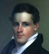
The Street is named after Jesse Edward Nash, Sr.  Dr. Nash was one of the City of Buffalo’s most prominent African-American citizens for the first half of the 20th Century.

J. Edward  Nash was born in Occoquan Virginia in 1868.  He worked as a farm hand, a blacksmith, a mason and a boatman.    He was a student at Virginia Union College in Richmond with Reverend Adam Clayton Powell, Senior, the pastor of Harlem’s Abyssinian Baptist Church.   Rev. Powell’s son was the first African-American elected to congress.  Reverend Nash became a minister at age 18.  At age 24, he came to Buffalo in 1892 to serve as pastor of Michigan Avenue Baptist Church.  He was pastor from 1892 until he retired in 1953.   Dr. Nash married Frances Jackson in 1925 and moved to 36 Potter Street in 1925.  Dr. and Mrs. Nash had one son, Jesse Junior, who became a professor at Canisius College.

Dr. Jesse Edward Nash, Senior

The City of Buffalo has had a strong history of African-Americans living in freedom.  When the City was incorporated in 1832, the city directory listed the names of 68 colored heads of families.  The majority of the African-Americans in Buffalo lived in the 4th Ward of Buffalo at the time – east of Main Street between North Street and South Division Street.  Michigan Avenue was the heart of the African-American neighborhood.  The Michigan Avenue Baptist Church was founded in 1836.  The current church was built in 1845, prior to this, they worshiped in a meeting room on Niagara Street near Pearl Street.

During the early 1900s, Buffalo’s African-American community was growing quickly, due to the City’s industrial economy.  When Dr. Nash came to Buffalo, there were only three established African-American churches.  By 1952, there were more than 30 churches.  Because of his education, Dr. Nash was well respected and he became one of the main representatives and spokesperson for the City’s African-American Community.

Reverend Nash helped to found the Buffalo Urban League.  This functioned as an agency to welcome African-Americans to Buffalo when they arrived from the south, by helping them find housing and jobs.  The Buffalo Urban League is still in operations today.

Reverend Nash was unique in his role in Buffalo.  He was widely respected by the city’s white leadership, so he had access to the Mayor and elected officials.  This was uncommon in many other cities during this time.   He worked to put together community meetings of black Buffalonians to intercede on behalf of other black citizens who were being wronged because of their race.

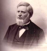
Dr. Nash was well-known, not just in Buffalo, but throughout New York State and the entire country.  He hosted Booker T. Washington in 1910 in Buffalo.  In addition to Mr. Washington, many nationally known African-American leaders were guests of Dr. Nash’s, including WEB DuBois.  Dr. Nash’s neighbor was Mary Talbert, another significant African-American in Buffalo during this time period, but we’ll get to her later (there’s a street named after her as well).

In 1912, Virginia Union University awarded Nash an honorary doctorate.  Dr. Nash served as treasurer of the Western New York Baptist Association, secretary of the Baptist-Disciples Ministers Fellowship.  He was chaplain at Meyer Memorial Hospital (the predecessor to ECMC).

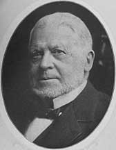
During the 1950s. Buffalo was undergoing a series of urban renewal projects.  Many of these projects impacted African-American neighborhoods disproportionately.   Dr. Nash advocated for fair housing and worked to stop the loss of affordable housing which was occurring under the name of “slum clearance”.

Dr. Nash retired as pastor in 1953.  To commemorate his retirement, the City renamed the street from Potter Street to Nash Street.  In 1954, Dr. Nash was awarded one of the first Brotherhood Awards from the National Conference of Christians and Jews.  He passed away in 1957 and was survived by his wife and his son Jesse Edward Nash, Junior.  He is buried at Forest Lawn.

Nash House, 36 Nash Street

The Nash House is located at 36 Nash Street.  The Buffalo Preservation Board and Buffalo Common Council designated the NAsh House a local historic landmark in 2001.  The house was originally built as a two-family residence, with an upper and lower unit.  Many of the houses in Buffalo were built like this as a practical form of housing for the urban middle class.   The Nash family lived on the second story of the house and rented out the lower floor.

The house was built around 1900.   Few changes have occurred through the years, and the historic integrity of the structure has been preserved.  The house and its contents, which included most of Dr. Nash’s papers, were acquired by the Michigan Street Preservation Corporation in 2000.  Restoration from 2002-2003 included restoration of the clapboard, windows and front porch.  The Nash family living quarters is fully restored, and the lower levels was rehabilitated for office and research space.

Dr. Nash and his family lived in the house from 1925 until 1987.   He passed away in 1957, but his widow occupied the house until she died in 1987.

The Nash House was restored and opened as the Nash House Museum in May 2007.   The museum provides a glimpse into what life was like in the early 1900s on Buffalo’s East Side.  The museum is open Thursdays and Saturdays from 11:30-4pm.   My interest has been piqued and I intend to check out the museum, hopefully this weekend.

For more information on the Michigan Street Heritage Corridor Commission and some of the amazing African-American history of Buffalo that happened in this neighborhood, please read this report prepared for the Commission by a UB Planning Studio.  

Dellenbaugh Block

This neighborhood has a personal history for me, as my uncle owned the complex of buildings known as the Dellenbaugh Block at the corner of Broadway and Michigan for much of my childhood.  He operated a car wash and pizzeria on the Broadway side of the block.  There was a pharmacy on the Michigan side of the building which always reminded me of the pharmacy in It’s a Wonderful Life.  The pharmacy here in this building was the first 24-hour pharmacy in Buffalo.

The Langston Hughes institute has plans to develop the Dellenbaugh Block.   More on their plans can be found here.

Some of my most vivid childhood memories were spent exploring that building and being fascinated by the neighborhood and the history.  The dark and scary basement of the building always freaked me out, because legend has it that it was a part of the underground railroad.  Portions of the building were built in 1842.  The city lists the building as being built in 1890, but to my childhood imagination, there were civil war era ghosts in that basement.

The Dellenbaugh Block is a designated landmark with the City of Buffalo.  The block is named for Frederick Dellenbaugh, a German immigrant.  Mr. Dellenbaugh was a physician and built his home and office at 173 Broadway circa 1842.  The house is visible from Nash Street, behind the newer storefront.   The storefront was the location of a Deco restaurant in the 1930s.

Broadway Arsenal in 1858

Across Nash Street is the Broadway Barns, a City of Buffalo DPW garage.  This building was originally designed as a New York State Arsenal.  Portions of the original circa 1865 armory still exist and can be seen from the inside of the building.  Once the regiments left the Arsenal, the building was converted to an exposition and event hall.

Broadway Auditorium in 1915

This was used for events prior to the construction of the Buffalo Memorial Auditorium on the Terrace.  There are pictures of elephants walking down Broadway to get to the circus at the old Broadway Auditorium.   After the Memorial Auditorium was built, the Buffalo Streets Department began using it as a garage.  What a change this building has seen in the past 150 years!  What a history in this little pocket of a neighborhood!


Check out the Street Index to learn about other streets in Buffalo.


Sources:

Cottrell, Kevin.   “J. Edward Nash History”.  accessed at: http://www.motherlandconnextions.com/nash.html

“Dr. J. Edward Nash, Sr.” (Obituary).  Buffalo Courier Express.  27 January 1957

http://www.showcase.com/property/163-173-Broadway-Street/Buffalo/New-York/1435912

http://greaterbuffalo.blogs.com/gbb/2005/12/campaign_landma.html

http://www.nashhousemuseum.org/history.html

Sanborn Map depicting Polonia Park in 1925

While researching Curtiss Street, I noticed that there was Polonia Park marked on some of the maps.  I have a great interest in the Broadway-Fillmore neighborhood and the area around the Central Terminal in particular, and I had never heard of this before.  I got sidetracked from my street researching and ended up finding out some interesting stuff which I would like to share with you all.  I know it’s not a street history, but hopefully you all will enjoy these tidbits of information as much as I do.

Polonia Park was located on Curtiss Street prior to the Central Terminal’s construction.  The park was purchased by the City in 1913 at the same time as the land for Schiller Park, Willert Park, an extension to Riverside Park and an addition to Lanigan Park.

In June 1916, the Buffalo Live Wire (a publication published monthly by the Buffalo Chamber of Commerce) posted that “A well-prepared city plan is indispensable to the intelligent acquisition of park properties, and if we enjoyed the guidance of a city plan in our recent campaign for additional parks, we would not now be wondering why we purchased, at a cost of $60,000, Polonia Park, consisting of lands useful for neither park nor playground.”

The article did not elaborate on this, but my guess is that because the land had been part of the railroad corridor, it was ill-suited for parkland.  Railroads use a great deal of pesticides to keep foliage from blocking the tracks, as can be seen when abandoned railroad corridors are still free from most grasses and shrubs long after the trains stopped coming through.  The West Shore Railroad, which connected Buffalo to New York City formerly cut through this park, following approximately the path which Memorial Drive follows today.

Despite the reports that the land was not useful as a park, the park was used during the early 1920s, as there are reports in the newspapers of baseball scores for games played in Polonia Park.

August 24, 1924
Buffalo Morning Express

By March of 1925, the property was owned by the Buffalo Board of Education as the intended site of the Peckham Vocational School.   Peckham Vocational was located at the corner of Peckham and Townsend, however they originally started out in the Adam Mickiewicz Library on Fillmore while the original school was being constructed.   As this ad from the Buffalo Morning Express, August 29, 1922 shows, there were four vocational schools in Buffalo at the time.  This was the time when many students would go out in the world to work after they completed 8th grade.  Vocational schools were a way to continue your education, while also learning a useful trade.

Ad for Vocational Schools
Buffalo Morning Express, August 29, 1922

Peckham Students

Peckham Vocational was a source of pride for Buffalo’s polish community.  The residents of Polonia were concerned that the high schools located in Buffalo were overlooking their community, so the residents rallied successfully to open a school in their neighborhood.  Peckham Vocational opened in 1911.  Board of Education had plans to build a new school and was about to let the contract to build when the railroad approached them to purchase the property to build what at the time was being called the “Fillmore Station”.   In exchange for the Polonia Park property, the Board fo Education received the property at the corner of Sycamore Street and Koons Avenue.  Peckham Vocational School was renamed Emerson Vocational School in 1937, after the school’s superintendent.  The school operated at its Sycamore Street address for 62 years until 1999.  Since then, the building has been remodeled and renamed Harvey Austin Public School 97, and operates as an elementary school.

After I posted my post on Curtiss Street, Marty from Forgotten Buffalowas kind enough to share these pictures of another planned park in Polonia.  It was clear that the people who lived in this neighborhood wanted a park, since they used the land that the chamber of commerce called unsuitable for a park as a park, and then plans were development for this park around 1938.  For reference, this map north is towards the bottom.  This land is currently the residential neighborhood between the Central Terminal and Broadway.

New Park Design For Park North of Central Terminal

Sadly, this park was never built.  While the residents of Polonia had successfully rallied to get a school built in their neighborhood in 1911, it seems that they were unable to rally enough support to build a neighborhood park.  Perhaps because it would have involved tearing down houses?

Recent efforts have occurred at the Central Terminal to build an urban habitat in the vicinity of the former Polonia Park.  The Urban Habitat Restoration project is working to reclaim the land which was used as a parking lot during the height of the Central Terminal’s use as a train station.  This project is working to restore some of the landscape, using native plants and green sustainable methods.   For more on this project, check out the Central Terminal Website here.

Over the course of  the past 100 years, this piece of property has transformed from railroad corridor, to park, planned use as school, to use as a parking lot, and now is being restored back to natural landscape.  Not too shabby of a history for our little piece of land that was once known as Polonia Park.


Learn about the history of other streets in Buffalo by checking out the Street Index.


Sources:

  1. “Buffalo’s Towering Temple of Transportation”, Greg Jandura.  accessed online, July 25, 2012:  http://www.trainweb.org/wnyrhs/nyctermpt1.htm
  2. “Council Wants Action on New School Tract”  Buffalo Morning Express March 21, 1925, pg 11
  3. Buffalo Live Wire, Vol. VII, No. 6,  June 1916, published by the Buffalo Chamber of Commerce.
  4. “Again Central Secures Delay” Buffalo Express Dec 14, 1905
  5. http://www.buffaloschools.org/m/content.cfm?subpage=39590
  6. Bucki, Carl,  “Polish Vocational School Was The Source Of Community Pride”.  Am-Pol Eagle.  Access online: http://ampoleagle.com/polish-vocational-school-was-br-the-source-of-community-pride-p5222-147.htm
  7. Plans for park designed by Joseph Fronczak provided by Marty Biniasz.

Curtiss Street
Present Day Alignment

Curtiss Street is runs along the railroad tracks near the Central Terminal.  The street follows the curves of the railroad, which has been there since at least the 1880s.  The streets in the vicinity of the Terminal have changed a bit in the last 100 years.  More information about other streets will be coming in other blog posts.  Since the construction of the Central Terminal, Curtiss Street has run underneath the Terminal at the curve.  (click photos to enlarge for easier reading)

Curtiss Street in 1889

Curtiss Street in 1925

Curtiss Street in 1950

People often believe the street is named after Glenn Curtiss, known for Curtiss Aeroplane Company.  However, Glenn Curtiss wasn’t born until 1878, and the street was named by at least 1889.  While it would have been very interesting if the street had been named in honor of an 11-year-old who ended up being as remarkable as Glenn Curtiss, this was not the case.   I was unable to find any concrete evidence linking Glenn Curtiss to the other Buffalo Curtiss family.  If anyone has any information of their linkage, please let me know in the comments.  But no, Curtiss Street is NOT named for Curtiss-Wright airplanes.

Curtiss Street is named for Charles Gould Curtiss.  Mr. Curtiss was an officer of the Lancaster and Depew Land Company, which developed Curtiss Street and several other streets in its vicinity.

Mr. Charles Gould Curtiss was born in 1827 and grew up in Utica, New York.  He ran the news stand at the Utica Rail Station while he was a boy, and eventually became a produce salesman.  At the age of 23, he formed a connection with a wholesale grocer, which brought him to New York City.  He made many connections while in New York. For a short time, he became an executive of Breckinridge County Coal Oil Company in Louisville Kentucky.  He worked to substitute coal oil for sperm oil. The discovery of petroleum caused the business to fail, as the coal oil was no longer necessary.

In 1857, Mr. Curtiss came to Buffalo to join Levi Willard in the insurance business.  In 1873, he organized a barley and malt firm that continued to operate for nearly half a century.  Charles and his wife Amelia lived in a large stone house at 63 West Huron Street.  He kept his horses at Efner’s Livery Stable at Franklin and Chippewa, and it is said that he rode his horses through Delaware Park on a daily basis.  At the time, the roads were only paved as far as North Street, so riding to the park was a ride out to the country.

In 1882, Charles was a delegate to the Democratic Convention where his friend Grover Cleveland was nominated for Governor.  After his election, Cleveland appointed Mr. Curtiss to the Board of Trustees of the Buffalo State Hospital for the Insane.  The Curtiss family also kept a farm at Delavan and Main Street where he raised chickens and kept a cow.  He felt that “the country was the best place for growing boys”, so he spent a great deal of time on the farm with his sons Harlow and Alexander.   Although his own schooling was limited, Charles felt an education was important, so he sent both sons to college.

Alexander Curtiss House
(currently the Ronald McDonald House)

Alexander studied medicine at the University of Rochester after coursework at Cornell.  Dr. Curtiss (Alexander) was in charge of the first hospital established in Denver, Colorado.  Following the birth of his first son, Colman, Dr. Curtiss returned to Buffalo and became a surgeon for Buffalo State Hospital.  Colman eventually ran his grandfather Charles’ barley and malt firm.  Colman was president of the company when it went under due to prohibition.  Following the closure of the malt firm, Colman worked in insurance for John Hancock Life Insurance Company.  Colman married Sally Cary, daughter of Trumbull Cary (another prominent Buffalonian).  Alexander and his family lived at 780 West Ferry, the house which is better known today as the Ronald McDonald House.

Ethel Mann Curtiss House
(100 Lincoln Parkway)

Harlow was a graduate of Trinity College in Hartford, Connecticut and studied law under Grover Cleveland.  Harlow became a lawyer and became an extensive real estate owner throughout the City.  Harlow and his wife Ethel were prominent in Buffalo during the early 1900s.  Ethel was originally Ethel Mann, the daughter of Matthew Mann, the doctor who operated on President William McKinley after he was shot on the Pan-Am grounds in 1901.  Harlow was influential in the development of the Curtiss Building at the corner of Franklin and Huron.  Ethel was considered a community leader as well, she worked with the Buffalo Council of Campfire Girls and conducted programs to develop leadership skills for women.  Ethel and Harlow lived at 100 Lincoln Parkway.

Curtiss Building
Franklin and Huron Streets

The Curtiss Building at Franklin and Huron Streets was designed by Harlow’s brother-in-law, Paul Mann, and was built in 1912.   The building is also known as the King & Eisele Building due to a jewelry firm which located in it during the 20s and 30s.  It was later known as the Hoelscher Building after the Hoelscher Building Corporation which was located there from the 1940s until the 1990s.  Mark Croce currently owns the building and had plans for a boutique hotel about 5 years ago.  However, the project appears to be at a standstill.

COMING SOON:   I became intrigued by the old maps when I saw the land where the Central Terminal now sits was once a park.  Coming later this week:  What was Polonia Park?

Sources:  “Curtiss Street Memorial to Trade Board Head, Developer” Courier Express Oct 22, 1939 sec. 6. p 10.
Field Notes

Live from Buffalo, NY

Grants.gov Community Blog

Connecting the grant community to #LearnGrants

Dienna Howard

I create, therefore I am.

Hidden Waters blog

Companion blog for the book "Hidden Waters of NYC"

Hoping for a Tail Wind

Because I definitely brought way too much gear.

priorhouse blog

Photos, art, and a little bit of LIT.

Sheepie Niagara

Bleating the Beat Since 2015