Feeds:
Posts
Comments

Archive for 2021

north-oak.png

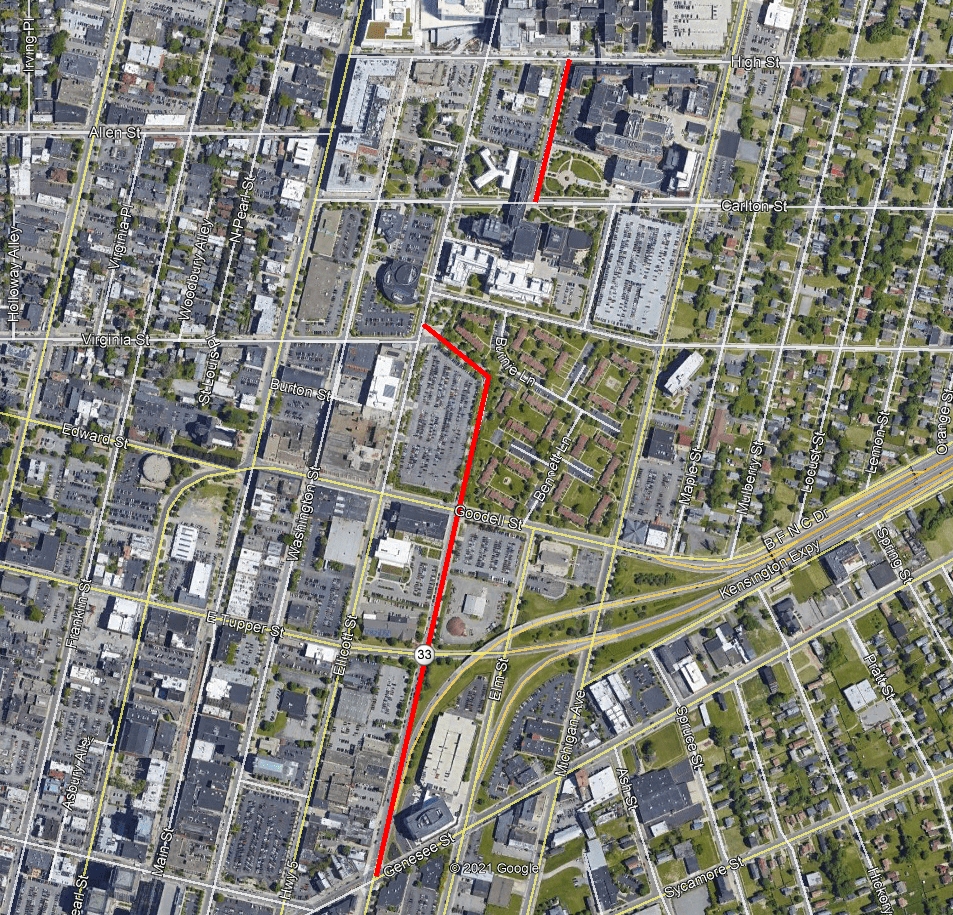
North Oak Street shown in red.  Source:  Google

Today, we are going to be talking about urban renewal again, specifically what was known as the “Oak Street Redevelopment Project”. The project revolved around the North Oak neighborhood, bounded by Best, Michigan, Goodell, and Main Streets.  This is basically the same boundary as the Buffalo Niagara Medical Campus today.  North Oak formed the central corridor of the neighborhood. It’s ironic that the street they named the project after was pretty much removed from the area, as Oak Street now runs disjointedly through the medical campus.

North Oak Street runs between Genesee Street and High Street.  This is one of the odd street naming conventions in this area. Elm Street and Michigan Avenue remain Elm and Michigan north of Genesee Street, without the north demarcation. There was historically a North Elm Street, running between Northampton and Riley Streets, but it was renamed Holland Place.  Similarly, nearby Pine Street north of Broadway becomes North Pine while the other streets in this area do not change as they continue across Broadway.  I am not sure of the rationale behind these naming conventions, in the case of North Oak, I imagine it could possibly be to differentiate the residential portion of Oak Street from the business section which runs from Genesee Street to Seneca Street.  The southern section of Oak Street has also been changed greatly by urban renewal as well.  In a separate urban renewal project, everything between Elm and Oak Streets in downtown was demolished.

Historically, the North Oak area was referred to as “The Orchard and the Hill”.  The Orchard is what we would refer to today as the Fruit Belt, with the streets named after fruits.  The Fruit Belt term began to be used in the 1950s and 60s.  More to come on the Fruit Belt in future posts.  The Hill was built around the area that is now Buffalo General Hospital, first built on High Street between North Oak and Ellicott Streets.  High Street is the top of the hill, hence its name as the highest street.  Due to the hospital, the area is sometimes called “Hospital Hill”.  When the hospital first opened in 1858, High Street was a rural area, outside of the city.  Keep in mind that when the City limits were set in 1832, North Street and Jefferson Street were set as the outer limits of the City of Buffalo – most of the city was still concentrated between the Terrace and Chippewa Street.  This was the northeastern corner of the city limits.  Up through the 1860s, much of the area between Mulberry Street and Main Street was open fields.  This is where the circus would pitch tents during summers.  

The gentle slope of the hill set the area aside from the rest of the East Side.  As buildings grew on Jefferson, Genesee, and Main Streets, the neighborhood was hidden from view.  The streets had lots of trees and gardens.  There weren’t large mansions or estates in the neighborhood, so there was a street face of small frame houses built close to the street line.  This created a continuous  urban feel to the neighborhood.  The area was mostly residential.  Many of the first residents came in the 1830s when a group of German Lutherans fled the religious persecution they were experiencing and came to Buffalo to settle in this area.  Due to the German’s proclivity towards brewing, the area is also sometimes referred to as “Brewer’s Hill”.  

best and ellicott - gta photo

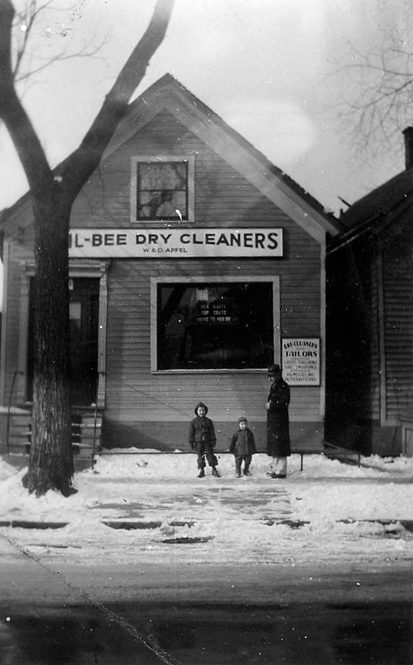
Example of a business in the neighborhood – Wil-Bee Dry Cleaners on Ellicott Street near Best Street, circa 1944. Building was built around 1864. Source: George Apfel, friend of author

The main commercial streets were Virginia, High, and Carlton Streets, which were lined with two and three-story cast iron and brick buildings with stores downstairs and apartments above.  Most of the residents lived and worked in the neighborhood – bakers, confectioners, seamstresses, carpenters, blacksmiths, and coopers.  Taverns were important institutions and social centers where the neighbors would mingle.  There were also many churches in the neighborhood.  One of the jokes in the neighborhood was that if you had a nickel, you could have a pint of beer for four cents and still have a penny left for the church offering plate.

By 1894, the neighborhood was mostly built out – mainly with one and a half-story wood-frame houses and two-story commercial buildings.  By the 1920s, this was one of the densest areas of the city.  Since the area developed as a working-class neighborhood, many of the residents relied on shops and services that were only a short walk away.  This was the horse and buggy era, and at that time, those were typically not within the means of a working-class family.  The Washington Market at Washington and Chippewa allowed many of the residents access to a variety of fresh produce and products just a short walk away. 

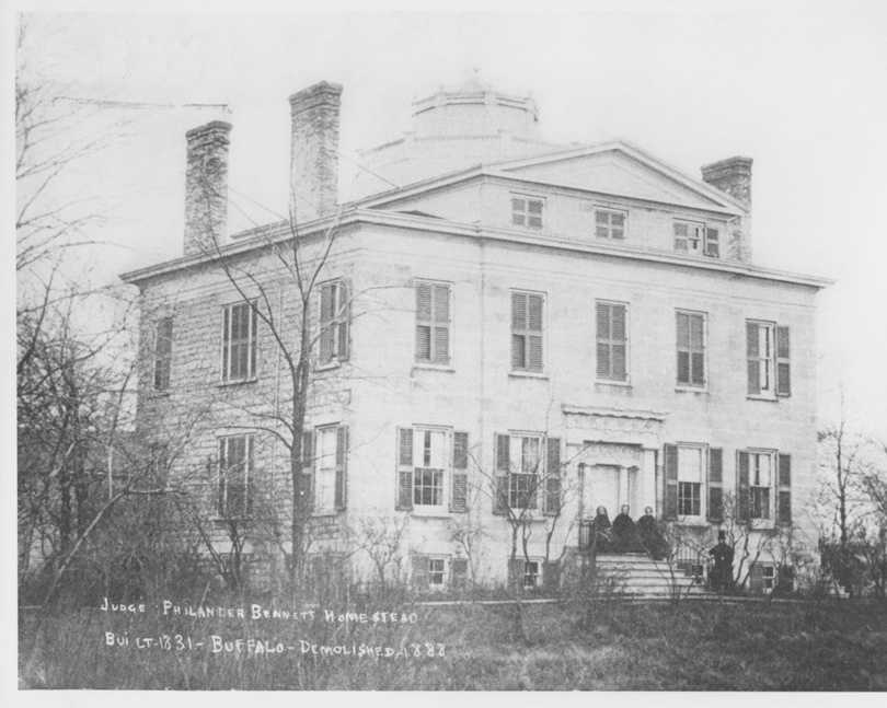
North Oak Street was a quiet, tree-lined street.  During the 1880s, North Oak was considered the Delaware Avenue of the East Side.  There were stately homes with tall windows and formal gardens.  Three mayors grew up on the street.  Soloman Scheu, Mayor of Buffalo from 1878-80 lived at North Oak and Goodell Street.  Mayor Scheu was famous in the neighborhood for the dinners hosted at his home and his New Years Parties were the hit of the neighborhood.   After his death, his house was used as the Neighborhood House for many years, one of Buffalo’s earliest settlement houses.  The house was torn down to become the M. Wile Company clothing factory.  Louis Fuhrmann, Mayor from 1910-17, lived at North Oak near Tupper in a big frame house with massive fireplaces.  After he was mayor, he moved to the Wicks House on Jewett Street (across from the Darwin Martin House).  Charles E Roesch, Mayor from 1930-33 lived at 633 North Oak.  He was born and raised on the street and continued to live there while he was Mayor.

oak street school

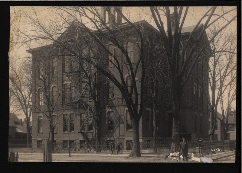
Oak Street School. Source: Buffalo (N.Y.). Department of Public Works, “School No. 15, Oak Street School,” B&ECPL Digital Collections, accessed May 18, 2021, http://digital.buffalolib.org/document/1765.

Public School No. 15 was located on North Oak Street, at the corner of Burton Street.  The College Crèche, a day nursery was also on North Oak Street.  The Crèche served 40 children whose mothers were widowed or deserted.  Buffalo General Hospital, the first big hospital built in Buffalo was at North Oak and High Street.  In the 1850s and 60s, the Ladies Auxiliary helped fight to get the hospital built.  Nearly every society woman in Buffalo was a part of the auxiliary.  It was a small feat at first to get the hospital built, but it continued to grow and prosper into the entity that we know today.  

There were also many churches in the neighborhood, with two churches on North Oak Street – the Hellenic Eastern Orthodox Church, built like an old Greek Temple was located at 361 North Oak Street.  The Hellenic Church eventually moved into the former North Presbyterian Church at Delaware and Utica in December 1952, having outgrown its Oak Street space.  St. Mark’s United Evangelical Church was also located on North Oak Street near Tupper Street.  In 1929, St. Mark’s merged with St. Paul’s and used their building on Ellicott Street between Tupper and Goodell.  The church was demolished as part of the construction of the Oak Street interchange of the Kensington Expressway in 1970.  

oak streets (1)

Oak Street Renewal Area shown in blue. Extant streets shown in green. Non Extant Streets shown in red. Source:  Author, based on historic maps

ralph street

Houses on Ralph Street.  Source

The North Oak neighborhood was a dense neighborhood.  I often get questions from readers researching their family histories.  They’ll say, “I found the house was at this address, but I can’t seem to find it on a map”.  Usually, it’s because a street name has changed, which we’ve covered a few on this blog.  But sometimes, it’s because the street no longer exists.  Here are some of the forgotten streets of the North Oak Neighborhood:

  • Burton Street- a portion of this still exists, but the road used to reach all the way to Mulberry Street
  • Edwin Alley – between Elm and Michigan, running from Goodell to Tupper
  • Werrick Alley – between Elm and Michigan, running from Goodell to Burton Alley
  • Ralph Alley – between Elm and Michigan, running from Burton to Virginia
  • Hammond Alley – between Elm and Michigan, running from Virginia to Carlton
  • Demond Alley – between Oak and Elm, running from Tupper to Virginia
  • Coolin Alley – between Oak and Elm, running from Virginia to Carlton
  • Morton Alley – between Ellicott and Oak, running from Goodell to Virginia
  • Neptune Alley – between Elm and Michigan, running from Carlton to High

While in many parts of the city, the Alley name is reserved for the rear part of the property, often for service to a carriage house or garage.  However, these alleys in the North Oak Neighborhood were lined with their own rows of houses, due to the density of the neighborhood.  Leading to some of the confusion is that some of these alleys had additional names over the years:

  • Demond was Boston Alley
  • Morton was Weaver Alley
  • Edwin was Goodell Alley
  • Hammond was Swiveler Alley
  • Neptune was Ketchum Alley
  • Coolin Alley was also called Codlin or Collin Alley
oak street houses

Example of the type of housing in the North Oak Street neighborhood.  Source:  New York State Department of Health

The neighborhood continued up through the 1950s when project talks began for the redevelopment of the area.  The city applied for funding from the federal government in the late 1950s.  This was the City’s fourth federal aid renewal project.  The City applied for the funds “with the background of the decade old failure of the Waterfront and Ellicott District renewal projects to materialize and slow pace of developing the Thruway Industrial Park as a renewal project.”  The City was slow to move on the Oak Street project, despite announcing plans, leading to many tenants abandoning the area prematurely.  This furthered the decline and blight of the neighborhood.  

Mayor Frank Sedita signed the contract between the city’s Urban Renewal Agency and the US Department of Housing and Urban Development (HUD) for the 145 acre Oak Street Redevelopment Project Area.  The project to acquire and clear the land and build new housing was expected to take five years and a phased approach.  They planned to do a “tear down-then building” approach which at the time was referred to as a “checker-board” method of demolition and new construction.  The intent was to help minimize the relocation difficulties for residents living in the area.  The long-range plan called for 1500 new housing units built over five years.  Approximately 514 families and 311 more individuals would be relocated as a result of these activities.

The Oak Street Redevelopment Project was to include

  • 1544 low/moderate and elderly housing units
  • Recreation facilities
  • Spot residential rehabilitation
  • Commercial Plazas
  • Hospital and Medical Facility Expansions – a $4 Million Roswell Park Research Studies Center, a $4.3 Million Roswell Park Cancer Drug Center, a $4.5 Million Buffalo General Mental Health Center, and a $1.6 Million Buffalo Medical Group building.
  • Three new parking ramps – one on Michigan between Carlton and Virginia Streets – to serve Roswell Park Memorial Institute, one at the SW corner of Michigan and North to serve Buffalo General Hospital, and one on Goodell between Oak and Ellicott Streets – to serve the Courier News, Trico, Eastman Machine, M. Wile and other industrial businesses in the area. These new parking ramps would have built 4,100 new spaces.  The largest of the three ramps, the 2000 space ramp on Goodell to serve the industrial businesses was never built.

The initial new housing was at the site adjacent to what was then the Fosdick-Masten Vocational School.  They purchased 39 parcels and tore down 29 buildings along Michigan between North and Best Streets.  In April 1968, the Board of Education agreed to release the open space around the school to BURA for these new apartments.  The school had been planning to move to Main and Delevan when their new school was completed.  This never happened and Fosdick-Masten graduated its last class in 1979.  The school was used as a warehouse and the interior was stripped, with plans to be demolished.  Those plans also did not come to fruition.  In 1980, the school became home to City Honors School.   Along the Michigan Avenue side of the site, they built 160 units of townhouses and garden-style apartments there, called Woodson Gardens.  A new street, Fosdick Avenue, was built to serve these apartments.  Woodson Gardens were demolished in 2013 and the school is raising money to rebuild their open space into Fosdick Field.  

St. Philip’s Episcopal Church, which was located at 161 Goodell Street worked with the city to be the nonprofit sponsor of the first phase of construction activities.  St. Philip’s was founded in 1861 in a basement on Elm Street between North and South Division.  At the time, they were one of the seven original African American Episcopal churches in the country!  St. Philip’s expanded in 1921 when they moved to Goodell Street, to the former home of St. Andrew’s Episcopal Church.  The church had been built in 1892.  St. Andrew’s moved to Main Street in University Heights.  St. Philip’s worked with the city to help relocate the residents into new housing.  The church was originally going to be moved to a new site within the neighborhood – to the corner of North and Ellicott Street.  Those plans fell through.  In 1973, St. Philip’s church was razed by the urban renewal project.  The church secretary stated, “We survived as an African American community for more than 150 years.  Now we’ve been through trials and tribulations.  It wasn’t all pretty and sweet.  It’s just the way it was”.  The congregation now calls the Delevan-Grider neighborhood their home.

William Gaiter was interviewed in the early 1970s as a leader in the Black Community and was looking forward to seeing the new housing developed in the area.  Especially the 500 units of low to moderate-income housing for elderly people that was planned for the site.  By 1975, the units had still not been built, due to lack of funds. 

oak street houses 3

Example of some of the run down houses in the North Oak Street neighborhood.  Source:  New York State Department of Health

The project was originally planned to start in 1962 and be completed by 1965.  The Urban Renewal Commissioner, James Kavanaugh, earmarked $599,000 for razing properties before the Common Council and the Federal Government approved the project.  This lead to displacement of residents before the relocation study was completed, so they were not eligible to receive their federal grants and assistance with relocating their families, who were made homeless by the urban renewal project.  The buildings started to be razed in May of 1965 because Roswell Park Memorial Institute was planning to start their expansion project, so they needed the building site to be clear.  Buildings were demolished, even though the federal project wouldn’t be approved until July of that year.  In May 1968, the City of Buffalo went to court to obtain titles to 15 of these parcels near Roswell.  The owners would be paid 75% of the federally established price for their properties while the properties went through the condemnation process.  They had already obtained titled to 20 of the properties in this area.  

605 Oak

605 North Oak Street. Source

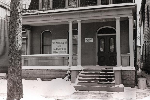
I was able to speak to the Salvatore Sisters, Melody and Michelle.  Their family lived at 605 North Oak Street.  The house had been purchased by their parents June and Michael Salvatore in the mid-1950s.  The house had been divided into four apartments, they lived in the upper rear apartment.  They attended 2nd and 3rd grade at School No 15.  They would go to Barone’s corner store at North Oak and Carlton.  Like many property owners in the area, the family depended on the rental income.  Offers were made to purchase the properties in the area by eminent domain.  The City’s offer to buy the house didn’t take into consideration the loss of the rental income in addition to the loss of their property and their home.  June Salvatore hired an attorney and sued the city for fair value.  In the meantime, houses around them were demolished, one by one.  Construction crews would leave debris around their property to intimidate them and block access to their home.  In the end, 605 North Oak was the last house standing on the North Oak and Elm Streets.  June Salvatore refused to be intimidated by this and continued fighting.  The sign went up on their house that said “We would rather fight than submit to legal robbery.”  Eventually, June Salvatore won the battle and was given $35,000 for the house (about $240,000 in 2021 dollars).  The family moved in 1968.  

While June Salvatore won her battle, how many were not so lucky?  


20210501_121255.jpg

Vacant lot in foreground where homes had been demolished. Houses in the rear waiting to be demolished.  Source:  New York State Department of Health

Demolition of this area around Roswell began in January 1968.  There were 126 people living on the block bounded by Oak, Elm, Carlton, and Virginia.  There were also commercial properties – businesses on the site included Joseph A Kozy, Volker Brothers Inc, Inro Inc, Pollack Building Corp, and Kreiss Sign Company.

A second area that began to be cleared in 1968 was the 8 blocks that became McCarley Gardens eventually.  This area was home to more than 530 people.  There were also five commercial properties   – the Good Neighbors Store, Nino’s Entrata, W. Martym Cleaner, Mildred’s Food Store, and T&L Cleaners.  Two other non-residential properties were in this area – St. Philip’s Episcopal on Goodell Street and Neighborhood House Association on Ralph Street.  Neighborhood House was a settlement house founded in 1894.  We discussed St. Philip’s above.  In 1981, Neighborhood House merged with Westminster Community House to form Buffalo Federation of Neighborhood Centers (BFNC).  BFNC Drive, which runs between the Locust Street exit of the Kensington Expressway and Goodell Street, is named after the organization, which provides family focused services for adults and youths living in low income and disadvantaged neighborhoods throughout Buffalo, Niagara Falls and Lockport.  The road was previously North Service Drive was renamed after the organization in 1994 as part of their centennial celebrations.  

Screenshot (7)

North Oak Street “Wasteland”. Source: Buffalo Courier Express, May 1973

By 1972, only 60% of the area had been demolished when President Nixon put a freeze on federal funds to build low-cost housing.  The area was left littered with building debris and rubble.  The City had planned to avoid what had happened in the Ellicott District, where the land laid cleared, vacant and strewn with trash for years.  Instead, the Oak Street project created an eyesore on the edge of Downtown, right where motorists were exiting the new Kensington Expressway.  As motorists drove into Downtown, they were greeted with a view of acres of rubble-strewn land, surrounded by empty, crumbling houses.  The City’s Community Development Commissioner’s solution was to screen the view by erecting a fence.  The fence held a sign explaining that the clearance activities were a “measure of progress toward making Buffalo a more attractive and livable city”.  

oak_buildings1951 (3)

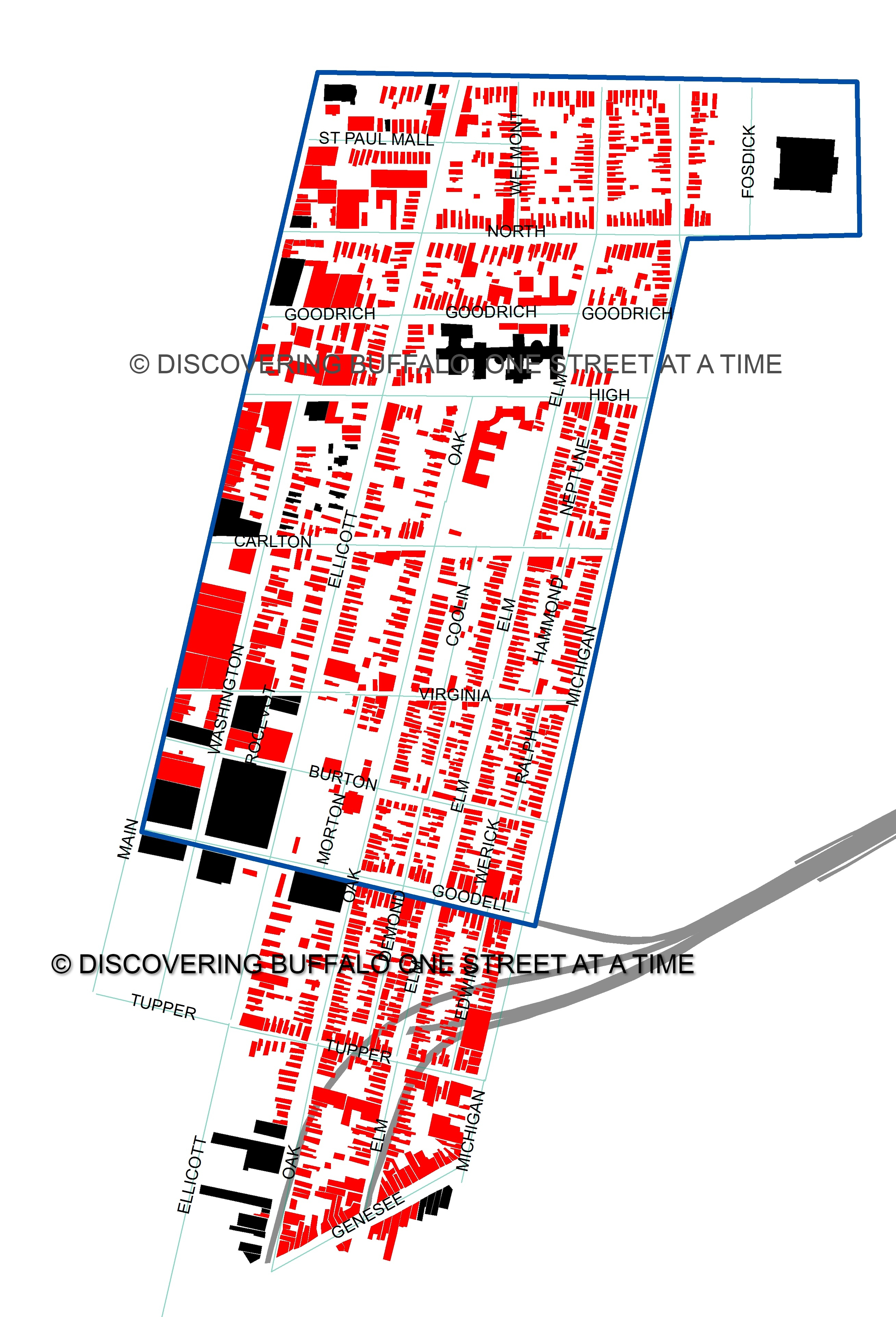
The Oak Street Redevelopment Area outlined in blue. Buildings shown in black are still standing. Buildings in red have been demolished. Source: Author, based on 1951 Sanborn Maps

In 1951, the Oak Street Redevelopment Area was home to 1308 buildings.  Only 41 of those buildings remain standing today.  Of the 1268 buildings demolished, 461 were residential:  434 frame houses, 1 rooming house, 13 flats (Buffalo upper and lowers), and 13 apartment buildings.  As was the case with the Salvatore home, many of the houses had been subdivided into multiple units.  The average number of people per unit in this neighborhood was 2.93 people.  Conservatively, this neighborhood had been home to at least 2000 people, and likely many more.  The 1500 housing units that were planned for the redevelopment area resulted in only 513 being built….with most of those units built nearly two decades after the residents were kicked out of their homes and the buildings demolished.  

roosevelt apartments

Roosevelt Apartments, 1978Source

In 1971, the City unveiled plans for its first big modernization project.  This was 80 apartments designed for the elderly at the building at 11-23 High Street, the Roosevelt Apartments.  The building is a seven-story Renaissance Revival Style building that was built in 1914.  The city acquired the building as part of the Oak Street Redevelopment.  This was the first project of its kind undertaken by BURA.  The current rents in the building were about $63 and they were expected to go up to $79/month ($520 in 2021 dollars) for one-bedroom and efficiency apartment.  The project never happened and the city turned out all remaining tenants in 1973 because they were losing money on the building.  the building sat vacant, on the brink between demolition and revitalization.  Groups went back and forth trying to figure out a way to renovate the building and find financing.  The building was slated to be torn down if one of the interested groups, Roosevelt Renaissance Group, was unable to obtain financing for their project.  The building sat vacant and abandoned until 1984 when it was converted into 113 apartments subsidized for the elderly.  The apartments are currently managed by MJ Peterson.

After years of sitting vacant and being an eyesore at the edge of Downtown, McCarley Gardens was built.  The complex consists of 150 affordable apartments,  with rents subsidized by HUD.  The groundbreaking for McCarley Gardens was in December 1977.  The site was built by and is still owned by, Oak-Michigan Development Corporation, an affiliate of St. John Baptist Church, located just across Michigan Ave from the complex.  The 15-acre housing site is located between Goodell, Oak, Michigan, and Virginia Streets.  They were the first low to moderate-income housing built in Buffalo in a decade and they received more than 1000 applications for the 150 units before opening.  The first tenants moved into the complex in March 1979 and the site was formally dedicated in July of that year.  McCarley Gardens is named after Burnie McCarley, a pastor of St. John’s.  Burnie’s daughter Jennie married King Peterson, for whom King Peterson Road is named.  

When McCarley Gardens opened, they were touted by the Courier Express as an “outstanding example of what can be accomplished through private initiative” and that St. John Baptist should be “highly commended for pursuing the project over mountains of red tape and craters of bureaucracy to a successful completion”.  The project took nine years to be completed.  The hope was that McCarley Gardens would serve as a rebirth for the neighborhood.    

1515699392225

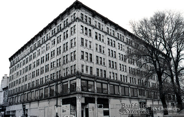
UB Medical School, Main and Allen Source

In the early 2000s, University of Buffalo proposed removing McCarley Gardens to turn the site into an academic and research facility to support the Buffalo Niagara Medical Campus.  The plan was vehemently opposed by both residents and politicians.  By 2014, UB backed away from those plans, building their new Medical School at Main and Allen Street and using the former M. Wile Company space as the UB Downtown Gateway Building.  Several different plans have been made for rehabilitation of the McCarley Gardens complex in recent years, including a recent plan involving Nick Sinatra to rehab many of the units to bring them up to date.

The other housing built in the Oak Street Redevelopment Area was Pilgrim Village, an 11.3-acre site at the north end of the redevelopment area, bounded by Michigan, Best, North, and Ellicott Streets. The 90-unit affordable housing community was built by former Buffalo City Court Judge Wilbur Trammell in 1980.  In 2002, the site was passed to Trammell’s son, Mark.  Mark Trammell worked with McGuire Development in 2017 on a redevelopment project for the site that was called Campus Square.  At that time, 25 apartments were demolished to prepare for new buildings.  Campus Square was supposed to be the start of redevelopment for the entire site, but construction was delayed, the project stalled and McGuire ended up taking the whole Pilgrim Village site through foreclosure.  

A portion of the Pilgrim Village site, 4.5 acres at the corner of Michigan and Best, was purchased by SAA-EVI, out of Miami.  The group is planning a $50 Million project to build two affordable housing projects –  a four-story building for seniors and a five-story building for families.  The two buildings are planned to have 230 apartments in total.  Plans for the rest of the Pilgrim Village site include new buildings that are a mix of housing, offices, stores, and medical labs.  The blocks have been difficult to redevelop despite many efforts over the years, so it is yet to be seen what will happen at the site.  There are currently 65 townhomes spread across the site.  

20210502_141406

Washington Place Houses that were preserved in the 1980s.  Photo by Author

Four houses that were supposed to be demolished were saved.  In the early 1980s, these four houses on Washington Street were boarded up, vandalized and filled with trash.  They are brick, Italianate houses built before 1872 and are adjacent to four houses on Ellicott Street used by St. Jude Christian Center and the Kevin Guest House.  The City was looking to demolish the Washington Street homes at 923, 929, 933 and 937 Washington Street to clear the land for a future, undetermined development.  These houses were the last of their kind in this area and the only remaining homes on Washington Street.  Austin Fox, a preservationist and architecture buff stood up to the City and argued the case for the houses.  The restoration project that resulted was called Washington Place.  The project restored the exterior of the buildings with public money with the intent of selling them to private developers.  The City spent $330,000 in Community Development Block Grant money to clean the outside brick, repair the masonry and put on new roofs, gutters, downspouts, doors and porches. The street on this block had been cobblestone, but the city repaved the street and built a 40-car parking lot adjacent to the buildings to make them more attractive for tenants.  At the time, this was one of four city-managed projects happening in this neighborhood that were designed to bring new life to the area. The other projects were the Allen Street subway station along with the metro rail, the renovations of the Roosevelt Apartments, the construction of the 14-story building at Ellicott and High Streets to expand Buffalo General Hospital, and construction of an indoor shopping mall at Franklin and Allen Streets – can you imagine, a MALL IN ALLENTOWN???? Thankfully, the mall never happened, though the other projects were completed!  With the hospital just two blocks away from Washington Place, the houses were marketed for medical offices.  As construction was wrapping up in 1981, the City was in negotiations with a medical group to buy the properties.  Since 2005, the houses have been owned by an entity of the Buffalo Niagara Medical Campus.  

be227c4e0853c5464eafe6d7555dc1f7

Anchor Bar. Source: Buffalo & Erie County Public Library

One beloved Buffalo site – the Anchor Bar  – was among buildings planned to be razed as part of the Oak Street Redevelopment project.  The Anchor Bar property was a part of a 3.1 acre parcel that was intended to be redeveloped with housing with St. Philip’s Church located at the NW corner of Ellicott and North Street, as mentioned previously.  Those plans did not come to fruition, and in 1974, BURA then intended to build a new facility for Carlton House Nursing Home on the site.  The Nursing Home began operating at 60 Carlton Street in the late 1960s, but their original site was purchased by the State for Roswell Park Memorial Institute.   Roswell still uses the Carlton House name for the structure. Many in government were angered by the purchase, as the City of Buffalo needed nursing home beds more than they needed the hospital.  The Anchor Bar was left out of the nursing home site at Ellicott and North, under the condition that the restaurant be rehabilitated and that the restaurant purchase 16,000 square feet of adjacent property around their restaurant to allow for off street parking lots.  The nursing home site at Ellicott and North has been the home of Buffalo Hearing and Speech since their building was constructed in 1994.  Can you imagine Buffalo if the Anchor Bar had been demolished just ten years after they “invented” chicken wings?  They may not be everyone’s favorite wings, but they certainly are a Buffalo tradition….if they had gone away, would Buffalo be known for wings today, or would everywhere call them chicken wings instead of Buffalo wings?

So the next time you are on the Medical Campus, think back and remember the North Oak Street neighborhood that used to be there.  To learn more about how urban renewal shaped the near east side’s Ellicott Neighborhood, you can read this post:  JFK Park, A Case Study in Urban Renewal.   Want to learn about other streets?  Check out the Street Index.  Don’t forget to subscribe to the page to be notified when new posts are made.  You can do so by entering your email address in the box on the upper right hand side of the home page.  You can also follow the blog on facebook.  If you enjoy the blog, please be sure to share it with your friends.

Sources:

  • Oak Street Project Contract Signed – Courier Express December, 16, 1970, pg 14
  • Report on Third Acquisitional Area – Health Research Incorporated New York State Department of Health. 
  • Report on Second Acquisitional Area.  Health Research Incorporated New York State Dept of Health.  Roswell Park Memorial Institute.  1968
  • Cichon, Steve.  “Torn Down Tuesday:  Ralph Street has Been Wiped Off the Map”.  Buffalo News.  November 3, 2015.
  • “City Goes to Court over Land Acquisition”.  Buffalo Courier Express March 1, 1968
  • McAvey, Jim.  3 Auto Ramps Planned for Oak Street Area.  Buffalo Courier Express.  June 29, 1967.  
  • Turner, Douglass and Dominick Merle.  Commitment of $599,000 Asked of City.  Courier Express.  September 18, 1961 p1.
  • “Council Votes Cash for Oak Street Project”  Courier Express, May 18, 1966.
  • Locke, Henry.  “A Conversation with William L Gaiter”.  Buffalo Courier-Express, July 14, 1975. P 9
  • Oak Street Area Project Is Backed.  Buffalo Courier Express.  November 22, 1957. P5.
  • Oak St Project Hearing Is Urged – Buffalo Courier Express, Sept 21, 1965, p 4.
  • Turner, Douglass and Dominick Merle.  Commitment of $599,000 Asked of City.  Courier Express.  September 18, 1965. P1.
  • Dearlove, Ray.  McCarley Gardens Keeps Construction on Schedule.  Courier Express.  August 20, 1989, sect H, p1
  • Williams, Michelle.  Church Dedicates Pastor’s Dream.  Buffalo Courier Express, July 16, 1979, p2.
  • City Aides Back Roosevelt Group for Renovation.  Buffalo Courier Express.  October 25, 1973.
  • Epstein, Jonathan.  At Medical Campus’ edge, a taller plan for a hard-to-develop block.  Buffalo News.  July 20, 2020. 
  • Decrease is Reported in Oversized Classes.  Buffalo Courier Express.  April 25, 1968. 
  • “Yes, Mayors Grow on North Oak Street:  Three Sons of Tree Lined Thoroughfare have Answered to ‘His Honor’ as Buffalo’s Chief Executive”.  Buffalo Timers, Sept 3, 1930.
  • Ritz, Joseph.  “Oak St Wasteland Seems Likely to Continue”.  Courier Express.  May 6, 1973, p B1.  
  • “Planning Board Approve Site for Nursing Home” Buffalo Courier Express.  Sept 27, 1974, p 15. 
  • Cardinale, Anthony and Mark Pollio.  “Community Group to Celebrate Centennial Buffalo Federation of Neighborhood Centers Festival Set for Aug 20”.  Buffalo News.  August 8, 1994.  

Read Full Post »

bennett

Bennett Street, current alignment shown in red. Former alignment included the portion in yellow

Bennett Street is a short street in the Ellicott Neighborhood of the East Side.  The street runs for one block from Broadway to William Street. Historically, the street continued a second block to Clinton Street prior to the urban renewal which demolished much of the neighborhood.  You might be thinking, but Angela, didn’t you already write about Lewis Bennett?  I did write about him, Lewis Bennett named the Central Park neighborhood, and Bennett High School, but this is a different Bennett and a different school!

pbennett
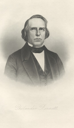
Philander Bennett was born to Nathaniel and Sarah Bennett on April 29, 1795. in Catskill, New York.  The family moved to Clinton in Oneida County while Philander was a child.  He attended Hamilton College and graduated in 1816.  Following his graduation, he went to Delaware, Ohio to try to establish a business.  A stock of goods being shipped along Lake Erie had to stop in Buffalo because of a storm.  They decided to unload the product in Buffalo and open a business at the corner of Main and Eagle Street, called Scribner & Bennett.  Scribner & Bennett quickly became the largest mercantile shop west of Albany.

Mr. Bennett married Henrietta Griffin in December 1817.   They had four children:  Griffin, who died at sea coming from St. Croix to New York at age 22 in 1841; Charles who left home in 1847 or 48 to attend Hamilton College near Utica and was never heard from again;  Mary Henrietta, who married Rollin Germain; and Edward.

In 1820, Philander Bennett left the merchant business to study law in the office of Heman B Potter, who became the District Attorney of Erie County.  In October 1822, he was admitted as an attorney of the Supreme Court and in February 1828, he became a counselor in the Court of Chancery.  He was appointed a Justice of the Peace in 1822.  He was appointed First Judge of the Court of Common Pleas for Erie County in 1829.  He held that office until 1837.  He also partnered with Le Grand Marvin in the firm Marvin & Bennett.

Mr. Bennett’s father, Nathaniel, moved to Williamsville in 1820 and lived there until 1838 when he relocated to Ohio.  Philander and his father were members of the Buffalo Land Company and owned a great deal of real estate in both Toledo and Cleveland.

Philander Bennett served as an Alderman of the City of Buffalo in 1832 and 1833 and again in 1840 and 41.  He was appointed by Governor Clinton the Judge Advocate of the 47th brigade of Infantry.  For many years he was connected with the “Albany Regency” but in his later years, he became deeply anti-slavery and took up the cause and joined the Republican Party when it was organized in 1854.

Mr. Bennett served as President of the City Bank of Buffalo and was Vice President of the Buffalo & Attica Railroad Company.  When President Van Buren came to Buffalo in 1839, Mr. Bennett was chairman of the committee of citizens appointed to receive the president and delivered a speech welcoming the President to the City.  He was a member of First Presbyterian Church.

bennett house

Bennett House on Clinton Street

The Bennett family lived in a house that was constructed in 1831 at the corner of Eagle and Pine Streets.  The house contained the first marble mantels to be brought to Buffalo.  The house was well known in Buffalo, residents often brought visitors to go see both the Bennett House and the Fargo House, as two examples of the most beautiful houses Buffalo had to offer.  The Bennett house was a square house with a cupola and stood in 15 acres of landscaped lawns and gardens.

For the last 16 years of his life, Philander lived in retirement, engaging in some foreign travel but mostly occupied with horticultural pursuits on his property.

559717c2-307d-423a-b3c2-150a5d99265a

Bennett House. Philander is at the bottom of the steps, with family members on the steps. Source: Picture Book of Earlier Buffalo

Philander Bennett died on July 22, 1863.  After his death, his widow remained in the home.  Following Henrietta’s death in 1885, the house and the grounds were sold by the two remaining children to the City of Buffalo.  Edward Bennett was born in 1827 and served as a successful merchant and owned substantial real estate.  Edward served as a parks commissioner from 1872 until 1888.  Mary Henrietta and her husband Rollin Germain (his name might sound familiar to those familiar with street names…) lived next door to the Bennett House.  Mary also owned substantial real estate throughout the city in her own name, which was rare during those times.

The Bennett family house was demolished in 1888 to construct Bennett Place/Bennett Park.  Many in town mourned the passing of that landmark which had been a center of luxurious social life and culture for half a century.  Some of the furniture and the mantel from the house were owned by their great-grandson Edward Bennett Germain, who lived at Nottingham Terrace in the 1930s.  Edward Germain was president of Dunlop Rubber and Tire Corporation.

Bennett Park was designed by Frederick Law Olmsted in 1887.  Olmsted’s design called for entrances from each corner of the property with flagstone walks circling around a horseshoe-shaped lawn at the center.  There was  a shelter house constructed in 1888 which faced Eagle Street and a gravel playground adjacent to Clinton Street.  The shelter house contained restrooms, a tool room and a large covered space open on three sides.  Thick foliage screened the park from the streets and helped conceal the park’s small size.  Bennett Park was a popular park, as it was located in a very densely populated neighborhood.

BennettPark

Olmsted Plan for Bennett Park

The park still exists but has been modified from its original design.  In 1920, a softball diamond and tennis courts were built and a new shelter house.  The gravel playground and many of the plantings were removed.  The park has been combined into the JFK Community Center Park and contains only the tennis courts.   The trademark Olmsteadian curvilinear paths on the west and south sides of the park still remain.

The part of Bennett Street between Clinton and William Streets was divided into East and West Bennett Streets.  The area between the two streets was home to the Clinton Street Market.  The market was one of the oldest in Buffalo, established around 1849.  The land had been deeded to the City for market purposes by the Bennett family from their property.  Because of its location, it was often referred to as Bennett Market, though the city preferred the Clinton Market name.  A Liberty Pole was raised and consecrated at the Market on the Fourth of July 1855.  The pole was 140 feet high and topped with a gilt eagle with outstretched wings.  This Liberty Pole was in addition to the one at the Terrace.  In 1856-57, the City graded and paved the Clinton Street Market site, along with the Chippewa Market (at Chippewa and Washington) and the Court Street Market (located where the Buffalo Fire Headquarters is now located).  The City also built market buildings on the three sites.  The Clinton Street Market and the Chippewa Market buildings were identical at 392 feet long by 36 feet wide, built in the Romanesque style.  The market building could accommodate 82 farmers’ wagons under the shelter.  Each stall was supplied with gas, water and sewerage.  The Court Street Market was built in the form of a Greek Cross, but with similar dimensions as the other market buildings.  The Clinton Street Market was a popular meeting site for residents of the 5th Ward for community matters, elections, etc.

atlas 1872 bennett

1872 Hopkins Atlas. Map shows the location of the Clinton Market, the original location of PS #32 and the location of the Bennett House. Note several other properties owned by Bennett Family members, including Mrs. Mary Germain and Edward Bennett.

In 1925, the City wanted to abandon the Clinton Market to build a community center and public bathhouse. Residents protested the closure of the market.  The city argued that the market was not profitable, however, the vendors said it was only not profitable b/c the market was not kept up by the city.  It had been ignored and no repairs had been made.  At the time, all of the markets in the city operated at a loss to the city.  Residents argued that the public markets should be operated for the benefit of the people and not the profiteers.  The residents signed petitions with more than 1000 names arguing to keep the market open.   The Market at the time had 22 stalls and 17 of the stalls were occupied.  The East Side Business Men’s Association put together a proposal to keep the market and establish the bath house at the southern end of the site, but the plan was rejected.   The Bath House was originally intended to be for the use of the Blacks in the neighborhood, but members of the Black community fought back and protested against the Bath House saying that it was segregation and discriminatory.  The Buffalo American (a Black Newspaper), stated that

“He (the Mayor) is guided solely by the sentiment there expressed, the Free Public Bath House and the Community House will be exclusively for Negroes.  If this is the Mayor’s program The American will oppose such a measure as will all of the thoughtful citizens of this section of the city.  A Public Bath House and Community Center for all citizens in this section of the city will meet with a hearty welcome from all, but a Bath House and Community Center for Negroes is nothing less than segregation and will not be sanctioned by any thoughtful person.  We do not know who the Colored men are who are urging the Mayor to take such steps, but we will not stand by idle and see all of our people segregated for a mere bath.”

Mayor Schwab had to make it clear on several occasions that the Bath House would be for both Black and Whites. Public Bath House No 4 opened in 1927 on William Street on the former location of the Clinton Street Market. A small stub of East Bennett Street was renamed Embassy Street.

bennett 1951

1951 Sanborn Map showing the location of the Bath House and the location of Bennett Park School

Despite the protests, the Clinton Market was closed.  On Saturday, October 16, 1926, at 10pm, the last of the merchants gathered their wares and left their stalls for the last time.  Under the terms establishing the market, the property reverted back to the heirs if it was used for any use other than market purposes.  The building was quickly demolished.  On the northern portion of the site, Public Bath House No 4 was built.    The southern end of the site was to be a gymnasium or a community center, but the empty lot was quickly taken over by students and teachers arriving at Tech High School, across Clinton Street from the former market.  The City originally thought that using the site for the Public Bath House and Community Center would be allowed under the agreement, but it was not.  Corporation Council and Charles B. Germain (Grandson of Philander Bennett and son of Rollin Germain), representing the heirs of the Bennett family, came to agreement for the City to pay the heirs $10,000 (about $154,000 in 2021 dollars) to abandon the market and receive the property.

bennett park school

Bennett Park School

The Bennett Park name also survives at Public School #32, Bennett Park Montessori School.  PS 32 was originally built organized in 1851 with the building originally located on Cedar Street (just behind the school’s current location).  In 1872, the school expanded with a second building next to the original building.  The current building on the site was built in 1913 and was known as the Bennett Park School, due to its location across the street from the park.  In 1969, the building became home to BUILD Academy, the City’s first Community School.  BUILD Academy moved to Fougeron Street in 1975.  In 1977, the building became home to Bennett Park Montessori Center (BPMC).  BPMC is the only public Montessori Program in Western New York and one of the largest Montessori schools in the country.  BPMC came about as a result of the desegregation of schools that was happening in the late 1970s and early 1980s.  The Arthur vs Nyquist last suit was filed in 1972 by a number of African American parents, including George Arthur, against Ewald Nyquist, the Commissioner of Education, the Board of Education, the Mayor and the Common Council of the City of Buffalo.  The case took a long time to be settled, but one of the things to come out of it was the establishment of magnet schools.  Magnet schools draw students from the entire school district, as opposed to neighborhood schools which draw from the neighborhood the school is located within.  Magnet schools tend to be more diverse, due to students coming from a variety of socioeconomic and racial backgrounds.  Parents and teachers from St. Mary of Sorrow’s Montessori preschool program and others worked together to create a public Montessori program.  Before BPMC, any parent who wanted their child to have a Montessori education had to pay for the teacher and the program.  St Mary’s Montessori program differed from other Montessori programs in the region because it was an integrated preschool.

In September 1977, BMPC opened, along with several other magnet schools.  BPMC had received 560 applications for Black students, 320 from white students and 42 from other races.  They had a total of 922 applications for 261 spots!  They opened on September 7th with 131 minority and 131 majority students.  During the 1990 school year, the school expanded to 560 students.  An addition constructed in 2009 expanded its capacity to 980 students.  The addition received the 2010 Best Education Project in the Brick by Brick Awards by Business First.  The school celebrated its 40th Anniversary in 2018.

So the next time you drive by Bennett Street, think about Philander Bennett, his beautiful house, the park that was named after him and the school named after the park.

Want to learn about other streets?  Check out the Street Index.  Don’t forget to subscribe to the page to be notified when new posts are made.  You can do so by entering your email address in the box on the upper right hand side of the home page.  You can also follow the blog on facebook.  If you enjoy the blog, please be sure to share it with your friends.

Sources:

  • Smith, Katherine H.  “Bennett Street Memorial to Merchant, First County Judge”.  Courier-Express.  April 6,1941, sec 5, p5.
  • Editorial.  The Buffalo American.  December 18, 1924.
  • Protest Plan to Replace market with Bath House.  Buffalo Courier.  February 15, 1925.  pg 72.
  • Mayor to Ask Council to Buy Clinton Market Site.  Buffalo Courier.  February 11, 1925, p4.
  • Citizens Ask Retention of the Clinton Mart.  Buffalo Timers.  January 10, 1925, p2.
  • The Fourth in Buffalo.  Buffalo Morning Express.  July 6, 1855.  p.3.
  • Clinton Street Bath House Project May Fall Through.  Buffalo Courier.  August 10, 1924, p 76.
  • Krueger, Pauline.  Abolishment of Clinton Market Boon to Tech.  Buffalo Times.  October 30, 1926.
  • Council Defers Action on Clinton Market Petition.  Buffalo Courier.  January 10, 1925.  p3.
  • Public Improvements – Markets and Public Buildings.  Buffalo Weekly Republic.  July 14, 1857, p2.
  • Edward Bennett Dead.  Buffalo Evening News.  May 12, 1898, p 19.

Read Full Post »

Marvin Street is a short street running between South Park Avenue and Perry Street in the Cobblestone/First Ward neighborhood of Buffalo.  The street is adjacent to the Seneca Buffalo Creek Casino.  The street is named for Asa Marvin, and his family, who used to own a bunch of land in the First Ward of Buffalo.

marvin
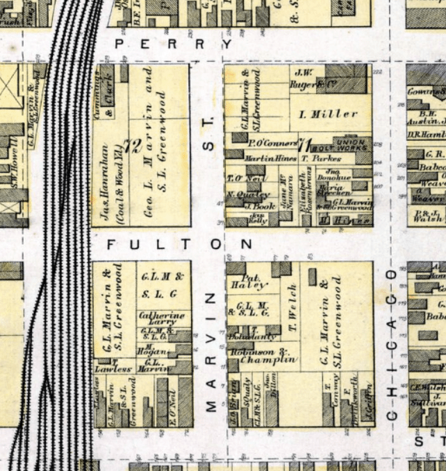
Asa Marvin was born October 13, 1778 in Norwalk Connecticut.  He grew up in Kirkland, in Oneida County.  He worked as a hatter and invested in property.  Mr. Marvin married Sarah Lockwood. They had two sons, George and LeGrand, and a daughter, Sarah.  Both sons were prominent lawyers in Buffalo during the 1830s-60s.  Asa and Sarah came to Buffalo after LeGrand had established himself here.  The Marvin Family lived at the southeast corner of Court and Franklin Streets.  The elm trees planted in front of the mansion were considered to be the tallest trees in Buffalo before they were chopped down.  Asa Marvin died on December 12, 1849.  He is buried in Forest Lawn Cemetery.

LeGrand Marvin was born in 1807.  He attended Hamilton College and then moved to Baltimore to teach.  He returned to Buffalo to study law with Philander Bennett.  Le Grand was admitted to practice as an attorney in 1833.  George was three years younger and attended Yale.  He returned to Buffalo and studied law under his brother.  George was admitted to the bar in 1836.  George married  lived on West Mohawk Street, the site of his house is now covered by the Statler.  George represented the Ninth Ward in the County Board of Supervisors and served as Chairman of the Board during his time.  The Ninth Ward at this time was the area around Niagara Square and up Niagara Street to Porter.  The brothers formed a partnership and worked together in their law practice.  It was said that the Marvin brothers had the largest law practice in the City of Buffalo.  

Buffalo_Evening_News_Sat__Dec_3__1887_

Sketch of Le Grand Marvin, Buffalo Evening News, December 3, 1887

Around 1831, Le Grand had been given power of attorney to care for his parents large estates.  He purchased real estate in the City for his father and managed it until he formed a partnership with George in 1839.  As a result, the Marvin family owned extensive property in Buffalo, including Marvin Street and all the land bordering it.  Le Grand Marvin divided the streets into building lots shortly before the street was opened in 1841.

In the spring of 1842, LeGrand made some bad endorsements for businesses which failed and as a result, became insolvent.  The law practice’s articles of incorporation were changed so that George was in charge, to help protect LeGrand from investors coming after him and collecting against the business.  

Le Grand married Julia Reynolds, a schoolteacher from Syracuse, in 1854.  They divorced in 1861.  

Following the death of their mother in 1963, the brothers began to argue over their mother’s properties.  The properties had been purchased by Le Grand originally.  Mrs. Marvin obtained title by foreclosure when Le Grand had his financial struggles.  She left the property to Le Grand in her will.  The litigation that follows broke up the firm and the law partnership dissolved in 1864. 

properties

Some of the Marvin-owned Properties along Marvin Street. Note: they are labeled here as owned by both George Marvin and Simon Greenwood. These were the properties that were under disputed ownership for 25 years while the case proceeded Source: 1872 Hopkins Atlas of Buffalo

The court case that proceeded was the longest in City history at that time.  After 22 years, the court case was settled in February 1886, in favor of Le Grand.  George had died in October 1882.  The matter was over real estate that was valued at $80,000 (about $2.2 Million today) and $12,000 (about $335,000 today) cash.   The value of the estate changed often, due to the longevity of the case, so various reports indicated differing amounts.  George’s family continued to appeal the case.

LeGrand became eccentric during his later years, and he was known to travel around Buffalo on the hottest days of summer wearing “artics and a woolen shawl”.  Following his death, the Buffalo Commercial said that:

No man, with his own hands, ever built a taller monument to his own eccentricity, than Le Grand Marvin.  He possessed an irrepressible tendency to rush into print on all matters that concerned him, however remotely….as a rule, his contributions to the press were declined with thanks, as the mere fact of publishing them would lay the medium through which they appeared open to libel suits from the inhabitants of Buffalo, consequently his literary remains are to be found principally in pamphlet form.

Whenever he felt anyone ran afoul of him, he’d jot it down and include it in his next pamphlet.  It was said that he distrusted and condemned all churches, political parties and professions.  He claimed that his marriage was not legal because his wife wore rouge at the wedding, so he felt she had defrauded him.  Despite the failure of his marriage and subsequent divorce, he wrote a pamphlet on “The Joys of Perfect Matrimony”.  He didn’t have any children, but he wrote pamphlets on “The Proper Rearing of Children”.  

While he was eccentric, he was still considered a fine lawyer and was well respected as one of the oldest members of the Buffalo Bar.  The court case continued following Le Grand’s death in 1887, with the case in another round of appeals and the will contested by George’s widow and children.  The properties were mainly located in the First Ward, and was some of the most valuable land in the city at the time.  In addition to the value of the land and buildings, they also brought in considerable rent from businesses operating on the properties.  Holmes Mill, Hamlin’s Grape Sugar Works, De Laney’s Forge and Cook’s Distillery were some of the businesses located on the land.

library bookplate

Old Buffalo Library bookplate showing Le Grand’s name. Source

The suit was decided yet again in favor of Le Grand almost a year after his death.  The bulk of his estate was to be left to the Buffalo Library (one of the predecessors to the Buffalo & Erie County Library).   Le Grand left behind a 37 page will, his final pamphlet.  After accounting for 25 year of legal fees and a few gifts to friends, the Library was expected to received about $35,000 or about $950,000 in today’s dollars.  Le Grand had been one of the founder’s of the library and was a life member.  The estate was contested by George’s family and finally settled in February of 1891.  

When he died, Le Grand also donated his body to University at Buffalo for research and dissection.  His skeleton was mounted in the vestibule of the Medical College on High Street for many years.  Do any of my UB friends know if they still have his skeleton?  

Sadly, George’s family was left without that income they had expected to come into after winning the law suit and the estate.  The loss of that money, plus the legal fees strained the family’s finances.   Son Phillip (Le Grand’s nephew) committed suicide in 1915 by jumping from a sixth floor window at the Buffalo Savings Bank.  Prior to his death, Phillip had visited every lawyer in the building trying to negotiate a loan to tide him over from the family’s financial difficulty and keep their home at 450 Richmond.  

So the next time you’re at the Casino, maybe take a look out the back of the parking ramp onto Marvin Street and pour one out for the Marvin Family.  And seriously, UB, someone let me know about that skeleton!

Want to learn about other streets?  Check out the Street Index.  Don’t forget to subscribe to the page to be notified when new posts are made.  You can do so by entering your email address in the box on the upper right hand side of the home page.  You can also follow the blog on facebook.  If you enjoy the blog, please be sure to share it with your friends.

Sources:

  • Smith, H. Katherine.  “Marvin Street Linked with Pioneer Buffalo”  Buffalo Courier-Express.  June 19, 1938, 4E.
  • “Le Grand Marvin:  A Chapter of Reminiscences Concerning the Great Litigant- Selections from His Own Works”  The Buffalo Commercial, December 10, 1887, pg 3.
  • “Some Old Buffalo Characters:  Recollections of People and Things in Early Buffalo””  Buffalo Commercial, October 14, 1911.
  • “Le Grand Marvin Wins His Law Suit after 22 Years”.  Buffalo Evening News.  February 9, 1886.
  • “Le Grand Marvin:  One of Buffalo’s Most Noted Characters Gone to His Last Rest”.  Buffalo Weekly Express.  December 8, 1887.
  • Percy C Marvin Jumped to Death at Bank Building.  Buffalo Times.  April 19, 1915.
  • “Le Grand Marvin’s Suit:  Wins a Victory in One of His Long Contested Suits”.  Buffalo times.  November 28, 1888.

Read Full Post »

person st

Person Street

Person Street runs between two sets of railroad tracks in the Broadway-Fillmore neighborhood of Buffalo.  The street runs for three blocks south of Broadway, and then  jags at Broadway and continues another two blocks.  The two halves of the street do not line up.  This is because north of Broadway, the street was once known as Kuempel Ave.   Sometime between 1893 and 1900, Kuempel Ave was changed to Person Street.  Person Street seems like a generic kind of name.  But it is named after an actual person who also happened to be a Person – Charles Person.

charles personCharles Person was born in Alsace-Lorraine in 1827.  He came to Buffalo in 1841 at the age of 14.  He worked in a liquor business learning the trade.  At the age of 23, he started his own liquor business.

Mr. Person and his wife Sophia had 11 children.  The lived on Elm Street, which was still a mostly residential neighborhood at the time.  George Urban and his family lived around the corner on Genesee Street.  The Person family had grape bushes along the length of their property, with plum and pear trees in the backyard.  The children spoke German with their mother, who had come to Buffalo at 18 but Charles Person insisted on speaking English whenever he could to learn to master the language.  

Mr. Person’s business, C. Person’s Sons was the city’s “foremost whiskey rectifier”.  Charles started the company in 1850. He sold his whiskey wholesale from 390-392 Elm Street next door to the family home.  His firm was the largest liquor warehouse in Buffalo.  Their building is currently part of the site that is presently the Catholic Health Headquarters.  The company was well known, not just in Buffalo but throughout New York, Pennsylvania and Ohio.  Two of their brands were Buffalo Club Whiskey and Riverside Whiskey. The whiskey business continued for three generations until prohibition.  For the two weeks before Prohibition started, the line outside of their business went for blocks, everyone stocking up on whiskey.  To understand the size of the business, when the doors closed, they still had 2,000 barrels of bonded whiskey remaining!  One of the grandsons reported that they kept the whiskey at his house, and that they still had stock into the 1940s!  During Prohibition, there were 4 attempted robberies at this house, so he had a special vault constructed to store the whiskey.   

Mr. Person held a lot of real estate throughout Buffalo and was the first person to own property on the street that now bears his name.  Mr. Person was Erie County Supervisor from the 4th Ward in 1873 and 1874.  In 1875, he was elected Alderman of the 4th Ward.  At the time, the 4th Ward encompassed Downtown between Eagle, Michigan, Goodell and Main Streets.  

Source:  Buffaloah.com 

Mr. Person died in 1885.  He left his business to three of his sons – Daniel, William and Frank.  The sons continued the success of the business.  When Charles first started the business, it was located in a space 20 by 30 feet.  The business grew to take up 60 times the space – a 4 story building with dimensions of 60 by 150 feet.  The building was described as including “elegant office and a distillation, packing, and storing area which employs an army of workers.”  In addition to their own whiskeys, they also sold imported wines from Germany, Spain, France, Italy and Hungary.  They were also the local agent for Cook’s Imperial Champagne, Pellich Gin, Sheboygan Mineral Water, and Anheuser-Busch Budweiser Beer. 

Son William Person was also Fire Commissioner of Buffalo for 18 years.  At  the time this was the longest anyone had held that title.  William ended up selling the remaining Person family lots on Person street in order to finance his son Eugene’s education at the University of Michigan.

Daniel H. Person was also a director of Meadville Distilling Company and of the Union Bank of Buffalo.  He was a member of the Harmonia Lodge No 699.  

Frank was the son who mostly managed the business.  Frank had 2 sons – Frank W. and two daughters – Clara and Flora.  Frank’s son and several of his nephews worked for the business.  Frank was director oft the Buffalo Automatic Smoke Consuming Company and the Freehold Savings and Loan Association.  He was a thirty-second degree mason.  

So the next time, you pass Person Street, think of the Person family…and maybe raise a glass of whiskey in their honor.

Want to learn about other streets?  Check out the Street Index.  Don’t forget to subscribe to the page to be notified when new posts are made.  You can do so by entering your email address in the box on the upper right hand side of the home page.  You can also follow the blog on facebook.  If you enjoy the blog, please be sure to share it with your friends.  

Sources:

  1. Smith, H. Katherine.  “Person Street Honors Land Owner Who Held City and County Posts”.  Buffalo Courier -Express.  October 1, 1939, Sec L-4.
  2. Mueller, Jacob.  Buffalo and Its German Community.  German-American Historical and Bibliographical Society.  1911.  Translated by Susan Kriegbaum-Hanks.
  3. White, Truman, editor.  Our County and Its People.  The Boston History Company, 1898.

Read Full Post »

Happy Women’s History Month!!  As any good reader of this blog knows, our streets are often named after rich white men.  So, in honor of Women’s History Month, I thought we’d highlight some of our street named after women.  

Mary B Talbert

Mary Talbert

  • Mary Talbert Blvd – Mrs. Talbert was the “most famous colored person in the country” during her time.  Read about her here in Part One, Part Two and Part Three.
  • Lovejoy Street – Sarah Lovejoy was the only woman killed defending Buffalo during the War of 1812.  You can read about her here.  
  • St. John’s Place – Margaret St. John’s home was the only house spared during the Burning of Buffalo during the War of 1812.  You can read about her here.  
  • Ripley Place – Mary Ripley was a teacher at Central High School.  She was charged with taming the boy’s study hall classes, which were the source of riots and police calls during the 1860s.  You can read about her here.
  • Lovering Ave – Sarah Lovering Truscott, along with her niece and daughter give this street its name.  Her niece, Mary Lovering, was one of the first society women in Buffalo to earn her living outside of the home.  You can read about them here.  
  • Gill Alley – Helen Gill decided to build a home in the Elmwood Village after her husband died.  This was unusual at the time, since most Victorian era homes were run by the man of the house.  You can read about her here.  
  • Gladys Holmes Blvd and Mary Johnson Blvd – Gladys and Mary were community activists on the East Side of Buffalo, living in the Talbert Mall.  You can read about them here.  
  • Minnie Gillette Drive – Minnie Gillette was our first Black County Legislator and helped to save the Old Post Office in Downtown (now ECC City Campus).  You can read about her here.  
  • Ora Wrighter Drive – Ora Wrighter was a community activist on the East Side of Buffalo.  You can read about her here.  
  • Wasmuth Avenue – Caroline Wasmuth was the first female land developer in Buffalo, back in the 1880s.  You can read about her here.  
  • 20191127_155801

    Lavinia Austin

    Austin Street – While the street is named after her husband, Livinia Austin took over his business (with her daughter Delia) after his death and did some developing of her own, including converting the Unitarian Church at 110 Franklin Street from a church into commercial space.  The county is currently rehabbing the building for use once again, calling it the Lincoln Building.  You can read about Livinia and the Austin family, here. Lavinia Austin
  • Many of the streets with women’s names were named after the children of a developer or land owner.  Examples of some of these streets that I’ve written about here include – Alice, Edith, Fay, Gail, Janet, Kay, May, Phyllis and Millicent. 

Of course, I have to give a shout out to the original Buffalo Streets girl herself, H. Katherine Smith.  She was a reporter for the Buffalo Courier for more than 40 years, and she was blind!  Her story inspires me every single time I read one of her articles.  

Of course, these women are just a few examples of some of the great Buffalo Women over the years!  In the comments, feel free to tell me your favorite stories about your favorite Buffalo Women!   I’ll start – my favorite is Louise Bethune, one of the first female architects. She designed the Hotel Lafayette, which has been my home for the last nine years, so I am forever grateful to her.  Who’s your favorite female Buffalonian?


Read Full Post »

urbanst

Urban Street (shown in red). George Urban St owned properties (shown in orange). Jacob Urban property (shown in blue).

Today we are going to talk about two roads.  The first is Urban Street on the East Side of  the City of Buffalo.  Urban Street runs from Fillmore Avenue to Moselle Street.  The second is George Urban Boulevard running from Harlem Road to Transit Road in the Town of Cheektowaga.  Both roads are named after the prominent Urban Family of Buffalo. 

geourbanblvd

George Urban Boulevard shown in orange. The form boundary of Pine Hill Farm shown in red.

George Urban Boulevard is 5 miles long and was constructed in 1924 at a cost of $125,000 a mile.  The road was designed to serve as an “Eastern Park Drive” to provide a direct highway (with Genesee St) from Buffalo to Lancaster and Alden.  The road was designed during the same time when suburban highways such as Millersport Road (now Millersport Highway) in Amherst, Sheridan Drive in Tonawanda were being constructed.  Main Street from the city line to Williamsville, Niagara Falls Boulevard and River Road highways were improved as well during this period.  Traffic planners of the era considered these streets to be extensions of the radial street grid (Broadway, Seneca, Genesee, Niagara, etc) that starts at Niagara Square.  These radials would connect to the main north-south highways such as Union Road or Transit Road to connect between radials.  Remember, there were no highways at this time, so these radial streets were the quickest way to get to outer suburbs.  

george urban
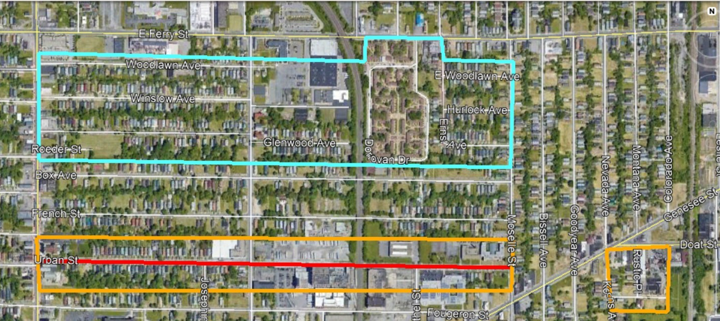
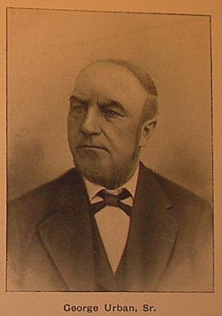
George Urban, Sr was born in August 1820 in Morsbrunn, Alsatia.  This area is a mix of French and German and has passed between France and Germany five times since 1681.  When George Urban Sr was born, this region was part of France but is now part of Germany.  He came to Buffalo in 1835 at the age of 15, with his parents – Philip Jacob Urban and Katherine Gass Urban. Katherine’s parents (George’s grandparents) had come to Buffalo in 1828. They were part of the first wave of German Settlers to arrive here in Buffalo. The Urban family purchased land (shown in blue on above map) in the northeastern part of the City – from Fillmore Avenue to Moselle Street, south of Ferry Street. Woodlawn and Glenwood Streets now run through their property. They also owned extensive other properties throughout the East Side of Buffalo, including the land where Urban Street is now located and several properties along Doat Street and the land where Rustic Place and Lansdale Place are now located.

Mr. Urban first worked for a general merchandise store, Colton’s, on Main St at the corner of Genesee Street. Mr. Urban established his own business in 1846, specializing in flour wholesale. His business was located at the northeast corner of Oak and Genesee Streets.  He eventually built several buildings at that corner that were known as the Urban Block.

In 1870, Mr. Urban went into business with his son, George Urban, Jr. The firm became George Urban & Son. The business was enlarged in 1881 when they installed the first steel roller mill in Buffalo, across Oak Street from their original store.  Before this, mills used traditional grindstones. The mill had a capacity of 250 barrels a day, which was increased until they reached a maximum daily capacity of 900 barrels.

Oak and Genesee 1889

Sanborn Map, Northwest Corner of Oak and Genesee 1889. Red box shows urban mill location

20210120_091520

Modern view of building on Oak Street that was formerly part of Urban Mills (photo by author)

Mr. Urban, Sr. was in high standing among the German community in Buffalo, but also among the greater community as well. He was a member of the Board of Trade and Vice President of the Western Savings Bank. He served as a Parks Commissioner and was influential in the establishment of the East Side parkways and Humboldt Park. Sources claim that the “East Side Park System, including Humboldt Parkway and the Parade owe their existence to his energetic and persistent efforts”. The Parade is now MLK Park. Humboldt Parkway was destroyed for the construction of Kensington Highway (the 33).  Fillmore Avenue was originally the other East Side Parkway, but it was converted to commercial purposes in 1906.

georgeurbansrgrave
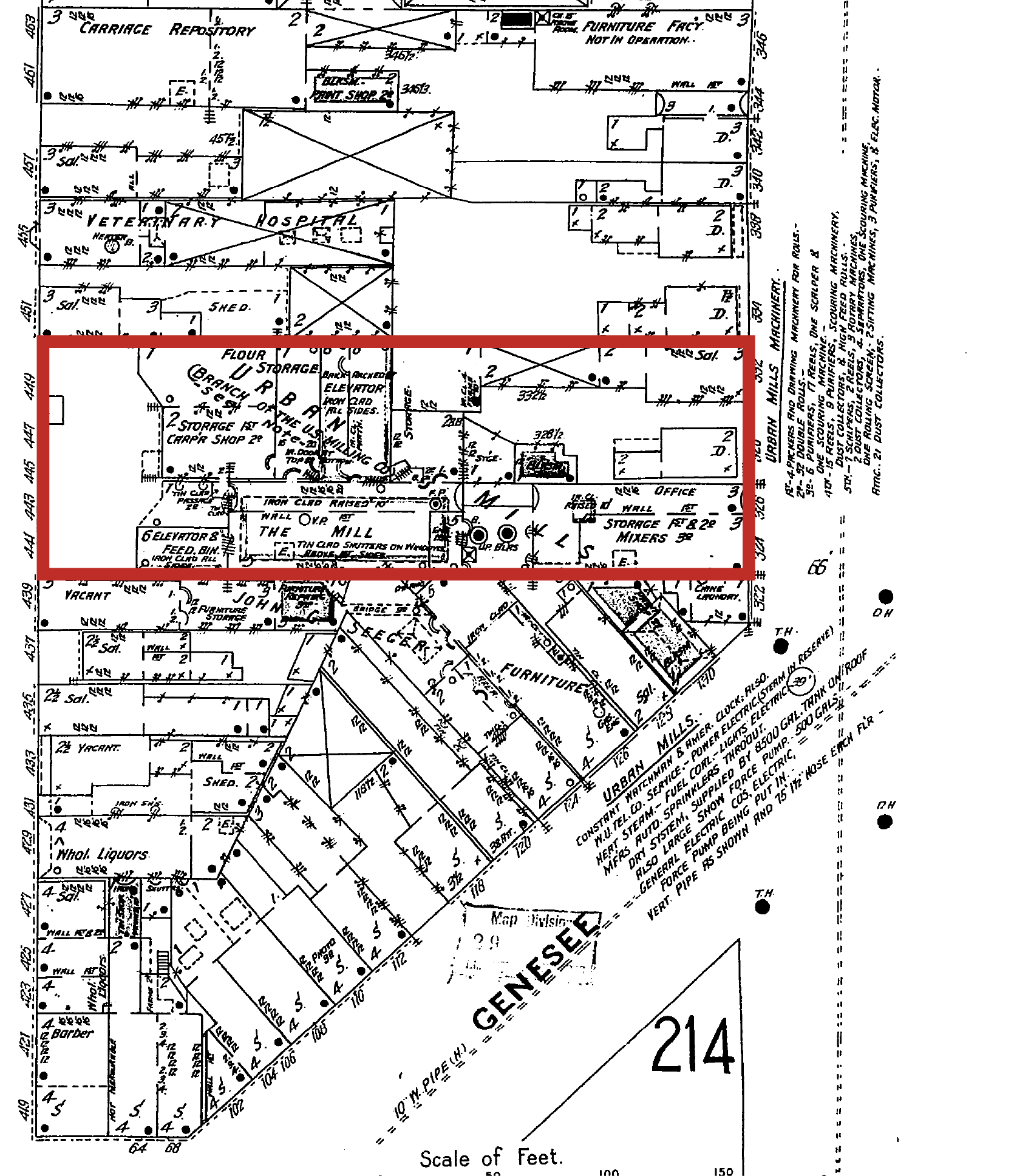
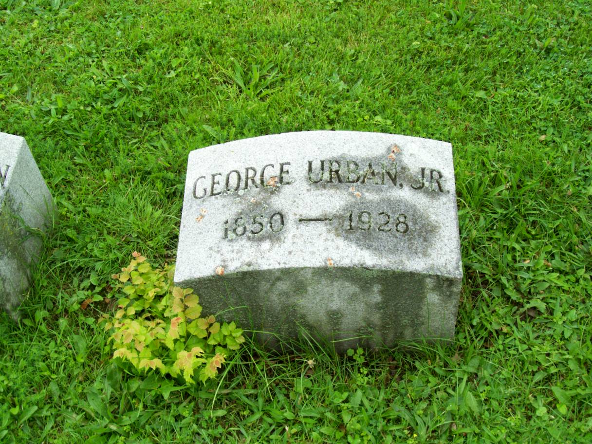
In 1846, Mr. Urban, Sr. married Marie Kern, also from Alsatia. They had three children: George Jr., Caroline and William C. Urban.  Mr. Urban died on Oct 13, 1887 at the age of 67.  He is buried in the Urban Family Plot in St. John Cemetery in Cheektowaga, not far from the road that would later be built and named after the family.  

urbansons
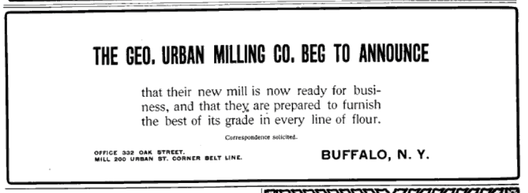
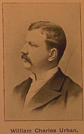
William Charles Urban was born on July 28, 1861. After graduating from public schools, he became a bookkeeper of the flour business. He became a member of the firm in April 1897 when the firm incorporated as Urban Milling Company.

William married Miss Louise Burgard of Buffalo in June 1886. They had six children – Grace, William, Raymond, Ada, Edward, and Louise. He retired in 1900 to private life at his home on the Pine Hill Estate in Cheektowaga. While he was well known around town because of his family, William kept a lower profile than his brother and father. He preferred to stay at home with his family rather than being a member of social clubs. He was a member of the English Lutheran Church. William died in 1902 and is buried in the Urban Family plot in St. John’s Cemetery in Cheektowaga.

urbansons
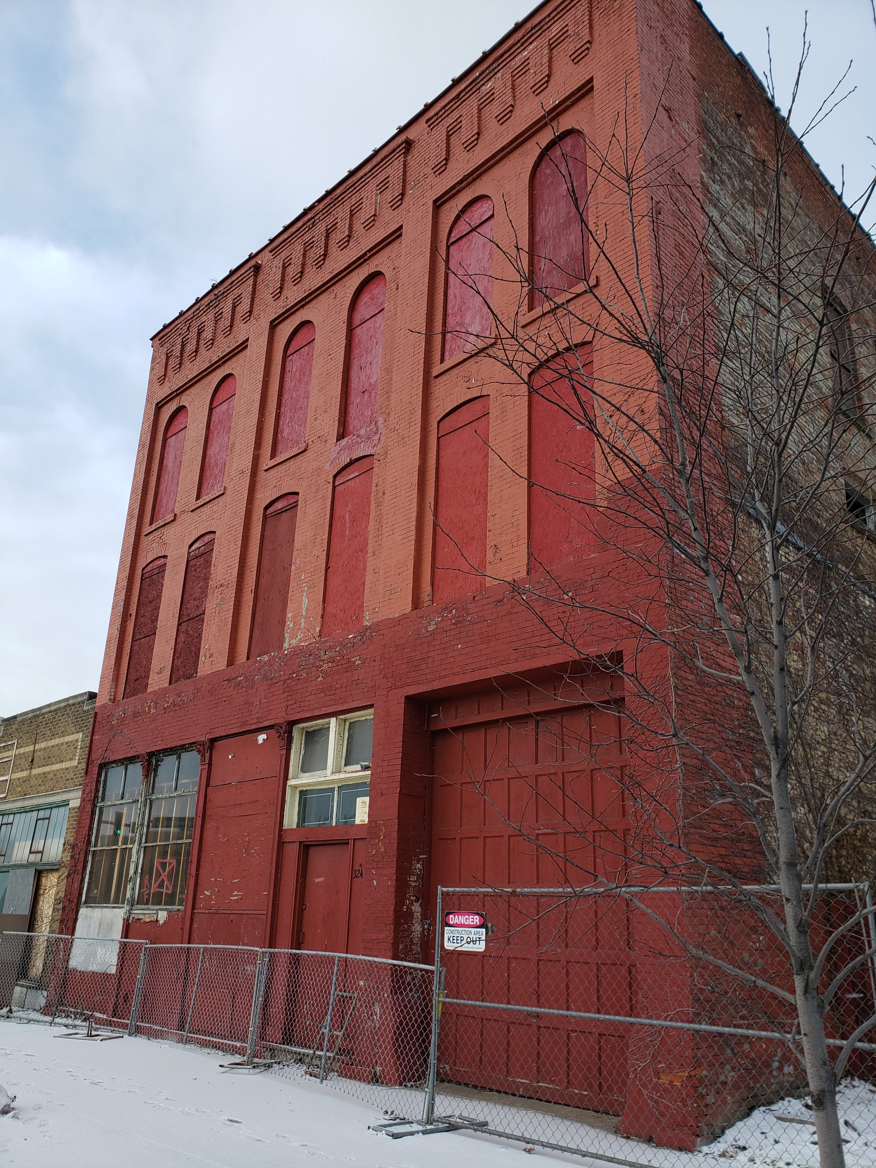
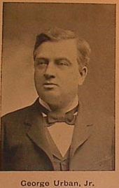
George Urban, Junior was born on July 12, 1850 in the Urban Family house at the corner of Oak and Genesee Street, across from the Urban Mill he would help his father build. He went to city public schools. At 16, he joined his father’s business. He became a partner in 1870. Mr. Urban, Sr. retired in 1885 and George, Jr. became head of the firm and the firm became Urban & Co, a partnership between George Urban Jr, Edwin G.S. Miller and brother William C. Urban. In 1897, the Urban Milling Company was incorporated.

Mr. Urban, Jr was particularly interested in electric power for lighting and equipment. He was involved in many electrical endeavors. He served as Vice President of the Buffalo General Electric Co., Vice President of the Cataract Power & Conduit Co., President of the Buffalo & Niagara Falls Electric Light & Power Co., President of the Buffalo Loan, Trust & Safe Deposit Co. He also was a director of the Buffalo German Insurance Co., the Buffalo Elevating Co., the Buffalo Commercial Insurance Co., the Ellicott Square Co., the Market Bank, the Bank of Buffalo and the German American Bank. He was also involved in politics, serving as Chairman of the Republican Committee of Erie County from 1892 -1895. His social club memberships included the Buffalo, Ellicott, Saturn, Country and Park Club. He was also a member of the New York Club and the Republican Club of New York City and the Whist Club of Rochester.

pine hill
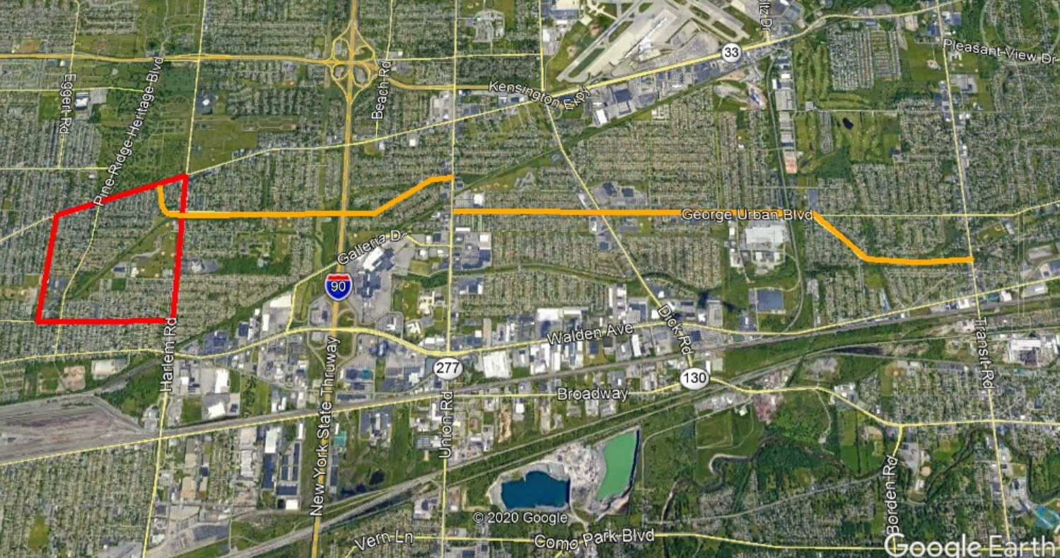
In October 1875, George Jr married Miss Ada E. Winspear. They lived at a large estate located at 280 Pine Ridge Road. The home had large grounds and gardens with greenhouses. The home has gone by several names including Pine Hill, Hill Top and Urban Hill. The property was purchased by Ada Winspear Urban’s grandparents in 1841 from the Ebenezer Society. Ada’s father, Pennock Winspear, purchased another 60 acres of land in Cheektowaga. The house was built between the 1850s-60s. The Urban family also purchased property after George and Ada met and owned over 120 acres of the Town of Cheektowaga. In 1892, Pine Hill Road was renamed Pine Ridge Road. While most of the business interests of the Urban family were in Buffalo, the bylaws of the Board of Directors of the milling company included that they were required to meet at least once a year at Pine Hill. Residents of Cheektowaga recall a parade of carriages coming up Genesee Street whenever there would be a party at the Pine Hill. There were often beer parties and clambakes.

Beautiful Buffalo Homes

Pine Hill Estate. Source: Beautiful Homes of Buffalo.

In 1882, the Urban farm was the location where Grover Cleveland‘s presidential campaign was launched.  George Jr was a staunch Republican but a friend of Grover’s, a democrat.  They had mutual acquaintances in the flour milling business and over time became friends.  The land where Urban Street lies was purchased by the Urban Family through an auction when Grover Cleveland was sheriff.  After Grover Cleveland was elected president in 1884, George Urban, Jr. insisted that he refused to cross party lines to support his friend. They remained friends despite their political differences.

georgeurbanjrgrave
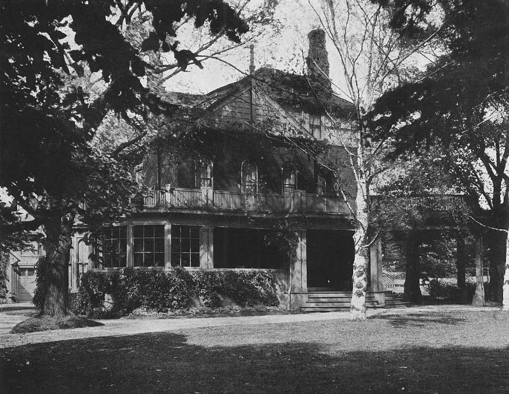
Mr. Urban Jr. raised poultry as a hobby, winning first prize for his poultry.  He also served on the Board of Directors for the Pan American Exposition in 1901.  The Urbans had four children – a son, George P. Urban, and 3 daughters- Emma, Ada and Clara.  The children were all born at the farm.  Mrs. Ada Urban had graduated from Central High School and was the first Jesse Ketchum Medal winner at the school.  George Urban Jr. died on February 23, 1928 and is buried in Forest Lawn Cemetery.  

george pGeorge Pennock Urban, son of George Urban Jr, was born in 1877. He went to Public School No. 9 and Central High School. He then attended Yale University to study mechanical engineering, graduating in 1901. In 1903, he became secretary and treasurer of George Urban Milling Company.

In 1913, George P. Urban married Mildred Pierce. They had one son, George P. Urban, Jr. Mildred passed away and George married Florence Zeller in 1918. They had four children – Katherine, Henry Zeller, Florence and Ada. Henry Zeller Urban would go on to be President and Publisher of the Buffalo News from 1974 to 1983.

George P.  Urban was the member of the family who began to break up the estate, as Cheektowaga was growing and there was a need for recreation, education and housing. The family home was moved to 218 Linwood Avenue but summers were still spent on Pine Hill.

In the 1920s, the Felician Order of Sisters purchased a part of the Urban estate to use as their convent and school.  the Sisters run Villa Maria College, which is located on lanes formerly part of the Urban estate.  The original Old Sisters’ Infirmary was originally William C Urban’s home.  In 1939, the Urban family home at 280 Pine Ridge was the site of the Cheektowaga Centennial Exposition. In 1946, part of the property was given to the Town and is now Cheektowaga Town Park. In 1950s, the land west of the Felician property was sold for residential development. Streets that were once part of the estate include Markus, Parkview, Parkedge, Pinewood and Pennock Streets.

George P.  Urban was also involved in the establishment of a Free Library System for the Town. In 1939, the Urban Home was offered as location for a library. Due to it’s location, it was decided the house was too far away from the rest of town to be a useful library location. At the time, Pine Hill Road was still an unlit dirt road. In 1947, the Winspear Library was opened, named after George’s maternal family. The library was only open for one year when the County took over the library system and decided another location was more suitable.

George P Urban was President of George Urban Milling Company after his father’s death. Additionally, he was President and Director of Thorton & Chester Milling Company, Mill Sterilizing Corp and the Riding Club Realty Co Inc. Like his father and grandfather, he was very involved in many organizations. He was a President of the Buffalo Corn Exchange, Director of the Automobile Club, member of the Buffalo Chamber of Commerce and the Buffalo Convention and Tourist Bureau. He was also a member of the Humane Society, the Public Library, Buffalo Country Club, Saddle and Bridle Club, Buffalo Trap and Field Clubs, Rotary Club and the Yale Alumni Association of Western New York, the New York Produce Exchange, Buffalo Orpheus, Buffalo Canoe Club, University Club, Saturn Club, Buffalo Club, Buffalo and Erie County Historical Society and Bowmansville Grange.

George P. Urban died in August 1966 at the age of 89. By the time of his death, the Pine Hill Estate had transformed from a sprawling farm to a residential home in a large suburban town. The house was sold in 1954 to furrier Pauline Fracasso who held elaborate parties in the home. It was sold again in 1971, 1983. 1996 and 2004.

urban mill

Mill on Urban Street, circa 1911. Source: Buffalo and Its German Community.

In 1903, when George P Urban became Secretary of Urban Milling Company, the company closed the Oak Street plant.  They built a large flour mill on Urban and Kehr Streets. The mill was built along the New York Central Belt Line tracks.  The location on the Belt Line helped to increased the ease of both bringing wheat to the factory and shipping off the finished product via rail. They manufactured several different flour brands that were distributed to all parts of the country. The mills were the first in Buffalo to be powered exclusively by electricity, powered by the mighty Niagara Falls. The daily capacity was 1,000 barrels a day when it opened, but this was increased to 1500 barrels a day. The mill was considered a model mill for cleanliness and for rapid and economic handling of products. This was in part because it was built away from the “dirty and dusty part of the city”. At the time, Buffalo was the second largest milling center in the world, second to Minneapolis.  Urban Flour continued to use office space at their old property on Oak Street.  

george urban ad 1903

Ad announcing George Urban’s new mill in The Weekly Northeastern Miller, October 1903.

Urban flour was considered to be especially good quality. They used a process that was first developed in Buffalo for milling that used a purifier to separate the whiter part of the flour from the lower grades. This process used electricity and was used for many years until the development of chemical processes to purify flour.  The flour was sales were limited to just the Northeast  – but Urban Flour had a stronghold across New York, New Jersey, New England and Pennsylvania.  They were most well known for Urban’s Liberty Flour and Up-an-Up Self Rising Cake Flour.

s-l1600 (1)

Example of an Up and Up muffin tin from Urban Flour

In the 1920s, Buffalo had 7 flour mills. By 1930, Buffalo was the flour milling capital of the US, surpassing Minneapolis, Minnesota which had held the title since 1880.  This was in part because after WWI, the market had shifted to places where it was easier to obtain and process Canadian wheat, which placed Buffalo in a strategic location.  In 1930, Buffalo’s milling capacity was 40,000 barrels a day and the industry surpassed 11 million barrels that year, conquering Minneapolis’s 10.8 barrels and becoming the grain capitol.  In 1936, the George Urban Milling Company, at 90 years old, was the oldest flour mill in the Eastern United States. They held a 90th Anniversary celebration at the Pine Ridge Farm, a luncheon at Hotel Lafayette and a banquet at Hotel Statler. In attendance at the banquet was Donald Sands of the Sands, Taylor & Wood Company in Boston. The company had been a customer of Urban Mill since it began milling flour.

Milling in Buffalo started to decline around the middle of the 20th Century. In 1957, George Urban Milling Company merged with Maritime Milling (formerly located at Hopkins and Lockwood in South Buffalo). When the two companies combined, the company employed nearly 700 employees and had annual sales of more than $30 Million. Maritime Mill was heavily in debt and Marine Trust Company stopped financing the Maritime Mill and Maritime was forced to declare bankruptcy, owing the bank more than $2.8 Million. The Maritime Mill closed, the mill property was sold. The building was in South Buffalo was vacant and abandoned for many years until it was eventually torn down.

download (4)

Urban Mill in the 1990s when owned by Cargill. Source: Library of Congress

By 1965, the Urban family interest in the company had lessened. The George Urban Milling Company was purchased by Seaboard Allied Milling Corporation, a large grain company from the Midwest. In 1982, Seaboard sold all of their domestic flour mills including the Urban Mill to Cargill, Inc. In March of 1994, Cargill closed the plant, stating that the location was no longer profitable because much of the plant was obsolete and more expensive than other sites which were accessible by water. There were 45 employees remaining at the plant when it closed. The mill was demolished shortly after it closed.  In 1994, Buffalo had four remaining mills, but was still the largest flour milling site in the world.  By 2001, just General Mills and Archer Daniels Midland (ADM…formerly Pilbury) remained, the industry no longer what it used to be.  

So, the next time you buy some flour to do some pandemic baking, think of when Buffalo was flour capital of the world and three generations of George Urbans made flour that made countless loaves of bread.  

Want to learn about other streets?  Check out the Street Index.  Don’t forget to subscribe to the page to be notified when new posts are made.  You can do so by entering your email address in the box on the upper right hand side of the home page.  You can also follow the blog on facebook.  If you enjoy the blog, please be sure to share it with your friends.

Sources:

  1. Buffalo and Its German Community. German-American Historical and Biographical Society. Jacob E. Mueller: 1911-12. Translated by Susan Kriegbaum-Hanks, July 2005.
  2. History of the Germans in Buffalo and Erie County, New York. Reinecke & Zesch. Buffalo, NY : 1898.
  3. Historic Background: The H. Seeberg Building: 113-125 Genesee Steet, Buffalo NY. Clinton Brown Company: Jan 11, 2011.
  4. “George Urban Milling: A History” Buffalo Express. January 16, 1916.
  5. Baldwin, Richard. “Old Hulk of Maritime Plant Still Remains Menace Despite Numerous Demands That It Be Torn Down”. Courier Express. April 30, 1967, p C10.
  6. “Urban Milling Firm Observes 90th Milestone”. Buffalo Courier-Express. August 23, 1936, p L3.
  7. Seaboard Corporation Timeline. Company Website: https://www.seaboardcorp.com/about-seaboard/seaboard-timeline/
  8. Memorial and Family History of Erie County, New York. Volume 1: Biographical and Genealogical. The Genealogical Publishing Company, Buffalo, NY: 1906-8
  9. “Cheektowaga’s Historical Site – The Urban – Winspear Estate – Pine Ridge Road” https://tocny.org/cheektowagas-historical-site-the-urban-winspear-estate-pine-ridge-road/
  10. “Urban Boulevard Plans Prepared”  Buffalo Enquirer.  Sept 2, 1924, p2. 
  11. Schroeder, Rick and Rick Stouffer.  “Cargill Shutting Down Flour Mill”  Buffalo News.   January 21, 1994.  
  12. Thomas E. Leary, John R. Healey, Elizabeth C. Sholes.  Urban Mill & Elevator, 200 Urban Street, Buffalo, Erie County, NY.    Historic American Engineering Record.  Retrieved from Library of Congress, https://www.loc.gov/item/ny1684/ .  
  13. “Minneapolis Flour Milling Boom”.  Minnesota Historical Society.  https://www.mnhs.org/millcity/learn/history/flour-milling

Read Full Post »

« Newer Posts

Field Notes

Live from Buffalo, NY

Grants.gov Community Blog

Connecting the grant community to #LearnGrants

Dienna Howard

I create, therefore I am.

Hidden Waters blog

Companion blog for the book "Hidden Waters of NYC"

Hoping for a Tail Wind

Because I definitely brought way too much gear.

priorhouse blog

Photos, art, and a little bit of LIT.

Sheepie Niagara

Bleating the Beat Since 2015